Find A Trail. Start Your Search Here:

Showing posts with label Dead Horse Ranch State Park. Show all posts

Wednesday, May 11, 2022

Wildlife Watching in Dead Horse Ranch State Park

DEAD HORSE RANCH STATE PARK LAGOONS

Mingus Mountain reflects in a lagoon at DHRSP

Wildlife watching in Dead Horse Ranch State Paris a hit-or-miss prospect.

Great blue herons are easy to spot at DHRSP

It’s a definite maybe for a river otter sighting, odds are good to spot a Great blue heron and certainly a red-winged blackbird, and observant watchers might spy a fast-moving California kingsnake. 
Limestone cliffs flank a lagoon at DHRSP

All bets are off though, for catching a gray fox climbing a tree.  
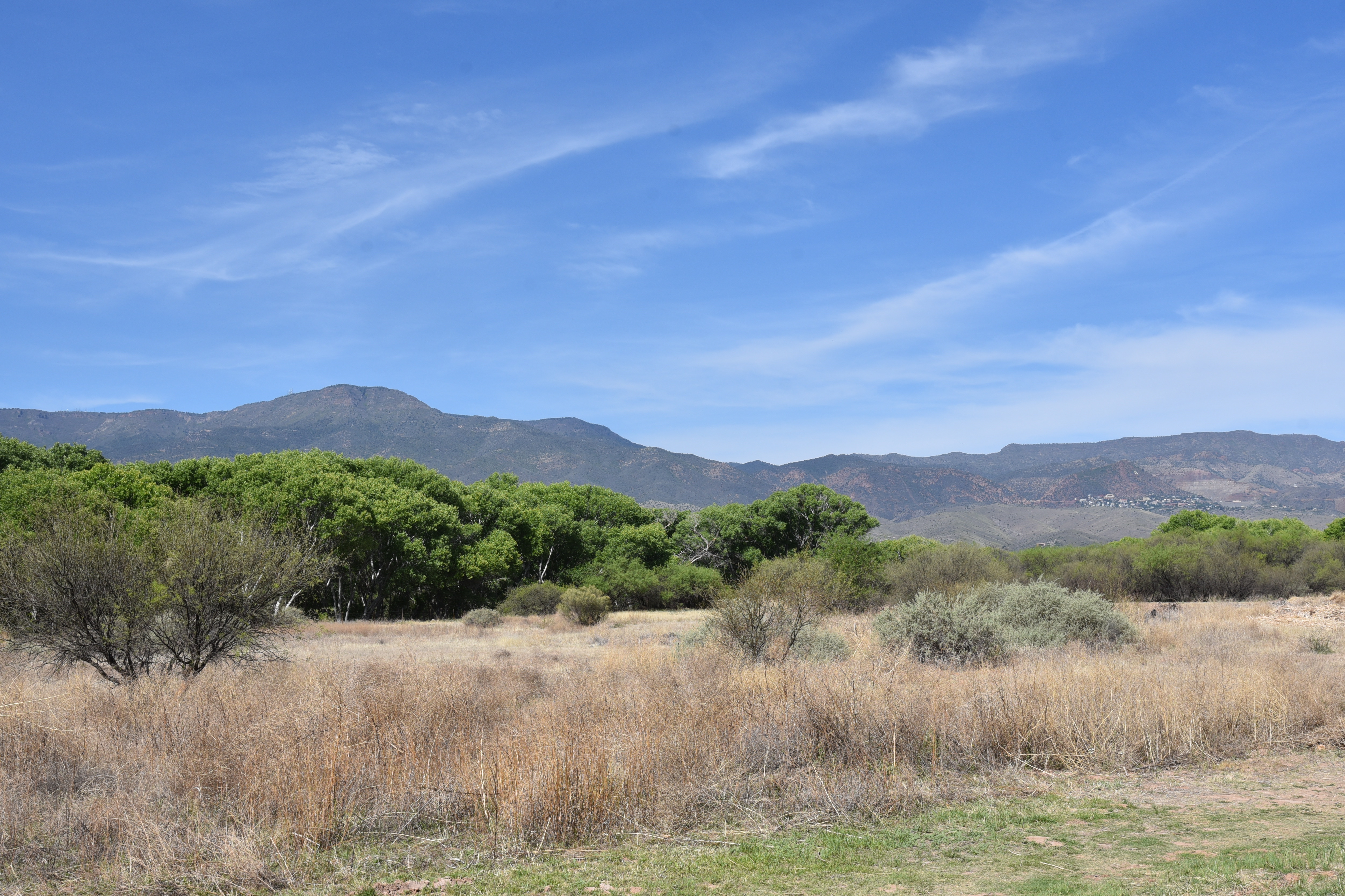
Diverse habitats at DHRSP attract wildlife

Still, a walk through the park that melds a semi-arid high desert climate with a humid riverside riparian habitat yields animal encounters both common and rare.
Silverleaf nightshade bloom along the lagoon trails


Situated on the north banks of a tree-lined bend of the Verde River, Dead Horse Ranch State Park has more than 20 miles of hiking trails. 

Keep wildlife wild. Observe from a distance.

Vociferous red-winged blackbirds thrive among reeds

The park trail menu has options for hikers of all ability levels including the ADA-accessible Canopy Trail, easy lagoon loops, and access to more challenging Coconino National Forest routes like 15.8-mile Lime Kiln Trail and Raptor Hill.  With easy access from Old Town Cottonwood, shaded paths in the Verde Valley park offer a quick escape from summer heat.  

Under a canopy of cottonwood, walnut, and willow trees, three level, multi-use, accessible trails loop around the park’s lagoons that draw river water by way of the historic Hickey irrigation ditch.

Globemallow add spots of orange to the trails

Open to hikers, bikers and leashed dogs, the wide, groomed tread of the loops is welcoming to strollers and other mobility devises making them family-friendly choices for exploring the water-centric site.   
River otters, waterfowl, deer and amphibians live in the park

A walk around the reedy, birdy ponds that capture mirror images of distant Mingus Mountain and a nearby wall of layer cake limestone reveals an oasis-like environment that abuts both a shady river corridor and arid mesquite scrubland. 

Benches and picnic tables placed around the lagoons provide comfortable places for observing wildlife in their natural environments. 

Lagoon trails are easy and accessible

AZ black walnut trees shade the lagoon trails

For best results, consult the Arizona Game & Fish Department’s Wildlife Viewing Tips. And remember to keep wildlife wild by not feeding or disrupting their habitats.

LENGTH: 1.9 miles total for lagoon loops

RATING: easy-accessible

ELEVATION: 3,300 feet

GETTING THERE:

675 Dead Horse Ranch Road, Cottonwood.

From Main Street in Cottonwood, go south on 10th Street and follow the signs to the park.

DAY USE HOURS: 7 a.m. – 7 p.m.

FACILITIES:

Visitor center, camping, cabin rentals, ramadas, fishing, restrooms, horseback rides

FEE: $7 daily fee per vehicle

INFO & MAPS:

https://azstateparks.com/dead-horse/

TIPS FOR OBSERVING WILDLIFE:

https://www.azgfd.com/wildlife/viewing/

Monday, October 22, 2018

LIME KILN TRAIL: DEER PASS TRAILHEAD TO RED ROCK STATE PARK


Lime Kiln Trail: Deer Pass to Red Rock State Park
Lime Kiln Trail crosses Dry Creek
For most of its 15-mile course, the Lime Kiln Trail winds through a dusty corridor of crumbling sediments and sparse vegetation.  Mountain bikers love the long, flowy route for its epic vistas and clear lines-of-sight that enable speedy traverses of the stark terrain. 
A highpoint vista on Lime Kiln Trail
The trail unwinds as a linear adventure anchored by two water-centric parks with miles of white-rock moonscape in between.  
Hikers who are interested in more than big, airy views and chalky flats underfoot should understand that this is a trail that keeps the juicy stuff close to its opposing terminals.
Sedona red rocks seen from the Lime Kiln Trail.
Named for a kiln built by the “Willard Boys” back in the 1880s to create lime for mortar used in building projects near Cottonwood, the trail runs between Dead Horse Ranch State Park in Cottonwood and Red Rock State Park in Sedona.  From the Cottonwood (west) end, the trail’s first mile hangs on ledges above the Verde River and the park’s lagoon, passing through a lush riparian area and the historic kiln site before it climbs out onto the desert.  On the Sedona (east) side, the trail’s last 4.8 miles make for a truly magnificent, under-appreciated trek.
Bradshaw Mountains in the distance.
From the Deer Pass trailhead located off State Route 89A, the route begins its descent to Oak Creek by way of dirt roads and a mixed bag of topography and vegetation zones.  Right out of the gate, the route flanks a track of land across the highway from the Sedona Wetlands Preserve that’s irrigated with reclaimed wastewater. A healthy thicket of cottonwood trees hints that the supplemental moisture is benefiting the high desert flora.
Pools of water linger in Dry Creek
Contrary to what you might think; there’s no smell. The next half-mile is an easy stroll over a grassy plateau of scant mesquite, yucca and cacti. To the south, the mesa tumbles off into the Oak Creek gorge while views of the Bradshaw Mountains and Verde Valley in the west and Sedona red-rock massifs bolster the horizons.  Soon, watershed features such as scoured drainages and a series of native stone check dams herald the descent to Dry Creek.  This is also where the route intersects the defunct Kachina Trails system—a maze of dirt horse paths that are no longer maintained.
Lizards hang out at Deer Pass Trailhead.
To stay on track, follow the basket cairns (rock piles wired into posts) that are placed at all junctions and intermittently throughout the trail.  
Junipers are common along the trail.
As the path dips off the grasslands and into the Dry Creek chasm, junipers, pinyon pines and flowering shrubs form a fragrant green fringe. 
Mesquite trees provide a little shade.
At the 1.8-mile point, pass a gate and head right on Forest Road 9845. 
Lime Kiln Trail is popular with equestrians and bikers.
This shared-use road (watch out for ATVs) traces the cliffs above Dry Creek.  
Cottonwoods thrive in an irrigated flat along the route.
Although the intermittent stream mostly lives up to its name, residual pools and lacy rivulets remain for days after rain storms.
Rain water puddles in normally parched Dry Creek. 
A masonry bridge at the 2.5-mile point marks the major creek crossing.
Fall foliage along Dry Creek
Here, stands of Goodding’s willows that blush gold in autumn sprout from the sandy wash.  The fall foliage show usually lasts through mid-November in Sedona’s Dry Creek canyons providing the last vestige of color long after the maple leaf canopies of West Fork of Oak Creek (one of the most popular trails in Sedona for fall foliage viewing) have gone down for the season.


Most of the route follows dirt roads.
This vivid spot can be a good turnaround point for a moderate 5-mile trip. Otherwise, follow the trail as it heads back uphill and crosses Red Rock Loop Road twice before descending to its terminus near the entrance to Red Rock State Park. 
Follow basket carins to stay on track.
LENGTH: 2.5 miles one way to the creek or 4.8 miles one-way to the park.
ELEVATION: 3880 - 3320 feet
GETTING THERE: Deer Pass Trailhead:
From the State Route 179/89A traffic circle in Sedona go 9.7 west (left toward Cottonwood) on SR 89A to Forest Road 89B (past mile post 365). Turn left and continue 0.1-mile to the trailhead on the right. There are restrooms but no water at the trailhead. Trail begins at the sign in the parking area behind the restrooms. No fees unless you enter the park.
INFO & MAP:

Monday, March 28, 2016

TAVASCI MARSH

TAVASCI MARSH
Clarkdale
Peck's Lake and Tavasci Marsh

This place is for the birds---and the hikers who love them.
Designated an "important birding area" by the Audubon Society, Tavasci Marsh occupies a placid strip of green bounded by Tuzigoot National Monument, Dead Horse Ranch State Park and Verde River Greenway State Natural Area. The 96-acre, spring-fed wetland hosts a colorful cocktail of winged beasts chipping among reeds, roosting, wading or gliding over the waters in feathered flotillas.
Access is via a free parking area near Tuzigoot or at DHSR ($7 fee per vehicle). Both entry
points funnel hikers into a network of trails that wind among enormous cottonwood trees, mesquite forests, cattail choked bogs, sandy flood plains and riverside riparian corridors. Another way to enjoy the site and tag on some educational benefits is to enter through the Tuzigoot monument. There's a $10 fee per person, but you'll get to explore a Sinagua pueblo and learn from visitor center displays and interpretive signs along short, barrier-free walkways. The hiking paths are mostly old dirt roads marked with lathe-style posts. The Tavasci March Trail explores the site's east flank, culminating at a wooden observation deck at Peck's Lake---an oxbow pond that's a remnant of a former channel of the Verde River. The Tuzigoot trails meander west and south along the stream.
It's not necessary to be a birding expert to spot some of the more than 245 species that call the marsh home for all or part of the year. Sightings of Red-winged Blackbirds, Cardinals, Wood Ducks and Osprey are almost a given, but a pair of binoculars (and a substantial dose of patience) will aid in scoping out the more illusive Lesser Nighthawks and Peregrine Falcons.
If you're lucky, you might also spot river otters and beavers where the marsh drains into the Verde River.
LENGTH:
Tavasci Marsh Trail: 0.9 mile one way
Tuzigoot Trails: variable, we hiked 3.6 miles along the loops.
RATING: easy
ELEVATION: 3,130' – 3,410'
GETTING THERE:
From Interstate 17 in Camp Verde, go west on State Route 260 to Cottonwood and follow the signs to either Dead Horse Ranch State Park or Tuzigoot National Monument.
INFO:
MORE PHOTOS:

Monday, January 26, 2015

LIME KILN-BILL ENSIGN TRAILS

LIME KILN-BILL ENSIGN TRAILS
Cottonwood
Bill Ensign Trail

The Lime Kiln Trail is a reclaimed wagon road that was originally used from the 1890s thru the early 1900s to transport building materials and market goods between Cottonwood and Sedona. Today, the 15-mile-long route serves as a recreational trail for hikers, equestrians and mountain bikers anchored by Dead Horse Ranch State park in the west and and Red Rock State Park in the east. Named for a kiln built in the 1880s to produce mortar for the construction of several homes in Cottonwood area, the trail wanders through a landscape of limestone-layered rock formations dotted with Crucifixion thorn, juniper and beavertail cacti with impressive views of the mining town of Jerome, Mingus and Woodchute Mountains and Sedona's House Mountain volcano. Multiple access points and connecting trails provide dozens of day hike and backpack options. One to try is an out-and-back circuit using the Lime Kiln and Bill Ensign trails. Beginning from the Lagoon trailhead at DHRSP, this trip passes by the kiln site where interested hikers can take a short spur trail to the crumbling remains. At the 1.7-mile point, turn right at the Bill Ensign junction and hike 1.5 miles through high desert terrain skirting the boundary of the Verde Valley Botanical Area--a preserve established to protect the endangered Arizona Cliffrose. The trail culminates at a high point overlooking a riparian corridor of willows and cottonwoods along the Verde River.
LENGTH: 7.5 miles (as described here)
RATING: moderate
ELEVATION: 3,300' – 3,590'
FEE: $7 daily fee per vehicle
FACILITIES: restrooms, camp sites, cabins, picnic ramadas, fishing
GETTING THERE:
Dead Horse Ranch State Park
From Interstate 17 go north to State Route 260 exit 287 and head west toward Cottonwood. Continue 11 miles to Main Street in Cottonwood (Hwy 89A) and turn left. Continue through Cottonwood on Main Street, turn right on 10th Street and follow the signs to the park.
INFO:
MAPS:
Lime Kiln-Bill Ensign:
Lime Kiln:

Thursday, July 2, 2009

LAGOON LOOP

LAGOON LOOP Dead Horse Ranch State Park Short in length but jam-packed with fun this wide dirt trail swings around a lagoon built by channeling Verde River water into a cove surrounded by colorful cliffs and views of the ore-rich hillsides of Mingus Mountain and Jerome. Level enough to accommodate strollers and wheelchairs, the trail stays close to the banks of the lagoon for up-close encounters with ducks, chattering warblers and swarms of red-winged blackbirds. Higher elevations, cool breezes and easy access to restrooms, drinking water and shaded picnic areas make this a popular destination for fishing, camping, and biking. HIGHLIGHTS: Kid-friendly, watch able wildlife, close to civilization LENGTH: Quarter-mile loop RATING: easy ELEVATION: 3,300’ GETTING THERE: From the park entrance, the trail is accessed from any of the lagoon parking areas. Information: Visit pr.state.az.us/Parks/parkhtml/deadhorse.html or call (928) 634-5283 Fee: There’s a $6 day use fee per vehicle.

RAPTOR HILL

RAPTOR HILL Dead Horse Ranch State Park A hike up Raptor Hill drives home the important impact the Verde River has on the surrounding landscape. Climbing the arid hillsides above the river, startling contrasts between the high desert scrublands and the green river gorge below assault the senses. The abrupt transition from a moist, burgeoning oasis to a parched lunar-scape happens in just 500 feet of vertical hiking. From high points along the trail, the ancient ruins of Tuzigoot National Monument and remnants of 20th century mining operations dotting the mountainsides frame unobstructed views of the Verde’s rare and fragile ribbon of life. HIGHLIGHTS: Visual vantage points above the Verde River LENGTH: 6 miles round-trip RATING: moderate ELEVATION: 3,350’ – 3,850’ GETTING THERE: From the park entrance, follow the main road to Flycatcher Road (2nd road on the left) where there’s a “Tavasci Marsh” sign. Follow this road less than a mile to the signed parking area. Information: Visit pr.state.az.us/Parks/parkhtml/deadhorse.html or call (928) 634-5283 Fee: There’s a $6 day use fee per vehicle.

Friday, March 27, 2009

VERDE RIVER GREENWAY

VERDE RIVER GREENWAY Dead Horse Ranch State Park Weaving among gigantic Arizona sycamore, Freemont cottonwood and Goodding willow trees, this trail stays on the cliffs above the Verde River. Patched together with wooden plank bridges, the route showcases excellent views of cattail-choked coves that support one of the highest concentrations of nesting birds in the United States. This precious riparian gallery forest of trees shrubs and grasses is one of only five remaining in Arizona-- and twenty in the world. Nearly twenty endangered species including the southwestern willow flycatcher, river otter, lowland leopard frog, spikedace minnow, Colorado squawfish and the southwestern bald eagle depend on this rare environment for their survival. ELEVATION RANGE: 3,300 DOG RATING: Dogs must stay on leash and out of the water. Driving distance from Phoenix: 130 miles one-way GETTING THERE: From Phoenix, go north on Interstate 17 to Camp Verde (exit 287) and take Highway 260 west to Cottonwood. Turn left on Main Street (89A toward Clarkdale) and continue to 10th Street. Turn right on 10th St. and proceed over the Verde River Bridge to the park entrance. From the park entrance, take the second right on the road leading to the Mesquite Day Use Area. The trail starts in the left parking area. INFO: Visit pr.state.az.us/Parks/parkhtml/deadhorse.html or call (928) 634-5283 To learn more about the national Wild & Scenic River System, visit: rivers.gov/wst-verde.html To learn about potential threats to the river’s survival, visit: biologicaldiversity.org/campaigns/save_the_verde/index.html Fee: There’s a day use fee per vehicle.

Monday, October 27, 2008

TAVASCI MARSH

TAVASCI MARSH Dead Horse Ranch State Park Situated in the backwaters of the upper Verde River, Tavasci Marsh is a bird watcher’s paradise. Herons, egrets, finches, wrens and flycatchers flourish in the profuse vegetation and aren’t shy about spreading their wings. The hike passes through a healthy mesquite bosque—one of the most rare ecosystems in the world—ending at a wooden observation deck with a viewing bench at the edge of the wetlands. Here, river otters cut through pond water like oiled torpedoes accompanied by a boisterous avian soundtrack. LENGTH: 3 miles round-trip RATING: easy elevation gain: 50 feet ELEVATION GAIN: 3,350’ – 3,300’ GETTING THERE: From Phoenix, go north on Interstate 17 to Camp Verde (exit 287) and take Highway 260 west to Cottonwood. Turn left on Main Street (89A toward Clarksdale) and continue to 10th Street. Turn right on 10th St. and proceed over the Verde River Bridge to the park entrance. From the park entrance, follow the main road to Flycatcher Road (2nd road on the left) where there’s a “Tavasci Marsh” sign. Follow this road less than a mile to the signed parking area.