Find A Trail. Start Your Search Here:

Showing posts with label Arizona Trail Passage #33. Show all posts

Monday, August 26, 2019

Flagstaff Urban Trails System-Arizona Trail Loop

Hike in the Urban-Forest Interface
FUTS routes close to town connect with the Arizona Trail

 “You can’t get there from here,” my hiking partner told a confused pair of trekkers who asked us for directions to an Arizona Trail junction. He gently kicked my shin to signal he was joking as the couple fumbled with a map. Waiting a beat to satisfy his warped sense of humor, my pal continued, “Just kidding, of course you can get there from here. This is Flagstaff.”  He’s not wrong.
I-40 passes above Duck Pond on the Arizona Trail
With hundreds of miles of national forest trails and city pathways, there are dozens of ways to access the iconic 800+-mile Arizona Trail (AZT) that swings through the northern Arizona city.
Mexican Hat flowers bloom along FUTS
The state-traversing route draws hikers, bikers and equestrians from all over the world to this Arizona Trail gateway community---a city or town that embraces and gives ongoing support to the trail and its users. In addition to deep-forest trailheads and popular campgrounds the Arizona Trail may also be accessed by using the Flagstaff Urban Trails System (FUTS). With over 50 miles of existing trails in place and plans for 80 more, the network of paved walkways, re-purposed dirt roads and single track paths make walking off a busy city street into a quiet forest as effortless as moving from room-to-room in your home. One stunning example of the connectivity offered by this community-driven system is located near the intersection of Interstates 17 and 40 southeast of downtown.
Russian knapweed (invasive) grows in meadows
View from the trailhead near Coconino Community College
You'll see planes from nearby Flagstaff Pulliam Airport
The moderate loop has some steep sections
The moderate 6-mile loop hike samples several flavors of FUTS. From a groomed trailhead near Coconino Community College, the hike begins by heading 0.2-mile north on the paved Lone Tree Trail. Next, turn right onto the Broken Arrow Trail which leaves the pavement and heads east on a dirt track.  After 0.4-mile, the trail continues on a dirt road through a drainage area surrounded by pines and wildflower meadows.
FUTS paths connect with Coconino NF trails
The route is obvious except for where a solitary tree stands at a fork in the road at the 1.6-mile point. Veer left here and continue 0.3-mile to Duck Pond and the junction for the Arizona Trail Passage 33.
A dragonfly rests near Duck Pond
Despite the rumble and hum of vehicles rolling over a bridge on Interstate 40, the reedy lake is a pleasant little place with active waterfowl and swarms of dragonflies. After exploring around the water, head right (southeast) at the AZT sign and make a short but steep uphill slog that leads into a sliver of Coconino National Forest that sits between country clubs and subdivisions.
FUTS paths provide non-motorized travel through Flagstaff
Along this 1.7-mile leg of the trip, freeway noise is gradually muffled by the hilly terrain, but aircraft using the Flagstaff Pulliam Airport that’s located a few miles to the southwest are regular reminders that this woodsy buffer zone is very much within the urban-forest interface. Follow the AZT signs to a 3-way junction with a gate and a sign for Fisher Point. To complete the loop, head right and follow an unsigned dirt road. After 0.6-mile of traipsing through sunny fields and shaded bends, the route rejoins the FUTS system. 
Part of the loop follows closed dirt roads
Continue 0.4-mile on the Fisher Point Trail which skirts the edge of a posh golf community then hang a left at the JWP Trail.
The loop is a seamless walk between city and forest
The final 0.8-mile return leg is on the non-motorized path that parallels John Wesley Powell Boulevard. This tiny taste of FUTS and its connectivity shows how with only a bike, horse or a pair of hiking boots, you can get just about anywhere in Flagstaff--and beyond.
LENGTH: 6-mile loop
RATING: moderate
ELEVATION: 6766- 6979 feet
GETTING THERE:
From Flagstaff, go 1.2 miles south on Lake Mary Road to J.W. Powell Blvd. Turn left and continue 1 mile to the trailhead at the corner of Lone Tree Road.
 INFO: Flagstaff Urban Trails System (FUTS)
Arizona Trail
-->

Monday, July 11, 2016

SKUNK CANYON-ARIZONA TRAIL-FLAGSTAFF LOOP CIRCUIT

SKUNK CANYON-ARIZONA TRAIL-FLAGSTAFF LOOP CIRCUIT
Flagstaff
Entrance to the Skunk Canyon slot
This pleasant stroll links a short, lesser known route with two of Flagstaff's most popular trails.
Offering a backdoor into a heavily used recreational corridor, Skunk Canyon Trail is a sleepy little gem accessible off of Flagstaff's Lake Mary Road near Walnut Canyon that shares dirt with the Flagstaff Loop and Arizona Trail. Over its 2.7-mile course, the 2-track trail follows the contours of a shallow gorge that morphs from a sun drenched, gaping meadow of hip-deep grasses and wildflowers into a skinny path in a woodsy slot canyon dripping in moss. Inside the slot "jewel" of the trail, towering pines, shallow limestone caves and tangled brambles complement its deeply shaded drainage.
Flagstaff Loop Trail 
After emerging from the dark forest, the trail enters another meadow before plugging in to Passage # 33 of the Arizona Trail. The AZT leg of the hike is a mile-long walk on a closed road under a canopy of Ponderosa pines to the junction with the Flagstaff Loop Trail. Sustainably constructed, the FLT makes a non-motorized hoop around town using sections of existing forest trails, abandoned roads and urban paths. When complete, the 42-mile project will anchor an interlaced trail system that will minimize negative environmental impacts and preserve green space for outdoor enthusiasts. This portion of the hike follows a single track on the slopes above Skunk Canyon and features glimpses of the San Francisco Peaks and Mount Elden. Loamy soils and a patchwork of sun and shade provide ideal habitats for flowering plants like Richardson's geranium, wild lima bean, Western blue flax, sunflowers and the mint-scented blooms of New Mexican vervain.
Stock tank along Skunk Canyon Trail
Hike Directions:
From the trailhead, hike out on the Skunk Canyon Trail--a dirt 2-track heading northeast. At the half-mile point, veer right onto a wider dirt road heading into a meadow. Ignore all unsigned spur paths. Do not be confused by the bikers you will probably see racing along a trail to the left---that's the Flagstaff Loop Trail and this trip's return route. Stay on the 2-track that passes by two stock tanks before narrowing into a single track that enters the slot canyon.  At 2.7 miles you'll come to an unsigned "T" junction at the Arizona Trail. Turn left here and hike 1 mile to the signed Flagstaff Loop junction, turn left and hike 1.3 miles back to the Skunk Canyon Trail and retrace your steps 1.3 miles to the parking area.
Richardson's geranium
LENGTH: 6.3 miles
RATING: easy
ELEVATION: 6,475' - 7,027'
Western blue flax
GETTING THERE:
From Phoenix, go north on Interstate 17 to exit 339, Lake Mary Road (Forest Road 3) located just south of the I-40/I-17 interchange in Flagstaff. From the bottom of the off ramp (across from a Circle K), turn right and go 2.1 miles south on Lake Mary Road to S J Diamond Road on the left. Follow this good dirt road 0.2 mile to the end where there's a small parking area and gate. Generic forest service and game & fish signs are posted, but nothing indicating “Skunk Canyon”--no worries though, you're in the right place.
INFO:
Flagstaff Loop Trail:
Arizona Trail Association
MORE PHOTOS:


Monday, May 16, 2016

OLDHAM TRAILS

OLDHAM TRAILS
Coconino National Forest, Flagstaff
Orange paint marks tress to save during 4FRI (Okay Orange)
The heat is on and with it comes the annual migration of Valley hikers to the cool forests of Northern Arizona. While trekking along high country trails, you might encounter trees bearing orange or blue paint blazes. These colorful codes are part of the Four Forest Restoration Initiative (4FRI), a planned 20-year effort to restore fire-adapted ecosystems in Kaibab, Coconino, Apache-Sitgreaves and Tonto National Forests through hand thinning, logging and prescribed burns.
Orange paint designates trees that will not be cut (and may also indicate treatment area boundaries) while blue marks those to be removed. An easy way to remember this: Okay Orange, Bye Bye Blue.
Scars of the 2010 Schultz Fire

Many Arizona forests are rife with unhealthy, tinderbox conditions. The major goals of 4FRI are to reduce fuels that contribute to unnaturally catastrophic wildfires, protect watershed resources, increase plant diversity and preserve wildlife habitats. The project is currently active in Flagstaff's Dry Lake Hills area. You can observe some of the prep work by taking a hike on the Oldham Trails. The tour begins in Buffalo Park with an easy half-mile walk north to the Lower Oldham/Arizona Trail junction. From here, follow the Arizona Trail signs.
Blue means cut. (ByeBye Blue)
Numerous, unmarked secondary trails run through the area and can be confusing. Oldham Trail runs to the east, nearest the mountain, but if you miss it, no worries---just keep heading north and you'll end up on Elden Mountain Road roughly 2.5 miles north of the park. Along the way, stop and contemplate the woodlands and see if you can figure out the logic behind the save/cut markings on the Ponderosa pine trees. Once on the road, signage improves and you can continue on to Upper Oldham or any of the Dry Lake Hills system trails. To keep with the theme of forest health, hike Upper Oldham Trail to Sunset Trail, turn right and walk 1.3 miles across a barren ridgeline to the summit of Mount Elden. Here, the devastation caused by the 2010 Shultz Fire is clearly visible on the mountain's flanks. This is exactly the kind of disaster the 4RFI is trying to prevent.
Logging activities in treatment areas may cause temporary trail closures, so be sure to check the forest service website before heading out.
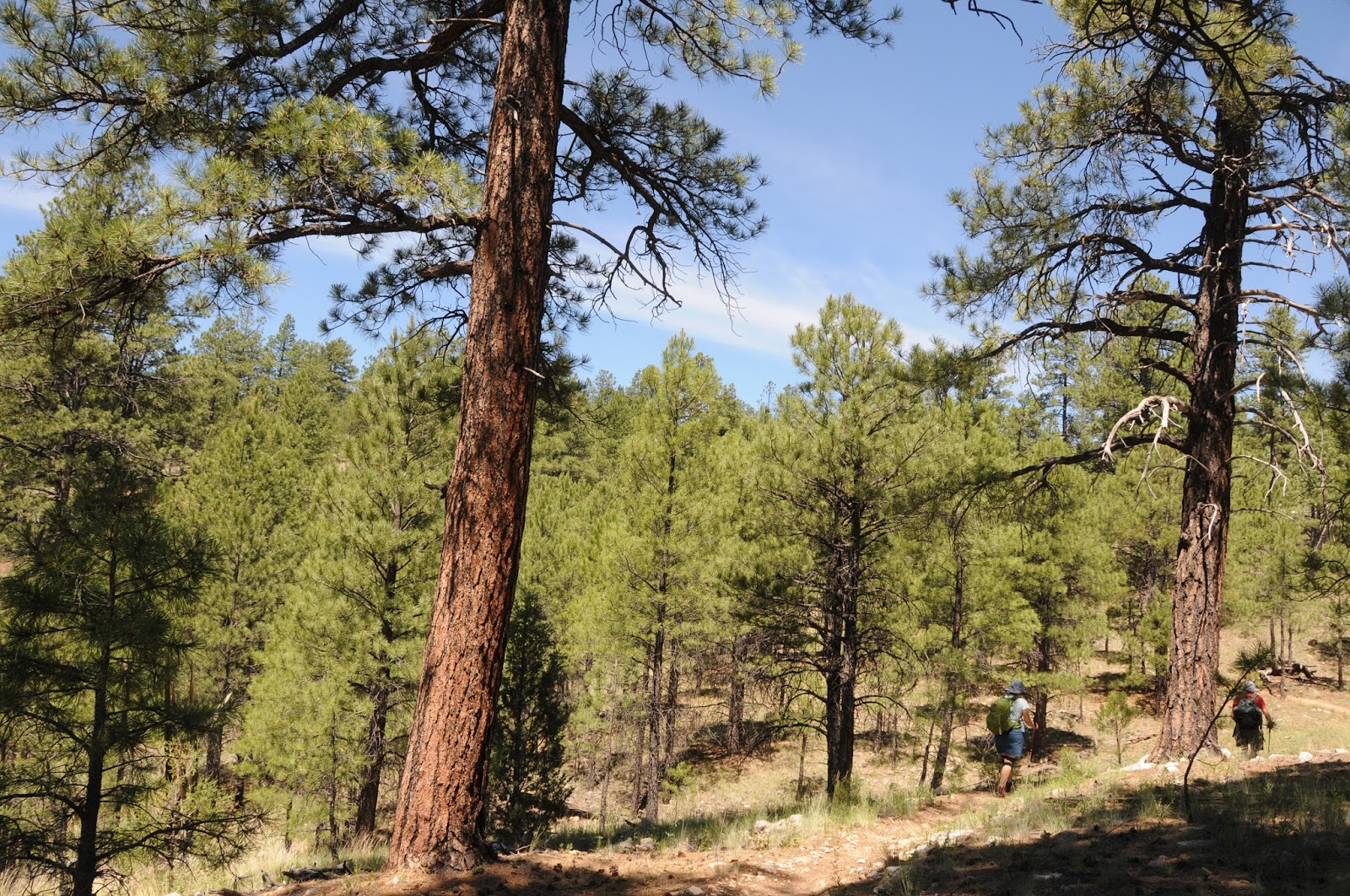
Upper Oldham Trail
LENGTH:
All distances include the 0.5-mile park access trail.
Lower (Easy) Oldham: 2.5 miles one-way to Mt. Elden Road
Oldham #1: 3.2 miles one-way to Mt. Elden Road
Upper Oldham: 5.3 miles one-way
To Mount Elden: 6.6 miles one-way
RATING: easy - difficult
ELEVATION:
Lower Oldham: 7,040' - 7,380'
Oldham #1: 7,040' - 7,590'
Upper Oldham: 7,040' - 8,920'
Sunset Trail to Mount Elden: 8,920' - 9,299'
GETTING THERE:
From Route 66 in Flagstaff, go 0.6 mile north on Humphreys St. to Fort Valley Road (US180). Turn left and continue 0.3 mile to Forest Ave., turn right and continue 1 mile to the stop light at Gemini Drive. Turn left and follow the signs to Buffalo Park.
INFO: Coconino National Forest
INFO:
Four Forest Restoration Initiative


Monday, June 23, 2014

PICTURE CANYON


PICTURE CANYON NATURAL AND CULTURAL PRESERVE
Flagstaff
A petroglyph panel in Picture Canyon

Vociferous flocks of waterfowl and warblers are just a few of the more than 150 species of birds that   inhabit the wetlands of Flagstaff's Rio de Flag.  A favorite destination for birdwatchers, Picture Canyon Natural and Cultural Preserve is a 477.8-acre, city-owned property along the Rio undergoing habitat restoration, which will return the site to a more natural and sustainable condition.  This section of the Rio--located in Flagstaff's industrial east side--is fed by effluent discharge from the Wildcat Hill Wastewater Treatment Plant. The shallow stream drifts through pine-bolstered riparian greenery before tumbling over the vertical volcanic rock walls of Picture Canyon in a series of cascades that can be viewed from lookout areas along the rim.   Restoration plans include proposed recreational trails to complement the existing state-traversing Arizona Trail and 44-mile city-circumnavigating Flagstaff Loop Trail, both of which cut through the property, adding to the site's potential as a major hiking destination.
Waterfalls in the canyon
In addition to its wildlife habitat and geological significance, petroglyphs (the "pictures") and other evidence of ancient Sinaguan inhabitants are peppered throughout the corridor.
Although the Arizona Trail is signed, most of the other roads and paths within the preserve are not. This makes finding your way around the roughly 6-miles of hike-able dirt roads and paths somewhat of a challenge. To help with navigation, a map kiosk at the trailhead provides an overview of the layout and landmark beacons Mt. Elden and Sheep Hill to the east and Wildcat Hill on the southwest can be used to find your bearings.   Even with miles of trails and wildlife viewing opportunities, it's the "pictures” that most people come to see.  Here's the quickest way to get to them for a 2-mile round trip hike.
From the trailhead, hike on the main road trail and stay straight at the first fork. Go right at a second fork located past the gas plant near a "246" sign  and continue to where the Arizona Trail crosses the road. Turn right here and hike on the AZT to a 4-way junction just before a wooden bridge.  Go left here to reach the rock art gallery.  As with all cultural sites, artifacts should not be disturbed.

Rio de Flag

LENGTH: up to 6 miles
RATING: easy
ELEVATION: 6630' - 6766'

Flagstaff's only waterfall

GETTING THERE:
From downtown Flagstaff, travel 5 miles east on Old Route 66 (a.k.a. Santa Fe) to El Paso Flagstaff, turn left and continue 1 mile to the trailhead on the right. Roads are 100% paved.  No fees.
Arizona Trail passes through the site

INFO:
City of Flagstaff
Preserve Facebook page:
Friends of the Rio de Flag:

MORE PHOTOS: