Find A Trail. Start Your Search Here:

Showing posts with label Spence Springs Trailhead. Show all posts

Monday, August 21, 2023

Noodle Loop

NOODLE LOOP

Spence Basin Trail System.

Wiggly course of Noodle Loop

Wiggly, woodsy, route. Say that three time fast and you’ll get the vibe of the Noodle Loop Trail No. 360. 

There's lots of shade on Noodle Loop

 
Living up to this tongue-twister summary and moniker, the short loop in the Spence Basin Trail System in Prescott National Forest, delivers a quick trip marked by lots of shade, abrupt bends and flowing curves.
Spence Basin trails are well signed

 The trek debarks from the Spence Springs trailhead located just a few miles northwest of Downtown Prescott.
Shrub oaks are common along the loop

While the loop is well-signed and synced with a phone app, many intersecting roads and trails including the 50+-mile Prescott Circle Trail can be tempting distractions.
The loop is slick and clear of obstacles

The hub, which sits between majestic 7,626-foot Granite Mountain and iconic 6,440-foot Thumb Butte is beloved for its maze of short, coiled paths that glide through hilly terrain with endless ways to customize day hikes.
Noodle Loop is a perfect choice for warmer days as it stays mostly in a pocket of pines, oaks and junipers. 
Mountain gromwell bloom July -September

Views are sparce but the loop’s string of bumps, bends, and hairpin turns that slingshot hikers over cottonwood-cluttered drainages, ledges and through boulder outcroppings provide plenty of entertainment.  
The loop stays in a shady, wooded basin

The maintained single-track path feels as it was engineered for speed. There are no major obstacles to work around and clear lines-of-sight make it easy to see oncoming bikes and horses that share the trail.
Cottonwoods thrive in a moist drainage

Following the natural contours of the terrain, the trail’s smooth, linguine-like dips and climbs add up to over 700 feet of accumulated elevation change. But the loop’s slick design acts as a silent propellant, whisking hikers through in painless, speedy style.
Mushrooms bloom after monsoon rains

LENGTH: 2.3-mile loop

RATING: easy

ELEVATION: 5,514 – 5,676 feet (703 feet of accumulated elevation change)

GETTING THERE:

Spence Springs Trailhead:

From Courthouse Square in downtown Prescott, go 4.8 miles north on Montezuma Street which will turn into Whipple Street then Iron Springs Road (County Road 10) to Spence Springs Road on the left.  This is located just past the turnoff for Granite Basin Recreation Area.  There’s a portable restroom at the trailhead.

INFO:

Prescott National Forest

https://www.fs.usda.gov/recarea/prescott/recreation/hiking/recarea/?recid=84362&actid=50

City of Prescott

https://www.prescott-az.gov/recreation-area/prescott-circle-trail/


Tuesday, March 9, 2021

Spence Basin Trail System

SPENCE BASIN TRAIL SYSTEM

There's excellent signage throughout the hike

Populating the space between the Thumb Butte and Granite Basin recreation sites in Prescott National Forest, the new Spence Basin Trail System adds nearly 30 miles of hiking options to the area’s already packed menu. 
Granite Mountain seen from Vista Trail

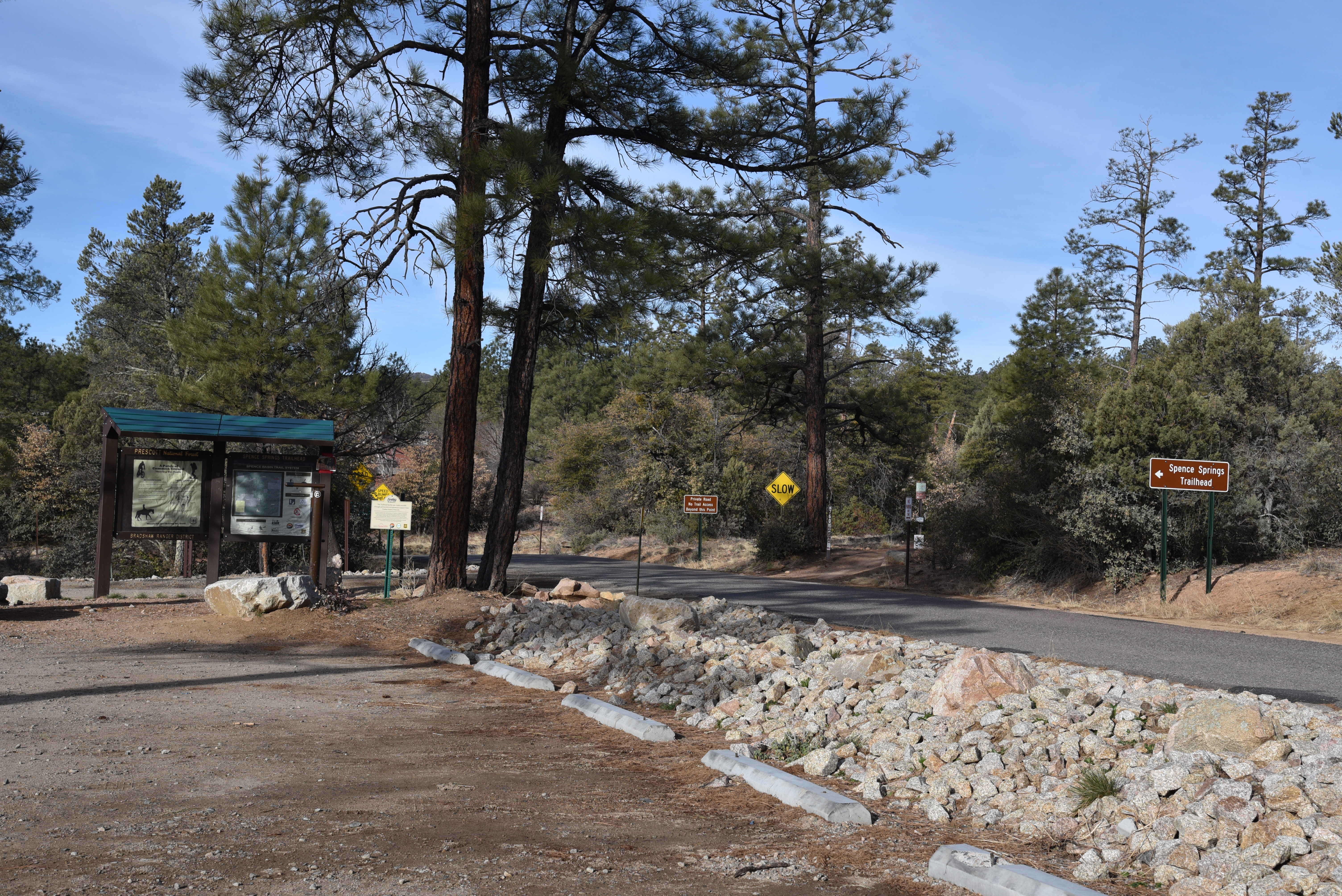
The routes, which were adopted and developed over that last few years, are located less than 5 miles northwest of historic downtown Prescott and are accessible by way of paved roads.  While the trails can be reached through connecting routes that extend north from Thumb Butte, the Spence Springs trailhead that opened in 2019 offers direct access to the heart of the system.

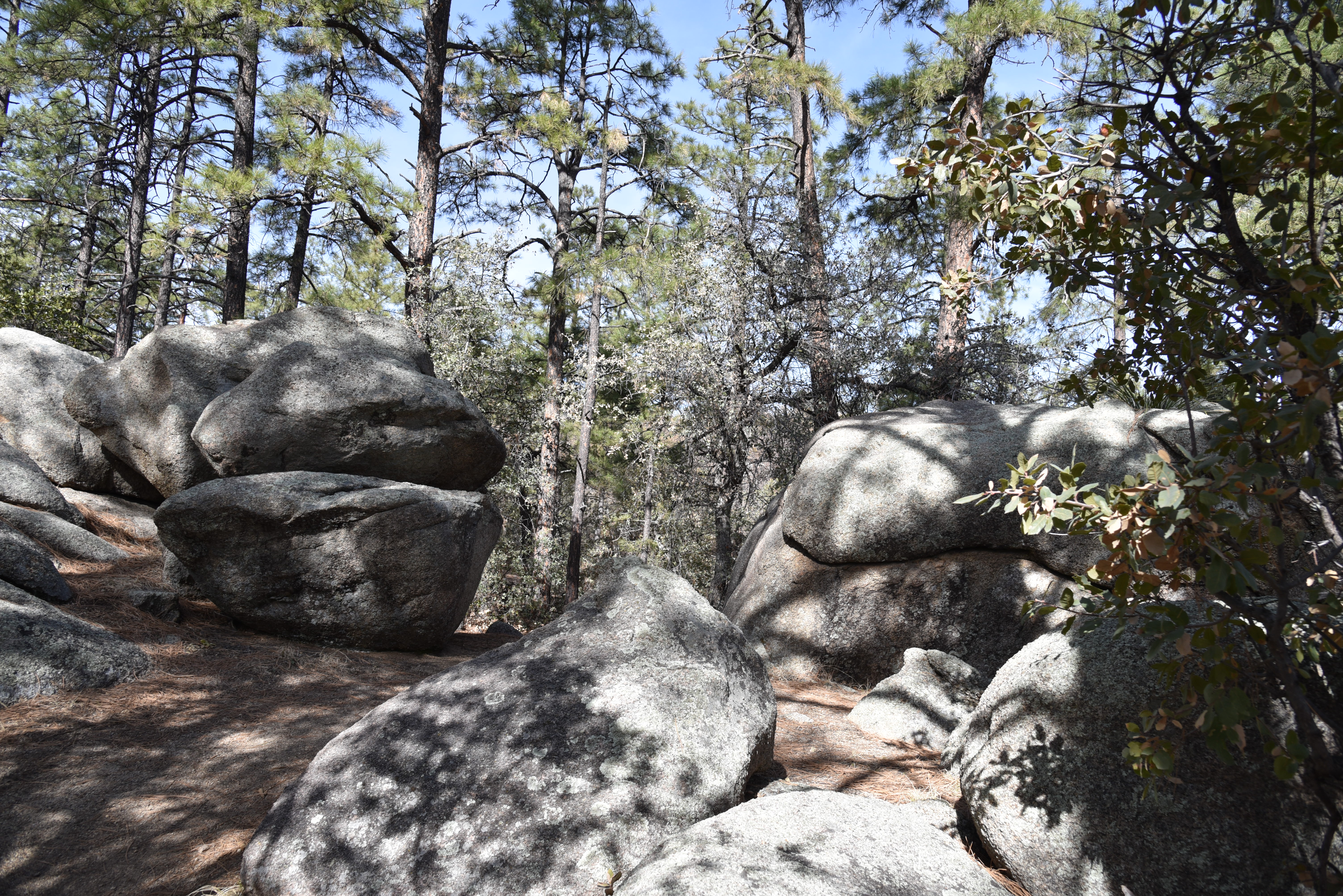
A boulder passage on Juniper Gate Trail

Ponderosa pines shade the Noodle Loop


The nearly 30-mile maze of Spence Basin’s loopy, hilly single tracks speak to their mountain-biker origins.  Tightly woven, with dozens of ways to customize both length and difficulty levels, the trails roll out in the varied terrain around Spence Creek.  The signage along the routes is among the best you’ll find anywhere, making it simple to find your way around.  Junctions are outfitted with you-are-here-style map signs that show mileages, connecting routes, GPS coordinates, emergency location codes and smart phone app codes.  Deciding where to begin exploring the convoluted trail cluster is the only dilemma.  For first-timers, an introductory loop using the Noodle, Vista, BLM and Juniper Gate trails is a great way to experience some of the best bits.  Here’s how.

Snowy Sierra Prieta Mtns seen from Vista Trail

From the trailhead, cross the road and begin with a short walk on Noodle Loop #760.  At the first junction (emergency marker sign SB03), turn right onto the Vista Trail #706.  This leg of the hike starts by delving into a sunny juniper-dotted drainage area with patches of shady ponderosa pine and oak woodlands.  Vista Trail makes an easy climb on slopes at the northern edge of the system.  Exposed highpoints reveal views of Thumb Butte and the Sierra Prieta Mountains to the south and fleeting glimpses of Granite Mountain and Williamson Valley to the north. 

Spence Springs Trailhead opened in 2019

BLM Trail cross a drainage in Spence Basin

At map sign SB18, pick up the BLM trail #729 which spirals off the high ledges into the rough-cut drainages of Spence Creek. 
Alligator junipers are abundant along the trails

Tracing the creek and major runoff areas, this segment of the hike winds through forests thick with water-loving shrubs and soaring pines.  Next up, connect with the Juniper Gate trail #714 at map sign SB05 and get ready for yet another flavor thrown into the mix.  True to its name, this leg is heavy on the junipers with a side of edgy traverses and cool boulder passages above the rocky creek bed. 
Snow lingers in crevases in Spence Basin

Follow Juniper Gate back to the Noodle Loop, which spools out like limp fettuccine with hairpin turns wrapping around inclines and scoured ravines, and follow the signs back to the trailhead.  
Trails cut through coniferous woodlands

After scratching the surface with this sampler hike, download the map app to see more ways to enjoy one of Prescott’s newest hiking hubs.
Thumb Butte seen from Vista Trail

LENGTH: 4.6-mile loop as described here

RATING: moderate

ELEVATION: 5,490 – 5,936 feet

GETTING THERE:

Spence Springs Trailhead:

From Courthouse Square in downtown Prescott, go north on Montezuma Street which will turn into Whipple Street then Iron Springs Road (County Road 10) for 4.8 miles to Spence Springs Road on the left.  This is located just past the turnoff for Granite Basin Recreation Area.  The trailhead is on the left a few yards down the road. 

At this writing, the trailhead has a port-o-potty and map kiosk but no water.

Future plans include the addition of a vault restroom and picnic tables.

INFO & MAPS:

https://www.prescott-az.gov/wp-content/uploads/2016/12/Trails-and-Outdoor-Recreation-Map-Back-Side.pdf

https://www.avenzamaps.com/maps/851151/spence-basin