Find A Trail. Start Your Search Here:

Showing posts with label creek. Show all posts

Tuesday, January 28, 2020

SPRING VALLEY TRAIL

SPRING VALLEY TRAIL: Hells Canyon Wilderness Area
A stock tank on Spring Valley Trail
When the itch to “Get the hell out of Dodge” hits Arizona city-dwelling hikers, sometimes all it takes to scratch it is a free afternoon and a short drive. 

A rustic gate frames views of distant Tonto NF peaks
Spanning 9,951 acres of back country a few miles northwest of Lake Pleasant approximately 25 miles north of Phoenix, Hells Canyon Wilderness Area offers a quick way to escape into an untamed swath of desert that’s more paradise than purgatory.
Small in comparison to other Arizona wilderness areas like Mazatzal (252,500 acres) and Superstition (160,200 acres)  Hells Canyon, which straddles Maricopa and Yavapai counties, was established in 1990 and is managed by the Bureau of Land Management.
A hiker takes in the views from a ledge above Garfias Wash
Of the several sketchy routes that wander through the area, the most popular and easiest to follow is the Spring Valley Trail. Except for a few BLM posts at the trailhead, the route is refreshingly devoid of signage which complements the hike’s remote atmosphere.  Navigating the trail involves only two crux moves: finding the trailhead and climbing down into Garfias Wash. For the later, the problem is easily solved by paying attention at the parking area.
From the dirt turnouts near a cattle guard on the access road, locate the small trail sign on the west berm. Then, look across the creek bed and spot the white trail register and a huge rock cairn that mark the official trailhead. Next, hike a few yards down the road, turn onto a wide dirt two-track and follow it a short way to a worn sign where you’ll turn right and use a series of cairns to work your way across the usually dry corridor of Castle Creek. From the register, head right and uphill along a well-defined path. At the top of the rise, go left where two big cairns mark the unsigned junction of the Spring Valley and Hermit trails. Beyond this point it’s clear sailing.
Spring Valley Trail is in Hells Canyon Wilderness Area
The trail dips and climbs through rocky terrain in the foothills of the Hieroglyphic Mountains passing by brilliant ocher mounds of volcanic tuff (compacted ash) embedded with rock fragments and other pyroclastic particles welded in a haphazard concrete-like structures. The trail’s west side is dominated by a sheer ridge line that rises to 2,904 feet. Below its crumbling slopes, acres of giant saguaros tower above sunny fields that are productive environs for spring wildflowers. 
Finding the trailhead isn't too difficult if you pay attention
Just past the one-mile point, the trail crosses an earthen dam that contains a stock tank frequented by native wildlife and the feral burros that live in the area.   
A rock cairn marks the way across Castle Creek
Although you may or may not catch a glimpse of the burros, their footprints and droppings around the tank and throughout the hike belie their presence. If you encounter them, it’s smart to keep your distance because they’ve been known to kick. Also, as with all wild animals, never approach, harass or feed them.  As the trail moves toward its highest point, be sure to pause and take in the ever-widening views of Castle Creek Wilderness and the Bradshaw Mountains in Prescott National Forest to the north and the New River Mountains in Tonto National Forest to the east and the glinting waters of Lake Pleasant.
The trail seems to end at the nose of the ridge overlooking Garfias Wash, but there are several options to extend the trek. You can opt to follow a faint trail heading right and an even more sketchy path that spins off the obvious trail and switchbacks steeply down to the wash or continue on a narrow cairned path that swerves north tracing the ridge line. Either way, the area’s rough nooks, washes and interesting geology hold many scenic surprises to explore.
The area's sunny slopes burst with wildflowers in spring
Lake Pleasant stands out on the southeast horizon
When done poking around, head back the way you came making note of distant dust plumes being kicked up by vehicles driving north toward Castle Hot Springs resort. The recently resurrected private spa secluded at the base of 3,260-foot Governors Peak is a luxury oasis built around natural hot springs that have attracted tourists since 1896.
The trail traces the slopes below Peak 2904
Huge saguaros thrive in the rugged backcountry
The trail has a remote, feral atmosphere.
A tiny sign on Castle Hot Springs Road directs hikers
Volcanic tuff features line the route
Hiker walks a ridge above Garfias Wash
Castle Hot Springs resort is hidden in the hills to the north
It’s not visible from the trail, but the posh, palm-shaded refuge that’s located just north of the wilderness boundary offers an alternative way to escape from Dodge for those who prefer clean sheets, Green Garden Gazpacho and craft cocktails over wilderness staples of tents, trail mix and electrolyte drinks.
LENGTH: 5 miles out-and-back
RATING:  moderate
ELEVATION: 1,800 – 1,920 feet
GETTING THERE:
Castle Creek Trailhead
From Interstate 17 in Phoenix, take the State Route 74 exit 223 (Carefree Highway) and go 11.4 miles west (toward Wickenburg) to Castle Hot Springs Road which is signed for Lake Pleasant Regional Park. Follow Castle Hot Springs Road 5.4 miles to the stop sign at the park’s north entrance. Turn left and drive 5.4 miles to a cattle guard past milepost 25 and park in any of the dirt turnouts along the road. Castle Hot Springs Road is graded dirt suitable for carefully-driven sedans. Part of the road crosses Castle Creek which may be impassable after storms.
INFO:


Monday, January 7, 2019

The Back Roads to Tonto Creek

The Back Roads to Tonto Creek
The pebbly fringe of Tonto Creek north of Roosevelt Lake.
Occupying a few dusty acres between nowhere and Roosevelt Lake, the blink-and-you’ll-miss-it community of Jake’s Corner is a popular waystation for outdoor enthusiasts.
A rustic gate along Forest Road 184D
Its outwardly ramshackle appearance and come-as-you-are ambiance are big draws for anglers, hunters, boaters, bikers and ATV riders.  Sometimes, hikers find the place, too. 
Located 22 miles north of the lake along State Route 188 in Gila County, the iconic watering hole is the northern outpost of a string of RV parks, creeky-floor honky-tonks, bait shops and general stores.
The back roads around Jake's Corner are rough but scenic.
The scenic stretch of SR 188 runs through the Tonto Basin—a drainage gorge that separates the wilds of the Mazatzal Wilderness and the Sierra Ancha Mountains.  Dozens of creeks and streams in the area flow off the foothills into the major course of Tonto Creek which feeds Theodore Roosevelt Reservoir.  Although recreation in this hilly, watery back country usually involves a motorized vehicle, there are plenty of places to hoof it along dirt roads.
Paper Flowers bloom year-round above Tonto Creek. 
Tonto Creek
Other than the state-traversing Arizona Trail which makes a grueling climb through the mountainous terrain to the west, there aren’t many non-motorized routes nearby unless you go 20 miles north to Payson.  But, hiking on shared-trails can be just as enjoyable when common courtesy is applied.  Directly across from Jake’s Corner Bar, a maze of forest roads offer miles of boots-on-the-ground exploratory options.  Like the adjacent community, the walkabouts here harbor no pretense. They are simply-signed and retain a raw, non-nonsense air. Many of the routes are championed by the Tonto Recreation Alliance--a volunteer organization that works with government agencies to maintain and promote off-highway vehicle access and educate recreators about public access issues in the Tonto National Forest.  
Cacti and mesquite frame Mazatzal Mountains views.
One circuit to try is a rough-cut route to Tonto Creek.  From a dirt parking area a half-mile from the bar, follow Forest Road 184A a few yards, then head left at Forest Road 184D. The first mile is a wobbly trek through wide-open high desert with great views of the Mazatzal Mountains.  After a series of dips and climbs on choppy two-tracks, pass a gate at the one-mile point and hike up to a knoll where a faint road curves to the left.
Glimpse of Tonto Creek from the difficult downhill hike.
From this highpoint, head right and continue to the Forest Road 184D/951 junction.  Ahead, to the left, is “hell’s half mile”. 
Mazatzal Mountains on the western horizon.
Primitive FR951 descends nearly 500 feet with take-no-prisoners aggression toward the creek.  A hiking stick is essential to work through the loose rock and uneven trenches.  Expect to pick up some mud and grit on this half-mile plunge. There’s no mercy until the messy road meets the sandy edge of Tonto Creek.
Sycamore and willow saplings grow in flood plains.
Rapids in Tonto Creek.
Lined with cottonwoods, sycamores and willows, this beautiful bend in the creek features white-capped rapids, calm reflecting pools and optional miles of streamside exploring. 
Tiny waterfalls in Tonto Creek.
Take time to watch for waterfowl and spy the footprints of deer, raccoons and bobcats pressed into sandbars before heading back the way you came.
The descent to Tonto Creek is steep and rocky.
Short in miles but with an overall elevation change of 917 feet, the effort warrants a post-hike beer and burger reward at Jake’s. Dressed in dusty boots and trail garb, you’ll blend.
A calm bend in Tonto Creek
A snowy bank where FR951 meets Tonto Creek.
LENGTH: 4 miles round trip
RATING: moderate-difficult
ELEVATION: 2607 – 3101 feet
GETTING THERE:
From State Route 87 (Beeline Highway) south of Rye just past milepost 235, go 3.2 miles south on State Route 188 to the community of Jake’s Corner.
Across from Jake’s Corner Bar, turn left onto Forest Road 184 (not signed) and continue 0.5-mile to Forest Road 184A (utility poles) and park.  Roads are paved and sedan-friendly dirt.
INFO: Tonto Recreation Alliance

-->

Friday, November 16, 2018

LaBARGE NARROWS

LaBARGE NARROWS
LaBarge Narrows in the Supes.
Hike begins near Canyon Lake.
LaBarge Creek route.
Not for the novice hiker, this combination hike and cross-county exploration leads to a breathtaking, secluded box canyon with that harbors a cloistered riparian ecosystem in the Superstition Wilderness near Canyon Lake.
Hiker at the base of Narrows walls.
The adventure follows Boulder Canyon Trail #103 along a desert ridge above Canyon Lake Marina before making a steep descent to where LaBarge Creek flows across the trail at the 2.9-mile point.
LaBarge Creek terrain.
Boulder Trail crosses the stream and veers right, but to get to the box canyon, leave the trail, veer left and follow the creek bed heading southeast. (Note: this route may be impassible after heavy rains.) From this point on, the hike is a cross-country boulder scramble.
Heading down Boulder Trail.
Do not attempt this hike if you are not in shape or lack basic route-finding skills.  
Battleship Mtn. flanks the rough route.
Save some energy for the hike out.
Inside the Narrows
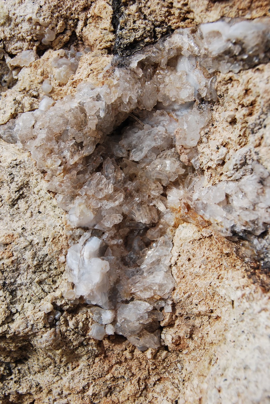
The destination appears as a prominent pyramid-shaped outcropping upstream--use that as your guide. As the route traverses the rugged sycamore-and-bear-grass-lined washes in the shadow of blocky Battleship Mountain, which flanks the western edge of the watercourse, the passage gets progressively tougher until, at the entrance to the “narrows”, the canyon is choked with massive quartz-encrusted monoliths.
Boulders at the Narrows entrance.
Strong hikers will have no trouble picking through the rocks to reach the goal. Within the towering walls of the narrows, golden Velvet ash trees dot the shores of tiny pools like windswept beacons of light. Autumn foliage color usually lasts through mid-December here unless frost turns the leaves prematurely brown.
Rough route is not for novice hikers.
Darting flocks of canyon wrens, chattering cardinals and roosting hawks find food and shelter among the cattails, reeds and willows that feast on the precious waters of LaBarge Creek.
Quartz crystals embedded in boulders.
Depending on water levels, you can hike through the twisting, rocky corridor as far as you like but consider your time wisely as the return trip back up the canyon will feel worse and take longer than you’d expect. The second bend within the narrows at roughly the 4.7-mile point makes for a good turnaround point leaving plenty of time to slog your way out with daylight to spare.
LENGTH: 9.4 miles out-and-back
RATING: moderate-difficult
ELEVATION: 1,600 – 2,400 feet
GETTING THERE: From U.S. 60 in Apache Junction take the State Route 88 (Idaho Road) exit. Turn left at the off-ramp light and continue on SR 88 for 15 miles to the Canyon Lake Marina between mileposts 210 and 211. A Tonto Pass is not required if you park in the designated hiker parking area. The trail begins at the sign for Boulder Canyon Trail #103 across the road.
Battleship Mtn (L) and Weavers Needle (C) from Boulder Trl
Canyon Lake seen from Boulder Trail.
INFO:
Tonto National Forest, Superstition Wilderness

Monday, June 25, 2018

PIVOT ROCK CANYON & WILDCAT SPRING

PIVOT ROCK CANYON & WILDCAT SPRING
Iconic Pivot Rock is the hike's keystone.
Lodged between the epic wilderness areas of West Clear Creek and Fossil Creek, the woodlands around Pivot Rock Canyon provide a quiet transition between the two recreational juggernauts.  Although it lacks the deep gorges, waterfalls and hiking challenge of its surrounding destinations, the unassuming little space on the Mogollon Rim holds fascinations of its own.  
Limestone slabs in Pivot Rock Canyon
Easily accessible off State Route 87 just south of the community of Clints Well, the area can be explored using a 1930s-era Civilian Conservation Corps campsite as a base.
From the no-frills dirt clearing, two short treks with distinct flavors head out in opposite directions. 
Butterflies congregate near the springs.
The woodsy, informal routes located just outside of the wilderness boundaries use abandoned roads and footpaths to explore an array of human artifacts and bizarre geology.
Often eclipsed by the epic, vertigo-inducing trails that scale the raw and remote cliffs of WCC (Tramway, Maxwell, Calloway) that are accessible only via tire-eating dirt roads, the Pivot Rock Canyon and Wildcat Spring trails emanates a softer character than their untamed, wilderness cousins.
Remains of a backwoods cabin.
Payson Packers maneuver through a fern gully.
The double-header circuit begins across the road from the campground at a “road closed” barrier with a walk to Wildcat Spring. Pass through the gate and follow the faint two-track, veering right (downhill) where the road splits. The road soon narrows to a footpath as it enters a shallow canyon meandering along the edge of an ephemeral stream.  The sketchy trail weaves among brambles, hip-high ferns damp forests and sunlit meadows. Several spur paths and game trails spin off the main route, but the best plan is to follow the paths-of-use on the canyon floor.  At 1.4 miles, the canyon converges to a point with evidence of runoff funneling down into the stream channel. Wildcat Spring is located up on the east wall of the canyon. A short scramble up to the defunct concrete trough reveals rusty pipes and a crudely-poured square tub holding more pine needles than water.
Wildcat Spring is usually bone dry.
On the flip side, the Pivot Rock Canyon hike is a little more convoluted. Begin hiking on the road at the end of the campground. At the 0.6-mile point, pick up an unsigned footpath on the right heading downhill to a creek channel. (For reference, there’s a small dirt clearing with a fire ring.)
Members of the Payson Packers hike group trek the roads.
Hop down the limestone slab staircase, head right and follow the obvious paths that crisscross the drainage smothered in pine-oak woodlands and aspen-shaded clearings.  The paths move through a narrow corridor bolstered by outcroppings of layered fossiliferous limestone that harbor water pockets, impressive overhangs and shallow caves. Roughly a half-mile into the canyon, keep an eye out for the eponymous rock formation on the upper left embankment. The easy-to-miss, natural limestone sculpture known as Pivot Rock hides in plain sight above the ravine.  Its massive foundation supports a balancing capstone posed like an abandoned project on a potter’s wheel.  A frenzy of wild grasses and tree sprouts have taken root in its porous, flaky surfaces. Nearby, a toppled pine tree lies shattered at its base, a near-miss that could have crushed or sent the monolith over the edge.
Once done visiting the rock, continue hiking the faint path that winds among gooseberry bushes, brambles and gigantic ferns to a point where tiny pools lush with White Watercress, Yellow Monkey flowers and swarms of butterflies and moths herald the approach to Pivot Rock Spring. 
An Orange Gooseberry thicket.
Even in our current extreme drought conditions, a trickle of water still flows from the spring’s location high on the canyon wall. Icy air and a glaze of sweet water oozes from the spring's cave-like source.
Pivot Rock Spring spews cool air and a trickle of moisture.
From the spring, backtrack to the access road and continue hiking the two-track north. Along the way, off to the left, a decaying pile of rough-hewn logs is all that remains of a backwoods cabin. 
White Watercress thrives near Pivot Rock Spring.
This is a favorite turnaround point for an easy day hike, however, it’s possible create your own circuit using the area’s maze of dirt roads and the Coconino National Forest road map for guidance.
LENGTH:
Pivot Rock: 3 miles roundtrip or up to 6 miles using linking forest roads.
Wildcat Spring: 2. 8 miles roundtrip
RATING: easy
ELEVATION: 6780 – 7100 feet
GETTING THERE:
From the State Route 260/87 junction in Payson, go 32 miles north on SR 87 to Forest Road 616, which is located past milepost 284 on the left. Follow FR 616 for 3.3 miles to an unsigned campground downhill on the right.
The Pivot Rock trail begins on the road at the end of the campground.  The Wildcat Spring hike begins across from the campground at a closed gate.
Limestone escarpments in Pivot Rock Canyon
INFO: