Find A Trail. Start Your Search Here:

Showing posts with label Brown's Mountain. Show all posts

Thursday, February 18, 2021

Brown's Mountain

BROWN'S MOUNTAIN

Brown's Mountain seen from the Brown's MtnTrail


The can’t-ignore centerpiece of Scottsdale’s McDowell Sonoran Preserve is a magnet for hikers.  When viewed from the miles of trails that weave around its base, the prominent mound might appear slightly intimidating, but if you’re like most trekkers, sooner or later you’ll climb it.

Switchbacks on the Brown's Mountain Trail

Whether you use a direct approach or long loop to access the preserve’s loftiest perch, the effort rewards with outstanding views and if you’re lucky, a peek at an aerial bird show.

Ravens soar around Brown's Mountain

The distinctive flat-topped mountain with colorfully-layered flanks sits in the preserve’s north sector among acres of yucca, cacti and desert trees.  Hikers aren’t the only ones that are attracted to this place.  Ravens have claimed the craggy cliffs below the mountain’s summit as prime nesting territory.

Ocotillo and cholla on the summit spur trail

The large, croaking and glossy jet-black birds are easy to hear and see against ocher cliffs and blue skies along the hike up the mountain.

A rocky section on the summit spur trail

While common ravens sometimes build nests in trees, they tend to favor jagged rock walls like those on Brown’s Mountain.  February through May is the best time to observe the birds’ dramatic mating rituals that include aerial dances with males and females swooping, diving and roosting to preen before building platform nests in stony cracks. 
Ravens mate for life and share parenting chores.  Females incubate eggs for 3 weeks while males provide care and feeding.  Chicks take flight about five weeks after hatching.

View of Pinncle Peak & Cone Mtn from summit

The most direct route to view the ravens in action and get to the summit begins at the Brown’s Ranch trailhead with an easy 0.6-mile walk on Brown’s Ranch Road.  Take a left onto the Brown’s Mountain Trail, and follow the moderate route as it ascends 0.7-mile along the mountain’s geologically-complex flanks where the ravens play around the rugged stone jetties that protrude from the mountain’s northeast slopes.  Once through a bare-rock chute, the route meets a saddle with a scenic overlook where the summit spur heads up the hill’s east face. 

The rock chute on Brown's Mountain Trail

The 0.2-mile summit spur ascends in tight, steep switchbacks with a short segment of blocky rock scrambling near the top.  All but the shortest hikers can get through this jumble without the need for a handhold.  The small, rocky summit offers unobscured, 360-degree views of the Valley, the preserve layout and distant mountain peaks. 

Hikers on the scenic overlook below Brown's Mtn

Several artifacts including concrete slabs inscribed with names from 1958 and a chopped wood power line pole add elements of history to the isolated peak that stands 550 feet above the desert floor.  From this high platform, the air antics of ravens take center stage. 
The saddle below Brown's Mountain

Sometimes swooping closely overhead or croaking from nearby outcroppings, they serve as loud, convincing reminders to stay on trails and not disturb nesting habitats and fragile terrain. 
Nearing the saddle below Brown's Mountain

View from the summit of Brown's Mountain

While on top, review the preserve map to scope out your return route or simply retrace your steps for a second look at the cliff-side raven drama.

LENGTH:  3 miles round trip to the summit and back

RATING: moderate

ELEVATION:  2,703 – 3,253 feet

GETTING THERE:

Brown's Ranch Trailhead: 30301 N. Alma School Pkwy., Scottsdale.

From Loop 101 in Scottsdale, take the Pima/Princess exit 36. Go 6.5 miles north on Pima to Dynamite, turn right and continue 2.7 miles to Alma School.  Turn left and go 1 mile to the trailhead. There are restrooms, water and maps at the trailhead.  The preserve is open from sunrise to sunset daily. No fees.

INFO:

https://www.scottsdaleaz.gov/preserve


Monday, November 26, 2018

BASALT RIDGE OVERLOOK

BASALT RIDGE OVERLOOK
Chunks of lichen-encrusted basalt litter the Basalt Ridge Trl.
Whether you’ve only skimmed its core trails or are a seasoned traveler of Scottsdale’s McDowell Sonoran Preserve, it’s easy to see that the 30,500-acre site is a wonderland of geological features.
Distinctive Cone Mtn. flanks the trails.
Brittlebush is plentiful along the route.
Upper Ranch Trail traverses the saddle of Brown's Mtn.
Invasive mistletoe attracts Phainopela birds.
In the preserve’s north sector, several popular routes wind among the impossible-to-miss mounds of Granite and Cholla Mountains that anchor a landscape of crystalized megaliths, nature-sculpted “mushroom rocks” and stony passages, while other trails wander off into areas with quieter dynamics.  As trail build-out progresses within the North Valley preserve, more and more subdued places are being revealed.
Wolfberry shrubs thrive in moist areas.
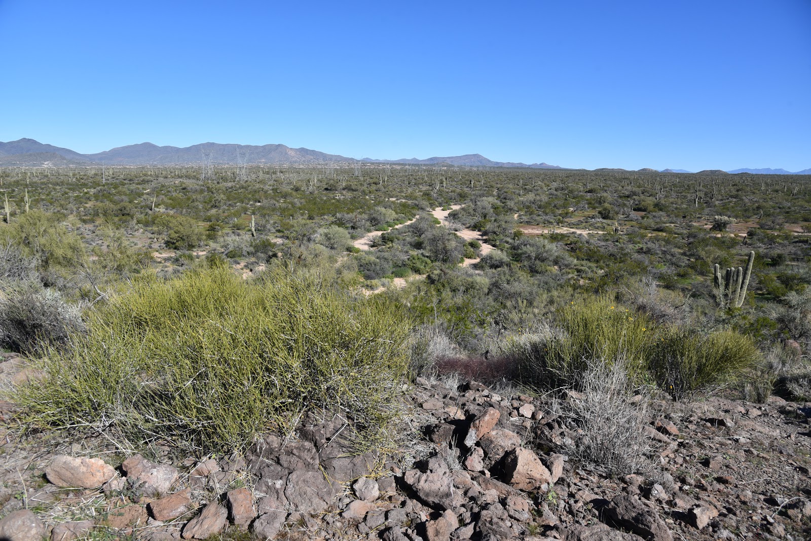
Take for instance, the Basalt Ridge Trail.  Like most trails in the preserve, the short singletrack can be accessed via numerous connecting trails.  One scenic option is to start at the Brown’s Ranch Trailhead and take the Upper Ranch Trail. The beauty of this circuit is that it departs the heavily-travelled main corridor almost immediately.  The Upper Ranch Trail glides northward over the saddle between the pointed form of Cone Mountain and flat-topped Brown’s Mountain before descending into a sunny stretch of desert cut with sandy washes, arroyos and impressive vistas of the Cave Creek Mountains.  Where water settles in the drainage areas, fragrant patches of Triangle-leaf bursage, fruit-laden wolfberry shrubs, colorful masses of in-your-face brittlebush flowers and creamy Desert wishbone blooms put on lavish botanical displays.  Roughly 1.6 miles from the start, fist-sized globs of rust-and-ash-colored rock begin to appear scattered along the route. 
Brown's Mtn. framed by blooming creosote.
Look closely and you’ll see the characteristic vesicular texture (holes formed by escaping gasses) of volcanic basalt. Unlike the showy, igneous granites that formed underground millions of years ago, this basalt is the result of surface lava flows or explosive events that also contributed to the site’s geological structure.  At the 1.8-mile point, the Basalt Ridge Trail veers off the Upper Ranch Trail tracing the crest of a low-slung rim.
Desert wishbone bush.
A half-mile and two junctions later, the Basalt Ridge Overlook spur leads to the nose of the rim perched above desert lowlands criss-crossed with dry washes and acres of mesquite. 
Mountain views on Upper Ranch Trail
Triangle-leaf bursage grows near washes.
From this tiny vantage point, views of the Four Peaks in Tonto National Forest to the east peek over Granite Mountain while the closer forms of Pinnacle Peak and Tom’s Thumb are visible to the south. Closer still are glimpses of the acres of preserve land set for future trail development that will undoubtedly add more surprises and deeper perspectives into this complex and beautiful terrain.
Cave Creek Mountains seen from the Basalt Ridge Trail
View from Basalt Ridge Overlook
LENGTH: 4.8 miles out-and-back
RATING: easy
ELEVATION:  2632 – 2741 feet
GETTING THERE:
Brown’s Ranch Trailhead,  
30301 N. Alma School Rd., Scottsdale, 85262.
From Loop 101 in Scottsdale, take the Pima/Princess exit 36, travel 6.5 miles north on Pima to Dynamite Road.  Turn right and continue 2.7 miles to Alma School, turn left and drive 1 mile to the trailhead. The preserve is open sunrise to sunset daily.
There are restrooms, water and a map kiosk at the trailhead.
INFO & MAPS:

Monday, October 19, 2015

BUCKSHOT-HAWKNEST CIRCUIT

BUCKSHOT-HAWKNEST CIRCUIT
McDowell Sonoran Preserve, North
Buckshot Trail

I have a new favorite trail in Scottsdale's McDowell Sonoran Preserve. Again. This happens every time I overcome my penchant for hiking well-known long paths with spectacular scenery and try something different. Although it's only 0.8-mile long, Buckshot Trail wins laurels because it straddles the gap between the familiar and the untried. It shoots off from the heavily travelled Brown's Ranch site to connect with the newer Hawknest Trail that arches over the preserve's north section for nearly its entire width. On the day I discovered this desert jewel, a huge group of hikers was assembled at the trailhead preparing to trek the 7.7-mile Cholla Mountain Loop--one of the area's most scenic circuits. They invited me to join them, but the drone of "been there done that" rattling in my cerebellum won over and I plowed north toward new-to-me territory instead. As with all hikes, trying to comprehend the unique character and secrets of an unexplored trail by viewing it as a line on a map is kind of like presuming to know the traits of a wine without having tasted it. Will it be a nobel Grand cru or some pedestrian vin du pays? The essence of the Buckshot Trail falls somewhere between Night Train and a hoity toity Bordeaux--amusing yet rich. Packed with massive saguaros, blooming shrubs and yucca-framed vistas, it's just far enough off the beaten paths to offer savory solitude. Only one other hiker (a preserve steward) and a handful of mountain bikers, crossed my path. Excellent maps available online and at the trailhead show numerous ways to cobble your own circuit using Buckshot Trail. Here's the route I took: From the trailhead, hike 1.9 miles north on Brown's Ranch Road to marker CL6 and turn right onto Corral Trail (note, this is 0.6 mile beyond the first Corral Trail access point). Go 0.5 mile on Corral, turn left on the Buckshot Trail and continue 0.8 mile to Hawknest Trail. Turn right (north) at the sign and hike 1.5 mile to Broken Spoke Trail, turn left and go 0.6 mile to High Desert Trail. Turn right (south) and go 0.7 mile to Corral Trail and follow the signs back to the trailhead.
On the return leg of the trip, solitude evaporated as I encountered some of the Cholla Mountain group and dozens of other hikers funneling onto arterial Brown's Ranch Road for the final mile-long trudge back to civilization and perhaps a nice Chianti.
LENGTH: 8.8 mile loop
RATING: easy
ELEVATION: 2,610' – 2,770'
HOURS: sunrise to sunset daily
GETTING THERE:
Brown's Ranch Trailhead
30301 N. Alma School Road, Scottsdale.
From Loop 101 in Scottsdale, take the Pima/Princess exit 36, go 6.5 miles north on Pima to Dynamite, turn right and continue 2.7 miles to Alma School Road. Turn left and continue 1 mile to the trailhead. There are restrooms, water and maps at the trailhead. No fee.
INFO: McDowell Sonoran Preserve
http://www.scottsdaleaz.gov/Assets/ScottsdaleAZ/Preserve/Preserve+North+Area+Trail+Map.pdf
MORE PHOTOS:

Monday, March 24, 2014

UPPER RANCH-BROWN'S MOUNTAIN LOOP


Wildflower high season at McDowell Sonoran Preserve
Scottsdale

Brown's Mountain Trail

Standing on the summit of Brown's Mountain, a heart-pumping realization of just how close the desert preserve lapping at its base came to being washed away in a tidal surge of golf properties strikes the senses.   The suburban sprawl tsunami was averted through the persistence and hard work of the McDowell Sonoran Conservancy, hundreds of volunteers and the City of Scottsdale, leaving us with an unspoiled parcel of Sonoran Desert to enjoy in perpetuity.  So, you better darn well get out there and hike! If the spectacular scenery and easy-to-navigate trails are not enough  motivation for you, the months of March and April bring wildflower high season. Even in drier years like 2013-14, strawberry hedgehog cactus, chia, lupines, poppies, buckwheat, chicory, scorpion weed, globemallow and rock gilia add splashes of vivid color to the subtle earth tones of the desert floor.
Mexican gold poppies

The familiar flat-topped silhouette of Brown's Mountain anchors the western end of the parcel. One option to get to the high point is to hike Brown's Ranch Road to Brown's Mountain Trail and take the summit spur trail to the top.
Although this path is narrow, rocky and steep, the climb's ROI is a birds-eye view of the entire trail system and surrounding mountain ranges.  Descend and continue on Brown's Mountain Trail to Upper Ranch Trail and follow its flower-fringed course back to the trailhead.

Brown's Mountain Summit Spur
LENGTH: 4.3 miles
RATING: moderate
ELEVATION:  2710' - 3253'
HOURS: sunrise to sunset daily

GETTING THERE:
Brown's Ranch Trailhead: 30301 N. Alma School Pkwy, Scottsdale.
From Loop 101 in Scottsdale, take the Pima/Princess exit 36. Go 6.5 miles north on Pima to Dynamite, turn right and continue 2.7 miles to Alma School.  Turn left and go 1 mile to the trailhead. There’s restrooms, water and maps at the trailhead.  No fees.
Brown's Mountain
INFO & MAPS: McDowell Sonoran Conservancy
City of Scottsdale:

Sunday, October 13, 2013

Brown's Ranch Trailhead GRAND OPENING this Saturday, Oct. 19, 2013


BROWN'S MOUNTAIN SUMMIT
McDowell Sonoran Preserve
Brown's Mountain

Desert hiking; how we have missed thee.  The return of cool temperatures and close-to-home Valley hiking gets an added boost this year with the opening of Brown’s Ranch Trailhead.
Everything old is new again in this beautiful swath of North Scottsdale desert.  For years, local hikers have been familiar with the maze of social trails orbiting Powerline Road north of Dixileta. With no enforced rules or designated routes to protect the area's cultural artifacts and fragile terrain, this "wild west" free-for-all recreation site was on its way to becoming either an outdoor slum or swanky golf community.  Instead, the City of Scottsdale and the McDowell Sonoran Conservancy have restored the granite-and-saguaro landscape to a glorious nature preserve.  Cleaned up, packed with amenities and staffed during peak months by superstar volunteer trail stewards, roughly 60 of the planned 120 miles of recreational trails were opened to the public on June 10, 2013.  The choice of hiking trails here can be overwhelming, so a good way to get acquainted with this new section of the preserve is to scope it out from to its high point---Brown's Mountain.  Maps at the parking lot and plentiful trail signs make navigation a cinch---just head out from the trailhead and trek toward the big hill straight ahead. The real beauty of this trail system is its connectivity.  Endless combinations of loops or out-and-back routes can be created to suit hikers of all stripes.
Brown's Mountain Trail

LENGTH: 3 miles roundtrip (trailhead to Brown’s summit and back)
RATING: moderate
ELEVATION: 2,710' - 3,253'
HOURS: sunrise -sunset daily
FACILITIES: paved parking, restrooms, water, horse hitch, bike racks, maps

GETTING THERE:
Brown's Ranch Trailhead: 30301 N. Alma School Pkwy. Scottsdale 85262.
From Loop 101 in Scottsdale, take the Pima/Princess exit #36, go 6.5 miles north on Pima to Dynamite Road.  Turn right and continue 2.7 miles to Alma School Road, turn left and go 1 mile to the trailhead.
NOTE: trailhead parking will be CLOSED from 1 p.m. Friday 10-18-13 through Saturday 10-19-13 noon for the grand opening event.  Park at Pinnacle Peak Patio (10426 E. Jomax) and take the shuttle, which will run from 7:30 a.m. to noon on Saturday.
Brown's Mountain Summit trail

McDowell Sonoran Conservancy
MORE PHOTOS: