RIDGE-SKETCH
LOOP
 |
| Framed view of the Pyramid rock formation on Sketch Trail |
 |
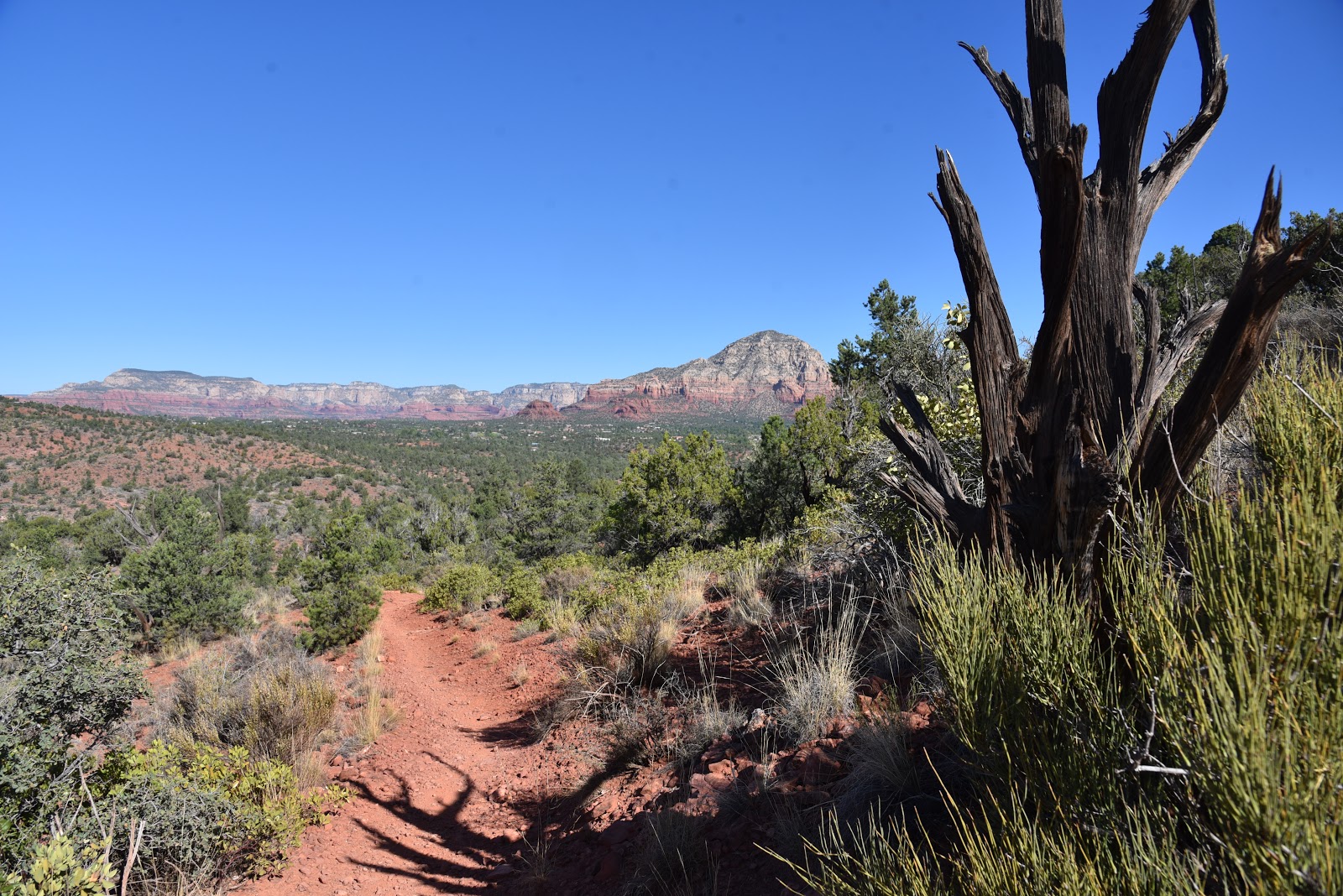
| Sketch Trail traces the edge of Carroll Canyon |
 |
| The trails pass among junipers, yucca and pinion pines |
A
merry-go-round style of scenic vistas, varied terrain and a little bit of mild
exposure combine for a pleasant high-desert hike in southeast Sedona. Tucked in
a hilly pocket of territory in the Carroll Canyon area of trails north of the
Crescent Moon Picnic Area on Oak Creek, the Ridge-Sketch circuit offers a quick,
4-mile tour of a slice of Coconino National Forest that’s close enough to town
to be convenient yet provide a quiet out-there feel.
 |
| An edgy bend in the Sketch Trail |
From the obscure trailhead on Chavez Ranch Road, begin by
hiking 0.3-mile west on the Ramshead Trail, hang a left at the Ridge Trail
junction and follow the signs and basket cairns 0.7-mile to the beginning of
the loop section at the Ridge-Sketch junction.
The 2.1-mile loop portion may be tackled from either direction, but to
get the climbing over first, go right and continue on the Ridge trail.
 |
| Sacred datura plants bloom along the route |
The east leg traces the scrubby foothills
below 4,680-foot Table Top--a jetty-like extension of Table Top Mountain which
is home to the Sedona airport. After a
few high-step maneuvers, the trail arrives on a sunny crest with
ocotillo-framed views of Courthouse Butte and Bell Rock, two of the area’s most
famous sandstone formations.
 |
| View of Sedona from the Ridge Trail |
Farther up the trail, profiles of the distant Bradshaw
Mountains and the distinctive triangular shape of the 4,498-foot Pyramid rock
formation stand out over the leafy floodplains of Oak Creek. Where the circuit meets the Sketch Trail, make
a hard left and get ready for a whole other experience. As the route heads downhill, the rounded,
buff-colored mound of Capitol Butte dominated the horizon before the knotted
path dips and bends on the lip of Carroll Canyon. The trail passes among twisted junipers and
breezy grasslands to a vista point at a precipitous drop off above the canyon’s
sheer limestone walls.
 |
| Courthouse Butte and Bell Rock seen from Ridge Trail |
Beyond this
keynote photo opp spot, the trail swerves south clinging to a slender ledge
pinched between contorted boulder-riddled escarpments and beveled drops
offs.
 |
| Sketch Trail has Bradshaw Mountains vistas |
Although it’s close-to-the-edge and
quite rocky, the last mile of the loop portion isn’t too difficult as long as
you aren’t afraid of heights and also keep an eye out for mountain bikers
approaching from behind blind curves.
 |
| Capitol Butte dominates the horizon on Sketch Trail |
As
you inch your way back to the loop junction-- using honeycomb patterns in the
limestone as handholds—take a moment to scope out the many miles of trails that
wind through the surrounding hills that may be used to build upon this sampler
loop.
LENGTH:
4-mile loop
RATING:
moderate
ELEVATION: 3996 - 4422 feet
GETTING
THERE:
From the
State Route 179/89A traffic circle in Sedona, go 4.2 miles west (toward
Cottonwood) on SR 89A to Red Rock Loop. Turn left and continue 1.8 miles to
Chavez Ranch Road (Forest Road 788) turn left and go 0.6-mile to the trailhead
on the right.
INFO:
-->