

 RIO SALADO HABITAT RESTORATION PROJECT
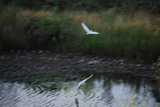
Just two miles south of downtown Phoenix, where the Salt River once flowed, a former dumping ground has been transformed into a thriving 595-acre oasis in the desert. With the cooperation of the Army Corps of Engineers, the Flood Control District of Maricopa County and droves of volunteers, tons of waste were cleared out of the Salt River channel and replaced with ponds, waterfalls and tens of thousands of indigenous plant species. Although the 5-mile-long strip of riparian habitat looks as if it occurred naturally, it’s actually a “demonstration wetland” that was created by tapping into the groundwater beneath the river channel and pumping more than 2.65 million gallons of water per day to sustain the habitat. Stretching from 19th Avenue to 16th Street, the project is a work in progress. The Central Avenue gateway is currently the most complete segment and there’s parking, interpretive signage, restrooms and drinking water. Trail segments are organized to feature specific desert habitats such as Cottonwood-Willow, Lower Sonoran, Mesquite Bosque and Palo Verde. Although just a few years old, the plants—which were harvested from seeds or cuttings within a half-mile of the Salt River—are already flourishing and attracting wildlife. Snowy Egrets, raptors, toads and dozens of other species have settled in. Future plans for the project include adding more gateways to access the more than 10 miles of paved and dirt trails and an Audubon Nature Center.
LENGTH: about 10 miles of paved and dirt trails are planned. As of 0506, about 3 miles of established trails are open.
RATING: easy and informative
ELEVATION GAIN: 50 feet
GETTING THERE:
From Phoenix. Drive south on Central Avenue through downtown. Just past the I-17 underpass, look for the obvious parking area on the leftAlternate routes:
From the east Valley, take Highway 60 west and connect to I-17. Exit I-17 at 7th Street. Go south on 7th Street to Broadway Road. Turn right (west) on Broadway Road and continue to Central Avenue. Turn right onto Central Avenue and head north for about 1 mile to the gateway.
From the west Valley, take I-10 to I-17 and exit at 7th Avenue. Go south on 7th Avenue to Broadway Road. Turn left (east) onto Broadway Road and go to Central Avenue. Turn left (north) onto Central Avenue and continue for about a mile to the gateway on the right.


 TAVASCI MARSH
Dead Horse Ranch State Park
Situated in the backwaters of the upper Verde River, Tavasci Marsh is a bird watcher’s paradise. Herons, egrets, finches, wrens and flycatchers flourish in the profuse vegetation and aren’t shy about spreading their wings. The hike passes through a healthy mesquite bosque—one of the most rare ecosystems in the world—ending at a wooden observation deck with a viewing bench at the edge of the wetlands. Here, river otters cut through pond water like oiled torpedoes accompanied by a boisterous avian soundtrack.
LENGTH: 3 miles round-trip
RATING: easy elevation gain: 50 feet
ELEVATION GAIN: 3,350’ – 3,300’
GETTING THERE:
From Phoenix, go north on Interstate 17 to Camp Verde (exit 287) and take Highway 260 west to Cottonwood. Turn left on Main Street (89A toward Clarksdale) and continue to 10th Street. Turn right on 10th St. and proceed over the Verde River Bridge to the park entrance. From the park entrance, follow the main road to Flycatcher Road (2nd road on the left) where there’s a “Tavasci Marsh” sign. Follow this road less than a mile to the signed parking area.
TAVASCI MARSH
Dead Horse Ranch State Park
Situated in the backwaters of the upper Verde River, Tavasci Marsh is a bird watcher’s paradise. Herons, egrets, finches, wrens and flycatchers flourish in the profuse vegetation and aren’t shy about spreading their wings. The hike passes through a healthy mesquite bosque—one of the most rare ecosystems in the world—ending at a wooden observation deck with a viewing bench at the edge of the wetlands. Here, river otters cut through pond water like oiled torpedoes accompanied by a boisterous avian soundtrack.
LENGTH: 3 miles round-trip
RATING: easy elevation gain: 50 feet
ELEVATION GAIN: 3,350’ – 3,300’
GETTING THERE:
From Phoenix, go north on Interstate 17 to Camp Verde (exit 287) and take Highway 260 west to Cottonwood. Turn left on Main Street (89A toward Clarksdale) and continue to 10th Street. Turn right on 10th St. and proceed over the Verde River Bridge to the park entrance. From the park entrance, follow the main road to Flycatcher Road (2nd road on the left) where there’s a “Tavasci Marsh” sign. Follow this road less than a mile to the signed parking area.


