Find A Trail. Start Your Search Here:

Showing posts with label Fay Canyon. Show all posts

Monday, May 24, 2021

Dawa Loop

DAWA LOOP

“Where’s Fay Canyon,” the bewildered couple asked of me on the Cockscomb Trail.  “Across the road from the trailhead,” I replied.

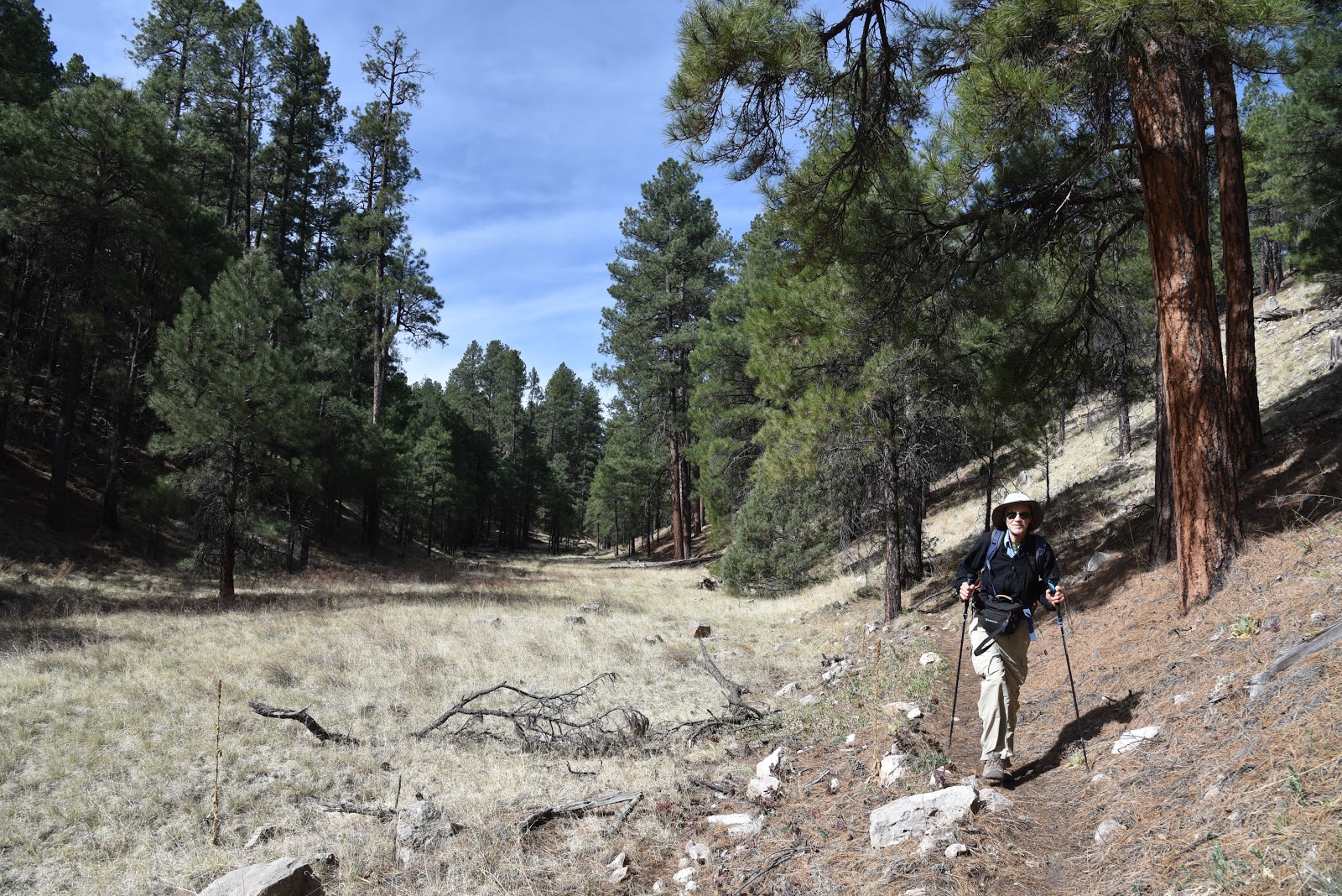
Conifers shade a crossing of Dry Creek

With the faint aroma of marijuana drifting from their air space, they added, “Thanks, that’s the trail we want. This one stinks.”

Stinks?  Being one who picks her fights, I let the offhanded dis roll, bid them a good day and continued hiking on one of the best “stinky” trails in Sedona.

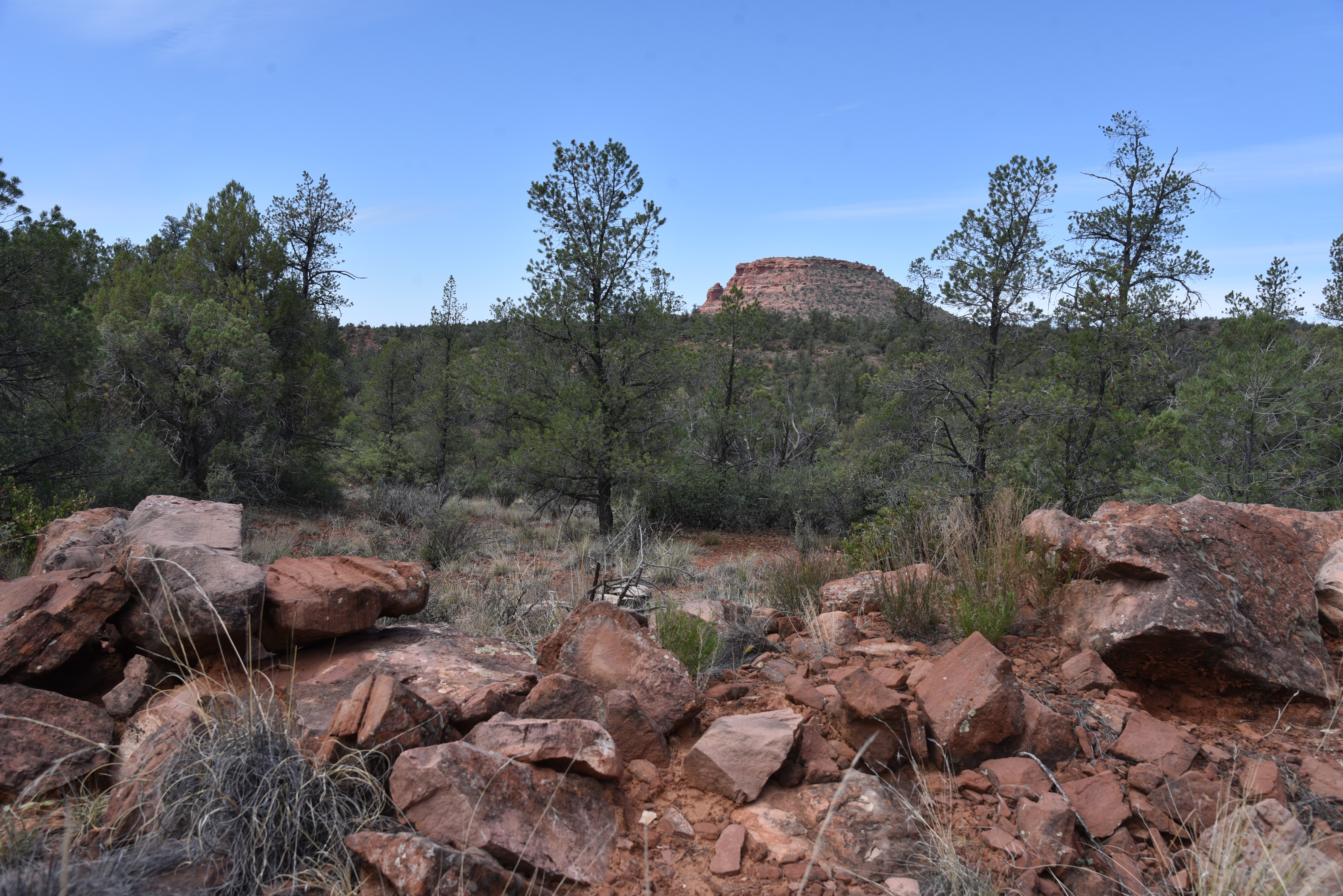
View of Doe Mountain from Cockscomb Trail


While Fay Canyon and the many other classic trails like Doe and Bear Mountains located along Boynton Pass Road in northwest Sedona are terrific, so are the dozens of routes that mill around the canyon-riddled landscape below the iconic big-name draws. 

Barberry shrubs bloom Apr-Jul

Offering quieter, less congested tours of Sedona’s spectacular scenery, the trails that explore the woody terrain around Dry Creek serve up myriad high-desert hike options. 
New Mexico locust bloom May-July

Like many Red Rock Country trails, the cluster south of Doe Mountain are short, interlaced and designed for easy customization. 

The route crosses Dry Creek several times

The Ok Trail traces a ledge above Dry Creek

Excellent map signs posted at trailheads and along the trails make it easy to plan a hike to suit individual preferences.  There are no bad choices.  None stink.  One circuit to try uses the Cockscomb, Dawa, Ok and Arizona Cypress trails for an interesting lollipop loop.  From the Fay Canyon trailhead, head out on the Cockscomb Trail. 
Tufted evening primrose bloom Apr-Nov

This 0.9-mile tether trail passes through sunny meadows and rolling hills with great views of Doe Mountain to the west and Mescal Mountain on the northeast horizon. where At the signed Dawa Trail junction, veer left to begin the first leg of the hike’s loop segment. 
Cockscomb formation seen from Dawa Trail

Here, mountain views begin to recede as vegetation thickens with pinon pines, cypress and New Mexico locust towering over prickly barberry shrubs. The first of several crossings of Dry Creek, which usually lives up to its name, comes just before the 1.7-mile point, where the route turns right onto the Ok Trail.  Over its shady, 0.2-mile length, the Ok Trail traces the ledges above the creek before it meets the Arizona Cypress Trail. 
A late-blooming Strawberry hedgehog cactus

At the junction sign, continue straight ahead, past a huge Arizona Walnut tree to where the trail makes another crossing of the creek.  Strewn with colorful river rocks and tumbled pebbles, the creek channel here includes a ragged wall of scoured red earth.
Desert four o'clock bloom Apr-Sept

 
Engelmann's prickly pear cacti bloom Apr-Jun

Living up to its name, the Arizona Cypress Trail is lined with hundreds of the eponymous shaggy-bark conifers, including a massive, decaying specimen just past the creek cross. 
Mescal Mountain (center) seen from Dawa Trail

It takes at three-person chain to hug the trunk of the not-quite-totally-dead tree.  Look closely and you’ll see a few living branches sprouting from the last viable sapwood of the ancient tree.  
Narrowleaf penstemon bloom Jun-Aug

This mostly viewless leg of the route parallels the creek for a half-mile, then reconnects with the south arm of the Dawa Trail.  As the path climbs out of the creek channel, it unpacks a fresh set of vistas.  
The Arizona Cypress Trail lives up to its name

To the southeast, the familiar forms of Courthouse Butte, Capitol Butte and Chimney Rock stand out above green canopies.  Gradually, the close-knit creekside greenery gives way to exposed ridges where cacti, wildflowers and blooming shrubs thrive in red-tinged soils.  
Teeny-weeny Miniature wool star bloom Mar-Jun

In just under a mile, the route returns to the first Dawa Trail junction, where you’ll retrace your steps on the Cockscomb Trail back to the trailhead or use the map signs to add more miles.
Map signs make navigation easy

LENGTH: 4.2-miles

RATING: easy

ELEVATION: 4,334 – 4,569 feet

GETTING THERE:

Fay Canyon Trailhead.

From the State Route 179/89A traffic circle in Sedona, veer left and go 3.2 miles on SR 89A to Dry Creek Road. Turn right and continue 4.5 miles on Dry Creek Road to the Boynton Canyon Road intersection, turn left onto Boynton Pass Road and go 0.5-mile to the trailhead on the left. There’s a restroom at the trailhead. A Red Rock Pass is not required.

INFO:https://www.fs.usda.gov/recarea/coconino/recarea/?recid=54974


Monday, February 11, 2019

Fay Canyon

Fay Canyon
An impressive rock formation at the end of Fay Canyon Trl.
Loosen the vice grip on your brain’s imagination center and the russet stone escarpments embracing Sedona’s Fay Canyon Trail transform into dragon scales, crouching gremlins and other-worldly beasts.  
Yuccas line the beginning of Fay Canyon Trail
Of course, rousing this kind of magical point-of-view needs some help. A willingness to tap into your inner child, or better yet, hiking with an actual pack of vociferous kids should do the trick.
Yuccas are plentiful in sunny spots on the trail.
Is it a steamboat or castle? Ask a kid. 
When approached without prejudice, expectation or mind-muddling electronic devises, whimsical forms hiding among the trail’s sandstone cliffs seem to pounce from their precipitous perches. 
Sandstone buttes along Fay Canyon Trail.
Letting go of what we know to be true and logical frees the mind to train a playful lens on Sedona’s Secret Canyon Wilderness Area.  
Oaks, pinion pines and junipers close in on the trail.
It’s the “wild” in wilderness areas that sets them apart from forests, parks and other public lands. The 1964 Wilderness Act set a global precedence for protecting unspoiled lands from development and destruction. Undisturbed lands benefit wildlife habitat, watersheds and offer opportunities for responsible recreational use. You can’t drive a motorized vehicle, fly a drone, build a structure or even ride a bike in these special places.  Of Arizona’s 90 protected areas, Sedona’s Red Rock Secret Canyon Wilderness is one of the most attainable and imagination-stoking destinations in the state.  It’s a satisfying trip for expert backpackers and casual day-trippers alike.  Seldom-seen sections (Bear Sign and Secret Canyon Trails) of the a 43,950-acre wilderness are reached by hiking miles into remote back country, while milder excursions are just a few steps from paved roads and plush resorts.  Whether you enter this enchanted zone through a groomed front door or a rickety back gate, you’ll soon understand how the simple act of walking a primal path is as much a privilege as it is a wonder behold.  
Russet cliffs weathered into fantastic forms.
The trail is in Red Rock Secret Canyon Wilderness.
A front-door favorite, the Fay Canyon trailhead on Boynton Pass Road is outfitted with a restroom and plenty of parking.  Just yards from a heavily-travelled byway, the effortless out-and-back trail immediately enters the wilderness, passing through sandy drainages and sunny fields dotted with yucca and twisted manzanita shrubs. As the path narrows, the animated cliffs close in revealing an outdoor art gallery of nature-sculpted shapes. Weathered pinnacles resemble golf tees, hammers, dancers and birds. If you’re hiking with or near kids (a given on this family-friendly trail), listen to some of the names they assign to the rocks. Sponge Bob, Bart Simpson, Pokemon. 
A primitive side trails leads to Fay Canyon Arch.
A half-mile in, a faint path on the right leads to an emerging natural arch. Barely visible from the trail, the true scale of the overhang isn’t apparent until you’re standing beneath it. The optional, quarter-mile diversion requires scrambling on loose rock with some minor exposure but pays off with fly-over vistas and interesting nooks to explore. 
Washes and tangled roots near the end of the trail.
Forests of oak, cypress and pinion pines thicken as the root-and-vine-tangled route dives deeper into the canyon culminating at a boulder-choked wash below a magnificent red rock formation. The sculptural piece de resistance, which stands several stories high, has no name. But its imposing presence and place in the landscape bumps creative thinking into over drive.  Is it a shark fin? An anvil? An alien landing platform? Who can say? The whole point of this excursion is to let your imagination roam wild. If you’re stuck for a name, just follow the kids.
There's easy access to Fay Canyon Trail.
What will you see in Fay Canyon's red rocks?
LENGTH: 1.2 miles one-way
RATING: easy
ELEVATION: 4500- 4800 feet
GETTING THERE:
From the State Route 179/89A traffic circle in Sedona, veer left and go 3.2 miles on SR 89A to Dry Creek Road (Forest Road 152C). Turn right and continue 4.5 miles on Dry Creek Road to the Boynton Canyon Road intersection, turn left

 onto Boynton Pass Road and go 0.5-mile to the trailhead on the left. There’s a restroom at the trailhead. A Red Rock Pass is not required.

INFO:


-->

Monday, April 30, 2018

FLAGSTAFF'S FAY CANYON

FLAGSTAFF'S FAY CANYON
Fay Canyon
Not to be confused with the Fay Canyon Trail in Sedona, Flagstaff’s version is a totally different experience. The meandering trail that follows the course of a gully that feeds into majestic Walnut Canyon southeast of town is a mellow, woodsy walk.  Located just east of the heavily-traveled Sandy’s Canyon trail off Lake Mary Road, the Fay Canyon route is a quieter trek with similar qualities.  
Creeping Barberry
The unsigned route is a little tricky to follow. Hike up Forest Road 9477B to the 0.3-mile point, veer left at a gate and pick up a single track heading north.  For reference, there’s a sign warning of heavy horse traffic a few yards down the trail. 
A ravine bisects Fay Canyon
Within a short distance, the trail makes a sharp turn to the right and begins a downhill plunge on long switchbacks.  This piney segment decends on an easy grade to emerge in at the head of the canyon.  Over the next two miles, the gorge gradually transforms from a steep-walled sliver to a gaping valley. Bisected by a water-scoured ravine, the canyon has horse trails on both banks. These can be confusing, but they eventually merge. Just keep heading north and you’ll be fine. 
Arizona valerian
Along its expanding course, the trail passes by pockmarked limestone cliffs, rock shelves and shallow caves.
Fay Canyon
A closer look at the limestone reveals crystal-filled geodes, entrenched fossils and glinting quartz nodules. 
Tiny crystals in limestone
In moister areas beneath the mixed conifer canopy, an understory of thorny-stemmed wild roses, gooseberries and willows grow in profusion among clumpy grasses and patches of creeping barberry, Arizona valerian and daisies galore.
At the 2.6-mile point, the trail ends in an airy meadow where the Arizona Trail passes through. 
Lizards are easy to spot in Fay Canyon
This is the turnaround point for an out-an-back hike, however, trail signs show distances for continuing to the Flagstaff Urban Trails System, Marshall Lake or Fisher Point.  One fun option is to make the short, but steep walk up to Fisher Point. Known for wild winds that churn up speed as they funnel through a network of forested gorges, the area surrounding Fisher Point is a fascinating enclave of contorted rock formations softened by wildflower fields and swaying pines. 
Dunes beneath Fisher Point
To get to the lookout point 400 feet above the major trail junction, follow the signs 1.2-miles and enjoy the breezy vistas. 
Wild rose
View from Fisher Point
LENGTH: 2.6 miles one-way for Fay Canyon, or 8.2 miles round trip with Fisher Point option.
RATING: moderate
ELEVATION: Fay Canyon : 6,620'-6,950' or 7,033' to Fisher Point
GETTING THERE:
From Flagstaff, go 4 miles south on Lake Mary Road to S. Wildlife Road (at the “Hitching Post Stables” sign).  Turn left and drive a few yards to a “T” intersection, veer left and continue less than 0.1 mile to the sign that reads Walnut-Skunk-Fay Closure Area, No Motor Vehicles.  Parking is very limited.  Please respect private property in the area by not blocking roads or driveways.

Sunday, September 11, 2011

ARIZONA'S OTHER FAY CANYON

FAY CANYON
Flagstaff
When creeping barberry leaves take on a red blush, the last days of summer in Arizona’s high country are upon us. And so it was with this harbinger of frost underfoot that we set out to enjoy the last few bittersweet weeks of northern Arizona hiking. To do so, we selected yet another “who knew” trail in Flagstaff.  With numerous limestone caves, ancient sand dune rock formations and acres of alpine meadows, Arizona's other Fay Canyon is a joy to explore.  Unlike the famous (and crowded) red rock, Fay Canyon located in Sedona’s high desert, this trail sees much less activity.  That's likely because there are few resources describing this hidden gem of a hike.  Conveniently located in the Mormon Lake area, this route through a shallow valley connects with the Walnut Canyon Passage of the Arizona Trail, Flagstaff Urban Trails System and Sandy's Canyon.  The trail is almost completely shaded as it travels the margins of a lush gorge flanked with bizarre geological structures and deep canyon drop offs.  To add length, we included a side trip to Fisher Point. Here’s how:
HIKE DIRECTIONS: from the trailhead, hike 0.3 mile along the double-track dirt road paralleling Lake Mary Road.  At the gate/fence located where the road makes a sharp right hand turn, pass the gate and continue straight (north) along a footpath.  From here, the trail is well maintained and easy-to-follow.  At two points along the route, the trail splits—in both cases, stay to the left and take the higher paths. (I’m pretty sure the splits merge eventually, but it’s just smart to stay on the main trail).  At the 2.6-mile point, Fay Canyon Trail ends at a “Y” intersection with the Arizona Trail. Here, head right (east) along a well-signed path to continue on to Fisher Point and the dunes.

Whether hiked alone or as a leg on longer treks, this quiet canyon trail offers a perfect way to enjoy one last summer mountain trek.
Creeping Barberry turns red when temperatures drop

LENGTH: 8.2 miles roundtrip as described here. Fay Canyon alone: 2.6 miles one way
RATING:  moderate
ELEVATION: 6,220' – 7,033' (this description), Fay Canyon only: 6,620'-6,950'
DISTANCE FROM PHOENIX:  148 miles one way
GETTING THERE:
From Phoenix, go north on I-17 to exit 339, Lake Mary Road (Forest Road 3) located just south of the I-40/I-17 interchange in Flagstaff.  From the bottom of the off ramp (across from a Circle K), turn right and go 4 miles south on Lake Mary Road to S. Wildlife Road (at the “Hitching Post Stables” sign).  Turn left here and drive a few yards to a “T” intersection, veer left and continue less than 0.1 mile to the sign that reads: “ Walnut-Skunk-Fay Closure Area, No Motor Vehicles”. Parking is very limited.  Please respect private property in the area by not blocking roads or driveways.
INFO:
PRINT MAP : Emmitt Barks Cartography “Flagstaff Trails Map”
Flagstaff Ranger District, Coconino National Forest, 928-526-0866

MORE PHOTOS:

Wednesday, October 8, 2008

FAY CANYON

The "shark fin" at trail's end
The ruins beneath the arch are likely reconstructed
Fay Arch
inside Fay Arch
Typical scene along the trail
FAY CANYON TRAIL Red Rock Secret Mountain Wilderness, Sedona Hiding in plain site in the cliffs above Fay Canyon Trail, are historic and geological wonders you won’t want to miss. However, you’ll need a keen eye to locate them. About a mile into the shaded high-desert canyon, look for an artful cairn and a faint spur trail on the right. From there, Fay Arch and remnants of an ancient stone structure are visible in the cliffs high above the trail. A short but steep hike up to the arch is worth the effort because the enormity of the Supai sandstone bridge and the adjacent slot canyon is best experienced up-close. The exploratory adventure doesn’t end at the ruins, though. The trail terminates at a prominent “shark fin” formation surrounded by cliffs that offer easy climbing and impressive views of Sedona. LENGTH: 2.4 miles round-trip RATING: easy (with a tricky optional side trip) ELEVATION: 4,500'-4,800' Fees: A Red Rock Pass ($5 daily fee per vehicle) is required. GETTING THERE: From the junction of Highways 179 and 89A (the “Y” traffic circle intersection) in Sedona, turn left onto Highway 89A and continue for 3.2 miles to Dry Creek Road. Turn right on Dry Creek Road (Forest Road 152C) and continue 2.9 miles  to the  Long Canyon/Boynton Canyon Road intersection. From here, turn left to stay on FR-152C and continue to Boynton Canyon Road. At the intersection, turn left onto Boynton Pass Road and drive for about a half-mile to the trailhead on the right.
INFO: Red Rock Ranger District, Coconino National Forest
http://www.fs.fed.us/r3/coconino/recreation/red_rock/fay-canyon-tr.shtml