Find A Trail. Start Your Search Here:

Tuesday, December 27, 2011

CRAZY CACTUSES, CANYONS & CREEKS

CAVE CREEK TRAIL #4
Tonto National Forest

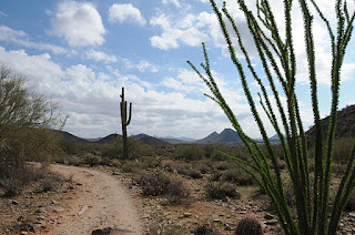
The product of both a growth anomaly and miraculous survival, a ginormous crested saguaro cactus, sporting a fabulous fan-shaped cap, is a keynote attraction of this popular hiking route.  Biologists remain stumped about how the bizarre fan-shaped tops of crested saguaro cactuses form citing genetic mutations, lightning and other forces of nature as possible culprits.  Adding to the allure of this aberrant plant (located roughly 3 miles from the east trailhead)  is its survival of the 2005 Cave Creek Complex Fire which destroyed much of the surrounding vegetation. In addition to this trademark biological wonder, the trail is steeped in enchantment, passing among rolling desert hills, trickling creeks, magnificent canyons, forests of sycamores, mesquite bosques and heady, go-on-to-forever vistas.  It's impossible to hike this trail and not be moved by its extraordinary beauty.
The trail runs east-west, and can be accessed from the west at Spur Cross Ranch or the east at Seven Springs Recreation Area.  The shallow flow of Cave Creek anchors both terminuses while a maze of scrub-laden hills and valleys fill the in-betweens.  This is an especially beautiful hike during “desert autumn” (November thru mid-December) when the creekside foliage glows in shades of gold.  

LENGTH: 10.4 miles one-way
RATING:  moderate
ELEVATION: 3,280'-2,960'
DOGS: dogs must be on leash.  There have been recent reports of rabid bobcats in the area, so be sure your dog’s shots are up-to-date.
BEST SEASON: October - April (December is primo!)
GETTING THERE:
EAST Cave Creek Trailhead: From the Loop 101 in Scottsdale, take the Pima/Princess Road exit and go  13 miles north on Pima to Cave Creek Road.  Turn right (east) and go 12.5 miles on Cave Creek Road (a.k.a FR 24 and Seven Springs Road) past Seven Spring Recreation Area  to Cave Creek trailhead on the left located between MCDOT mile markers 12 and 13.  Roads paved up to the last 10 miles, which are maintained dirt/gravel, passable by passenger cars when dry. Two minor creek crossings are required—do not attempt after heavy rains.
WEST: Spur Cross/Skull Mesa Trailhead: From the park trailhead, hike 2.9 miles north on Spur Cross Road (FR48) to the Skull Mesa trailhead and pick up trail #4. MAP:
FACILITIES: restroom, picnic tables
FEES: Tonto Pass is NOT required as long as you park at the hiker trailhead only.
INFO: Tonto National Forest:

MORE PHOTOS:

Wednesday, December 21, 2011

TRAIL OF DOOM?

PYRAMID TRAIL
South Mountain Park, Phoenix
One year from today, the Maya Long Count Calendar will complete its 5,125-year cycle, triggering the End of the World. Time for a HIKE!

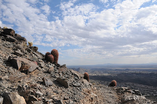
From the desert floor beneath the triangular-shaped peak that dominates this trail, a zig-zagging path ascending its west face  looks like steps on a Mayan temple--  a chiseled, deliberate skyward trek. With my imagination stoked by a recent viewing of the Mel Gibson film Apocalypto,  I trudged up this hill in the waning days of 2011 wondering about the impending doom predicted by the  Maya Long Count Calendar. According to ancient Maya astronomers, on the winter solstice 2012 (12-21-12, 11:11 p.m. UT --4:11 p.m. in Phoenix) our sun will align with the center of the Milky Way, triggering cosmic chaos and the end of the world. Apparently, the City of Phoenix  did not get Quetzalcoatl's memo and went ahead with a major land purchase in 2009, adding the Pyramid and Bursera trails (both completed in 2011)  to the Ahwatukee side of South Mountain Park.  However, other than its name and Mayan-esque physical characteristics, this trail has nothing at all to do with the demise of the universe.   Instead, it's full of life, a joy to hike and would make for an excellent 2012 New Year's Day hike---because of the end of the world and all.  (eh-hum, back to hiking) The first mile is an easy walk among cactuses, creosote and ironwood-cluttered arroyos just yards from the backyards of a residential area along Pecos Blvd.  The trail then swerves away from the homes, taking on the pyramid via switchbacks that go from elongated and effortless to short and grinding. Passing cliffs where cholla and barrel cactuses cling to bare rock, the trail hugs the edge of the hill for expansive views of the Sierra Estrella Mountains and the cotton fields of the Gila  Indian community.  After topping out on an isolated stony outcropping, the path then makes a minor dip onto a saddle then goes up again  toward an array of towers near where it connects with the National Trail. 
Whether or not the  Maya (or other) theory of 2012 armageddon comes to fruition, this trail is as good a place as any to witness stellar cataclysm--or make a dent in a new year's resolution to get more exercise.
Arroyo on the Lower Trail

LENGTH: 6 miles roundtrip
RATING:  moderate
ELEVATION: 1,235' – 2,337'
DOGS: leashed dogs allowed
FACILITIES: none
BEST SEASON: October -April

GETTING THERE:
From Phoenix, take I-10 south/east (Tucson) to exit 161 for Pecos Road.  Drive 7.2 miles west (right) on Pecos to 17th Avenue.  Head north (right) on 17th Ave. and continue 0.7 mile to where 17th Ave meets Chandler Blvd.  Turn left here and go 0.3 mile to the end of the road where a generic "trail" sign marks the trailhead.
HIKE DIRECTIONS:
From the trailhead, begin by hiking west, making a sharp right a few yards in.  Continue 0.44 mile to the junction with Bursera Trail.  Here, go right (east) and continue 2.6 miles to trail's end at the junction with National Trail. NOTE: there are a couple of junctions marked only with plain brown posts---at these, just head toward the peak.
INFO: City of Phoenix Parks & Recreation
MAPS:

Saturday, December 17, 2011

DEEM HILLS


City of Phoenix Parks & Recreation
View from the Ridgeline Trail

Not too long ago, only an informal quagmire of footpaths provided access to this set of low-slung hills in northwest Phoenix. This was great for the locals who knew the area, but not so much for those of us who like to know where we're going.  In 2010, the City of Phoenix gave the Deem Hills trails a major facelift adding excellent signage, trailhead facilities and onsite/online maps, thus  re-DEEMing (sorry, couldn't resist) this city park from its pit of neglect. Now a primo hiking destination, trekkers can choose from several routes ranging in difficulty from very easy to mildly strenuous.  The 5.9-mile long Circumference Trail serves as a main artery route, acting as a gateway to several paths that crawl up and around the hills.  In my opinion, the most interesting routes in the park are the Ridgeline and Basalt Trails.  Both paths involve some climbing, but it's so gradual, you'll hardly break a sweat.  On the way up, views of north Phoenix mountains, CAP canal and surrounding suburbs stand out from  the trailside inky-black basalt boulders and rock slides.  Although the din of I-17 is never quite out of earshot, this close-to-town hiking spot makes for an easy way to get out for a quick jaunt in the desert.
Ridgeline Trail

LENGTH: 14.29 miles of trails (one way)
Circumference Trail: 5.9-mile loop
Palisade Trail/WaterTank Road: 1.53 miles
Basalt Trail: 0.64 mile
Ridgeline Trail: 1.45 miles
CAP Road: 1.61 miles
Various Access Trails: 2.5 miles
Water Tank Road: 0.33 mile
RATING:  easy-moderate
ELEVATION: 1,500' at trailhead to 2,098' top of Ridgeline Trail
Basalt Boulders on the Basalt Trail
KID FRIENDLY: yes
DOGS: leashed dogs are allowed.  Handlers must immediately pick up poo and pack it out
BEST SEASON: October -April

GETTING THERE:
EAST (39th Ave. ) TRAILHEAD: From Phoenix, go north on I-17 to exit 218 for Happy Valley Road.  Pass through the traffic circle, heading west (left) on Happy Valley Road and continue 1 mile to 35th Avenue. Turn north (right) and follow 35th Ave. 1.4 miles to Pinnacle Vista Road. (NOTE: 35th Ave.  swerves and turns into 33rd Ave).   Turn west (left) and follow Pinnacle Vista 0.7 mile to where it dead-ends and veers right at 39th Ave.  The trailhead is roughly 0.1 mile up 39th Ave. on the left.
FACILITIES: map sign, shaded seating area, drinking fountain
WEST (51st Ave) TRAILHEAD:  Deem Hills Park
  at 51st Avenue and Deem Hills Parkway . From I-17, follow Happy Valley Road west to 51st Ave. Turn north (right) and continue on 51st Ave (it will turn into Deem Hills Pkwy) to the trailhead on the right.
FACILITIES: Restrooms and water available.
INFO: City of Phoenix Parks & Recreation

Wednesday, December 14, 2011

HIKING WITH TOURISTS : PART 2

BADGER SPRINGS WASH
Agua Fria National Monument
Air travel these days is a real bear. What with the body scans, shoe searches and the outright abuse  of  overhead bin space, trying to cram a decent pair of hiking boots and a backpack into weight-restricted luggage is certainly not at the top of the “to do” list of many holiday travelers.  Yet, with so much to see in the great Arizona outdoors, we simply should not let the lack of good equipment put a damper on treating our winter visitors to a hike.  Here's one local favorite that's not too rough but has a nice wilderness feel to it.  Badger Springs Wash Trail is a short, sandy gateway to Agua Fria Canyon ending at the mouth of the gorge just before the going gets tricky. One of only two  “official” trails in Agua Fria National Monument, the route delves into a world of steep granite walls and gangly scrub with a panel of ancient petroglyphs at trail's end serving as the outing's  piece de resistance. Although properly-equipped hikers can stumble through the full length of the boulder-strewn canyon, tourists are usually thrilled by the unfamiliar sights
and satisfied with the enormity of eye-candy along this abbreviated trek. 

Head of Agua Fria Canyon, Dec. 9, 2011

Boulders & Sand define Badger Springs Wash
LENGTH: 2 miles roundtrip
RATING: easy (some rocky spots)
ELEVATION: 3,100' – 2,900'
GETTING THERE: From Phoenix, go roughly 40 miles north on I-17 to exit 256 for Badger Springs Road.  Turn right and continue about 1.2 miles (past the restroom) to the circular parking area. This last mile is on rugged dirt/gravel, so a high-clearance vehicle is recommended.
The trail begins at the southeast side of the lot.  You'll see a sign and register box about 50 yards in.
INFO: Bureau of Land Management, 623-580-5500

Monday, December 12, 2011

HIKING WITH TOURISTS: PART 1

GOWAN TRAIL
Tonto Natural Bridge State Park, Payson
As an avid hiker, one  dilemma that frequently crosses my boots is this---what to do when out-of-state guests arrive from the frozen north.  Although many of my visitors love and appreciate the outdoors (and also want me to take them hiking) few are regular hikers and none have experience in our state's special terrain.  Over the years, I've come up with a list of innocuous trails that are suitable for those equipped only with tennis shoes,  a borrowed walking stick and a bottle of water but still give good exposure to the Arizona wilds.  The Gowan Trail, which leads to the world's largest naturally-sculpted travertine arch at Tonto Natural Bridge State Park, is one of those trails.  Short, engineered with steps to ease the climb  and packed with the WOW factor, this hike is always a crowd pleaser. Other short trails in the park are also “tourist-friendly”. Maps are available in the visitor center.


Suspension Bridge over Pine Creek
LENGTH: 1 mile round trip
RATING: moderate (although the trailhead sign warns of difficult terrain, it just ain't that bad)
ELEVATION:  3,155' - 2,805'
KID FRIENDLY: with supervision
DOGS: pets not allowed on the trails
FEES:
Adults (age 14+): $5
Youngsters (7-13): $2
Kiddies (0-6): free

Tonto Natural Bridge
HOURS: 9 a.m. To 5 p.m. Park is closed on Tuesdays, Wednesdays, Thanksgiving & Christmas
FACILITIES: restrooms, visitor center/gift shop, picnic areas, swimming, hiking
DISTANCE FROM PHOENIX: 110 miles one way

Ice hangs from the top of the bridge: Dec. 8, 2011
GETTING THERE: From Phoenix, north on SR87 (Beeline Highway) to Payson.  From the intersection of SR87/260, continue 10 miles north on 87 to the signed turn off on the left. The paved road down to the park is narrow and steep.
INFO: 928-476-4202

Saturday, December 10, 2011

HIKING FALL COLOR IN DECEMBER

HIKING FALL COLOR IN DECEMBER
December 7, 2011

Suspension bridge over Queen Creek
Color on December 7, 2011
Entering the Suspension Bridge, Dec. 7, 2011
If you missed the fall hiking season in northern Arizona his year, a second chance to view autumnal color has arrived in the deserts, and just in time to treat my visiting cousins from Connecticut (where fall foliage was ruined by a severe, October snow storm this year) to a beautiful hike under canopies of tawny leaves.  Our first stop was Boyce Thompson Arboretum where the annual fall festival, staring the famous Chinese pistachio trees, is in full swing this week.  Take the scenic High Trail, which is accessed via a wood suspension bridge and follows a ridge above Queen Creek for the best views of the vivid amber sycamore, blood-red pistachio and lemony cottonwood trees.
LENGTH:  up to 4 miles, maps available online and at the park
RATING:  easy
ELEVATION: 2,400’-2,600’
View from the High Trail

GETTING THERE:
From Phoenix, go east on US 60 to the signed turn off for the park located just outside the town of Superior. 
FEES:  $9 per adult, $4.50 for kids 5-12 and FREE for kids under age 4 and under.
HOURS:  Sept. – April: 8 a.m. to 5 p.m., May – Aug. 6 a.m. – 3 p.m.
DOGS: leashed dog are permitted. Bring poo bags.
INFO:  (520) 689-2811, http://ag.arizona.edu/bta/

Wednesday, December 7, 2011

RICHINBAR MINE RUINS

RICHINBAR MINE RUINS
Agua Fria National Monument
Approaching the Petroglyph Site

Mine Site Ruins
Few places in Arizona are as rich in history as the mesas and valleys of Agua Fria National Monument (AFNM).  Straddling the canyon-riddled grasslands along I-17 between Black Canyon City and Cordes Junction, the area's complex landscape can be viewed from behind the wheel of a car or by stopping at Sunset Point rest area.  However, it takes hiking into the guts of this wild place to really appreciate its significance.  Although most of the AFNM is very rugged terrain, this historic mining operation is one of only three spots on the monument that almost anybody can get to without much fuss.  (Pueblo La Plata and Badger Springs Wash are the other two).  The hike begins at a locked gate just off the freeway, following a dirt road past a windmill with water toughs for the cattle that graze the surrounding flatlands.
In just under a mile, the road reaches the cliffs overlooking Agua Fria River Canyon. This is a good place to get an overview of the layout and plan your exploring before descending to the site.  Concrete foundations and random heaps of rotting wood, rusty metal and barbed wire are all that remains of Richinbar Mine.  Clinging to the steep inclines above the canyon and below the low-slung mound of Joe’s Hill volcano, the mine operated from the 1880s to the 1940s under various owners harvesting tons of copper, lead, gold and silver.  Three major mine shafts—one at least 500 feet deep—are on the site.  Although they're cordoned off by barbed wire, it's wise to use extreme caution around these holes.  Much has been written about the mine and the hardy workers who lived and labored in this unforgiving terrain and the links below are excellent sources to peruse before taking this hike. 
But long before the rich ore drew modern day miners to the area, this place was inhabited by Native Americans who built seven major cities and hundreds of satellite dwellings that now stand as crumbling foundations throughout the monument.  The locations of most ruins are not publicized to aid preservation, however, there's a well-known petroglyph site here with elegant etchings of antelope and deer ---it's on the pinnacle to the far north of the mine.

First View of the Mine Site

LENGTH:  1.5 miles one-way to the mine. 
(We wandered around the site for a total hike of just under 4 miles).
RATING: easy
ELEVATION: 3,370' – 3,497'
BEST SEASON: October - April
GETTING THERE:
From Phoenix, go north on I-17 (roughly 35 miles) to the Sunset Point rest area.  From here, continue 1.7 miles to the turnoff for FR9006 on the right.  A windmill and stock tanks are your landmark. (If you reach Badger Springs Road, you've gone 2.3 miles too far). Turn onto FR9006 and park in the dirt lot being sure not to block the gate. The gate is usually locked, but it's easy (and legal) to squeeze through.   Roads are paved up to the dirt parking area.
Petroglyphs
INFO:
Agua Fria National Monument: general info and maps
https://www.blm.gov/visit/agua-fria
Arizona Pioneer & Cemetery Research Project: historical info and photos


Friday, November 25, 2011

HUMBOLDT MOUNTAIN

HUMBOLDT   MOUNTAIN
Tonto National Forest
Looking East Over the Verde River Valley
UPDATE: 9-26-20 The Sears Fire is burning in this area. https://inciweb.nwcg.gov/incident/7218/
View from the Summit
Sometimes I just feel like a brainless hike up a hill with no route finding, treacherous terrain or precarious precipices. Just. Up.  Thankfully, Humboldt Mountain meets this criteria and it's not too far from downtown Phoenix.  You've probably seen this hill and wondered about it ---there's a huge, white “golf ball” (as it’s commonly called) on the summit that’s visible from the back roads north of Cave Creek and Carefree. The white ball, which is an FAA radar station used for air traffic control, shares the summit with a fire tower and a hardware jungle of tech equipment.  The hike involves walking up a narrow road of crumbling asphalt via a series of gentle switchbacks and a combination of flat and fairly steep segments.  The 2005 Cave Creek Complex Fire took a toll on the area's vegetation, but recovery is underway and desert shrubs are popping up everywhere.  With every few feet of elevation gain, the views get bigger and better.  Much of the lower road winds through cactus-studded grasslands with Cave Creek Mountains, Pinnacle Peak and New River Mesa on the horizon.  Higher up, the road winds around to the eastern slope of the mountain where there the sprawling Verde River Valley and Horseshoe Lake come into view. Just below the summit, the one and only hairpin turn in the road kisses the edge of a scenic saddle.  Here, sycamore-and-cottonwood cluttered drainages appear as  twisted meanders nearly 2,000 feet below.  From this saddle, the final uphill slog to the summit rewards with more excellent views and the revelation that “golf ball” is hardly an accurate description of the FAA tower. It is most indubitably, a soccer ball.

LENGTH:  7.8 miles roundtrip
RATING:  moderate
ELEVATION: 3,570' – 5,204'
BEST SEASON: October - April
Saddle View

GETTING THERE:
From Loop 101 in North Scottsdale, take the Pima/Princess Road exit and go 13 miles north on Pima Road to Cave Creek Road.  Turn right (east) and continue on Cave Creek Road (a.k.a. FR 24, Seven Springs Road) to FR 562 (Humboldt Mountain road) located between MCDOT mile markers 9 and 10.  The turnoff is easy to miss—it’s on the right, paved and there’s a “562” sign about 100 feet up the road.  Park in the turnouts along FR24 and FR562 and hike up FR562 to the summit. 
HINT: If you get to Seven Springs Recreation Area, you have gone roughly 2 miles too far.
INFO:  Cave Creek Ranger District, Tonto National Forest, (480) 595-3300

MORE PHOTOS:

Sunday, November 20, 2011

LOST DOG WASH-RINGTAIL-OLD JEEP LOOP

LOST DOG WASH-RINGTAIL-OLD JEEP LOOP
Ocotillo on Ringtail Trail
McDowell Sonoran Preserve, Scottsdale
Lost Dog Wash Trail
Thompson Peak from Taliesin Overlook
Now, here's a trail after my own heart.  Although the eponymous canine didn't have such luck---it's nearly impossible for hikers to get lost on this trail. That's because this desert path bumping up against the 'burbs of North Scottsdale is lovingly maintained and outfitted with directional signage at every critical point.  Not exactly the best trail choice for solitude or a “wilderness feel”, this popular path's benefits are its ease-of-tread, proximity to town, beautiful views and nice trailhead facilities. Also, for those living in less than fit bodies due to Arizona summer hibernation, this trail makes for an effortless segue into the winter hiking season. 
Sandwiched between a sea of terracotta tile roofs and the foothills below the peaks of the McDowell Mountains, Lost Dog Wash is kind of a peanut-butter-and-jelly hike---easy to make and everybody loves it. For comparison, the Tom's Thumb hike—one of the tougher trails in the preserve-- is a Tofurkey Rubin hike---more exotic and not for everyone.
Given that I only had a couple of hours to hike this week, Lost Dog Wash was a natural choice. However, to add interest, I made a loop hike using 3 short trails. The Lost Dog trail is extremely popular and is usually crowded with hikers, runners, dog walkers and mountain bikers.  This loop option (details below) briefly escapes the spokes and spandex via the Old Jeep Trail.  The preserve also boasts a team of trail stewards—highly trained and knowledgeable outdoor enthusiasts who volunteer their time to educate the public about this precious swath of desert.  I hiked with one of them today for about a mile and learned quite a bit from him before we hiked off on divergent paths.  The stewards also lead public hikes and there’s one coming up this Thanksgiving morning called “More Pie Please”.  To join this free, easy, 3-mile hike, meet at 7:45 a.m. at the Lost Dog Trailhead (see below) and preemptively work off the calories for your extra slab of pecan pie (or Tofurkey Rubin).
LOOP DIRECTIONS:
Begin on Lost Dog Wash Trail (LD) and hike 0.5 mile to the Ringtail Trail (RT) junction.  Go right and follow RT 0.5 mile to the LD Overlook at emergency marker RT5.  Visit the overlook, then return to the trail and go another 0.2 mile to the junction with Old Jeep Trail (JT).  Go left (north) on JT and hike 1.4 miles to where the trail reconnects with LD.  Continue straight on LD.  In another 0.5 mile, you'll come to the turn off for Taliesin Overlook.  Although LD trail continues another 0.4 mile past the overlook, I made this the turnaround point for the loop.  Hike back to JT junction, but this time, go right (south) and follow LD 1.6 miles back to the trailhead.
LENGTH: 5.3 mile loop
RATING: easy
ELEVATION:  1,755' – 2,092'
FACILITIES: restrooms, water, shade ramadas, horse hitching posts 
HOURS: sunrise to sunset (it's illegal to be in the preserve outside these hours)
KID FRIENDLY: yes
DOGS: leashed dogs allowed.  Handlers must immediately pick up poo and pack it out.
GETTING THERE:
From the Loop 101 in Scottsdale, take exit 41 for Shea Blvd., turn east (right) and go 4.2 miles to 124th Street. Turn left (north) on 124th Street and go 1 mile to where the road dead-ends at the trailhead.
INFO: City of Scottsdale McDowell Sonoran Preserve
McDowell Sonoran Conservancy:
http://mcdowellsonoran.org/

MORE PHOTOS:

Saturday, November 12, 2011

CORONA DE LOMA TRAIL

CORONA DE LOMA TRAIL
South Mountain Park, Phoenix
It was from the summit of Quartz Peak in the Sierra Estrellas where I acquired a deep, visual understanding of the three-mountain-range structure of South Mountain Park (SoMo).  From the top of that isolated peak, the trio of parallel ranges running east-west at the southern fringe of downtown Phoenix, rolled out below, and suddenly, it all made sense.  The layout of the park, roads, trailheads, the cosmic fugue---everything. But then again, put me on any mountain summit, and clarity ensues.
In order, from north to south, the ranges are (with sample trails) Ma-Ha-Tauk (Alta Trail), Gila (Holbert, National Trail) and Guadalupe (Desert Classic).  That day on Quartz Peak, I realized that although I was very familiar with the trails on Gila and Ma-Ha-Tauk; I still had a lot to learn about the other side of the mountain.  With that goal in mind, I set off for Corona de Loma Trail.
Save for a couple of mildly confusing junctions, this trail on the back (Ahwatukee) side of  SoMo is a great way to climb to a summit ridge with much less traffic than on other similar treks in the park like Kiwanis, Holbert and Telegraph Pass. 
Exposed to the sun and covered in scree, the trail winds up the mountain via long switchbacks passing by deranged-looking ironwood trees, cactuses, milky white quartz, shimmering micas and outcroppings of decaying metamorphic stone.   Geology buffs revel in the complexity of rock both underfoot and on the horizon featured on this hike, but even those whose rock knowledge begins and ends with a 3rd grade “grow your own crystal” kit will appreciate  the bizarre  rock sculptures-- like the one I call "snakehead"-- that line the trail.
LENGTH:  6.4 miles roundtrip (including access trail from Warpaint TH)
RATING:  moderate
ELEVATION:  1,370' – 2,360'
KID FRIENDLY: best for older kids, kinda steep in several places
TRAILHEAD FACILITIES:  none
DOGS: must be on leash, rough terrain for paws, handlers must pack out poo
BEST SEASON:  October -April
GETTING THERE:
From Phoenix, go south on I-10 to exit 159 for Ray Road.  Go west (right) on Ray Rd. and continue 0.3 mile to 48th Street.  Turn north (right) and go 0.3 mile to Knox Road.  Turn west (left) and follow Knox 1.8 mile to Warpaint Drive on the right.  Drive 0.2 mile north on Warpaint to the trailhead on the right.  There are two unsigned “trailheads” here. The one you want for this hike has a wooden fence lining the entry. There’s only parallel parking along the street. Pay attention to no-parking zones as this trailhead is in a busy residential area. 
HIKE DIRECTIONS:
From the trailhead, hike roughly 0.1 mile to a “Y” junction where there’s a rusty sign post with arrows.  Go right here and hike 0.7 mile to a second “Y” junction with a metal post with the number “43” scratched into it.  Go left (you’re now on the Desert Classic Trail) and continue 0.2 mile to sign post “46”.  This is the turnoff for the access trail to Corona de Loma, although no signs indicate this.  Turn right at this junction and continue 0.2 mile (stay straight at an unsigned cross path a few yards up) to the signed turn off for Corona de Loma on the right.  The path is obvious but unsigned as it climbs up to a high ridge, dips into a narrow canyon and then climbs up again to Buena Vista Lookout where it intersects the National Trail.
See the “more photos” link below for pix of the critical junctions.
INFO AND MAPS: City of Phoenix Parks & Recreation:
FOR COOL INFO ON SoMo geology, visit the GEMLAND Website:
MORE PHOTOS:
http://www.facebook.com/media/set/?set=a.1910790068198.73723.1795269672&type=1&l=af35516782

Tuesday, November 8, 2011

DIXIE MOUNTAIN LOOP

DIXIE MOUNTAIN LOOP TRAIL
Phoenix Sonoran Preserve
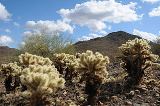
Next time you’re considering  giving up your right to vote—hike this trail first. Like many people these days, you’re probably feeling over taxed, over worked (or under employed) and powerless to intervene with anything governmental.  Folks, I submit the Phoenix Sonoran Preserve---a  recreational oasis that WE THE VOTERS decided was worth saving from development.  In 1998, voters approved the Growing Smarter Fund to conserve tracks of our beautiful Upper Sonoran desert.  So far, the city has purchased 7,000 of a proposed 20,000 acres for this north Phoenix preserve.  With obesity on the rise, strapped budgets and increasing healthcare costs, it's good to live in Phoenix---we have the largest municipal park system in the nation  with hundreds of miles of free hiking/biking trails to help us save money and stay healthy. Wherever you live in the Valley, you're probably not far from a hiking trail.  So, it's not necessary to spend big bucks on video-driven exercise toys or gym memberships to stay/get in shape—just lace up your boots and hit the trail.
Cholla cactuses along Dixie Loop
View from Western Vista summit
Located just a few clicks east of I-17 on the fringes of a residential area, this pristine island of desert features panoramic views of the entire Valley.  You'll see the  Hieroglyphic Mountains to the west, Cave Creek and New River  Mountains to the north, and Camelback and Piestewa Peaks to the south.  Luminescent  “jumping” cholla, sweet-smelling creosote and arroyas choaked with acid-green Palo verde trees decorate  the paths, providing ample nesting places for the resident Gila woodpeckers, Gambel quails, lizards and red-tail hawks.
So before you join the ranks of the “poo-pooing-perceived-powerless”, get off the couch, hit the trail and prepare to be awestruck. Who knows, you (or somebody you know) may also be inspired to become a registered voter.


LENGTHS:
Dixie Mountain Loop: 4.62 miles, including the Hawks Nest access trail.  OR 5.74 miles including both optional summit spurs.
Hawks Nest: 0.40 mile one way
Dixie Mountain Summit: 0.22 mile one way
Western Vista: 0.34 mile one way
RATING: easy-moderate
ELEVATION: 1,600' – 2,251'. Most of the loop trail hugs the 1,700' level. Western Vista spur: 2075', Dixie Mountain Summit: 2,251'
DOGS: dogs must be on leash and handlers must pack out poo
KID FRIENDLY: yes
BEST SEASON: October -April
FACILITIES: no restroom or water. plenty of parking, trail map sign, and there’s a special lot for horse trailers
HOURS: 6 a.m. to 7 p.m.
GETTING THERE:
Desert Vista Trailhead:
From Phoenix, go north on I-17 to Jomax exit.  Go 0.2 mile on Jomax to Norterra Parkway, turn left (north) and continue 1.2 miles to North Valley Parkway.  Turn right (south) and go 0.2 miles to Copperhead Trail.  Turn left and go just a few yards  to Melvern Trail.  Turn left on Melvern and go 0.1 mile  to Desert Vista Trail on the right .  Follow Desert Vista through a gate that leads to the trailhead..
INFO: City of Phoenix, Phoenix Sonoran Preserve
For general information: 602 262-7901
REGISTER TO VOTE: Maricopa County Elections Department, 602-506-1511.
MORE PHOTOS:

Thursday, November 3, 2011

SUGARLOAF HILL

SUGARLOAF SUMMIT LOOP
Sedona
View from the summit ridge

Chimney Rock
Capitol Butte (a.k.a. Thunder Mountain)
Funny how things work out sometimes.  One fine day in late October, I drove to Sedona with plans to hike the Allen’s Bend trail. T’was not to be.  For whatever reason, the gate on the road to the trailhead was locked, so I wandered over to another trail, hiked for a couple hours and tried again---still locked.  Oh well. Chalking this up to fate, I saved the $8 access fee (which I subsequently squandered on a six-pack of local ale), and went for a cup of coffee to mull over where to go instead.  Using the forest service recreation guide that came with my Red Rock Pass, I looked for  a trail I hadn't already done and decided on Thunder Mountain—part of Sedona's North Urban Trail System. However, when I arrived at the trailhead (which also provides access toTeacup and Sugarloaf trails) , I learned that  Thunder Mountain trail is short, flat and kinda boring, but alas, to the east, a red rock butte with people milling around on its summit caught my attention---Sugarloaf. The trailhead sign had a map of the route, so (after locating the owners of an errant beagle wandering the parking lot), off I went.

Although the way is marked by signs and basket carins, this hike is located just north of a residential area with many informal paths intersecting the main trails.  Therefore, you'll need to pay attention to stay on course.   From the trailhead sign, hike 0.5 mile along the Teacup Trail  to a small saddle marked by a basket carin with a wooden post sticking out of it. To reach the summit, hang a right here and make the quarter-mile climb to the top of Sugarloaf's bald crest.  Considering that this hill is hemmed in by much higher  and vastly more impressive rock features, views from its apex  are surprisingly excellent.  Local geological landmarks including Capitol Butte (a.k.a. Thunder Mountain), Chimney Rock and Coffee Pot Rock clutter the landscape.  To the west, the hazy silhouette of Mingus Mountain  soars above the Verde River Valley.  To complete the loop, hike back down to the carin/post, turn right and follow the (somewhat difficult-to-follow) path back to the trailhead.  To extend your hike, click on the web site link below to learn about connecting trails and other loop options from the Sugarloaf trailhead.

LENGTH: 2.2 miles roundtrip
RATING: easy
ELEVATION: 4,300' – 4,900'
KID FRIENDLY: yes
DOGS:  allowed, but must be on leash. There's a poop bag dispenser at the trailhead.
BEST SEASON: October - May
FACILITIES: none
FEE: A Red Rock Pass is required--$5 daily fee.  
http://www.redrockcountry.org/passes-and-permits/index.shtml
DISTANCE FROM PHOENIX:  130 miles one way
GETTING THERE: From Phoenix, go north on I17 to exit 298 for SR179, Sedona-Oak Creek. Go west (left at the offramp)  to the “Y” intersection of SR179 and US89A in Sedona, veer left through the traffic circle (toward Cottonwood) and continue 2 miles on 89A to Coffee Pot Drive on the right (located between Soldier Pass Road and Dry Creek Road). Go 0.5 miles on Coffee Pot to Sanborn Drive, hang a left, and continue 0.1 mile to Little Elf Drive where a generic “hiker’ sign points right.  Turn onto Little Elf and follow the signs 0.2 mile to the Sugarloaf Trailhead. Roads are 100% paved.
INFO: Red Rock Ranger District, Coconino National Forest, 928-282-4119

Friday, October 28, 2011

SEDONA FALL COLOR UPDATE 2011: SECRET CANYON

SECRET CANYON TRAIL #121
Red Rock Secret Canyon Wilderness, Sedona

A community of pinion pines, juniper and assorted cactuses at the trailhead belie what lies ahead on Secret Canyon Trail. Epic views of Sedona’s red rock landscape dominate the first 1.75 miles of this hike before the trail makes a sharp westward swerve at the mouth of the canyon. From here, the route leaves the shade-less chaparral plunging into a streambed where torrential spring water runoff and blowing dust have carved bizarre sculptures in the sandstone escarpments flanking the path. Residual pools of water stand at the bases of moisture-hungry cottonwoods with heart-shaped, lemony leaves.
Near the 5-mile point, the trail enters “the narrows”, a series of slick-rock corridors hemmed in by a vertical fortification of sandstone with clusters of blood-red maples and rusty-orange oaks bursting from the rubble-strewn canyon floor. Beyond this point, the trail degrades into a quagmire of scree and undergrowth, which is why most hikers make the narrows their turnaround point. However, those with good route-finding skills can opt to scramble, squeeze and scoot along a sketchy footpath for another half-mile.

LENGTH: 5.5 miles one-way
RATING: difficult
ELEVATION: 4,500 – 5,100 feet
DISTANCE FROM PHOENIX: 134 miles
GETTING THERE:
From the “Y” intersection of SR179 and SR 89A in Sedona, go left through the traffic circle (toward Cottonwood) and go  3.2 miles west on 89A to Dry Creek Road. Turn right and go 2 miles to Vultee Arch Road (Forest Road 152). Turn right and follow FR152  3.4 miles to the trailhead on the left. A high clearance vehicle is required on FR 152.
FEE: Red Rock Pass--$5 per vehicle is required. http://www.redrockcountry.org/passes-and-permits/index.shtml
INFO: Coconino National Forest, Red Rock District, 928-203-2900


Tuesday, October 25, 2011

HART PRAIRIE FALL COLOR UPDATE 2011

Just heard from Neil Chapman, Hart Prairie Preserve Program Manager.  Aspen color on Hart Prairie is just about over for this year.  By this weekend, it's done.  

Saturday, October 22, 2011

SEDONA FALL COLOR UPDATE 2011: HUCKABY TRAIL

Fall color is arriving later than usual along the US 89A strip of Oak Creek this year. Although we found sprigs of blazing red sumac and some nice golden sycamores, willows and common hop trees, peak color has yet to arrive. The next couple of weeks will be splendid. 
Crossing Oak Creek--you WILL get wet

HUCKABY TRAIL
Sedona
Arizona sycamore
Ever drive up US89A to the spot near Grasshopper Point and Midgley Bridge?  Yup—it's a madhouse, especially in autumn when the sycamores, cottonwoods and willows lining Oak Creek take on gorgeous tawny hues.  Swarms of visitors scramble for coveted parking spots along this scenic and precipitous curve in US89A in order to hike, bike or simply take in the views from the road.  An alternative way to get to the sweet color spots under the bridge with (somewhat) less congestion is to begin hiking three miles downstream at the Schnebly Hill trailhead and follow the Huckaby Trail to the creek.
This relatively new trail (est. 1998) starts out in classic Sedona, yucca-and-cypress-studded, high-desert terrain, then dips into the shady, riparian corridor of Oak Creek Canyon via a series of moderately challenging twists and turns.  Near the 2.3-mile point, the route meets the creek where you’ll have to rock-hop or do a knee-deep wade to the west bank in order to complete the final 0.3-mile  uphill leg to US89A and the north end of Midgley Bridgley.

LENGTH:  5.2 miles roundtrip
RATING:  moderate
ELEVATION:  4,500' – 4,300'
FACILITIES: Huckaby Trailhead: restroom, picnic tables.  None at Midgely Bridge trailhead.
FEE: A Red Rock Pass is required: $5 daily fee per vehicle. The permit kiosk at Huckaby trailhead was not working on 10-22-11.  That's why it's smart to purchase your pass at  local vendors like Circle-K, cuz, the trailhead kiosks seldom work (at least in my experience). We also saw a ranger checking windshields for passes today. Check out this link to learn more about the Red Rock Pass Program:
DISTANCE FROM PHOENIX: 125 mile one-way
GETTING THERE:
SCHNEBLY HILL TRAILHEAD:
From Phoenix, go  north on I-17 to exit 298 (SR179 for Sedona-Oak Creek).  At the bottom of the offramp, turn left (west) and follow SR179 to Schnebly Hill Road in Sedona, located at the  traffic circle/bridge over Oak Creek (and before the Talaquepaque center).  Veer right thru the traffic circle, and go 0.8 mile  on Schnebly Hill Road to the trailhead (signed for Margs Draw, Munds Wagon and Huckaby) on the left.  Roads are 100% paved.
MIDGELY BRIDGE TRAILHEAD:
From I-17, follow SR179 to the “Y” junction with US89A in Sedona. Veer right through the traffic circle and go 1.9 miles north on 89A to the parking area on the northwest side (left) of the bridge.  The trail begins under the bridge.  Roads are 100% paved.

INFO: Red Rock Ranger District, Coconino National Forest, 928-282-4119

MORE PHOTOS: