DIXIE MOUNTAIN LOOP TRAIL
Next time you’re considering giving up your right to vote—hike this trail first. Like many people these days, you’re probably feeling over taxed, over worked (or under employed) and powerless to intervene with anything governmental. Folks, I submit the Phoenix Sonoran Preserve---a recreational oasis that WE THE VOTERS decided was worth saving from development. In 1998, voters approved the Growing Smarter Fund to conserve tracks of our beautiful Upper Sonoran desert. So far, the city has purchased 7,000 of a proposed 20,000 acres for this north Phoenix preserve. With obesity on the rise, strapped budgets and increasing healthcare costs, it's good to live in Phoenix---we have the largest municipal park system in the nation with hundreds of miles of free hiking/biking trails to help us save money and stay healthy. Wherever you live in the Valley, you're probably not far from a hiking trail. So, it's not necessary to spend big bucks on video-driven exercise toys or gym memberships to stay/get in shape—just lace up your boots and hit the trail.
 |
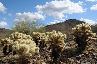
| Cholla cactuses along Dixie Loop |
 |
| View from Western Vista summit |
Located just a few clicks east of I-17 on the fringes of a residential area, this pristine island of desert features panoramic views of the entire Valley. You'll see the Hieroglyphic Mountains to the west, Cave Creek and New River Mountains to the north, and Camelback and Piestewa Peaks to the south. Luminescent “jumping” cholla, sweet-smelling creosote and arroyas choaked with acid-green Palo verde trees decorate the paths, providing ample nesting places for the resident Gila woodpeckers, Gambel quails, lizards and red-tail hawks.
So before you join the ranks of the “poo-pooing-perceived-powerless”, get off the couch, hit the trail and prepare to be awestruck. Who knows, you (or somebody you know) may also be inspired to become a registered voter.
LENGTHS:
Dixie Mountain Loop: 4.62 miles, including the Hawks Nest access trail. OR 5.74 miles including both optional summit spurs.
Hawks Nest: 0.40 mile one way
Dixie Mountain Summit: 0.22 mile one way
Western Vista: 0.34 mile one way
RATING: easy-moderate
ELEVATION: 1,600' – 2,251'. Most of the loop trail hugs the 1,700' level. Western Vista spur: 2075', Dixie Mountain Summit: 2,251'
DOGS: dogs must be on leash and handlers must pack out poo
KID FRIENDLY: yes
BEST SEASON: October -April
BEST SEASON: October -April
FACILITIES: no restroom or water. plenty of parking, trail map sign, and there’s a special lot for horse trailers
HOURS: 6 a.m. to 7 p.m.
GETTING THERE:
Desert Vista Trailhead:
From Phoenix, go north on I-17 to Jomax exit. Go 0.2 mile on Jomax to Norterra Parkway, turn left (north) and continue 1.2 miles to North Valley Parkway. Turn right (south) and go 0.2 miles to Copperhead Trail. Turn left and go just a few yards to Melvern Trail. Turn left on Melvern and go 0.1 mile to Desert Vista Trail on the right . Follow Desert Vista through a gate that leads to the trailhead..
INFO: City of Phoenix, Phoenix Sonoran Preserve
For general information: 602 262-7901
REGISTER TO VOTE: Maricopa County Elections Department, 602-506-1511.
MORE PHOTOS:


No comments:
Post a Comment