 SPUR CROSS-METATE-TOWHEE LOOP
Spur Cross Ranch Conservation Area, Cave Creek
SPUR CROSS-METATE-TOWHEE LOOP
Spur Cross Ranch Conservation Area, Cave Creek
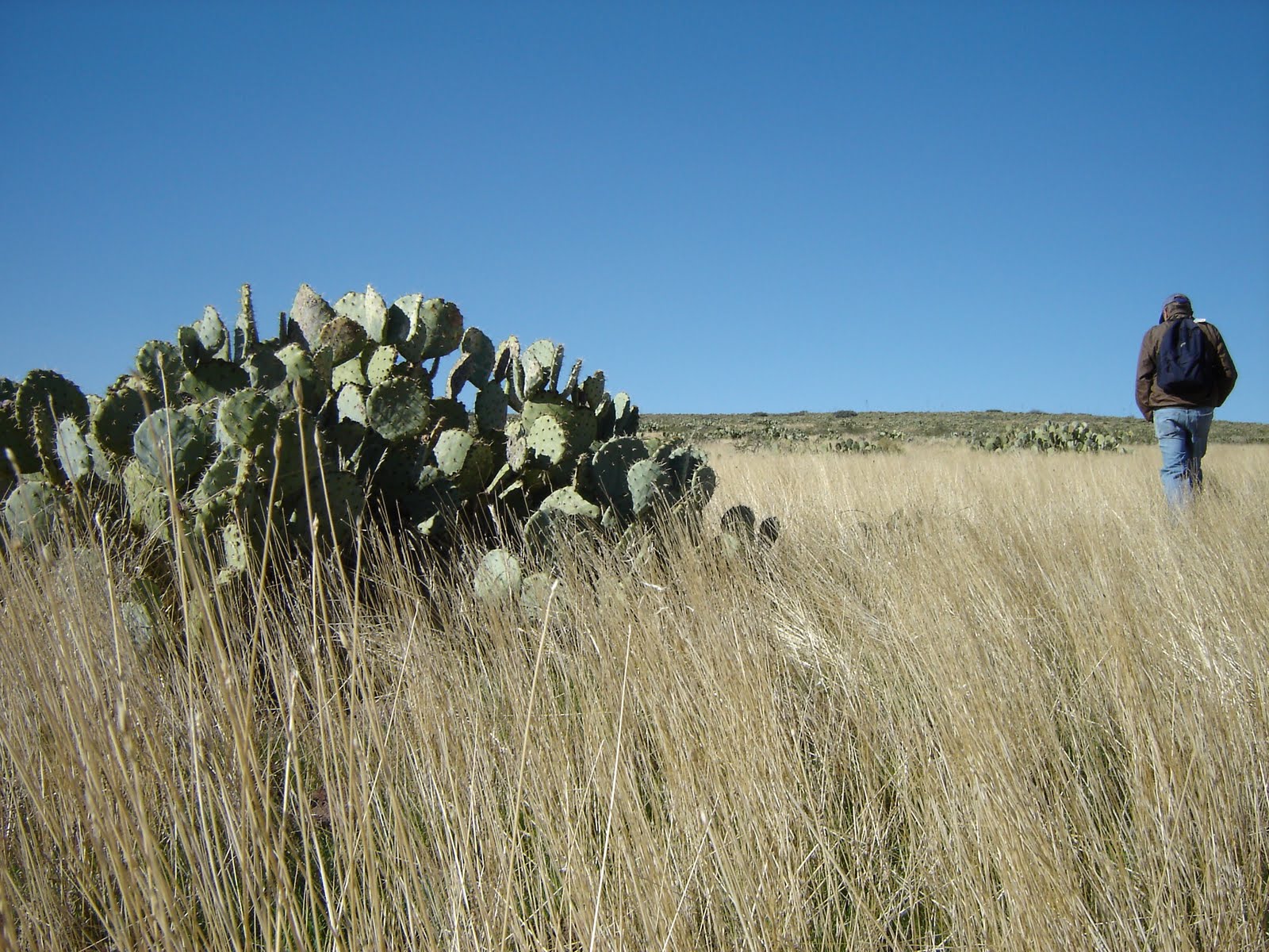
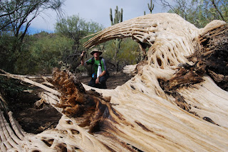
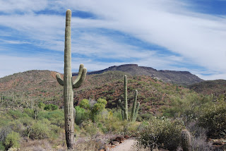
This short loop hike makes for an excellent introduction to the diverse bio zones of Spur Cross Ranch Conservation Area. The route wanders through rare mesquite bosques, creekside riparian habitats and a forest of some of the most outrageous saguaro cactuses anywhere. Handy steppingstones make short work of crossing usually shallow Cave Creek while gentle uphill grades lead to high ledges where views of famous local geological features like Elephant Mountain, Sugarloaf and Skull Mesa soar over pristine swaths of Sonoran desert. The route is well signed and maintained. Park rangers and volunteers offer a full schedule of public programs that range from hikes to archeological sites to talks on native flora and fauna. Check out the Web site below for details.
HIKE DIRECTIONS:
From the permit kiosk, hike straight ahead on the wide dirt road to the first major trail junction and take the left leg (heading northwest) of the Spur Cross Trail (SX). Follow SX 0.2 mile to the Metate Trail (MT) junction, hang a right (northeast) and follow MT 0.2 mile to the Towhee Trail (TW). Veer right onto TW, which will rejoin MT in 0.2 mile. Follow MT 0.5 mile back to SX, hang a right (south) and continue 1.5 miles back to the trailhead.
LENGTH: 2.8-mile loop
RATING: easy
ELEVATION: 2,200 – 2,300 feet
BEST SEASONS: October - April
GETTING THERE:
Spur Cross Ranch Conservation Area is located approximately 35 miles north of central Phoenix. Interstate 17, State Route 51, and Loop 101 can all be used to reach the park. From the intersection of Carefree Highway and Cave Creek Road head north on Cave Creek Road about 2.5 miles to Spur Cross Road. Turn north for approximately 4.5 miles to the public parking area. After 3 miles the road turns to all-weather graded dirt and is passable by sedan. The last 1.5 miles can be confusing; continue north on the graded road past the green house, through the tall gateposts and on past the horse corrals to the signed public parking area on the right.
FEE: $3 daily fee per person. Bring exact change for the self-serve permit kiosk.
FACILITIES: port-o-potties
INFORMATION & MAP: www.maricopa.gov/parks/spur_cross/Directions.aspx


 SPUR CROSS-METATE-TOWHEE LOOP
Spur Cross Ranch Conservation Area, Cave Creek
This short loop hike makes for an excellent introduction to the diverse bio zones of Spur Cross Ranch Conservation Area. The route wanders through rare mesquite bosques, creekside riparian habitats and a forest of some of the most outrageous saguaro cactuses anywhere. Handy steppingstones make short work of crossing usually shallow Cave Creek while gentle uphill grades lead to high ledges where views of famous local geological features like Elephant Mountain, Sugarloaf and Skull Mesa soar over pristine swaths of Sonoran desert. The route is well signed and maintained. Park rangers and volunteers offer a full schedule of public programs that range from hikes to archeological sites to talks on native flora and fauna. Check out the Web site below for details.
HIKE DIRECTIONS:
From the permit kiosk, hike straight ahead on the wide dirt road to the first major trail junction and take the left leg (heading northwest) of the Spur Cross Trail (SX). Follow SX 0.2 mile to the Metate Trail (MT) junction, hang a right (northeast) and follow MT 0.2 mile to the Towhee Trail (TW). Veer right onto TW, which will rejoin MT in 0.2 mile. Follow MT 0.5 mile back to SX, hang a right (south) and continue 1.5 miles back to the trailhead.
LENGTH: 2.8-mile loop
RATING: easy
ELEVATION: 2,200 – 2,300 feet
BEST SEASONS: October - April
GETTING THERE:
Spur Cross Ranch Conservation Area is located approximately 35 miles north of central Phoenix. Interstate 17, State Route 51, and Loop 101 can all be used to reach the park. From the intersection of Carefree Highway and Cave Creek Road head north on Cave Creek Road about 2.5 miles to Spur Cross Road. Turn north for approximately 4.5 miles to the public parking area. After 3 miles the road turns to all-weather graded dirt and is passable by sedan. The last 1.5 miles can be confusing; continue north on the graded road past the green house, through the tall gateposts and on past the horse corrals to the signed public parking area on the right.
FEE: $3 daily fee per person. Bring exact change for the self-serve permit kiosk.
FACILITIES: port-o-potties
INFORMATION & MAP: www.maricopa.gov/parks/spur_cross/Directions.aspx
SPUR CROSS-METATE-TOWHEE LOOP
Spur Cross Ranch Conservation Area, Cave Creek
This short loop hike makes for an excellent introduction to the diverse bio zones of Spur Cross Ranch Conservation Area. The route wanders through rare mesquite bosques, creekside riparian habitats and a forest of some of the most outrageous saguaro cactuses anywhere. Handy steppingstones make short work of crossing usually shallow Cave Creek while gentle uphill grades lead to high ledges where views of famous local geological features like Elephant Mountain, Sugarloaf and Skull Mesa soar over pristine swaths of Sonoran desert. The route is well signed and maintained. Park rangers and volunteers offer a full schedule of public programs that range from hikes to archeological sites to talks on native flora and fauna. Check out the Web site below for details.
HIKE DIRECTIONS:
From the permit kiosk, hike straight ahead on the wide dirt road to the first major trail junction and take the left leg (heading northwest) of the Spur Cross Trail (SX). Follow SX 0.2 mile to the Metate Trail (MT) junction, hang a right (northeast) and follow MT 0.2 mile to the Towhee Trail (TW). Veer right onto TW, which will rejoin MT in 0.2 mile. Follow MT 0.5 mile back to SX, hang a right (south) and continue 1.5 miles back to the trailhead.
LENGTH: 2.8-mile loop
RATING: easy
ELEVATION: 2,200 – 2,300 feet
BEST SEASONS: October - April
GETTING THERE:
Spur Cross Ranch Conservation Area is located approximately 35 miles north of central Phoenix. Interstate 17, State Route 51, and Loop 101 can all be used to reach the park. From the intersection of Carefree Highway and Cave Creek Road head north on Cave Creek Road about 2.5 miles to Spur Cross Road. Turn north for approximately 4.5 miles to the public parking area. After 3 miles the road turns to all-weather graded dirt and is passable by sedan. The last 1.5 miles can be confusing; continue north on the graded road past the green house, through the tall gateposts and on past the horse corrals to the signed public parking area on the right.
FEE: $3 daily fee per person. Bring exact change for the self-serve permit kiosk.
FACILITIES: port-o-potties
INFORMATION & MAP: www.maricopa.gov/parks/spur_cross/Directions.aspx