BLUE RIDGE PASSAGE #28 of the ARIZONA
TRAIL
Passage #28 of the Arizona
Trail traverses some of the state's most scenic territory. Packed
with history and ever-changing exposure to creek and canyon riddled
terrain, the 16.1-mile trek is a summertime favorite especially among
hikers who also like to camp. The route passes near several popular
Mogollon Rim campgrounds including Moqui, Blue Ridge and Rock
Crossing and there are plenty of dispersed camp sites along the trail
for backpackers who prefer to rough it. Traveling from south to
north, the segment begins in the enchanting cloister of General
Springs Canyon. There's an historic forest service cabin at the
trailhead and the ruins of the Fred Haught homestead off a side trail
roughly 3 miles in. Canyon-bound meadows flushed green by perennial
pools and monsoon rain burst with butterfly-magnet wildflowers.
Keen-eyed hikers might spot our state amphibian, the Arizona Tree
Frog. Moist cienegas are prime habitat for the tiny, green hoppers
that sport a characteristic black eye stripe.
 |
| East Clear Creek |
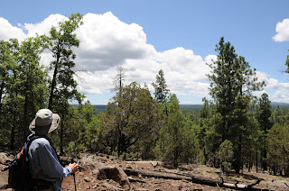
Moving north, the trail
climbs through pine-oak woodlands onto Battleground Ridge, the site
of Battle of Big Dry Wash-- a July 1882 confrontation between the
United States Army Cavalry and the White Mountain Apache tribe. Two
monuments near the route stand testimony to the area's contentious
history. After topping out on craggy limestone cliffs above East
Clear Creek, views peeking through the tree cover reveal glimpses of
the river-like waterway of C.C. Cragin Reservoir and clearly show why
the passage is called blue ridge. Next up--a 600-foot descent into
the creek gorge. Finding water here is hit-or-miss. Either
way, the crossing is usually easy but the ascending trail on the
opposite bank takes back its 600 feet. Once beyond the creek, the
trail cuts through high pastures surrounding busy recreation sites on
its way to its northern terminus at State Route 87.
 |
| Fred Haught Canyon |
LENGTH: 16.1 miles one way
RATING: moderate
ELEVATION: 6,740' - 7,395'
 |
| Fred Haught Cabin |
GETTING THERE:
South: General Springs Trailhead:
From the intersection of State Routes
87/260 in Payson, continue 28 miles north on SR87 to Forest Road 300
(Rim Road) near milepost 280. Turn right and go 12.2 miles to Forest
Road 705 where there’s a Battle of Big Wash Monument on the
northeast side of the intersection. Go left (north) onto FR705 and
continue 0.5-mile to the General Springs/AZ Trail trailhead. Roads
are maintained dirt and passable by sedan, although high-clearance is
a better idea. Trail begins north of the cabin sharing the first
miles with the Fred Haught Trail.
North: Blue Ridge (Hay Meadow)
Trailhead:
From the State Route 87/260 junction
north of Pine-Strawberry, continue 19.5 miles north on SR87 to Forest
Road 138 (signed for Moqui Campground),turn right and go about 100
yards to the trailhead on the left. Roads are paved up to FR 138.
In Between: Jumbo Trailhead:
From State Route 87 north of Clints
Well, turn right onto Forest Road 751 (just past milepost 295) and
continue 2.1 miles to the trailhead on the left.
INFO: Arizona Trail
Association
MORE
PHOTOS:


