Find A Trail. Start Your Search Here:

Showing posts with label MEDL. Show all posts

Monday, June 2, 2025

Taawa Trail

TAAWA TRAIL

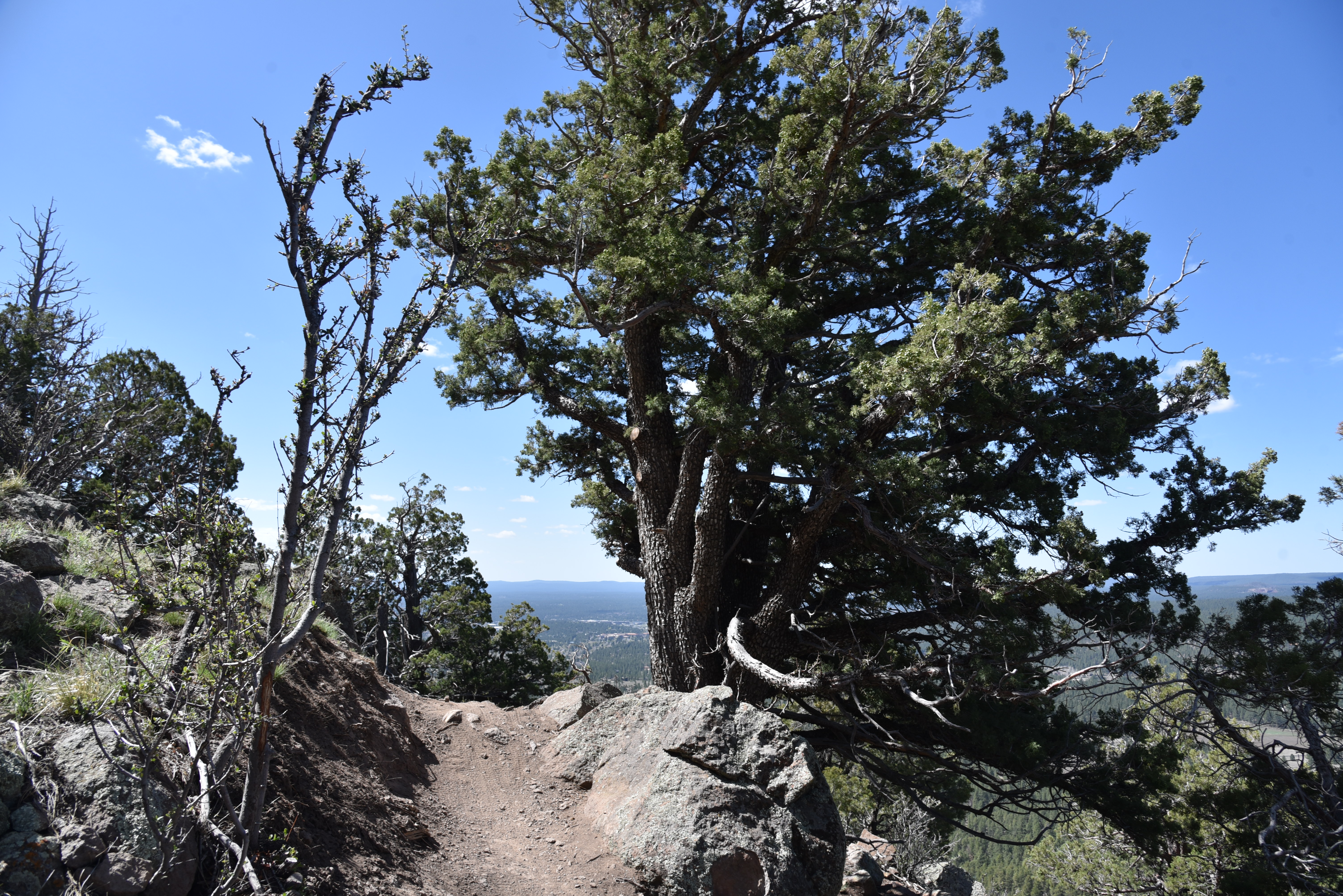
A steep drop-off on the Taawa Trail

One of Flagstaff’s newest hiking routes is destined to become an Arizona high-country classic.  

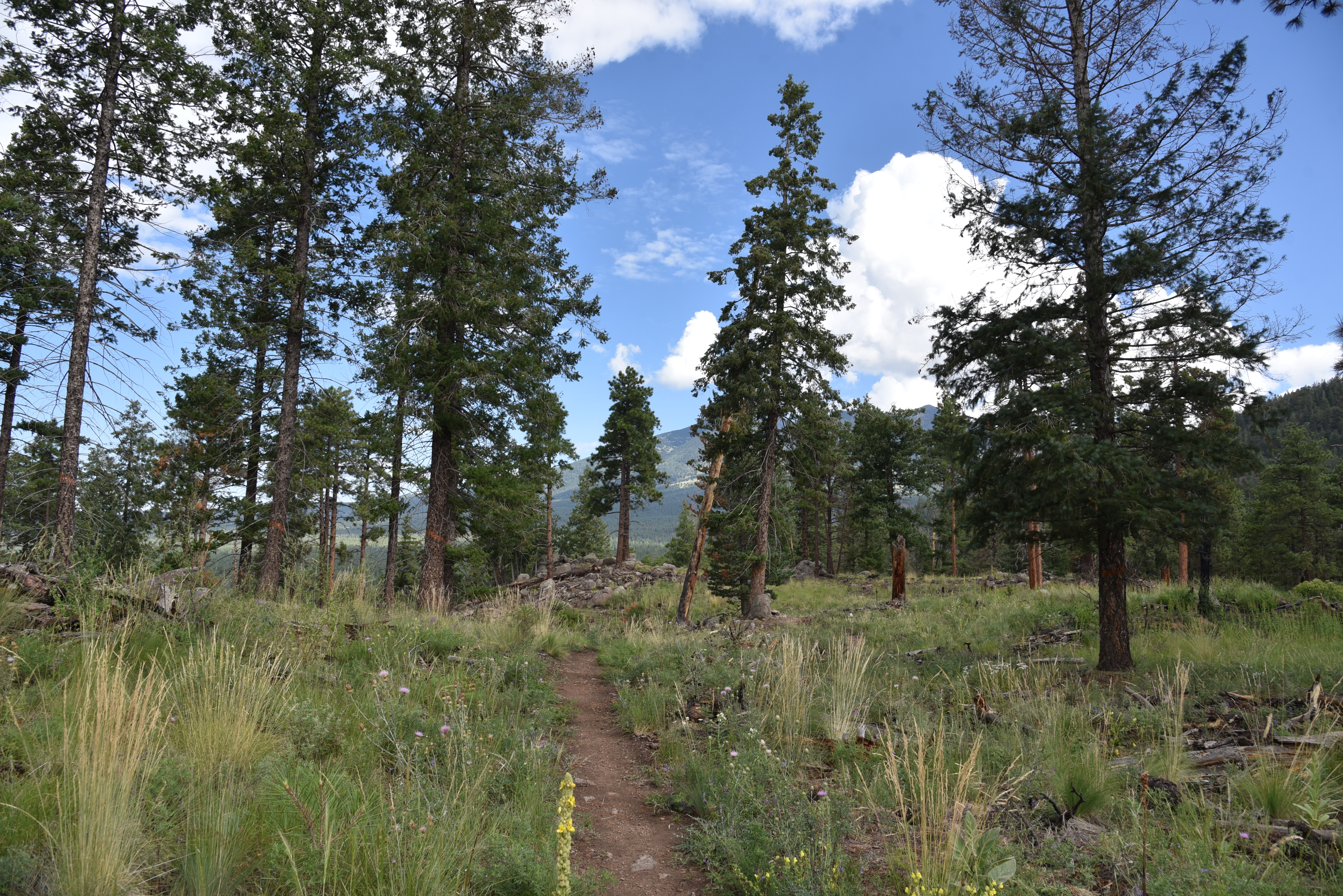
Completed in the fall 2024, the Taawa Trail is the last trail to be built in Flagstaff’s Mount Elden-Dry Lake Hills (MEDL) area and is one of the few designated for hiker-only use.  The challenging yet approachable path seamlessly melds easy mountain traipses with aggressive climbing. 

A survivor Alligator Juniper on the Taawa Trail

It’s kind of like eating ice cream with habanero sauce.

The close-to-town MEDL trail system has been popular with non-motorized trail users since its debut in 1987. In addition to its recently expanded menu of new stacked loops, the area also shares space with the Arizona National Scenic Trail and the Flagstaff Loop Trail.

Volcanic boulders line the Taawa Trail

View of the San Francisco Peaks from Taawa Trail

Trail planning, design and construction was a hyper-local effort with contributions from the U.S. Forest Service Coconino National Forest Flagstaff Ranger District, American Conservation Experience, and many volunteer hours and fundraising events organized by local bike organizations and local businesses.

The Taawa Trail is for hikers only

The results are breathtaking.  New signage mitigates the formerly confusing and disruptive unauthorized paths.  Beautiful singletracks follow the natural contours of the land as they meander through diverse eco zones that rise from pinion-juniper woodlands where tiny cacti huddle among boulders to aspen glens and high elevation fir-spruce forests.  All in just a few miles of switchback-mitigated climbing.

Claret cup cactus color the trails May -July

The Taawa Trail –which is named for the Hopi word for sun spirit or creator--replaces a maze of social paths including the Lost Burrito Trail on its lower half. 

Access Taawa Trail from the Rocky Ridge Trail

The trail’s upper segment is all new, sustainable construction aligned to protect wildlife, keep hikers safe and deliver an exceptional outdoor experience.  The 2.1-mile trail that ascends more than 1,000 feet can be accessed from the Shultz Creek Trailhead by hiking 0.6-mile on the Rocky Ridge Trail to the Taawa junction. 
A steep, tricky spot on the upper Taawa Trail

It’s easy going for the first mile up to where the trail makes its first crossing of the Big Bang Trail. 
Make a return loop using the Big Bang Trail

That’s where a set of tight, edgy switchbacks take on the foothills.  Steep and exposed, the thin path climbs steadily through stony passages in pine-oak woodlands. 
A shady segment on the Taawa switchbacks

The vertical assault calms down after about a half mile, leveling out in patchy high meadows where trees part just enough to give up fantastic views of the San Francisco Peaks and the town of Flagstaff below.  The trail ends at its high point at the second Big Bang Trail junction.
Summer storms build quickly in mountain climes

From here, hikers can either back track or make a return loop using Big Bang for a slightly longer, more challenging trek.

LENGTH:  5.4 miles out-and-back as described here.  6.4 miles with Big Bang return option.

RATING:  moderate-difficult

ELEVATION: 7,160 – 8,422. feet

GETTING THERE:

Schultz Creek Trailhead: In Flagstaff, go 3 miles north on U.S. 180 (Humphreys Street) and turn right on to Schultz Pass Road (Forest Road 420). Continue 0.5-mile on FR 420 and make a hard left at the Elden Lookout Road (Forest Road 577) "Y" and go another half mile on FR 420 to the parking area on the left.  There are no fees or facilities at the trailhead. 

INFO:

https://www.fs.usda.gov/r03/coconino


Wednesday, August 28, 2024

Tonteel Trail

TONTEEL TRAIL

Schultz Tank views from Tonteel Trail

Schultz Tank has long been a popular stopping off point for trail users in Flagstaff’s Mount Elden Dry Lake Hills (MEDL) area.  The created water hole is located between the low-slung volcanic mounds collectively known as the Dry Lake Hills and San Francisco Mountain, the dormant stratovolcano that hosts Arizona’s highest hiking destination: Humphreys Peak trail.

Tonteel Trail cross a dam at Schultz Tank

Schultz Tank is contained by two constructed earthen dams, and while it’s a year-round reliable water source, its size vacillates according to season and precipitation. Tonteel is a Dine (Navajo) word for “ocean” or ”water that is wide”.

Pines shade parts of the Tonteel Trail

Whether overflowing as it’s known to do in spring, or wanning as autumn approaches, there’s always enough water to attract wildlife and support a burgeoning fringe of vegetation. 

A flotilla of ducks on Schultz Tank

Ducks are ubiquitous and large game like elk and deer appear mostly around dawn and dusk.

Situated at 8,000 feet, the glassy pool is also a hub for hikers, equestrians and mountain bikers. Recent trail development in the area has extended hike options far beyond the old standard routes like Sunset, Brookbank and the Arizona National Scenic Trail. 

The short, scenic loop is family-friendly

The new Tonteel Trail anchors the hub both literally and figuratively.  The half-mile, family-friendly path circles the tank forming a sort of wagon wheel loop from which other forest trails spin off like spokes.
Schultz Tank serves as a trail hub

Mountain breezes ruffle Schultz Tank waters


The trail is a simple, easy trip around the water ducking in and out of pines and over the dams where blooming shrubs attract swarms of butterflies, bees and dragonflies.  Mountain vistas reflect into the often wind-ruffled pool beloved as a grounding point for day hikes, picnics, wildlife watching or filtering water before backpacking into the surrounding mountain wilderness.

New Mexican vervain blooms June - September


LENGTH: 0.5-mile loop

RATING: easy

ELEVATION: 7,961 – 8,029 feet

GETTING THERE:

Schultz Tank Trailhead:

From Flagstaff, travel north on U.S. 180 (Fort Valley Road) to milepost 218.6 and turn right on Schultz Pass Road (FR420).  Continue 0.5-mile on FR420 to a fork, veer left to stay on FR420 and continue 4.8 miles to the Schultz Tank trailhead on the right. Schultz Pass Rd is maintained dirt suitable for all vehicles.

Day use only. No camping.

FACILITIES: restroom

INFO & MAPS:

Coconino National Forest

https://www.fs.usda.gov/detail/coconino/recreation/?cid=FSEPRD1169467#schultztank


Tuesday, August 27, 2024

Broadside Trail

BROADSIDE TRAIL

Mixed conifer forest on Broadside Trail

Moody Blue.  Don’t look for it on the color wheel, fashion catwalks or in the prog rock song book.  It’s a color buried so deep in the visible light spectrum it defies description.

A tree shaded meadow on the Broadside Trail

It shows up in nature in the underside of storm clouds, inside a faded lupine bloom, imbedded in fir needles and within the fine grains of volcanic rock.
It’s an icy color with a bitter sting.  It smells of pine sap and mint---not the sweet culinary kind---but the rude, wild stuff that grows around forest water holes. Rather than a one-note visual, Moody Blue is a whole-body experience.  On cloudy summer days, it’s abundant on the Broadside Trail. One of the newer additions to Flagstaff’s Mount Elden-Dry Lake Hills (MEDL) Trail System, the Broadside Trail flows through cool woodlands in a pocket of foothills between the San Francisco Peaks and Mount Elden.  The 3.4-mile fresh cut route joins old standards Sunset and Brookbank trails for a shady trek in Coconino National Forest.
Moody blue in the clouds

The close-to-town MEDL system has been popular with non-motorized trail users since its debut in 1987. In addition to its ever-expanding menu of new stacked loop trails, the area also shares space with the Arizona National Scenic Trail and the Flagstaff Loop Trail.

The Broadside Trail opened in 2023, but until August 16, 2024, when Schultz Pass Road and Elden Springs Road were reopened following post-fire restorations, getting to it required hiking on long connecting trails.  With drive up options to the Sunset and Schultz Tank trailheads restored, hikers now have direct access. 

New MEDL trails are well signed

The MEDL area has survived numerous disasters.  Scorched by the 1977 Radio Fire, 2010 Schultz Fire, 2019 Museum Fire and most recently by the 2022 Pipeline Fire, the corrugated landscape is being rehabilitated with forest clearings, flood control projects, new sustainable trail alignments and the elimination and/or adoption of social trails for better overall environmental health and public safety.  

Contributors to the trail planning, design and constructions are U.S. Forest Service Flagstaff Ranger District, American Conservation Experience, Arizona Conservation Corps, Flagline Trails, and many volunteer hours and funding efforts from Flagstaff Biking Organization.

Slash piles from forest restoration work

 
Richardson's geranium blooms April - October

The results are breathtaking.  New signage mitigates the formerly confusing and disruptive maze of unauthorized paths.  Beautiful singletracks follow the natural contours of the land as they meander through diverse eco zones that rise from pinion-juniper woodlands where tiny cacti huddle among boulders to aspen glens and high elevation fir-spruce forests. 

Sunny meadow on the Broadside Trail

All in just a few miles of switchback-mitigated climbing.

The Broadside Trail starts high in the hills around Schultz Tank. 

Clouds build over the San Francisco Peaks

At the Sunset Trailhead, snap a photo of the trail map to use for your return route options. Broadside immediately enters fragrant pine-shaded foothills, staying flat and easy for its first mile.  
Broadside begins at the Sunset trailhead

The trail ascends to its high point on long switchbacks that ease the climb and maximize scenic views.  Glimpses of fire-singed foothills and the San Francisco Peaks are visible where thick tree cover is disrupted by alpine meadows rife with colorful lupine, wild geranium and thistles.  
Purple locoweed blooms June - September

During summer monsoon season, clouds gathering over the peaks is a near daily occurrence. Near the top of Broadside Trail, where it meets connecting routes Full Sail and Sunset, look for Moody Blue in the sky and underfoot. 
Trailhead map kiosk shows loop options

How will you know when you’ve spotted it? Well, when attempting to describe color in the natural world, words are often inadequate. Ridiculous, really. 
Words do not suffice...

Paint might do better. Moody Blue is a made-up name for the mutable shade that might include a mix of ultramarine, cobalt, burnt umber, vermillion and gold all grayed down with a dab of titanium white.  Who knows?  Writing dances around the visible outer crust. Painting exposes the soul.  This trail and its signature blue needs some paint.
Lupine bloom June - October

LENGTH: 3.24 miles one way or 5.1-mile loop using Sunset Trail or 6.6-mile loop using Full Sail.

RATING:  moderate

ELEVATION: 8,108 – 8,800 feet

GETTING THERE:

Sunset Trailhead

In Flagstaff, go north on U.S. 180 to Schultz Pass Road, turn right and continue 5.4 miles to the Sunset trailhead on the right.  Schultz Pass Road is maintained gravel/dirt suitable for most vehicles. Schultz Pass Road reopened August 16, 2024, following repair work needed after  the 2022 Pipeline Fire.  No facilities.

INFO:

Coconino National Forest

https://www.fs.usda.gov/recarea/coconino/recreation/recarea/?recid=84557&actid=50


Monday, August 28, 2023

Dipper-Apollo-Pluto-Spacewalk Circuit

DIPPER-APOLLO-PLUTO-SPACEWALK CIRCUIT

Impressive monolith on the Pluto Trail

Flagstaff has a long and colorful association with astronomy and space exploration. Notable mentions include the discovery of Pluto from the Lowell Observatory by Percival Lowell in 1894. And in the 1960s, the Apollo astronauts trained in the Cinder Hills area to test procedures in volcanic craters that resembled the lunar landscape prior to landing on the real thing in 1969.

Apollo Trail winds through volcanic boulders


Additionally, Flagstaff has the distinction of being named the first International Dark Sky City in 2001.

A hairpin curve on the Dipper Trail

That’s a big deal because the city’s policies on limiting nighttime light pollution have many benefits including improving human health, protecting sensitive wildlife and ecosystems and maintaining clear skies for stargazing and studying the universe.
Mountain vistas on the Spacewalk Trail

 (Learn more at darksky.org)

In homage to the Northern Arizona city’s outer space heritage, a new maze of trails in the Mount Elden-Dry Lake Hills (MEDL) area was opened to the public in August.

Wildlife browse sand sage August - November

New MEDL trails connect with Rocky Ridge Trail

 Part of the Schultz stacked loop system, located just a few miles north of downtown, the new Dipper, Apollo, Pluto and Spacewalk trails tie into the previously unveiled Big Bang Trail.
Pluto Trail passes a recovering burn scar

They also add toned muscle to Old Standard backbone routes like Rocky Ridge, Sunset, Brookbank and Upper Oldham Trails.
Mt. Elden seen from the Apollo Trail

Built by Coconino National Forest and Arizona Conservation Corps with the assistance of local volunteers, the trail names slap a celestial sugar coating on a decidedly terrestrial domain.
Wildflower meadow on Spacewalk Trail

While the area’s high elevation and slightly lower O2 levels might give lowlanders (if you’re from Phoenix, you’re a lowlander) a mini case of the woozies, the trail designs minimize the impact. These new routes are not of the old school straight-up-and-down ilk that seem engineered to make you feel like a looser.
Ancient alligator juniper on the Dipper Trail

These scenic paths capitalize on natural landscape contours, using sweeping switchbacks to ease climbs and tight hairpin turns to propel trail users around ravines and gullies.
Paintbrush color sunny spots March - September

The looped trails are easy to customize


To explore this new hub, begin at the Schultz Creek Trailhead, which was relocated away from the course of Schultz Creek this summer,  with a short walk on the Chimney Trail to connect with the Rocky Ridge Trail.

San Francisco Mountain seen from Dipper Trail

The route follows Rocky Ridge for 0.7 miles to where the Apollo Trail heads left.  The 0.3-mile connector path twists among lichen-encrusted volcanic boulders and sporadic tree cover, serving up appetizer views of what’s to come.
Sunflower meadows below the Dipper Trail

At the 1-mile point, Apollo intersects the Dipper Trail. For this trip, the route heads right taking on an edgy segment where enormous alligator junipers frame mountain vistas and glimpses of downtown Flagstaff before exposing first peeks at the sky-scraping silhouette of 12,633-foot San Francisco Mountain.
Mixed conifer woodlands on Pluto Trail

 
Immediately beyond the mountain preview, Dipper meets the Pluto trail at the 1.8-mile point.  Pluto is another capillary-type route of about a third of a mile that runs between the Dipper and Spacewalk trails.  The tightly coiled path jogs around a recovering burn scar and a prominent monolithic stone outcropping, then connects with the Spacewalk Trail. Great views of the peaks can be had by heading left at the junction.
Purple locoweed bloom June - September

Narrowleaf tick clover bloom July - September

The easy singletrack meanders for a half-mile through wildflower meadows and mixed conifer woodlands before bumping into the Big Bang Trail, the turnaround point for this exploratory trip. However, a quick map consult will show a full menu of loop options for longer or shorter hikes.

LENGTH:  4.66 miles out-and-back

RATING: moderate

ELEVATION: 7,160 – 7,765 feet (964 feet of elevation change)

GETTING THERE: Schultz Pass Trailhead: In Flagstaff, go 3 miles north on U.S. 180 (Humphreys Street) and turn right on to Schultz Pass Road (Forest Road 420). Continue 0.5-mile on FR 420 and make a hard left at the Elden Look Road (Forest Road 577) and go another half-mile to the  parking area on the left. There are no fees or facilities at the trailhead. 

INFO:  Coconino National Forest

https://www.fs.usda.gov/recmain/coconino/recreation


Tuesday, May 16, 2023

Big Bang Trail

BIG BANG TRAIL

San Francisco Peaks seen from Big Bang Trail

Being loved to death is a slow and complicated process. Whether self-inflicted or enabler enriched, initially, it feels good. But before long, the halo wears off and reality pitches a swift, hard slap. It’s kind of like scarfing down tacos five nights a week only to wake up one morning “surprised” with a love handle hangover.

The first mile of Big Bang Trail is easy

Swapping out tacos for unauthorized trail building, this is a good  analogy for what has been happening in Flagstaff’s Mount Elden/Dry Lake Hills (MEDL) area for decades.
An alligator juniper anchors a bend in Big Bang Trail

While it might feel good to buck the system and blaze user-created paths, they cause environmental damage, disrupt wildlife and can lead to trail users getting lost or injured. This should come as no surprise to any outdoor enthusiast. While the slap has been stinging for quite some time, it’s only been in the last few years that efforts to rehabilitate the popular recreation area have  materialized.
Schultz Creek flows near the trailhead

The MEDL trail system, which includes popular old-standards like Brookbank, Sunset, Oldham and a segment of the Arizona National Scenic Trail, was originally dedicated in 1987.

Wing Mountain and Kendrick Peak on horizon

Because of its proximity to town, multiple access points and scenic qualities, the MEDL area in Coconino National Forest suffered from deteriorating conditions due to overuse, a confusing maze of unauthorized “social or wildcat” trails and recent human-caused wildfires.  The negative impacts on natural resources were palpable. Now, a joint effort between the forest service and local outdoor organizations is taking action to mitigate the damage, disperse pressure off the old standards and improve sustainability in the area.

Much of the trail hugs exposed edges

One of the first of the new breed of routes to be completed is the Big Bang Trail.

Creeping barberry blooms April - June

The 4.4-mile singletrack is outstanding not only for its smart design but also for its panoramic vistas, oscillating levels of difficulty and variety of terrain.  The serpentine path climbs over 1,200 feet along the natural contours of the Dry Lake Hills northeast of 9,299-foot Mount Elden.  
Mount Elden seen from Big Bang Trail

The trail may be accessed from the Schultz Creek trailhead by following the Rocky Ridge Trail (also part of the Arizona National Scenic Trail)  0.2-mile to the signed junction. The first mile takes it easy, twisting among Ponderosa pines, alligator junipers and oaks with glimpses of 8,578-foot Wing Mountain standing out to the west.  Spots of damage from the 2010 Schultz Fire and the 2022 Pipeline Fire are evident along the way as are slash piles and other signs of restoration efforts.
Boulders line a section of the Big Bang Trail

Where the route makes a northeast bend, views of the San Francisco Peaks  that soar to over 12,000 feet, break through the cover of a mixed-conifer forest. Right about where the mountains views show up, the trail becomes moderate in difficulty, dodging boulders with hairpin turns.
Fendler rose scent the trail June - August

 
Next, the route takes on a more aggressive, edgy ascent along stony cliffs with steep drop offs overlooking Flagstaff.  As the coniferous forest thins and gradually morphs into a drier, more exposed mountain clime. Views of 10,428-foot Kendrick Peak pop out on the northwest horizon and Sedona’s 7,122-foot Wilson Mountain can be seen to the south.  
Flagstaff visible below the Big Bang Trail

Right around where it meets the 8,000-foot point, the trail bends north among sun-loving cliff-rose shrubs, yucca, and scrub oak, hitting its highest point and concluding the major climbing before winding through woodlands and meadows to its terminus at the Brookbank Trail.  
Big Bang spins off the Rocky Ridge Trail

If the Big Bang Trail is any indication of what’s in store for MEDL as trail realignments, and more connectivity roll out, hikers, bikers and equestrians can look forward to a greatly improved recreational experience. And if trail users heed the slap and stick to designated trails instead of disrupting natural resources, this environmentally-sound system will last for generations.
Mixed conifir forests frame the San Francisco Peaks

LENGTH: 9.2 miles roundtrip/out-and-back

RATING: moderate-difficult

ELEVATION: 7,147 – 8,404 feet

GETTING THERE:

Schultz Pass Trailhead:

In Flagstaff, go 3 miles north on U.S. 180 (Humphreys Street) and turn right on to Schultz Pass Road (Forest Road 420). Continue 0.5-mile on FR 420 and make a hard left at the Elden Look Road (Forest Road 577) and go another half-mile to the  parking area on the right.

There are no fees or facilities at the trailhead.

2023 ROAD CLOSURES:

During 2023, the Schultz Creek restoration project, which will mitigate damage to the Schultz Creek watershed caused by the 2022 Pipeline Fire, will result in temporary road and trail closures in the area. During construction, Schultz Pass Road beyond the Coconino National Forest boundary will be closed to motorized vehicles, but will remain open to hikers, bikers and equestrians. There’s limited parking at the forest boundary located a few yards south of the Schultz Creek trailhead, and more parking at the “Schultz Y” at the corner of Schultz Pass Road and Elden Lookout Road.  Phase 1 will begin on May 22 and run through June. Phase 2 will happen in late 2023.

FOR NEWS & UPDATES:

https://www.fs.usda.gov/detail/coconino/news-events/?cid=FSEPRD1106239