Find A Trail. Start Your Search Here:

Showing posts with label Flagstaff Urban Trails System. Show all posts

Monday, July 18, 2022

Arizona Trail: Passage 31

ARIZONA NATIONAL SCENIC TRAIL: WALNUT CANYON PASSAGE 31

Gate on Passage 31 of the Arizona Trail

Shady and cool, Passage 31 of the Arizona National Scenic Trail is a satisfying respite from summer heat.  The 17.9-mile segment of the 800+-mile, state traversing route

drops off the plateau lakes region of Anderson Mesa and heads into pine-oak woodlands in Coconino National Forest southeast of Flagstaff.  Also known as the Walnut Canyon passage for its swing by the finger canyons and periphery of Walnut Canyon National Monument, this close-to-town segment of trail has several access points that make it perfect for day hikes, loop and car shuttle options. One trip to try goes from Marshall Lake to Sandy’s Canyon.

Greenery around Marshall Lake Tank

At the Marshall Lake trailhead, hikers get a reality check on the effects of drought.  While Marshall Lake is rarely more than a shallow, reed-choaked pond, this year, it’s bone dry.  Still, its elongated, pine-wrapped footprint is a picturesque sight and favorite grazing territory for elk.

Mountain vistas are meager, trees are major

The hike heads north from the large Arizona Trail sign along a well-defined and maintained singletrack.

Sign at Marshall Lake trailhead

 
Thick tree coverage and riffled terrain obscure big vistas, so this hike is more about immersing in the details of forest life. 
There are many ways to extend this Flagstaff hike

It’s a great place to smell “yellow belly” pines--older Ponderosa pine trees that have developed yellow-brown bark scales and emit a syrupy fragrance that’s often described as butterscotch, vanilla or cardamon. 
Marshall Lake was dry, July 2022

Each tree has a unique olfactory signature that blooms when warmed by the sun. 
Winged buckwheat blooms July - September

Go ahead and take a whiff, but be respectful. There’s no need to damage the bark to determine if the sap is sweet, savory or spicy.  
Hike may be extended into Sandy's Canyon


About 1.5 miles in, the green swale behind Marshall Mesa Tank appears below a set of easy switchbacks that lead into a shallow ravine.  The wildlife water hole is contained by an earthen dam, but, like the lake, it was dry, but lingering moisture feeds a fringe of wildflowers and elderberry trees.
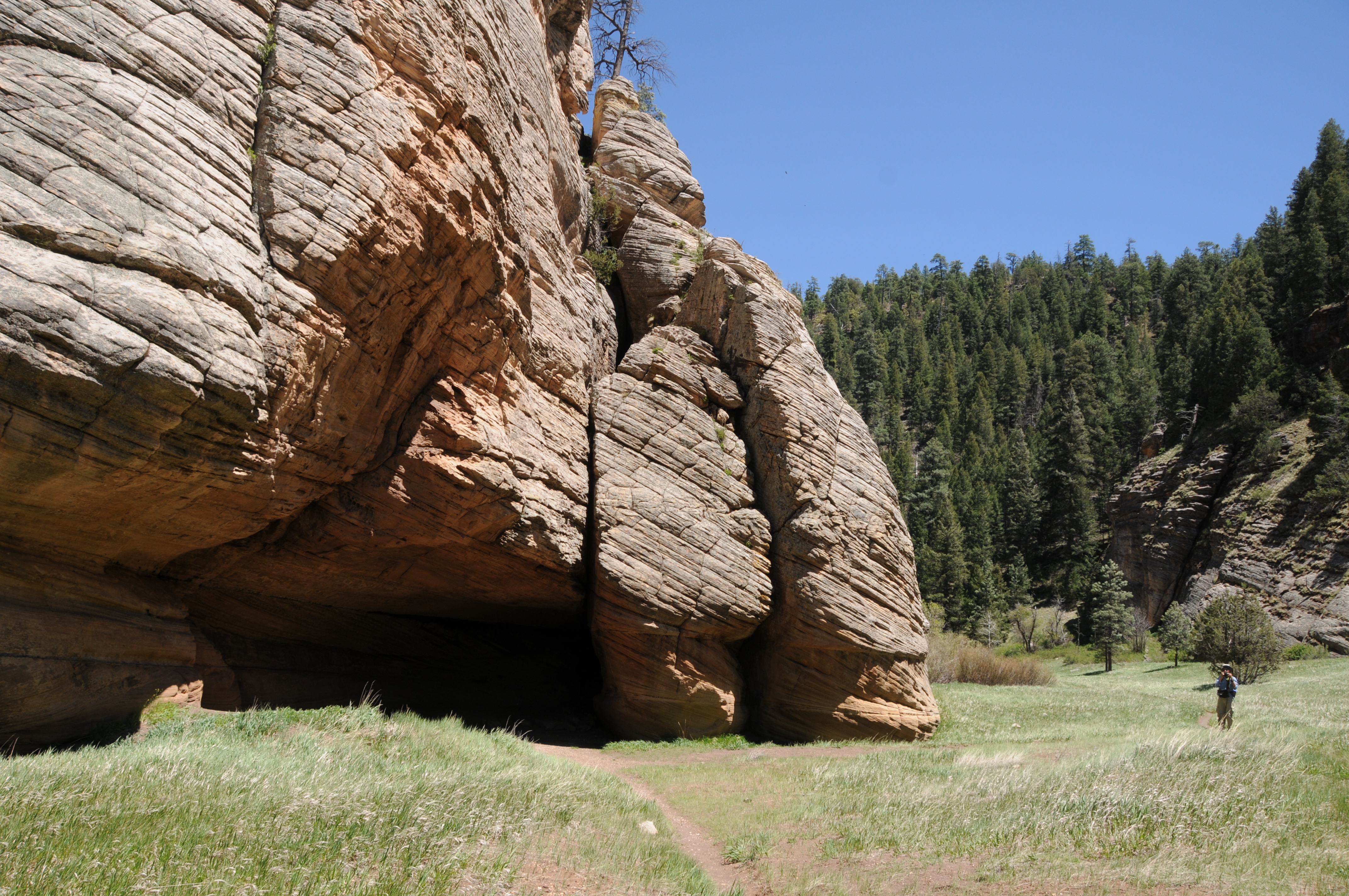
Limestone formations in Sandy's Canyon

Several more minor downhill twists lead to the junction with the Sandy’s Canyon trail. 

Yellow belly pines add olfactory notes to the hike

Here, the Arizona Trail veers right into the canyon where bizarre limestone formations are the key attractions on this very popular forest destination. For those who parked a shuttle vehicle at the Sandy’s Canyon trailhead, veer left at the junction and hike 1.5 miles for a 5.6 mile one-way trek.
Horned lizards are easy to spot on the ArizonaTrail

For a longer hike, Passage 31 continues north to Interstate 40 where it connects with the Elden Mountain Passage on the east side of Flagstaff. The trail also links up with the Flagstaff Urban Trails System and the Flagstaff Loop trail. Consult the Flagstaff city website for details on how to customize a hike circuit. Otherwise, just shit into reverse at the junction for an 8.2-mile out-and-back day hike.

LENGTH:

• 8.2 miles round trip, Marshall Lake trailhead to Sandy's Canyon junction and back.

• 17.9  miles one way for the entire segment.

• 5.6 miles one way for car shuttle.

RATING: moderate

ELEVATION: 6,885 – 7,185 feet as described here (6,500 – 7,185 feet for full passage)

GETTING THERE:

Marshall Lake trailhead:

From Flagstaff go 9 miles south on Lake Mary Road (County Road 3) to Forest Road 128 on the left, signed for Marshall Lake. Continue 2.2 miles on FR 128 (pass the observatory) to the Arizona Trail post at FR 128D, turn left and continue to the parking turnout at the large Arizona Trail sign.

Sandy’s Canyon trailhead:

From Flagstaff,  go 4.5 miles south on Lake Mary Road to the Sandys Canyon Trailhead on the left. Follow Sandy’s Canyon trail 1.5 miles to the Arizona Trail junction on the right.

INFO & MAPS:

Arizona Trail Association

Aztrail.org

Flagstaff Urban Trails System

https://www.flagstaff.az.gov/1379/Flagstaff-Urban-Trails-System-FUTS


Monday, August 26, 2019

Flagstaff Urban Trails System-Arizona Trail Loop

Hike in the Urban-Forest Interface
FUTS routes close to town connect with the Arizona Trail

 “You can’t get there from here,” my hiking partner told a confused pair of trekkers who asked us for directions to an Arizona Trail junction. He gently kicked my shin to signal he was joking as the couple fumbled with a map. Waiting a beat to satisfy his warped sense of humor, my pal continued, “Just kidding, of course you can get there from here. This is Flagstaff.”  He’s not wrong.
I-40 passes above Duck Pond on the Arizona Trail
With hundreds of miles of national forest trails and city pathways, there are dozens of ways to access the iconic 800+-mile Arizona Trail (AZT) that swings through the northern Arizona city.
Mexican Hat flowers bloom along FUTS
The state-traversing route draws hikers, bikers and equestrians from all over the world to this Arizona Trail gateway community---a city or town that embraces and gives ongoing support to the trail and its users. In addition to deep-forest trailheads and popular campgrounds the Arizona Trail may also be accessed by using the Flagstaff Urban Trails System (FUTS). With over 50 miles of existing trails in place and plans for 80 more, the network of paved walkways, re-purposed dirt roads and single track paths make walking off a busy city street into a quiet forest as effortless as moving from room-to-room in your home. One stunning example of the connectivity offered by this community-driven system is located near the intersection of Interstates 17 and 40 southeast of downtown.
Russian knapweed (invasive) grows in meadows
View from the trailhead near Coconino Community College
You'll see planes from nearby Flagstaff Pulliam Airport
The moderate loop has some steep sections
The moderate 6-mile loop hike samples several flavors of FUTS. From a groomed trailhead near Coconino Community College, the hike begins by heading 0.2-mile north on the paved Lone Tree Trail. Next, turn right onto the Broken Arrow Trail which leaves the pavement and heads east on a dirt track.  After 0.4-mile, the trail continues on a dirt road through a drainage area surrounded by pines and wildflower meadows.
FUTS paths connect with Coconino NF trails
The route is obvious except for where a solitary tree stands at a fork in the road at the 1.6-mile point. Veer left here and continue 0.3-mile to Duck Pond and the junction for the Arizona Trail Passage 33.
A dragonfly rests near Duck Pond
Despite the rumble and hum of vehicles rolling over a bridge on Interstate 40, the reedy lake is a pleasant little place with active waterfowl and swarms of dragonflies. After exploring around the water, head right (southeast) at the AZT sign and make a short but steep uphill slog that leads into a sliver of Coconino National Forest that sits between country clubs and subdivisions.
FUTS paths provide non-motorized travel through Flagstaff
Along this 1.7-mile leg of the trip, freeway noise is gradually muffled by the hilly terrain, but aircraft using the Flagstaff Pulliam Airport that’s located a few miles to the southwest are regular reminders that this woodsy buffer zone is very much within the urban-forest interface. Follow the AZT signs to a 3-way junction with a gate and a sign for Fisher Point. To complete the loop, head right and follow an unsigned dirt road. After 0.6-mile of traipsing through sunny fields and shaded bends, the route rejoins the FUTS system. 
Part of the loop follows closed dirt roads
Continue 0.4-mile on the Fisher Point Trail which skirts the edge of a posh golf community then hang a left at the JWP Trail.
The loop is a seamless walk between city and forest
The final 0.8-mile return leg is on the non-motorized path that parallels John Wesley Powell Boulevard. This tiny taste of FUTS and its connectivity shows how with only a bike, horse or a pair of hiking boots, you can get just about anywhere in Flagstaff--and beyond.
LENGTH: 6-mile loop
RATING: moderate
ELEVATION: 6766- 6979 feet
GETTING THERE:
From Flagstaff, go 1.2 miles south on Lake Mary Road to J.W. Powell Blvd. Turn left and continue 1 mile to the trailhead at the corner of Lone Tree Road.
 INFO: Flagstaff Urban Trails System (FUTS)
Arizona Trail
-->

Friday, July 14, 2017

OBSERVATORY MESA NATURAL AREA

OBSERVATORY MESA NATURAL AREA
Flagstaff
Observatory Tank along Forest Road 515
Wavyleaf thistle and guests
Allow me to introduce A-1 Mountain, ruler of magma, queen of ashes and Mother of the Mesa. This dramatic introduction—admittedly inspired by a certain fantasy franchise—is an accurate description of the 300,000-year-old cinder cone located on the urban-forest interface west of Flagstaff. A-1 Mountain is the source of volcanic materials that built Observatory Mesa and other nearby geological features. Rising to 8,300 feet, the pine-cloaked mound is just one of many visual goodies dished out to visitors of the Observatory Mesa Natural Area.
A-1 Mountain is a 300,000 -year-old cinder cone volcano
The 2,251-acre site was acquired by the City of Flagstaff in 2013 to preserve native ecosystems and an essential wildlife corridor while allowing for  recreation.  Rich in biodiversity, the landscape is a mix of pine-oak woodlands, grasslands, shrubby range, tiny drainage areas and seeps that foster wetland species like willows, frogs, wild roses and salamanders.
Observatory Mesa
 
Hikers can access the area on dirt forest roads or by way of the Flagstaff Urban Trails System (FUTS) trailhead at Thorpe Park near downtown. Either way, both options merge at a hub in the middle of the mesa where the Mars Hill, Tunnel Springs, Flagstaff Loop and Observatory Mesa trails spin off in different directions.  Although both access points are close to town, the trailhead along Forest Road 515 has more of a woodsy feel than its city-inflected counterpart. 
Slash piles 
Beginning at the FR 515 trailhead requires some route finding. The side road at the kiosk is Forest Road 515D which is one of several non-motorized dead-end roads that wander through meadows, wetlands and forests replete with antelope, porcupines, fox and squirrels. You can wander along these scenic roads for hours, but if you want the most direct route to the FUTS hub, hike 2.6 miles farther up FR 515 (the road you came in on) from the parking spot at the kiosk. At 1.1 miles, go right at a fork and then stay straight on the main road at a second fork. Continue to a cattle guard and gate at the 1.3-mile point where Forest Road 9113C crosses, pass the gate and continue hiking on FR 515 to a hub of trail signs. From here, you can pick up the FUTS or return the way you came. 
Logs ready for transport
While hiking on the mesa, you'll see fresh-cut tree stumps and slash piles (stacks of branches). These products of forest thinning efforts are part of the Flagstaff Watershed Protection Program that's designed to reduce the threat of devastating wildfires and post-fire flooding while improving forest health to promote diverse habitats for sensitive species like the Gunnison’s prairie dog, boreal chorus frog and Mexican spotted owl. Signs at the hub have information about the program. During logging operations, heavy equipment is in use on and around the dirt roads, so stay alert and be sure to park well out of the way.
Yellow Salsify
LENGTHS:
Forest Road 515 hike to hub: 2.6 miles one-way, 7400' - 7560'
Observatory Mesa Trail: 1.6 miles one-way, 7070’ – 7370’
Mars Hill Trail: 1.9 miles one-way, 6933’ – 7402’
Tunnel Springs Trail: 1.9 miles one-way, 7014’ – 7404’
RATING: moderate
GETTING THERE:
Forest Road 515 Trailhead:
From the Interstate 17/40 interchange in Flagstaff, go 4.8 miles west (toward Williams) on I-40 to A-1 Mountain Road exit 190. Follow A-1 Road (Forest Road 506) 1.8 miles and continue straight on Forest Road 515. Pass a cattle guard and go 0.2 mile and park at the kiosk. No facilities. 
Thorpe Park Trailhead:
From downtown Flagstaff, go north on Humphreys Street to Cherry Avenue, turn left and continue to North Thorpe Park Road, turn right and drive a short distance to the parking area near the ball fields.  Pick up the Observatory Mesa Trail across the road near the disc golf course.

Monday, August 11, 2014

TUNNEL SPRINGS TRAIL


TUNNEL SPRINGS TRAIL
BNSF trains pass by about every 15 minutes

The multi-faceted hiking network of the Flagstaff Urban Trails System (FUTS) is the perfect complement to the hundreds of miles of wilderness and national forest trails surrounding the city.
FUTS (say, "foots") uses sidewalks, gravel roads and dirt single tracks for a seamless web of hiking/biking routes that link in-town strolls and meanders through suburban wetlands to more rigorous peripheral trails. Although many of the system's offerings appeal to those looking for a quick way to burn some energy without having to drive miles to a trailhead, several routes located at the
urban-woodland interface mimic the feel of more remote locations.  Tunnel Springs Trail is sort of a city-rural-wildland hybrid hike melding the convenience of easy access just off busy Route 66 with a moderate climb through Ponderosa pine forests.  Passing under and above BNSF railroad tracks, the trail's companion cacophony of metal-on-metal screeching and mournful freight car rumbling is the hike's signature characteristic. The clamor of wailing rails fades as the trail ascends Observatory Mesa along a smooth, gravel road.
Trail signs are few and unmarked crossroads can cause confusion. Here's the plan. From the trailhead, follow the walkway between the private homes down to a road paralleling the railroad tracks.  Turn left here, pass through the tunnel and veer left again. Pass a gate and go right to stay on the widest road heading uphill. At the green tanks (Lowell Tanks), go left and continue to another gate at the (unsigned) Mars Hill Trail junction. Return the way you came or continue 1.6 miles to Thorpe Park.
LENGTH: 1.9 miles one-way
RATING: easy
ELEVATION: 7014' - 7404'
GETTING THERE:
From Flagstaff, travel west on Route 66 to Railroad Springs Blvd. (just before mile post 194,Chevron station on corner), turn right and go 0.4-mile to a "T" intersection with Adirondack Ave. The trail begins on a path between two residences directly ahead. Park along the street.


INFO:
City of Flagstaff
F.U.T.S. Map:
MORE PHOTOS:

Monday, June 23, 2014

PICTURE CANYON


PICTURE CANYON NATURAL AND CULTURAL PRESERVE
Flagstaff
A petroglyph panel in Picture Canyon

Vociferous flocks of waterfowl and warblers are just a few of the more than 150 species of birds that   inhabit the wetlands of Flagstaff's Rio de Flag.  A favorite destination for birdwatchers, Picture Canyon Natural and Cultural Preserve is a 477.8-acre, city-owned property along the Rio undergoing habitat restoration, which will return the site to a more natural and sustainable condition.  This section of the Rio--located in Flagstaff's industrial east side--is fed by effluent discharge from the Wildcat Hill Wastewater Treatment Plant. The shallow stream drifts through pine-bolstered riparian greenery before tumbling over the vertical volcanic rock walls of Picture Canyon in a series of cascades that can be viewed from lookout areas along the rim.   Restoration plans include proposed recreational trails to complement the existing state-traversing Arizona Trail and 44-mile city-circumnavigating Flagstaff Loop Trail, both of which cut through the property, adding to the site's potential as a major hiking destination.
Waterfalls in the canyon
In addition to its wildlife habitat and geological significance, petroglyphs (the "pictures") and other evidence of ancient Sinaguan inhabitants are peppered throughout the corridor.
Although the Arizona Trail is signed, most of the other roads and paths within the preserve are not. This makes finding your way around the roughly 6-miles of hike-able dirt roads and paths somewhat of a challenge. To help with navigation, a map kiosk at the trailhead provides an overview of the layout and landmark beacons Mt. Elden and Sheep Hill to the east and Wildcat Hill on the southwest can be used to find your bearings.   Even with miles of trails and wildlife viewing opportunities, it's the "pictures” that most people come to see.  Here's the quickest way to get to them for a 2-mile round trip hike.
From the trailhead, hike on the main road trail and stay straight at the first fork. Go right at a second fork located past the gas plant near a "246" sign  and continue to where the Arizona Trail crosses the road. Turn right here and hike on the AZT to a 4-way junction just before a wooden bridge.  Go left here to reach the rock art gallery.  As with all cultural sites, artifacts should not be disturbed.

Rio de Flag

LENGTH: up to 6 miles
RATING: easy
ELEVATION: 6630' - 6766'

Flagstaff's only waterfall

GETTING THERE:
From downtown Flagstaff, travel 5 miles east on Old Route 66 (a.k.a. Santa Fe) to El Paso Flagstaff, turn left and continue 1 mile to the trailhead on the right. Roads are 100% paved.  No fees.
Arizona Trail passes through the site

INFO:
City of Flagstaff
Preserve Facebook page:
Friends of the Rio de Flag:

MORE PHOTOS:

Tuesday, September 3, 2013

Wildflower wetlands


SINCLAIR WASH & RIO DE FLAG
Flagstaff Urban Trail System

Rio de Flag

Last weekend in Flagstaff, the morning air had a telling, damp crispness to it.  Shorter days and cooler temperatures mean the summer wildflower season is winding down. But, in the moist corridor of Rio de Flag, high country flora will be blooming through late September.  Sinclair Wash Trail, which begins at Fort Tuthill Park and ends at the Arizona Trail off Route 66, is a major artery of the Flagstaff Urban Trail System (FUTS).  Winding through a diverse mix of terrain and connecting with 8 other trails, the floral sweet spot of this wide, mostly flat trail is the wetland area near Sawmill County Park. A short but steep descent from the playground drops hikers in the middle of Rio de Flag---a waterway created as part of the town's water reclamation program. The mile-long segment follows the stream through a limestone canyon festooned with oak archways and climbing vines. Where the trail approaches the I40 underpass, a cattail-choked marsh fosters a plethora of plant and animal life.  Here, the late summer wildflower checklist includes: globemallow, wild chrysanthemum, sunflowers, clovers, wild geranium, Red-osier dogwood, coneflowers, aquatic buttercups, New Mexican vervain and alfalfa.

wetlands

LENGTH: 5.7 miles one way. 2 miles roundtrip for the Rio de Flag section only.
RATING: easy
ELEVATION: 6805'- 6988"
GETTING THERE:
Sawmill County Park (short hike):
In Flagstaff, go east on Butler Ave to Lone Tree, turn right, continue to Sawmill Road on the left and follow the signs to the park.
Fort Tuthill County Park (long hike):
From I17 south of Flagstaff, take exit 337 for AZ89A and "county fairgrounds". At the end of the off ramp, continue straight into Ft. Tuthill Park and follow the signs to trailhead parking.
Prairie coneflower
INFO: City of Flagstaff
MORE PHOTOS:

Tuesday, April 23, 2013

KACHINA WETLANDS via HIGHLANDS TRAIL


KACHINA WETLANDS via HIGHLANDS TRAIL
Flagstaff
Kachina Wetlands: April 2013

Hidden on a high Flagstaff mesa just about a mile off I17 is a walk able, 70-acre waterfowl wonderland.  The Kachina Wetlands is a collection of 8 shallow ponds constructed to manage treated effluent water. The project, which began in 1988 with the cooperation of various agencies including NAU, AZ Game & Fish and Coconino County, has auxiliary goals to improve wildlife habitat and foster native vegetation. Although some of the ponds are not operational right now, the site is still prime real estate for winged beasts.   Thick growths of cattails and other aquatic plants coupled with  mid-pond islands provide safe havens from marauding elk and hungry forest critters for the hundreds of species of birds and waterfowl that frequent the area.  The marshy pools are aflutter with grebes, mallards, coots, sandpipers, nighthawks, woodpeckers, swallows, chickadees, jays, warblers, blackbirds and soaring birds of prey.  Until recently, the only hiking opportunity here was the mile or so of circumference paths.  That all changed when the Highlands Trail-- which connects to Ft Tuthill Park-- was completed in 2009.  Woodsy but unremarkable, the easy, urban-class Highlands Trail stays close to civilization dodging public roads and private properties on its 3.7-mile track from the park to the wetlands. The trail wanders through a checkerboard of pine-oak woodlands (with occasional views of San Francisco Peaks and Mormon Mountain), skirts a few suburban backyards and crosses AZ89A before reaching the wetlands. 


LENGTH: 9.6 miles round trip
RATING: easy
ELEVATION:  6890' - 7040'
BEST SEASON: open year-round, but bird sightings are best spring-fall
DOGS: dogs MUST be on leash and stay out of the wetlands ponds
FACILITIES: restrooms, picnic tables, camping at the park
GETTING THERE:
Fort Tuthill County Park (as described here):
From Phoenix travel north on I17 to exit 337 for AZ89A and "county fairgrounds". At the end of the off ramp, continue straight into Ft. Tuthill Park and follow the main road to the Yavapai Ramada parking lot.
Kachina Wetlands (direct access):
From Phoenix take I17 north to exit 333 for Kachina Village.  Go left off the access road, drive under the freeway and take the first right on Tovar Trail. Follow this road 1.5 mile to the corner of Tovar Trail and Lohali Trail, park on the right and pass through the gate to the wetlands.
Yellow-headed blackbird

HIKE DIRECTIONS:
From the Ft Tuthill Yavapai parking lot, hike south on the road on the west side of the amphitheater to where Soldiers Trail (marked by green lathe-style signs) crosses.  Head west (go right) and follow Soldiers Trail roughly .30 mile to a signed, but un-named junction.  This is the access path for Highlands Trail.  Turn left here and within 0.2 mile you'll come to the north end of the loop portion of Highlands Trail.  Go either way and continue 1 or 1.3 mile to AZ89A.  Cross the road and continue 2.5 miles on Highlands to Kachina Wetlands.  There are several trails circling the ponds.  When done exploring, return the way you came or take the opposite leg of the Highlands loop back to the parking area. NOTE: Ft Tuthill Park has an "official" trailhead serving all its trails.  If you begin there, add another mile to the overall distance shown here.
Peaks view along Highlands Trail

INFO & MAP:
Fort Tuthill County Park, Coconino County Parks & Recreation: 928-679-8000

Kachina Wetlands:
NAU management plan:
Northern Arizona Audubon bird checklist:

MORE PHOTOS:

Wednesday, May 16, 2012

Barrier-free hiking on Flagstaff's McMillan Mesa


McMILLAN MESA
Flagstaff Urban Trails System/Arizona Trail

I've decided to call this one a sandwich hike. Like the great American lunch staple, the good stuff of this trek happens in the middle while the scenic equivalent of white bread bolsters the fringes.   The hike takes off near the main entrance of Buffalo Park, swinging south onto a route that's now part of the most urban passage of the Arizona Trail where there's a large sign with a tribute to Flagstaff educator and trail founder, Dale Shewalter.  Within a few yards, the trail crosses over Cedar Avenue on Matt Kelly bridge--which is named for a young bike rider who was killed by a drunk driver.
Past the bridge there's some serious ugly---a power plant and quarry. Still, this is billed as an urban trail, so I guess I don't have a complaint coming. Farther along, the wide, gravel route crosses McMillan Mesa-- the good stuff-- a grassy ridge sandwiched between downtown and the upper eastside of Flagstaff.  Sparsely populated with junipers, pines and firs, the view to the southeast is surprisingly lovely.  To the northeast, the busy city sprawls and carries on below. The trail is suitable for strollers, wheelchairs and walkers, making this a popular choice for multi-generational families.  Also, benches are placed at scenic spots along the way, including one that's perfect for train-spotting the BNST railroad that parallels Route 66. 

LENGTH:  1.5 miles one-way
RATING: easy, stroller-friendly, barrier-free
ELEVATION: 7,040'
DOGS: leashed dogs allowed
KID FRIENDLY?: yes
GETTING THERE:
Buffalo Park (North):
From Flagstaff, travel north on Fort Valley Road (US180) to Forest Ave.  Turn right and continue to the stop light at Gemini Drive.  Turn left and follow the signs to the park.
Hemlock Way (south):
From Flagstaff, travel east on Route 66 to Switzer Canyon Road.  Turn north (left) and go 0.6 mile to Turquoise Drive, turn right, go 0.3 mile to Ponderosa Pkwy, turn right and go 0.5 mile to Locust, turn left and go 0.1 mile to Apple, turn right and go 0.1 mile to Hemlock, turn left and continue 0.1 mile to the trailhead.
INFO: City of Flagstaff
Arizona Trail Association

MORE PHOTOS:

Thursday, February 2, 2012

Family-friendly hiking in Flagstaff's Buffalo Park

BUFFALO PARK TRAILS
Flagstaff

Is it just me, or are Arizona winters becoming much shorter and warmer?  It normally takes until March before uncomfortably balmy temperatures send me fleeing to the high country in search of cooler hiking.
However, this January, we here in Phoenix were “blessed” with a few near 80-degree days, which provided the perfect excuse to make a dead-of-winter hiking trip to Flagstaff.  Besides, I was nearly out of my Late for the Train North Rim decaf coffee beans (no, this iconic Flagstaff roastery did not give me free joe for this plug, it's just good stuff), so I figured, I'd hike a trail or two located just north of their Fort Valley cafe location before replenishing my caffeine stash.  Buffalo Park used to be a private wildlife zoo and the goofy buffalo sculpture standing guard at the entrance is a remnant of its past life.  After the zoo closed, the property was incorporated into the Flagstaff Urban Trails System (FUTS---say “foots”) as a non-motorized hike-bike-run-accessible recreation area. Its short loop trails---imaginatively named #1 and #2--- are flat, wide and  ringed with Ponderosa pines and mountain views. The park also serves as a shove off point for the Switzer Canyon, Oldham, McMillian Mesa and Arizona Trails which connect at the park perimeters. In addition--for those who want to add a dose of Flagstaff arts and sciences to the trip-- the park is very close to the Museum of Northern Arizona, Coconino Center for the Arts and the Arizona Historical Society-Pioneer Museum making it a good place to get a quick leg stretch in between cultural immersions.  Need a cup of hot java after a long day of hiking and culture?  You know where to go.
San Francisco Peaks: elevation 12,633'

LENGTH: 2 miles roundtrip
RATING: super easy & barrier-free, suitable for strollers, wheelchairs and walkers
ELEVATION: 7,065 – 7,150'
KID friendly?:  yes
DOGS:  must be on leash and owners must remove all waste
GETTING THERE:
Elden Mountain: elevation 9,200'
From Phoenix, go north on I 17 to Flagstaff.  As you exit I 17 and enter town, you'll be on Milton Road.  Follow Milton north to where it makes a sharp right turn and becomes Route 66.  Continue a very short distance to the first traffic signal at Humphreys Street and make a left.  Travel north on Humphreys to Fort Valley Road (a.k.a. US 180) veer left and continue to Forest Ave.  Turn right and go to the turnoff for the park at Gemini Drive.  Turn left and follow the signs to the park entrance.
NOTE:  the park is used frequently for events (marathons, races for various cures and the like) and may be closed for part or all of some days---especially on weekends.  So, be sure to call ahead.
INFO:  City of Flagstaff
928-774-5281
MORE PHOTOS: