Find A Trail. Start Your Search Here:

Showing posts with label Granite Basin. Show all posts

Monday, April 2, 2018

CLARK SPRING TRAIL #40

CLARK SPRING TRAIL #40
Clark Spring Trail
Clark Spring is bone dry.  Like many water features in drought-stricken Arizona, the ordinarily moist natural fountain that trickles into a sandy drainage in Prescott’s Granite Mountain Recreation Area isn’t flowing this year.  Although lack of winter snow and rain has caused the spring to regress into a barely discernable trench, the riparian corridor it feeds along Clark Spring Trail #40 is alive and well.  Even without springtime waterworks permeating the area with lacy rivulets and clear cascades, a hike along this stunningly diverse trail makes for an afternoon of fun and discovery.
Riparian corridor on Clark Spring Trail
The scoured, mile-long gully near the spring that
hosts a community of willows and cottonwoods is just one part of a multi-faceted trip through jumbled terrain just a few miles north of downtown Prescott.  Finding the trail is a little tricky.  
Wild candytuft blooms February through August
Begin on Granite Mountain Trail #216 at the Metate Trailhead. Hike 0.25-mile (veer right at an unsigned junction to stay on #216) to the Balancing Rock Trail #349, turn left and continue to the turnoff for Clark Spring Trail #40 and follow the road roughly 20 yards to the trail proper.  Here, the route begins a 700-foot ascent, moving out of shady Ponderosa pine forests and onto a sunny ridge cluttered with manzanita, cacti and agave. A smattering of pinion pines and live oaks frame views of Granite Mountain, Flagstaff’s San Francisco Peaks and the golden flatlands of Williamson Valley. 
A Half Dome-like cliff (right) on Clark Spring Trail
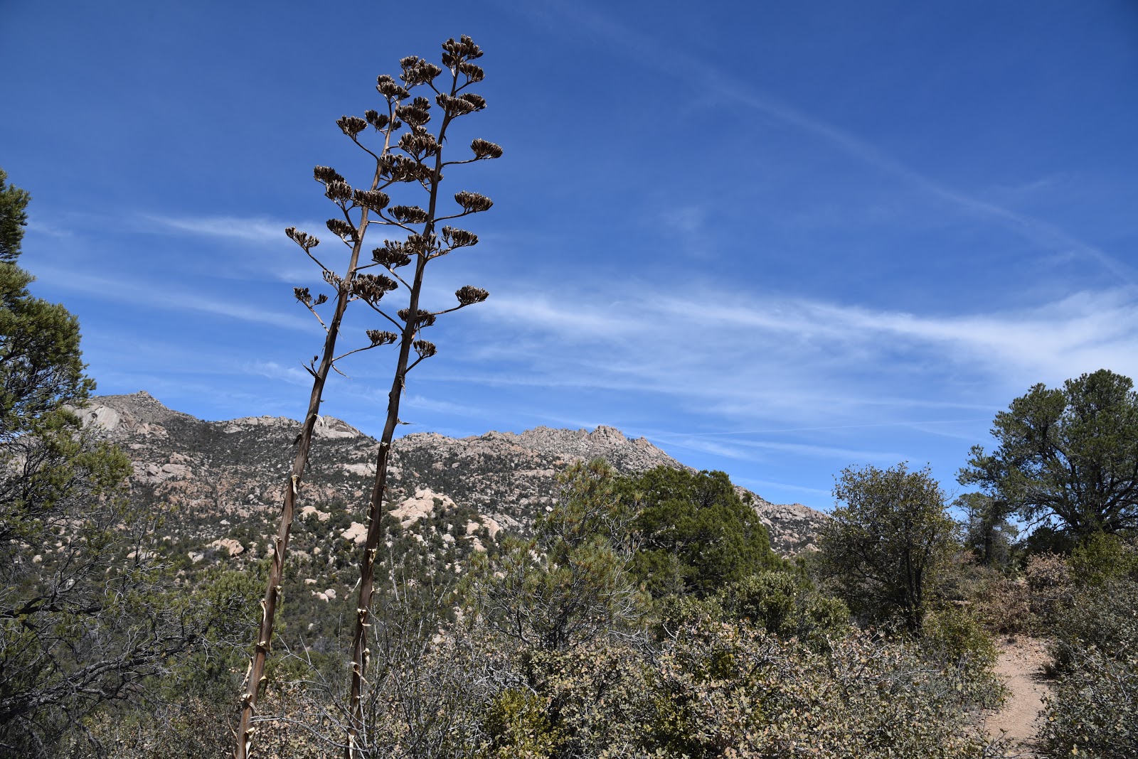
Except for a sheer cliff face that mimics Yosemite National Park’s Half Dome formation, Granite Mountain looks like it fell off the back of a galaxy-class dump truck. Haphazard mounds of rubble, craggy shelfs and balancing spires belie the handiwork of eons of wind and water erosion. Look carefully and you’ll see the sooty scar of the 2013 Doce Fire struggling to heal on the far slopes.  Above the distressed granite piles, ospreys and turkey vultures ride the current above nearby Granite Basin Lake. The steep, rocky segment tops out on a flat where a gateway of spent agave stalks mark the beginning of the descent to the spring area.  This beautiful section wanders under oak-pine canopies that throw refreshing shadows on the dry but still lush riparian corridor below.
Squirrels in trees
The cooler, usually moister environment is a wildlife magnet and you’re almost guaranteed to spot foraging squirrels, scrub jays and woodpeckers drilling into dead trees for insects. The greenway stroll ends where the trail heads back uphill on long, canyon-hugging switchbacks.
View of Williamson Valley in distance
Massive boulders, enormous Alligator junipers and the best views of the hike are the key features of the final half-mile that ends at a high pass between Little Granite Mountain and Two Rock Mountain. 
Agaves and Granite Mountain
For an out-and-back hike, the junction with Little Granite Mountain Trail #37 is the turnaround point. But if you want more miles, take the loop option. 
Drainage area on Granite Mountain Trail
A word of caution though, the last two legs of the loop are more exposed and pass through fire-damaged terrain. Be sure to bring plenty of water and sun protection if you choose this option. To do the loop, hike 2.8 miles north (go right) on Trail #37 to Blair Pass.
Acorn woodpecker in flight
Veer right on to Trail #261and enjoy the final 1.6-mile trek thorough high desert wilderness back to the trailhead.
LENGTH: 4.4 miles out and back OR 6.6-mile loop
RATING: moderate
ELEVATION: 5620 – 6400 feet
GETTING THERE:
From downtown Prescott, go north on Montezuma Street (which turns into Whipple Street and then Iron Springs Road) and continue 4.5 miles to N. Granite Basin Road.
Turn right and go 3.7 miles to the Metate Trailhead. Roads are paved and there are restrooms at the trailhead.
FEE: $5 daily fee per vehicle. Bring exact change for the self-pay kiosk.
INFO & MAP: Prescott National Forest

Monday, February 22, 2016

MINT WASH-WEST LAKE LOOP

MINT WASH-WEST LAKE LOOP
Granite Basin Recreation Area, Prescott
View of Granite Basin Lake from Mint Wash Trail

As a perennial bucket-lister, Granite Mountain Trail #261 lives up to its hype with a strenuous 1,400-foot ascent on a hulking mound of billion year old rock. It's one of Prescott's most glorious hikes, serving up a wilderness summit experience with a substantial side of sweat. Once you've got that one out of your system, there's plenty more to explore around the base of the mountain. In the shadow of the massif's intimidating brow, a maze of looping paths in Granite Basin Recreation Area offer more than 33 miles of easy and moderate rated hike alternatives. The site is cradled in a craggy, forested pocket lodged between a wilderness area and suburbia. Built out with creature comforts like restrooms, picnic tables and a tiny lake, the area's trail complex is family-friendly, well-signed and designed for either short strolls or day-long treks. Whichever trail or trails you select, you'll be walking through a bizarre landscape of volcanic rock outcroppings weathered smooth by eons of exposure. Water trickling though drainages nourishes a mash up of wild mint and cacti huddled beneath tall Ponderosa pines. Like sister trail #261, there are plenty of spots where views of the sprawling flatlands of Williamson Valley and the cloud-brushing peaks of Flagstaff are framed by  tunnels of arching oak.
A detailed map available for download on the forest service web site shows how the trails connect. Here's one circuit that includes a swing by Granite Basin Lake, lots of shade and a high saddle vista point. From the Cayuse Trailhead begin on West Lake Trail #351 and hike 1.2 miles then veer right onto Mint Wash Trail #345. This junction is located just before a road crossing and is signed but easy to miss. Hike 0.7 mile on #345 and turn left on Mint Wash Connector Trail #352. Continue 1.1 miles to the Chimbley Water Trail #348, turn left and hike 0.5 mile to Willow Trail #347, turn right and follow it 0.8 mile back to the trailhead.
LENGTH: 4.3-mile loop
RATING: easy
ELEVATION: 5,400' – 5,770'
HOURS: day-use gate hours vary by season but are roughly sunrise to sunset daily
FACILITIES: restroom, picnic tables.
GETTING THERE:
Cayuse Trailhead:
From downtown Prescott, go north on Montezuma St. (turns into Whipple St.) to Iron Springs Road.
Go 3 miles on Iron Springs to Granite Basin Road (Forest Road 374), turn right and continue 2.4 miles to the Cayuse Equestrian Trailhead on the right. Parking is 0.1 mile up the road.
FEE: $5 daily per vehicle (free on Wednesdays). Bring exact change for the self-serve pay station.
INFO & MAPS: Bradshaw Ranger District, Prescott National Forest, 928-443-8000
MORE PHOTOS: