Find A Trail. Start Your Search Here:

Showing posts with label Devil's Kitchen. Show all posts

Monday, April 8, 2019

Cibola Pass-Jordan Trail Loop

Cibola Pass-Jordan Trail Loop
A juniper-framed view on Cibola Pass Trail

Mitten Ridge formations seen from Cibola Pass Trail.
As implausible as it may seem, some people driving through Sedona are in a hurry. It happens, though, but it’s no excuse to forfeit a hike in order to beat the traffic or catch a flight.  Many of Sedona’s trails offer drive-up-and-hike convenience and clever connectivity that accommodates those who have only a couple of hours to indulge in a picture-perfect jaunt.  Take, for instance, the Cibola Pass-Jordan Loop.
Sugarloaf and Chimney Rock seen from Jordan Trail.
When hiked from the Jim Thompson trailhead that’s located just a short drive from Uptown Sedona, this heavenly trek that slices through forests at the southern edge of the Red Rock Secret Canyon Wilderness, gets you in-and-out of the good stuff pronto.  
Huge agaves grow along the route.
As the average hiker moves at about 2-3 miles per hour, it’s possible to whip through this 2.2-mile circuit in just over an hour—provided you can limit ogling and photo stops. The hike scrimps on length but splurges on scenery and workout value.  From the parking area, start hiking at the Cibola Pass post near the fee pay station. Continue a few yards to a three-way junction and continue straight ahead on the Cibola Pass trail. Hiking the loop in this direction gets the steep climbing out of the way within the first half-mile.
A shady spot on the Jordan Trail
The abrupt but not-too-difficult climb is a mashup of switchbacks and flat rest areas overlooking the deep cuts of Mormon Canyon and layers of sheer wilderness mesas.  The signature feature along this section is the hand-shaped, russet stone tower that caps Mitten Ridge.
A scenic point on the Jordan Trail
The route makes a brief passage though the wilderness area on slickrock slopes with stunning juniper-framed views before dipping into a shady drainage.  At the 0.7-mile point, the circuit meets the Jordan Trail junction.
A slick rock passage on the Jordan Trail
Time permitting, take an optional 0.6-mile roundtrip venture, by heading right to see Devil’s Kitchen—an impressive sandstone sinkhole.  To stick with the quick-trip plan, go left at the junction and make a swift ramble on the Jordan Trail through a 1.5-mile pocket of fragrant cypress, giant agaves and oak-fringed bluffs. You’ll be back at the trailhead in a flash with dusty boots and time to spare.
Goodding's Verbena blooms April through September.

LENGTH: 2.2 miles
RATING:  moderate
ELEVATION:  4520 – 4682 feet
GETTING THERE:
Jim Thompson Trailhead:
From the State Route 179/89A traffic circle in Sedona, go right onto 89A and continue 0.3-mile to Jordan Road on the left. Go 0.8 mile on Jordan Road, turn left onto Park Ridge Dr. and continue 0.5-mile to the trailhead on the right. The last half mile is on a gravel road with potholes but is suitable for all carefully driven vehicles. A $5 Red Rock Pass is required.  There is a restroom and a pay station at the trailhead.
INFO:  Coconino National Forest
Red Rock Pass Information:
-->

Sunday, February 17, 2013

Hike to Devil's Kitchen and the Seven Sacred Pools


SOLDIER PASS-BRINS MESA-CIBOLA PASS-JORDAN TRAIL LOOP
Coconino National Forest, Sedona
Devil's Kitchen

Seven Sacred Pools
For a short trek, this little loop packs in plenty of variety.  First up, is Devil's Kitchen---Arizona's largest sinkhole. Formed by a series of catastrophic geological events, the hole will continue to grow over time and the AZ Geological Survey considers the area unstable and hazardous. Although it might look tempting, the sinkhole is just not safe to explore beyond the trail. A link below leads to an AZGS article about Devil's Kitchen and includes lots of interesting maps and data.   Beyond the slump, head left and hike less than a mile  to see the "seven sacred pools", a chain of shallow ponds scoured from red sandstone that reflect both blue sky and colorfully-layered canyon walls.  Once done exploring the pools, follow the trail through a calming landscape of cypress, juniper and yuccas to the sign for Red Rock Secret Canyon Wilderness.  Here, an unsigned, but obvious footpath heads right for a mildly steep quarter-mile side trip to the Soldier Pass Arches. Past the arches, the route makes its final ascent to the Brins Mesa Trail junction.  At just under 5,000' the views here are breathtaking and breath saving as it's all downhill trekking from here.  Continuing 
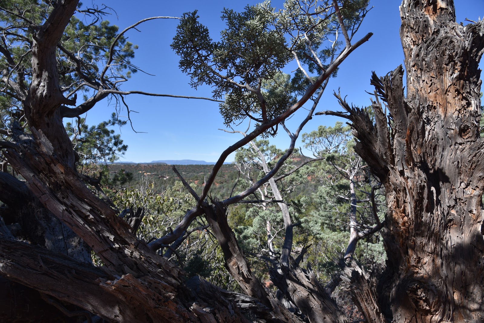
southeast on the Brins Mesa Trail, the route dives into a canyon land of Paleozoic-age sandstones singed by the 2006 Brins Fire.  A haunting landscape of blackened stubble mixed in with healthy high desert flora splatters the gorges in earthy shades of green.  A mid-segment lookout point provides unobstructed vistas of Sedona, and sometimes, graceful waterfalls can be seen washing over distant crags. 
HIKE DIRECTIONS:
From the trailhead, follow the access path 0.2 mile to the first junction and turn left to pick up the Soldier Pass Trail.  Hike roughly 0.7 mile to the wilderness sign where an optional side path leads to a series of natural arches.  This side trip will add 0.5 mile to the hike.  Continue another 1.0 mile on Soldier Pass to Brins Mesa Trail.  Turn right here and hike 2.0 miles to the Cibola Trail, turn right and go 0.6 mile to Jordan Trail, turn right again and hike 0.3 mile to the Soldier Pass junction, turn left and hike 0.2 mile back to the trailhead.

LENGTH:  5-mile loop (5.5 with arches detour)
RATING: moderate
ELEVATION:  4,450'- 4,930'
FEE: A Red Rock Pass is required.  $5 daily fee per vehicle.
http://www.redrockcountry.org/passes-and-permits/index.shtml
HOURS: the Soldier Pass trailhead is gated and open only from 8 a.m. to 6 p.m. daily.
There's alternate access off Jordan Road.
GETTING THERE: Use the FREE SEDONA SHUTTLE: 928-203-5252, SedonaShuttle.com
From Phoenix, go north on I17 to exit 298 for Sedona/Oak Creek. Turn left (west) onto SR179 and continue to the traffic circle intersection at SR89A.  Veer left through the circle heading toward Cottonwood on SR89A.  Between milepost 372 and 373, turn right onto Soldier Pass Road, drive 1.5 miles to Rim Shadows, turn right and continue 0.25 mile to the short drive to the trailhead on the left.
INFO: Coconino National Forest, Red Rock Ranger District ,928-203-2900
GEOLOGY ARTICLE