Find A Trail. Start Your Search Here:

Showing posts with label Mormon Lake. Show all posts

Monday, July 17, 2023

Arizona National Scenic Trail Mormon Lake Passage 29

ARIZONA NATIONAL SCENIC TRAIL MORMON LAKE PASSAGE 29

Old growth pine, spruce and fir trees on the AZT

The Mormon Mountain Passage 29 of the Arizona National Scenic Trail slides through the of forests and high plains of Anderson Mesa and the Plateau Lake region of Northern Arizona.

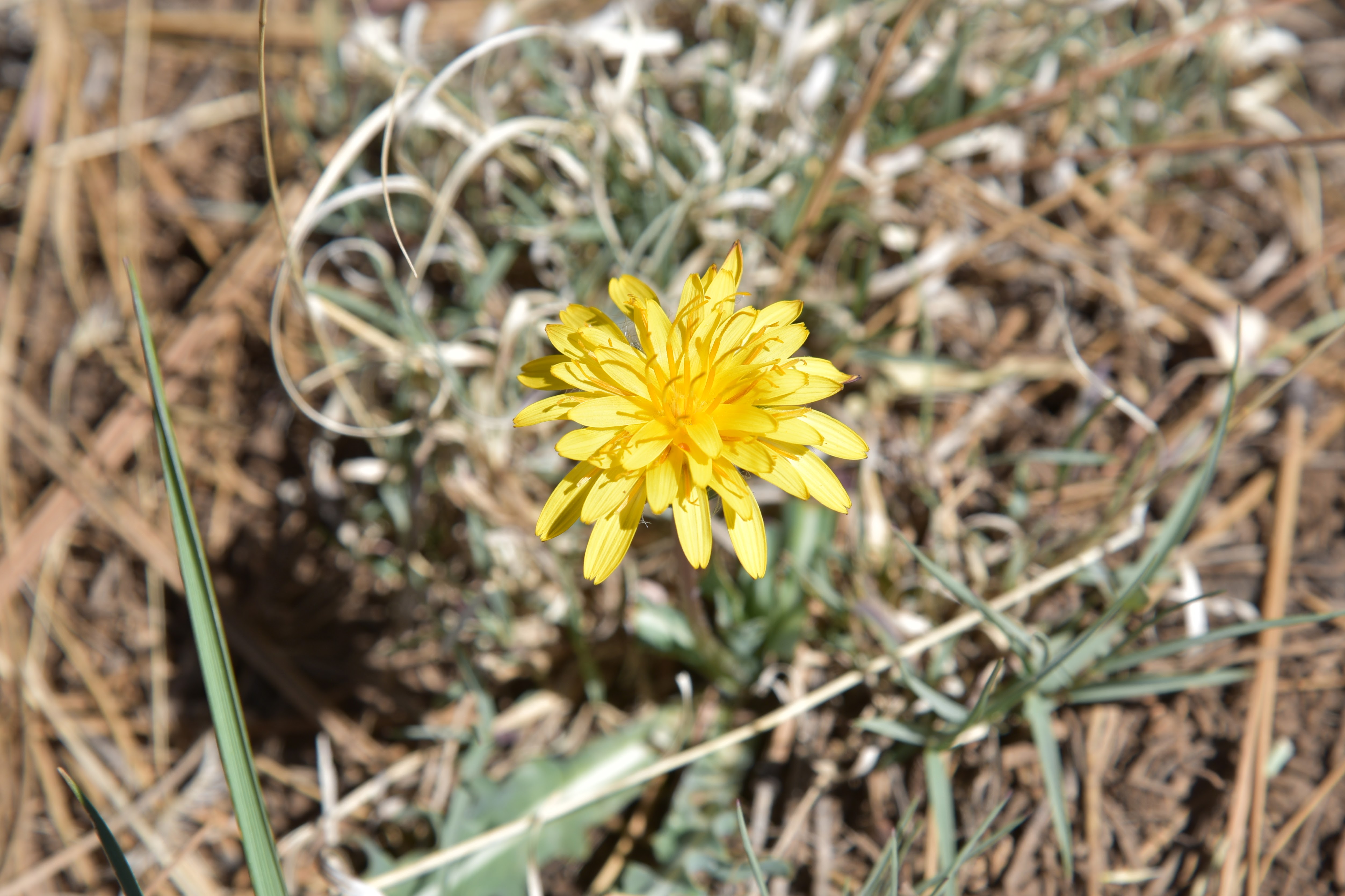
Pollinators alight on sunflowers near Double Springs

At 14.8 miles in length, it’s one of the shortest segments of the 800+-mile route that runs from the Mexico border to Utah and is also one of the most accessible.

Cliffs and clouds on Passage 29 of the AZT

The segment heads north from the Gooseberry Springs trailhead off Lake Mary Road and crosses paths with several campgrounds, water sources and the busy recreation hub around Mormon Lake Lodge to its terminus at Mayflower Spring north of the Dairy Springs Campground.
Navajo Spring site on the Arizona Trail near Mormon Lake

While the trail maintains its backcountry ambience in Coconino National Forest, it never wanders too far from civilization. That’s why this shady slice of the long-distance route located roughly 20 miles south of Flagstaff is a perfect place for day hikers or trail novices to step out with confidence and comfort. Multiple access points and make dropping in and out of the passage or creating abbreviated day hikes a cinch.

A day hike option that starts near the segment’s north end at the Mormon Mountain trailhead doubles down on the shade for a cool summertime escape.

Double Springs trailhead

  Located near the Dairy Springs Campground on the west shore of Mormon Lake, the trailhead is mainly used for the Mormon Mountain Trail, a 6-mile roundtrip hike to the 8,449-foot summit of the eponymous volcanic peak. From the trailhead, it’s a 0.4-mile walk to the Arizona Trail junction where this trip heads left (south). Smothered in old growth mix-conifer woodlands, mountain breezes whip up a cocktail of earthy-pine fragrance in the air. The fir-spruce deep woods that dominate the first mile gradually give way to a Ponderosa pines and Gamble oaks centric biozone.  Where a short stretch of alligator junipers takes over on a sunny ridge, the tree cover gives up fleeting peeks at the lake.
Wildflower meadow near Navajo Spring

After crossing Forest Road 240, the trail enters Double Springs Campground and follow a road a short distance to the Lakeview Trail on the right. The Arizona Trail follows Lakeview for a mile to a junction at the 3-mile point. For a 6-miler, this makes for a good turnaround point.
Part of Passage 29 follows the Lakeview Trail

Mormon Mountain Trailhead in Coconino NF

However, the Lakeview Trail continues for another mile on a sketchy path up to a scenic lookout spot. It’s an optional detour, but forest clearing operations make it somewhat difficult to follow. The Arizona Trail continues south through meadows and aspen glens.
Trail junction at the 3-mile point

At the 6-mile point just beyond Forest Road 90N, the trail meets the Navajo Spring site. A canopy of feathery aspens and acres of wildflowers foil the intrusion of an arc of rectangular concrete troughs.  Once used to water livestock, the decaying array sits in a sunny clearing where filtered light softens its manufactured edges.  
AZT rollovers simplify passing through gates

Farther down a shallow canyon, the Navajo Spring Trail spins off to the left and continues for just over a mile to Mormon Lake Lodge. This makes for another car shuttle or turnaround point option.
Part of the route follows an old railroad bed

For a longer trek, the trail continues south following parts of an old railroad bed before concluding at the Gooseberry Springs trailhead.
The trail is shady and pine-fresh!

 For hikers who still want more, lots of dispersed camp sites anchor the beginning of the trail’s 29.4-mile Happy Jack Passage 28 that explores the Mogollon Rim.
Gooseberry Springs trailhead

ARIZONA TRAIL IN A DAY:

With this primer completed, you might want to participate in the 6th annual Arizona Trail in a Day event happening on October 17, 2023. The event rallies hikers all across the state to complete the entire trail (in coordinated segments) in 24 hours while raising awareness and funds for trail construction, maintenance and educational programs. Cool T-shirts, too! REGISTER HERE: https://aztrail.org/events/aztinaday-2023/

LENGTH:

From the Mormon Mountain Trailhead:

To Lakeview Trail Split: 3 miles one way

To Navajo Spring: 6 miles one way

To Gooseberry Springs Trailhead: 14 miles one way

RATING:  moderate

ELEVATION: 7,150 -7,484 feet (overall)

Mormon Mountain Trailhead (Dairy Springs Campground): 7,287

Double Springs Campground: 7,146 feet

Lakeview Trail junction: 7,383 feet

Wallace Spring: 7,333 feet

Navajo Spring junction 7,467 feet

Gooseberry Springs Trailhead: 7,484


GETTING THERE:

MORMON MOUNTAIN TRAILHEAD (as described here):

From Flagstaff, go 20 miles south on Lake Mary Road (Forest Road 3) and turn left on Mormon Lake Road (Forest Road 90) past milepost 323. Continue 3.6 miles to Montezuma Road and the turn off for Dairy Springs Campground, turn right and go 0.3 mile to the trailhead. Roads are paved and maintained dirt suitable for all vehicles.

DOUBLE SPRINGS CAMPGROUND:

From Flagstaff, go 20 miles south on Lake Mary Road (Forest Road 3)  to Mormon Lake Road (Forest Road 90) past milepost 323 on the right. Follow Mormon Lake Road 5 miles to  the Double Springs Campground turnoff and continue 0.2-mile to the trailhead. Roads are paved and maintained dirt suitable for all vehicles.

NAVAJO SPRING TRAILHEAD:

From Flagstaff, 20 miles south on Lake Mary Road (Forest Road 3) and turn left on Mormon Lake Road (Forest Road 90) past milepost 323. Continue 7 miles to Mormon Lake Lodge. Park in the dirt lot behind the reservation office and horse corral. Hike begins at the Environmental Education Center across the road. Roads are 100% paved.

GOOSEBERRY SPRINGS TRAILHEAD:

From Flagstaff, go 32 miles south on Lake Mary Road (County Road 3) to Forest Road 92. This is past mile post 313 on the left and signed for Gooseberry Springs. Continue a short distance to the trailhead on the right. Roads are paved and maintained dirt suitable for all vehicles.

INFO & MAPS:

Coconino National Forest

https://www.fs.usda.gov/recarea/coconino/recarea/?recid=55006

Arizona Trail Association

https://aztrail.org/explore/passages/passage-29-mormon-lake/


Monday, July 11, 2022

Bill Back Park

BILL BACK PARK

Sunny meadow of Bill Back Park

No crowds, no water, no restrooms, no trash service, no picnic tables, no fees--no problem. That’s the deal with dispersed camping, a way of lodging in the forest outside of developed campgrounds.
Golden-beard penstemon bloom June - October

Camping styles at these no-frills dirt pullouts range from primitive bivouacs, group tent cities (Barbie forts, anybody?) to luxury RV setups complete with full kitchens and satellite television. Which kind of makes you wonder, no?

Forest Road 230 serves as the trail

Whatever the interpretation of “sleeping rough”, dispersed camping requires a higher degree of preparedness as well as attention to proper sanitary procedures, trash removal and campfire safety including knowing when fires are banned. 

A tiny waterhole attracts wildlife

Summertime in Arizona means forest roads are lined with pop-up temporary living quarters.  

While many of these no-star waystations are located steps away from popular hiking trails like the Arizona National Scenic Trail, others are not.

Alfalfa blooms April - October

So in between dipping into the beer cooler and flipping through tawdry novels, a good way to break up the time on the off-the-beaten track tracks is to take a walk on dirt roads to soak in the beauty of the forest and spy the details that are easy to miss while lurching along in a motor vehicle.
Woodland pinedrops bloom June- Sept

The Coconino National Forest Motor Vehicle Use Map, which is available for free in hard copy, downloadable pdf or digital format, shows where dispersed camping is allowed. 

Lupine is a common summer bloomer

No-frills dispersed campsites offer solitude

One shady, high elevation place to try is the roads around Bill Back Park south of Flagstaff and Mormon Lake.
Delicate American vetch bloom May - Sept

Less than a half-mile from paved Lake Mary Road, Forest Road 230 not only offers dozens of generously spaced campsites, but also makes for easy summer strolling under tall pines. Beginning at the junction of Stoneman Lake Road (FR213) the hike down FR 230 begins in sunny meadows before ducking into Ponderosa pine woodlands. The outwardly monodominant forest of soaring conifers belies a much richer ecological diversity that’s easily exposed to those with an inclination for discovery.

Rustic corral along a side road

Roadside pops of color, courtesy of lupine, penstemons, clover, thistle and blooming shrubs, brighten meadows while tiny waterholes harbor mini wetland environs rife with water buttercups, frogs and elk.
Yellow sweet clover blooms June- August

 
Bill Back Park, a long, open pasture fringed with pines attracts swarms of birds and critters.  At the south end of the park, Forest Road 230G spins off to the left. 
Common silverweed grows in moist areas May - August

A few yards down this non-motorized spur path, a wood-and-barbed wire corral falls apart in plain view.  Beyond the corral, the road descends through the heavily forested divide between 7,743-foot Bill Back Butte and 7,639-foot Jackson Butte.
Western Blue Flax blooms April - September

FR230 passes between Bill Back and Jackson buttes

Gamble oaks and wild roses enter the botanical mix before the road meets a cattle guard at the 3.85-mile point.
Horned spurge shrubs bloom April - August

 
 This makes for a good turnaround point in order to get back to camp for a frosty IPA in isolated, pine-swaddled bliss.  

LENGTH: 7.7 miles roundtrip

RATING: easy

ELEVATION:  7,231 – 7,406 feet

GETTING THERE:

From Flagstaff, go 34.2 miles south on Lake Mary Road (Country Road 3) to Stoneman Lake Road (Forest Road 213). Turn left and continue 0.4 mile to Forest Road 230 on the left.  Park in any of the dirt turnoffs along the road.

Coconino National Forest Motor Vehicle Use Map

https://www.fs.usda.gov/detail/coconino/landmanagement/projects/?cid=stelprdb5356224


Monday, May 23, 2022

Upper Lake Mary

UPPER LAKE MARY

Mormon Mountains stand out over Upper Lake Mary

At the tail end of the twin reservoirs of Upper and Lower Lake Mary, an airy draw closes in on the murky meanders of Walnut Creek. 

Upper Lake Mary viewed from FR 9485C

Cutting through dry stubble and emergent grasses, the entrenched creek course snakes south through coniferous woodlands in Coconino National Forest.
Rocky Mountain iris bloom May - September

Earthen dams on the creek contain the elongated lakes that are a major source of water for the City of Flagstaff roughly 15 miles to the north.

Log pole fence on the shore of Upper Lake Mary

 While the lower lake is usually bone dry, Upper Lake Mary retains enough water for boating, water skiing, fishing, and picnicking. Nearby camping and access to the Arizona National Scenic Trail, make the lakes a popular recreational destination. 
Drought has altered the landscape around the lake

Water levels vary depending on rain and snowmelt.  According to the USGS, Upper Lake Mary is about 5.6 miles long with a surface area of 939 acres and a maximum depth of 39 feet when at full capacity. Prolonged drought has altered the lake’s size and character.
Field bindweed bloom May - September

Deepest near the dam at its north end, Upper Lake Mary shallows out as it bends southward gradually morphing into puddles, mucky swales, and a dry draw where the ghost of the creek exists in deeply incised, twisted channels.
Butter & eggs bloom May - September

A short forest road on the east shore provides a close look at this transitional segment where the lake goes from pond to puddle to pasture in just under one mile.  Forest Road 9485C serves as the trail for the 2-mile round trip hike. 
San Francisco Peaks on the horizon

Wide, rocky, and relatively flat, the dirt two-track sits just below Lake Mary Road. 
Mountain dandelion bloom May - October

Over the first-quarter mile, Ponderosa pine trees stand over the last sizable reaches of lake water where Great blue herons, waterfowl and—for early morning hikers—elk, might be spotted browsing the weedy fringes.
Hike uses FR 9485C below Lake Mary Road

The rounded peaks of Mormon Mountain stand out over an ever-fading spillway to the south.  About where a rustic pole fence stands at what appears to be the former edge of the lake, water sightings are replaced by juniper-framed views of the creek meanders and glimpses of the San Francisco Peaks to the north. 
Creek meanders at the far south end of Upper Lake Mary

While drought has altered the landscape, there’s still a thriving understory of blooming shrubs and wildflowers. Sunflowers put on an especially gorgeous show in late summer, blanketing the shores in acres of brilliant yellow.

LENGTH: 2 miles round trip

RATING: easy

ELEVATION: 6,830 – 6,850 feet

GETTING THERE:

From Flagstaff, travel  15.5 miles south on Lake Mary Road (County Road 3) to Forest Road 9485C on the right past milepost 329. There are no fees at this day use parking area.


Monday, July 12, 2021

KINNIKINICK LAKE

KINNIKINICK LAKE

Scrub land surrounds Kinnickinick Lake

Fishing and hiking share a common component--hoofing it to get to the good stuff.  Anglers typically trudge miles along streams and lake shores in search of the ideal spot to cast a line, while hikers will go out of their way to explore quirky, out-of-the-way sights.

Kinnickinick Lake, located 38 miles south of Flagstaff, is one place where anglers and hikers can unite in purpose.

Reeds grow around the lake's dam

The small trout fishery is situated on a desolate plateau, dotted with scraggly junipers a few miles southeast of Mormon Lake in Coconino National Forest.  Vast grasslands where domestic cattle browse among sporadic stands of Ponderosa pines and water tanks define the dusty, 9-mile drive in on kidney-jarring back roads.

Calliopsis bloom along the water Jun-Sept


At approximately 100 surface acres in size, the lake sits at 7,000 feet in elevation and is open for day-use  fishing, hiking, wildlife viewing and boating.  
Pines and junipers provide spotty shade along the hike

Largely shade-less with an eerie kind of allure, Kinnickinick, which is a Native American word used to describe plant-based mixtures for smoking, makes for an unusual trek.

The 2-mile circumference hike around the water involves following faint paths-of-use along a mix of mucky fringe, jumbled boulders and pine-shaded shores. 

The rocky fringe of Kinnickinick Lake

The route passes several barbed wire fences—close all gates and never cut or alter any parts—alternating among low bluffs above the lake and shoreline scrambles. 
The airy terrain of Kinnickinick Lake

The lake is bound by a dam at the head of Grapevine Canyon where acres of reeds serve as camouflage for waterfowl like ospreys, Great Blue herons and ducks and well as the herds of elk and pronghorn that roam the area.  
The lake is a haven for birds and waterfowl

A fun way to hike the lake is to do a hybrid kayak-walk trip.  This option circumvents the barbed wire and much of the loose-rock footing while providing better opportunities to view wildlife.
Poison milkweed attracts pollinators


Either way, this off-the-beaten-path, primitive destination offers an alternative to the typical party atmosphere of spending a day at the lake.

The hike follows faint paths-of-use

Curly dock flourishes in muddy areas around the lake

LENGTH:  2-mile circumference hike

RATING: moderate

ELEVATION:  7,010 – 7,095 feet

GETTING THERE:

From Flagstaff go 24 miles south on Lake Mary Road (County Road 3) to Forest Road 125 on the left signed for Kinnickinick Lake.  Go 5 miles on FR 125 to Forest Road 82, veer right and continue 4.5 miles to the lake.  Forest roads 125 and 82 are rough dirt but passable by most carefully-driven vehicles.  The lake is open for day use only and there are no fees. There is a restroom near the boat ramp and picnic tables are spread out along the shore.

INFO: Coconino National Forest

https://www.fs.usda.gov/recarea/coconino/recarea/?recid=55002

Monday, May 10, 2021

Mormon Lake Lookout Site

MORMON LAKE LOOKOUT SITE

Gate on Mormon Lake Lookout road

There are few certainties in life, but one fixed reality is, things fall apart.  Whether a star dying in a spectacular super nova or the protracted disintegration of a favorite pair of shoes, sooner or later everything in the taxonomy of the natural world will expire.  While we are dialed-in to the mundane disintegrations that go on right under our noses every day (oil in a car, paint on house, cells in our brains) the slow-burn of obsolescence and decay on mountain back roads reads more poetic than prosaic.  
Cinder pit along FR 124C

Perhaps because we don’t look at them every day, the breakdown of land forms and back woods human-made artifacts barely registers.  And since we’re not scrambling to fix them, they exist as curiosities instead of problems.
Masonry box at Iowa Camp Spring

A stroll along Forest Road 124C near Mormon Lake exposes several sites where falling apart happens with engaging style.

Pine thermopsis bloom April - July

 
Located at the south end of the Arizona’s largest natural lake, FR124C in Coconino National Forest is a rough two-track open to motorized travel that traces the edge of Anderson Mesa in the plateau lakes region 25 miles south of Flagstaff. 
View from the abandoned lookout site

The road makes a moderate, steady climb heading toward an unnamed hill where the Mormon Lake fire lookout tower once stood.  From the start, the route enters a forest dominated by ponderosa pines and gamble oaks, steering away from the whir of cars passing on Lake Mary Road.  At the 0.3-mile point, a narrow side road on the left leads to a cinder pit that looks like a miniature version of Red Mountain, a collapsed cinder cone volcano north of Flagstaff.  The pit, which is sometimes used by recreational shooters, is a long, broken cliff of volcanic rock with ashen hoodoos eroding out of a cascade of crumbling red cinders.  Volcanic features like this one can form over weeks to years but take millions of years to break down as is happening here.
Summit views are sparse but breathtaking

Beyond the pit, the road enters a higher eco-zone where Douglas, white and cork bark fir trees mingle with the pines.  Between the branches, glimpses of Mormon Lake going through one of its cyclical breakdowns appears as a golden pasture where during wetter years, a shallow lake fills the bowl-like depression.  As the forest grows thicker and the road becomes steeper, a pop of wildflower color gives away the location of the moist environment around Iowa Camp Spring.  Take the non-motorized Forest Road 9474D detour and hike a few yards to visit the site and its stone-masonry spring box.  Trees, shrubs and time are encroaching the historic artifact that looks as if it’s been a while since water flowed in more than a trickle from its rusted pipes.  Around the point where the road reaches 7,600 feet in elevation, a small grove of aspen trees stands in a drainage on the right. 

FR124B leads to the lookout site

Fremont barberry blooms April - July

Aspens have been in a decades-long decline in Northern Arizona.  Stressed by insects, pathogens, drought, frost, browsing elk and dense forests that block sunlight, the trees that reproduce mostly by sprouting root systems that can be viable for up to thousands of years are not regenerating at a healthy rate.  Forest scientists are trying to figure out what is causing the dieback and how best to manage the situation. 
Rubble marks the location of the old fire lookout

Mixed conifir woodlands along FR 124C

At the 2.2-mile point, the road comes to a fork where Forest Road 124B, a non-motorized dirt road, swerves off to the right.  This junction is signed, but the road number post is not easy to spot.

Aspens are in decline in Coconino NF

 
FR124B leads to the abandoned lookout site, gaining 277 feet in just under a mile.  Near the top of the hill, there’s a metal gate and a trail log marking the final 0.2-mile walk to the summit.  On top, the views that can be found in the spaces between trees are sparse but breathtaking. 
Mormon Mountain (right) seen from the trailhead

A jumble of boulders hint at the recent decommissioning and demolition of the former Mormon Lake Lookout and cabin.  The site was home to a wooden lookout built in 1915 that was replaced in 1927 with a 48-foot metal tower topped with a 7 x 7-foot cab.
Dry Mormon Lake (center) sen from FR 124C

 
It’s unclear why the fire watch tower was abandoned, but the Hutch Mountain Lookout to the south seems a likely usurper. 
Eroding hoodoos at the cinder pit site

Judging from backhoe marks on boulders strewn on the site, the tower’s demise was planned, swift and clean, unlike the other falling apart things along the roads leading to it.

LENGTH:  5.9 miles round trip

RATING: moderate

ELEVATION:  7,109- 7,977 feet

GETTING THERE:

From Flagstaff, go 25.6 miles south on Lake Mary Road (County Road 3) to Forest Road 124C on the left past milepost 319.  Park in the dirt turnouts. 

INFO:

http://nhlr.org/lookouts/us/az/mormon-lake-lookout/