Find A Trail. Start Your Search Here:

Showing posts with label McDowell Sonoran Preserve. Show all posts

Monday, March 9, 2026

Cow Poke Loop

COW POKE LOOP

Four Peks seen from 136th St. Express Trail

Besides the jaw-dropping views, amazing geology and lush Sonoran Desert vegetation, one of the best features of hiking in Scottsdale’s McDowell Sonoran Preserve is its trail connectivity.

Blackfoot Daisies

  Whether you’re up for a short trek with lots of company, a day-long haul through the preserve’s outer reaches or an easy loop away from the masses, the site’s 200+ miles of interconnected trails offers plenty of options
Boulder passage on the Bootlegger Trail

for customized hikes. Springtime is ostensibly when the preserve’s protected 30,500 acres of pristine desert habitat shines brightest. 
Bursage grows in sandy washes

It’s when balmy weather, clear skies and an abundance of colorful wildflowers, blooming shrubs and cacti add undiluted bliss to the trails.
Christmas cactus

A good recommendation for spring flower spotting that sidesteps the most heavily used routes is a loop hike using the parts of the Bootlegger, Granite Mountain Loop, Cow Poke, Dove Valley and 136th Street Express trails.
Coulter's lupine

  That might sound complicated, but signs placed at every junction coupled with available paper and digital maps, make getting around simple.
Cow Poke Trail

From the Granite Mountain trailhead on the preserve’s far east boundary.
All junctions are signed

Head out on the Bootlegger Trail, which traipses through enormous rock formations and giant saguaros that frame views of the Salt River Valley and mountain peaks in Tonto National Forest.
Desert lavender

Desert hyacinth

At the GM4 junction, head right on the Granite Mountain Loop—for a twisty, undulating half-mile walk where drainages feed pockets of brittle bush, desert lavender, trixis, bursage, scorpionweed, hackberry, wolf berry, wishbone bush and fairy dusters. 
Rock formation on the Granite Mountain Loop

Desert marigold

About halfway through the Granite Mountain leg, a scenic viewpoint on a rocky knoll showcases vistas that stretch all the way to the Superstition Wilderness where the prominent silhouettes of Weaver’s Needle and the Flatiron stand out on the horizon.
Mexican gold poppies

At the GM5 junction, hang a right onto the Cow Poke trail. 
Owl clover

This 0.6-mile leg ditches the boulder-cluttered environ of the first half of the hike in favor of a more pastoral scene. 
trixis


Mostly flat and open to the sun, low-growing wildflowers thrive here.  Look for owl clover, Mexican gold poppies, Christmas cactus, Desert marigolds, Blackfoot daisies, and lupines.
Wishbone bush

At CP1, hang a right for a short walk on the wide, sandy Dove Valley trail before picking up the 136th St. Express trail for the final leg. The 136th Street Express is replete with yucca, cholla and Palo Verde trees. 
Wolfberry shrub

Views of the Four Peaks hover on the skyline to the east before the trail bends west for the walk back to the trailhead. 

LENGTH: 4.5 mile loop

RATING: easy

ELEVATION: 2,547 - 2,766 feet (374 feet of total elevation change)

GETTING THERE:

Granite Mountain Trailhead

31402 N. 136th Street, Scottsdale.

From Loop 101in Scottsdale, take the Pima/Princess exit #36 and do 6.5 miles north on Pima Road jot Dynamite Blvd/Rio Verde Dr.  Turn right and go k5.9 miles to 136th St., turn left and continue 1.8 miles to the trailhead entrance on the left.

Preserve hours are sunrise to sunset daily. 

INFO: https://www.scottsdaleaz.gov/preserve


Saturday, January 3, 2026

Maverick-Cholla Mountain-Corral Loop

MAVERICK-CHOLLA MOUNTAIN LOOP

Saguaros on the Maverick Trail

All it takes is a little rain to paint the desert in wildflower color.  

Buckwheat

The late December precipitation in the Phoenix area soaked the Sonoran Desert just enough to revive drought-stressed plants and spur new growth.
Chuparosa

Scottsdale’s McDowell Sonoran Preserve is a rich botanical garden that’s already teasing of spring blooms to come.  
Desert lavender

A short hike using Browns Ranch Road, Maverick Trail, Cholla Mountain Loop and the Corral Trail provide a good tour of desert plant diversity.  From the Brown’s Ranch Trailhead, follow Brown’s Ranch Road north.
Dry Gulch Trail

Along this wide passage, fragrant turpentine bushes and yellow-flowered brittlebush dominate the fringe, shading delicate wishbone bushes sporting tiny white blossoms.  
Cholla Mountain Loop

At the one-mile point, turn right at the Maverick Trail sign.  Fiddleneck, globemallow and shrubby deervetch sprout along washes and at the bases of desert hackberry and wolfberry shrubs.  
Mormon tea

Wolfberry

This early in the season, it takes a sharp eye and slow pace to catch patches of rattlesnake weed, lacepod and scorpionweed emerging from the sandy soils.  
Wishbone bush

Continue following the signs to the Cholla Mountain Loop trail where massive boulders harbor clumps of chuparosa, desert lavender and jojoba bushes.  
Shrubby deer vetch

Hang a left at the Dry Gulch Trail and follow it a short distance noting the expansive basin of giant saguaros that front views of Tonto National Forest mountains to the north.
Christmas cactus

Next, turn left at the Corral Trail. This leg features acres of filaree, also known as stork’s bill.  Introduced by Spanish settlers, the low-growing naturalized plant with purple flowers and a beak-like seed pods served as forage for livestock.
Filaree aka stork's bill

Brown's Mountain seen from Corral Trail

Also, along this leg, look for spiny Mormon tea, fragile paperflower, pungent triangle bursage and Christmas cactus.
Fiddleneck

Back at the Browns Ranch Road junction, head back to the trailhead taking in big views of distinctive flat-topped Brown’s Mountain framed by mesquite, yucca and creosote. 
Fairy duster

Happy New Year!

LENGTH: 4.5 miles

RATING: easy

ELEVATION:  2,678 – 2,800 feet

GETTING THERE:

Browns Ranch Trailhead:
30301 N Alma School Pkwy, Scottsdale


Monday, November 4, 2024

Brown's Ranch Interpretive Trail

BROWN’S RANCH INTERPRETIVE TRAIL

Sign on Brown's Ranch Interpretive Trail

Hikers walking the Corral Trail in Scottsdale’s McDowell Sonoran Preserve have for years  wondered about the scattershot of crumbling concrete and contorted metal strewn about the site of the old Brown’s Ranch. The mysteries have been solved.

The new Brown’s Ranch Interpretive Trail reveals the details in the detritus.

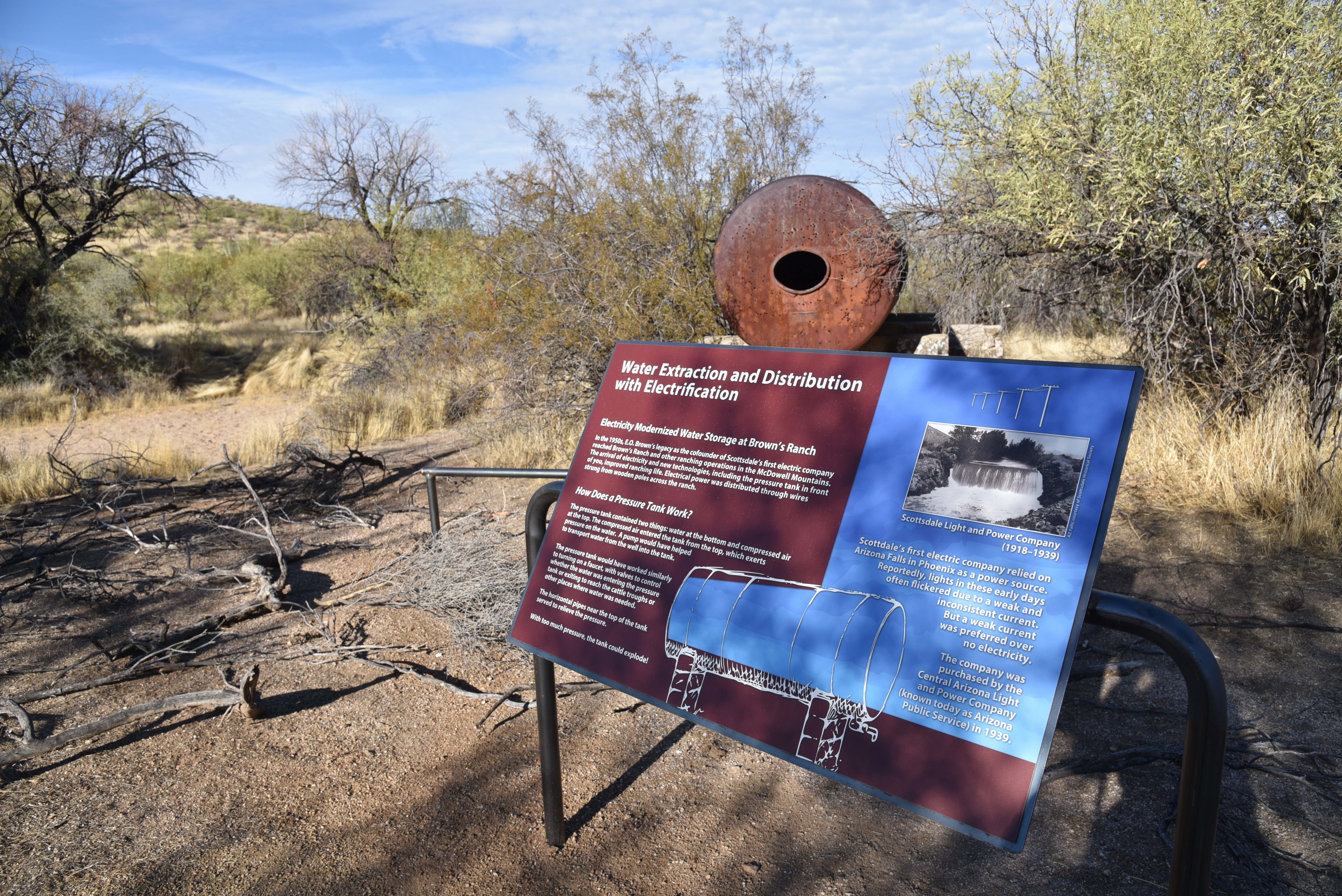
Cistern at the Brown's Ranch site

Opened in October 2024, the easy 0.3-mile loop trail features 20 educational displays that identify the rusty parts, and faint remains of a working cattle operation that operated from 1916 though the 1970s.  

Also tells the story of the ranch founders—the Brown family--- as well as the native peoples, evolving technologies, military presence, and the personalities that colored and shaped the area from prehistory through the “Old West” an into the present.

Technology in the "Old West" explained

 
An old grain hopper rests among mesquite trees

Prior to the opening of the interpretive trail, the site of the Northern headquarters of the 40,000-acre cattle ranch operation was little more than a few acres of nameless bullet-riddled stuff wrapped in a tangle of barbed wire.  Now the history has been resurrected and artifacts named.

Entrance to the Brown's Ranch Interpretive Trail

For instance, what my hiking pals and I called “an airplane engine fallen from the sky” is a gain hopper. And a deep concrete pit we thought was a water trough is really the base of a cattle weigh station.  Who knew.
Signs on Brown's Ranch Road point the way


The site is reached by hiking 1.4 mile north on Brown’s Ranch Road from the Brown’s Ranch Trailhead. 

Barbed wire surrounds the ranch site

The trail sweeps around the mesquite-and-grass choked artifacts rolling out in chapters over its double loop layout.
The new trail is located off Brown's Ranch Road

Beautifully illustrated signs along the route address topics like how ranchers found water, what life was like as a hired hand and inventive construction and manufacturing methods used in the area.

First timers and regular preserve visitors alike will appreciate how the embellished trail enriches the hiking experience.

LENGTH: 3.1 miles roundtrip

RATING: easy

ELEVATION: 2,647 – 2,759 feet

GETTING THERE:

Brown’s Ranch Trailhead: 30301 N. Alma School Pkwy., Scottsdale.

From Loop 101 in Scottsdale, take the Pima/Princess exit 36 and go 6.5 miles north on Pima to Dynamite Road.  Turn right and continue 2.7 miles to Alma School Pkwy., turn left and drive 1 mile to the trailhead.

HOURS: The preserve is open sunrise to sunset daily.

FACILITIES: restrooms, water, maps. No fees.

INFO:

McDowell Sonoran Preserve

https://www.scottsdaleaz.gov/preserve


Tuesday, March 19, 2024

Redbird-Gooseneck Loop

RED BIRD-GOOSENECK LOOP

A boulder passage on the Gooseneck Trail

By trail, it’s only 7 miles from the Fraesfield trailhead to the Tom’s Thumb trailhead in Scottsdale’s McDowell Sonoran Preserve Central Region.

Fraesfield trailhead seen from Gooseneck trail

 
Three miles, as the crow flies. The trail miles wind within a narrow strip of Sonoran Desert that sits between the preserve’s north and south regions.  
Snow capped Mazatzal Mountains

Serving as a non-motorized travel corridor and buffer zone between suburbs and wilds, the tiny parcel abuts private property and McDowell Mountain Regional Park with just enough width for a seamless, airy transition.  
Granite formation on the Redbird Trail

While the Central Region of the preserve sees less action than its compatriots, the maze of routes it holds offer less crowded treks with some of the best mountain vistas in the northeast Valley. 
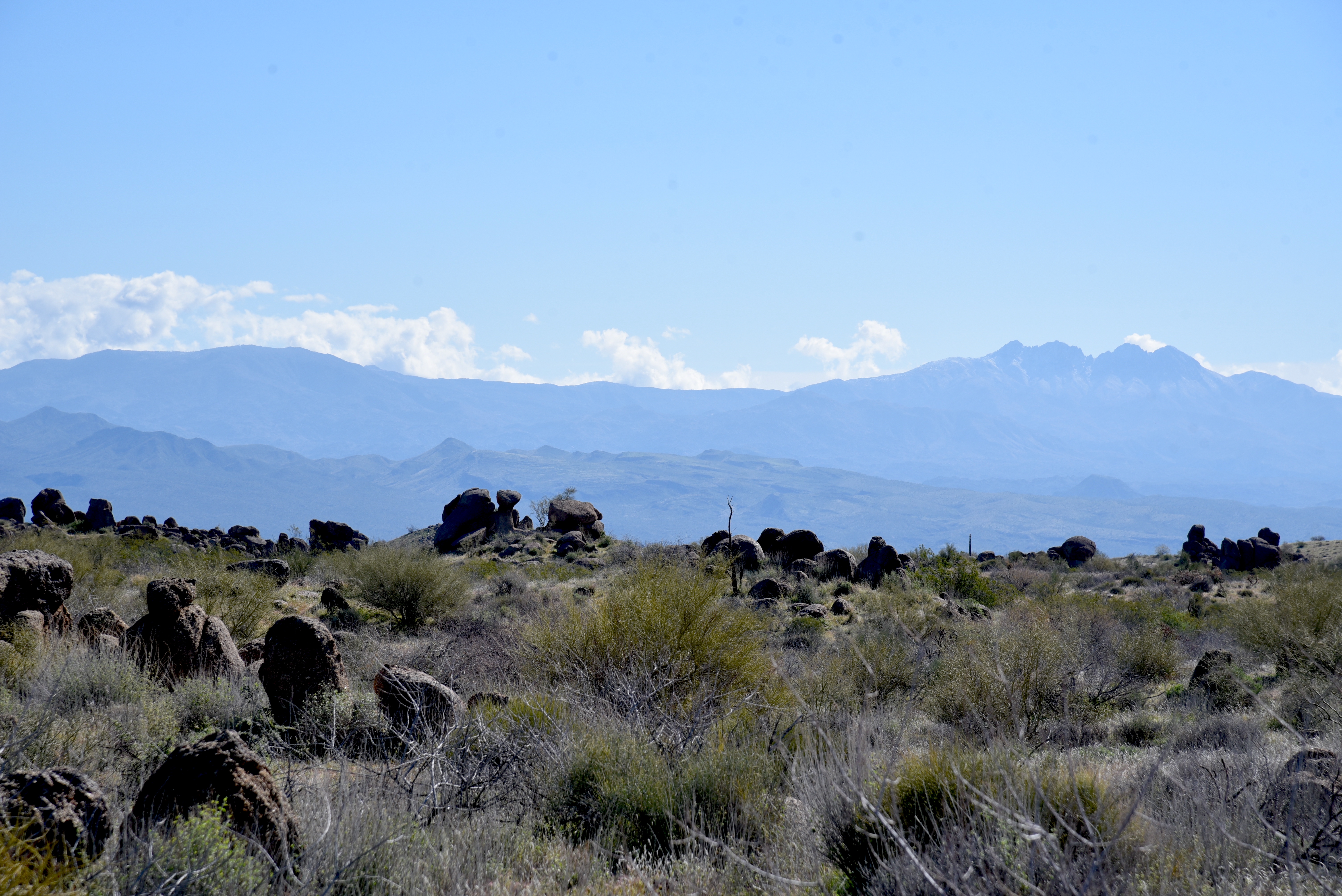
Desert rockpea bloom on the Redbird Trail

The 6.7-mile Gooseneck Trail, which is also part of the 315-mile Valley-circling Maricopa Trail, is the region’s main artery and can be used as the primary path in building customized hikes.
Creosote forest on Gooseneck Trail

From the Fraesfield trailhead, the Gooseneck single track trail heads south in a lazy-S format--much like its moniker suggests.  
Four Peaks seen from Service Road #2

Several short trails, connectors and service roads spin off the curvy, weel-signed conduit for use in creating loops, through hikes or out-and-back treks.  One day hike to try uses the Gooseneck, Redbird and Service Road #2 trails for a tour that includes amazing geology, lush desert vegetation and eye-popping views all around.  
Desert hyacynth (Blue Dicks) on Redbird trail

To get the most out of this off-the-beaten hike, spend a few moments at the Fraesfield trailhead mountain-identifying display. The artistic iron display shows the names and elevations of surrounding peaks visible from the trails. 
Mushroom rocks sprout in the Central Region

Heading south on Gooseneck, the route winds among saguaros and cholla cactus, crossing Rio Verde Drive at the 0.8-mile point.  Across the road, the vegetation morphs from cactus-centric to a sea of creosote and brittlebush.  The mostly level trail gains elevation gradually, opening magnificent mountain views.  The prominent profiles of Mazatzal Peak, Mount Peeley, Saddle Mountain and Mount Ord stand out to the northeast.
Tom's Thumb seen from Service Road #2

To the southeast, the hazy silhouettes of the Superstition Mountains dominated by Weaver’s Needle and the Flatiron hover over the Salt River basin and Tonto National Forest. 
Wolfberry shrub in a desert wash

The preserve’s famous “mushroom rocks”—granite formations that have been sculpted into bizarre shapes over millions of years by the forces of nature, make an appearance here as well.  At the 1.6-mile point, the route heads west on the Redbird trail. This 1.1-mile segment passes through several glinting stony passages at the hike’s highest elevation with excellent views of  the iconic Tom’s Thumb pinnacle perched atop the McDowell Mountains.  The route then swings east on Service Road #2.  The unsexy name belies a beautiful walk through a wash-riddled landscape where water-loving wildflowers, mesquite and hackberry shrubs thrive in sandy soils.  The road also unveils best looks at the cloud-piercing mounds of the Four Peaks Wilderness Area. 
Superstition Mountains seen from Redbird Trail

Brown's Mtn (L horizon) seen from Service Rd

Where the road meets up with Gooseneck, the route swings back north for the return leg of the hike.  Open to the sky and drenched in the resinous scent of creosote, the homeward trek keeps on delivering goodies.  Look for peeks at the flat-topped form of Brown’s Mountain in the preserve’s north region backed by the sprawling mesas and peaks of the Cave Creek Mountains.  
Fiddleneck bloom on the Redbird Trail

Once explored, it becomes clear that the preserve’s Central Region is much more than just a bland thoroughfare between two supernovas.  Like an Oreo cookie, there’s good stuff in the middle.
Kiosk at Fraesfield trailhead

LENGTH: 6.6 miles roundtrip

RATING: easy

ELEVATION: 2,494 – 2,693 feet

GETTING THERE:

Fraesfield trailhead:

13400 E. Rio Verde Dr. Scottsdale

There are no fees. There are restrooms but no drinking water at the trailhead.

HOURS: sunrise to sunset daily

INFO & MAPS:

Scottsdale’s McDowell Sonoran Preserve

https://www.scottsdaleaz.gov/preserve