


 BOYCE THOMPSON ARBORETUM
Superior
BOYCE THOMPSON ARBORETUM
Superior
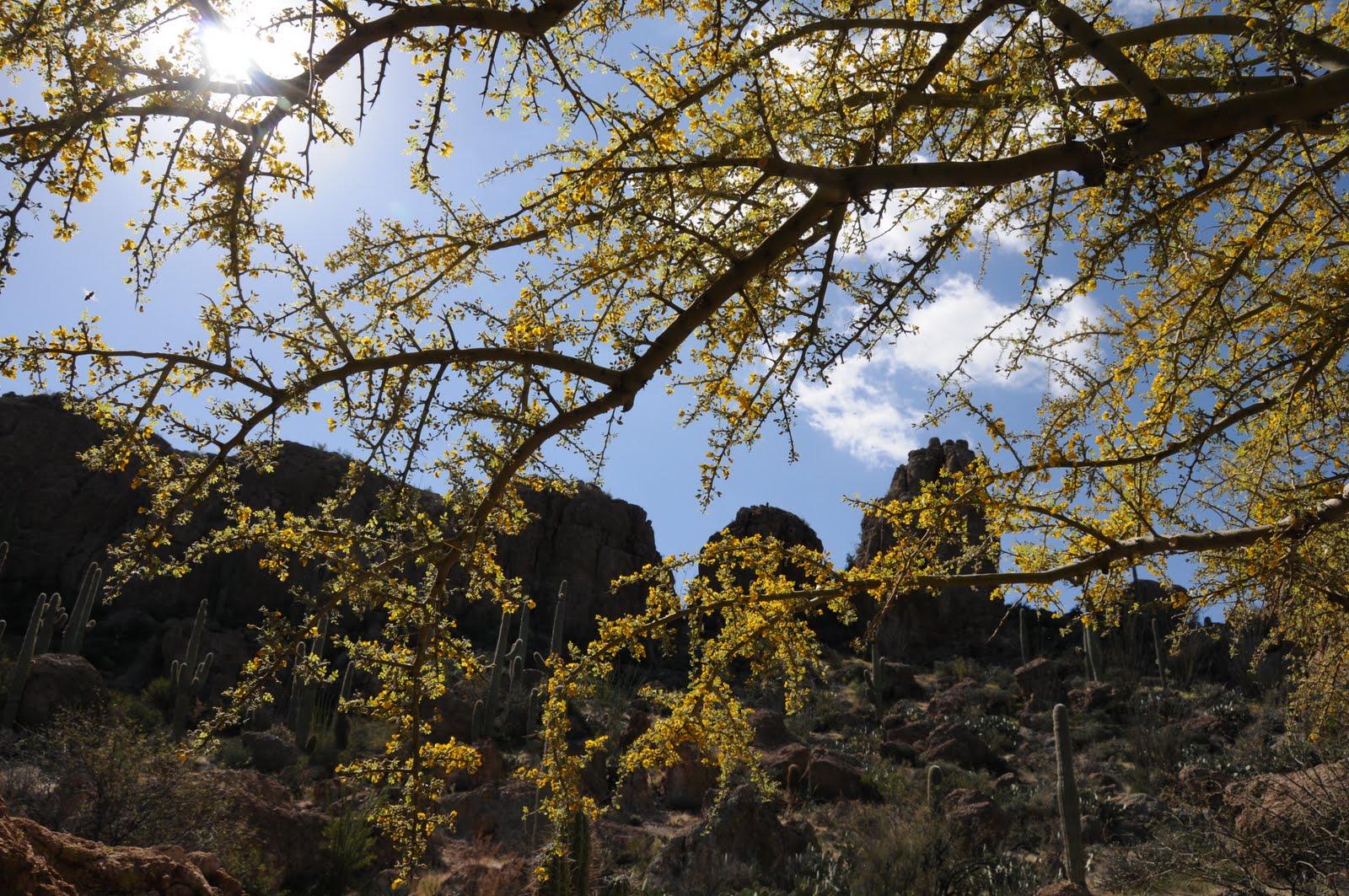
So far, 2011 has been a disappointing year for desert wildflowers. For instance, last week, I drove up to Payson on SR87, which normally is lined with manic penstemons, lupines, poppies and globemallow---but not this year. Desperate for a wildflower fix, I decided to head out to Boyce Thompson Arboretum today. This beautiful Arizona state park features both native and global arid climate plants organized into a series of easy loop trails. Trail exhibits include Australian Desert, Chihuahuan Desert, Upland Sonoran, a riparian corridor along Queen Creek, a South American Desert loop and countless others. Although the wildflower show was less than awesome, it was better here than anywhere else I’ve seen this year. I also discovered that boojum trees are pretty cool. So are Mescal Bean trees, Chinese Pistacia and the resident buzzards. There’s so much to see it’s ridiculous and park volunteers are veritable fountains of information---seriously, they nearly exploded my brain on the hummingbird trail. Anyhooo, since this is a HIKING blog, I must say that I wandered nearly 4 miles within the park and still didn’t see everything.
The best part for me was crossing the suspension bridge (which sways as you walk) over Queen Creek to access the “high trail”. Nearly a mile in length, the high trail is carved out of the cliffs above Queen Creek and offers some sweet views of the volcanic topography near Picketpost Mountain and Superior.
LENGTH: up to 4 miles--free park trail maps available at the entrance
RATING: easy-moderate
ELEVATION: 2,400’-2,600’
GETTING THERE:
From Phoenix, go east on US 60 to the signed turn off for the park located just outside the town of Superior.
FEES: $7.50 per adult, $3.00 for kids 5-12 and FREE for kids under age 4 and under.
HOURS: Sept. – April: 8 a.m. to 5 p.m., May – Aug. 6 a.m. – 3 p.m.
DOGS: leashed dog are permitted. Bring poo bags.
INFO: (520) 689-2811, ag.arizona.edu/bta facebook.com/boycethompsonarboretum
MORE PHOTOS: http://www.facebook.com/album.php?aid=52402&id=1795269672&l=9ee8fd99c1


 BOYCE THOMPSON ARBORETUM
Superior
So far, 2011 has been a disappointing year for desert wildflowers. For instance, last week, I drove up to Payson on SR87, which normally is lined with manic penstemons, lupines, poppies and globemallow---but not this year. Desperate for a wildflower fix, I decided to head out to Boyce Thompson Arboretum today. This beautiful Arizona state park features both native and global arid climate plants organized into a series of easy loop trails. Trail exhibits include Australian Desert, Chihuahuan Desert, Upland Sonoran, a riparian corridor along Queen Creek, a South American Desert loop and countless others. Although the wildflower show was less than awesome, it was better here than anywhere else I’ve seen this year. I also discovered that boojum trees are pretty cool. So are Mescal Bean trees, Chinese Pistacia and the resident buzzards. There’s so much to see it’s ridiculous and park volunteers are veritable fountains of information---seriously, they nearly exploded my brain on the hummingbird trail. Anyhooo, since this is a HIKING blog, I must say that I wandered nearly 4 miles within the park and still didn’t see everything.
The best part for me was crossing the suspension bridge (which sways as you walk) over Queen Creek to access the “high trail”. Nearly a mile in length, the high trail is carved out of the cliffs above Queen Creek and offers some sweet views of the volcanic topography near Picketpost Mountain and Superior.
LENGTH: up to 4 miles--free park trail maps available at the entrance
RATING: easy-moderate
ELEVATION: 2,400’-2,600’
GETTING THERE:
From Phoenix, go east on US 60 to the signed turn off for the park located just outside the town of Superior.
FEES: $7.50 per adult, $3.00 for kids 5-12 and FREE for kids under age 4 and under.
HOURS: Sept. – April: 8 a.m. to 5 p.m., May – Aug. 6 a.m. – 3 p.m.
DOGS: leashed dog are permitted. Bring poo bags.
INFO: (520) 689-2811, ag.arizona.edu/bta facebook.com/boycethompsonarboretum
MORE PHOTOS: http://www.facebook.com/album.php?aid=52402&id=1795269672&l=9ee8fd99c1
BOYCE THOMPSON ARBORETUM
Superior
So far, 2011 has been a disappointing year for desert wildflowers. For instance, last week, I drove up to Payson on SR87, which normally is lined with manic penstemons, lupines, poppies and globemallow---but not this year. Desperate for a wildflower fix, I decided to head out to Boyce Thompson Arboretum today. This beautiful Arizona state park features both native and global arid climate plants organized into a series of easy loop trails. Trail exhibits include Australian Desert, Chihuahuan Desert, Upland Sonoran, a riparian corridor along Queen Creek, a South American Desert loop and countless others. Although the wildflower show was less than awesome, it was better here than anywhere else I’ve seen this year. I also discovered that boojum trees are pretty cool. So are Mescal Bean trees, Chinese Pistacia and the resident buzzards. There’s so much to see it’s ridiculous and park volunteers are veritable fountains of information---seriously, they nearly exploded my brain on the hummingbird trail. Anyhooo, since this is a HIKING blog, I must say that I wandered nearly 4 miles within the park and still didn’t see everything.
The best part for me was crossing the suspension bridge (which sways as you walk) over Queen Creek to access the “high trail”. Nearly a mile in length, the high trail is carved out of the cliffs above Queen Creek and offers some sweet views of the volcanic topography near Picketpost Mountain and Superior.
LENGTH: up to 4 miles--free park trail maps available at the entrance
RATING: easy-moderate
ELEVATION: 2,400’-2,600’
GETTING THERE:
From Phoenix, go east on US 60 to the signed turn off for the park located just outside the town of Superior.
FEES: $7.50 per adult, $3.00 for kids 5-12 and FREE for kids under age 4 and under.
HOURS: Sept. – April: 8 a.m. to 5 p.m., May – Aug. 6 a.m. – 3 p.m.
DOGS: leashed dog are permitted. Bring poo bags.
INFO: (520) 689-2811, ag.arizona.edu/bta facebook.com/boycethompsonarboretum
MORE PHOTOS: http://www.facebook.com/album.php?aid=52402&id=1795269672&l=9ee8fd99c1


