


 BOYNTON CANYON #47
Red Rock Secret Canyon Wilderness, Sedona
BOYNTON CANYON #47
Red Rock Secret Canyon Wilderness, Sedona
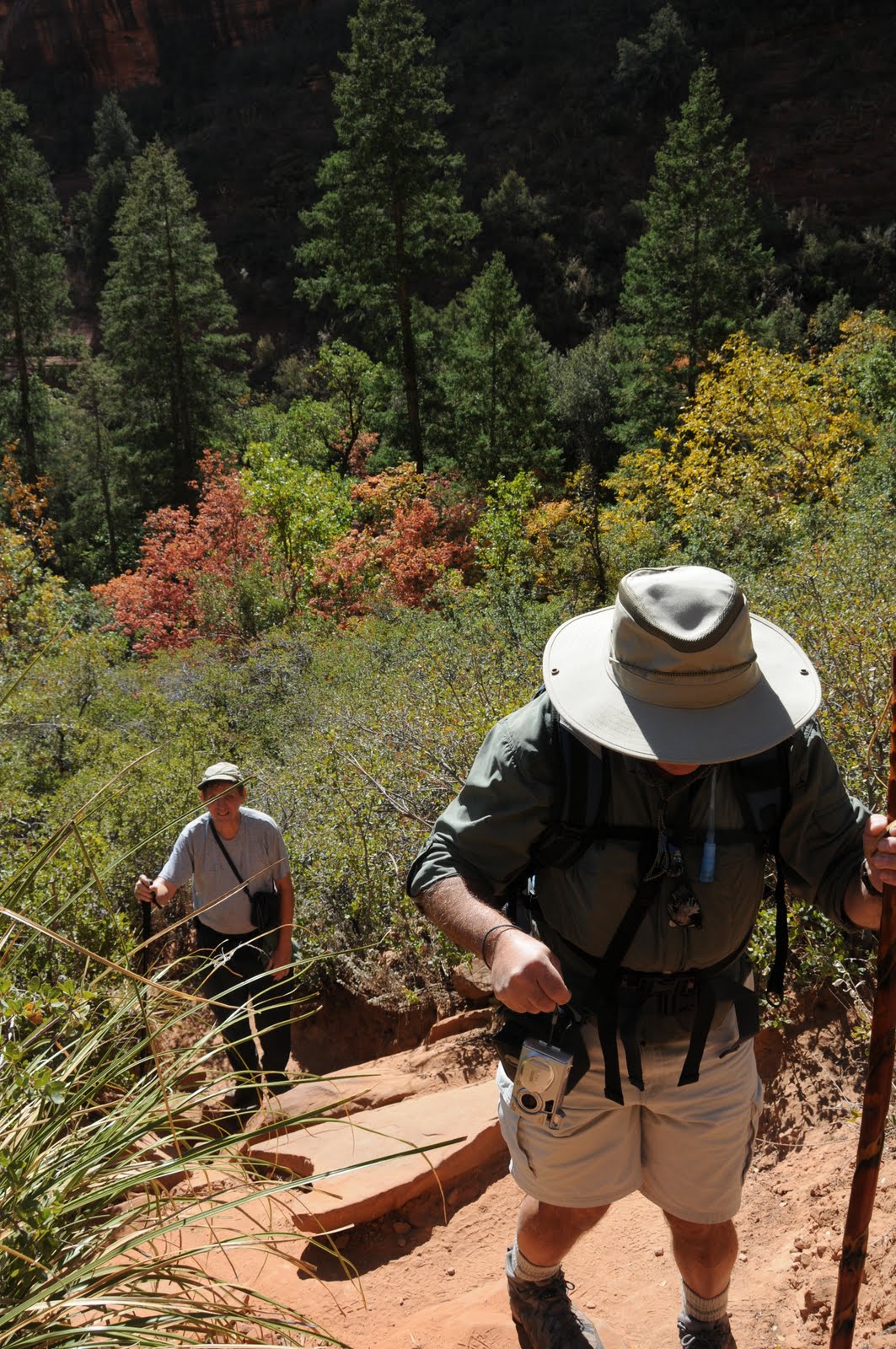
One of Sedona’s most popular hiking destinations, the Boynton Canyon Trail weaves through a yawning gorge flanked by rusty-red and buff-colored ramparts. The route begins in a sandy gateway of mangled manzanita, agaves and yucca climbing gently uphill. Midway through the hike, the chaparral is swallowed up in forests of pine, oak, golden Arizona ash, box elder, Arizona walnut, Velvet ash, Common hop trees and syrupy-red Bigtooth maples. Here, the cliffs close in on the trail and robust canyon winds whip fallen leaves into a frenzy of color---mimicking the rustle and roar of a confetti addled street festival. Near the high point of the route, look for a steep spur path marked by rock cairns hidden in a tangle of brush. Experienced hikers can climb this earthen staircase to a scenic box canyon with sky-high red walls on all sides.
BEST TIME FOR FALL COLOR: mid-October. For weekly reports, call the Forest Service Fall Color Hotline, 1-800-354-4595 or visit.fs.fed.us/r3/recreation/fall-colors/fall.shtml
LENGTH: 3.7 miles one way
RATING: moderate
ELEVATION: 4,500- 5,050 feet
BEST SEASONS: September - May
BEST TIME FOR FALL COLOR: mid-to-late October
DISTANCE FROM PHOENIX: 135 miles one way
GETTING THERE:
From the "Y" intersection of AZ 179 and AZ89A in Sedona go left (toward Cottonwood) and continue 3 miles to Dry Creek Road. Turn right onto Dry Creek Road (Forest Road 152C) go 3 miles to Boynton Canyon Road, turn left and proceed another 0.3 miles to the parking lot on the right. Roads are paved.
FEE: Red Rock Pass--$5 per vehicle is required
INFO: Coconino National Forest, Red Rock District 928-203-2900
http://www.fs.fed.us/r3/coconino/recreation/red_rock/boynton-tr.shtml
Red Rock Pass: http://www.redrockcountry.org/passes-and-permits/index.shtml
MAP: http://www.redrockcountry.org/maps/map-graphics/red-rock-map-9-05.pdf


 BOYNTON CANYON #47
Red Rock Secret Canyon Wilderness, Sedona
One of Sedona’s most popular hiking destinations, the Boynton Canyon Trail weaves through a yawning gorge flanked by rusty-red and buff-colored ramparts. The route begins in a sandy gateway of mangled manzanita, agaves and yucca climbing gently uphill. Midway through the hike, the chaparral is swallowed up in forests of pine, oak, golden Arizona ash, box elder, Arizona walnut, Velvet ash, Common hop trees and syrupy-red Bigtooth maples. Here, the cliffs close in on the trail and robust canyon winds whip fallen leaves into a frenzy of color---mimicking the rustle and roar of a confetti addled street festival. Near the high point of the route, look for a steep spur path marked by rock cairns hidden in a tangle of brush. Experienced hikers can climb this earthen staircase to a scenic box canyon with sky-high red walls on all sides.
BEST TIME FOR FALL COLOR: mid-October. For weekly reports, call the Forest Service Fall Color Hotline, 1-800-354-4595 or visit.fs.fed.us/r3/recreation/fall-colors/fall.shtml
LENGTH: 3.7 miles one way
RATING: moderate
ELEVATION: 4,500- 5,050 feet
BEST SEASONS: September - May
BEST TIME FOR FALL COLOR: mid-to-late October
DISTANCE FROM PHOENIX: 135 miles one way
GETTING THERE:
From the "Y" intersection of AZ 179 and AZ89A in Sedona go left (toward Cottonwood) and continue 3 miles to Dry Creek Road. Turn right onto Dry Creek Road (Forest Road 152C) go 3 miles to Boynton Canyon Road, turn left and proceed another 0.3 miles to the parking lot on the right. Roads are paved.
FEE: Red Rock Pass--$5 per vehicle is required
INFO: Coconino National Forest, Red Rock District 928-203-2900 http://www.fs.fed.us/r3/coconino/recreation/red_rock/boynton-tr.shtml
Red Rock Pass: http://www.redrockcountry.org/passes-and-permits/index.shtml
MAP: http://www.redrockcountry.org/maps/map-graphics/red-rock-map-9-05.pdf
BOYNTON CANYON #47
Red Rock Secret Canyon Wilderness, Sedona
One of Sedona’s most popular hiking destinations, the Boynton Canyon Trail weaves through a yawning gorge flanked by rusty-red and buff-colored ramparts. The route begins in a sandy gateway of mangled manzanita, agaves and yucca climbing gently uphill. Midway through the hike, the chaparral is swallowed up in forests of pine, oak, golden Arizona ash, box elder, Arizona walnut, Velvet ash, Common hop trees and syrupy-red Bigtooth maples. Here, the cliffs close in on the trail and robust canyon winds whip fallen leaves into a frenzy of color---mimicking the rustle and roar of a confetti addled street festival. Near the high point of the route, look for a steep spur path marked by rock cairns hidden in a tangle of brush. Experienced hikers can climb this earthen staircase to a scenic box canyon with sky-high red walls on all sides.
BEST TIME FOR FALL COLOR: mid-October. For weekly reports, call the Forest Service Fall Color Hotline, 1-800-354-4595 or visit.fs.fed.us/r3/recreation/fall-colors/fall.shtml
LENGTH: 3.7 miles one way
RATING: moderate
ELEVATION: 4,500- 5,050 feet
BEST SEASONS: September - May
BEST TIME FOR FALL COLOR: mid-to-late October
DISTANCE FROM PHOENIX: 135 miles one way
GETTING THERE:
From the "Y" intersection of AZ 179 and AZ89A in Sedona go left (toward Cottonwood) and continue 3 miles to Dry Creek Road. Turn right onto Dry Creek Road (Forest Road 152C) go 3 miles to Boynton Canyon Road, turn left and proceed another 0.3 miles to the parking lot on the right. Roads are paved.
FEE: Red Rock Pass--$5 per vehicle is required
INFO: Coconino National Forest, Red Rock District 928-203-2900 http://www.fs.fed.us/r3/coconino/recreation/red_rock/boynton-tr.shtml
Red Rock Pass: http://www.redrockcountry.org/passes-and-permits/index.shtml
MAP: http://www.redrockcountry.org/maps/map-graphics/red-rock-map-9-05.pdf
No comments:
Post a Comment