


POVERTY DRAW & KEHL CANYON
Mogollon Rim
 |
| Typical trail condition |
Forest roads have always been open to hikers for easy
treks. Now that the forest service
has been closing less-used roads to motorized traffic to allow soils, plants
and wildlife habitats to recover, these eroding ruts have found second lives as
footpaths. Forest Road 147E is one
of those routes. Located on the
Mogollon Rim near Potato Lake, this former Jeep two-track provides easy access to
East Clear Creek and the upper portion of Kehl Canyon. Although it will be decades before
roads like this one are totally absorbed into the wilds,
 |
| Moist & mossy |
For this adventure, there’s no officially numbered hiking
trail, however, the route is not too difficult to navigate. Here’s the plan:
From the parking area, begin hiking on FR147E. This dirt
road parallels Poverty Draw, which runs off to the left. Well equipped,
experienced hikers can drop into the draw and pick through a maze of brush
and pools for 1 mile to East Clear Creek, but the easy way is to walk on FR147E
to the 0.9-mile point where a barbed wire fence blocks the road. Do NOT pass
through the fence—instead, head left following the wire line to a primitive
entry in the barbed wire. Cross the fence (leaving it the way you found it) and
hike downhill on a rudimentary path to East Clear Creek. Cross the creek and
hike east (straight ahead) aiming for the washed out embankment. Head right (south) and follow the
decommissioned 4x4 road into Kehl Canyon. After roughly 1mile, the road makes a
sharp right turn up a bank. Here
is where you’ll leave the road and head left to stay in Kehl Canyon. If you thought the hike up to this
point was amazing---just wait, it gets even better. From this point on,
contorted sandstone escarpments and old growth coniferous forests close in on
the moist and lush canyon. Sturdy boots, long pants and hiking sticks are
required to get through the rock barriers, logs, brush, water-carved caves and
a Technicolor show of marsh-loving wildflowers. The canyon snakes four miles southward to Rim Road and Kehl
Springs campground. However, the
going gets challenging at the 2.6-mile point, where a quagmire of deadfall,
boulder-choked washes, and narrow passages will slow your pace and tax your
problem-solving skills.
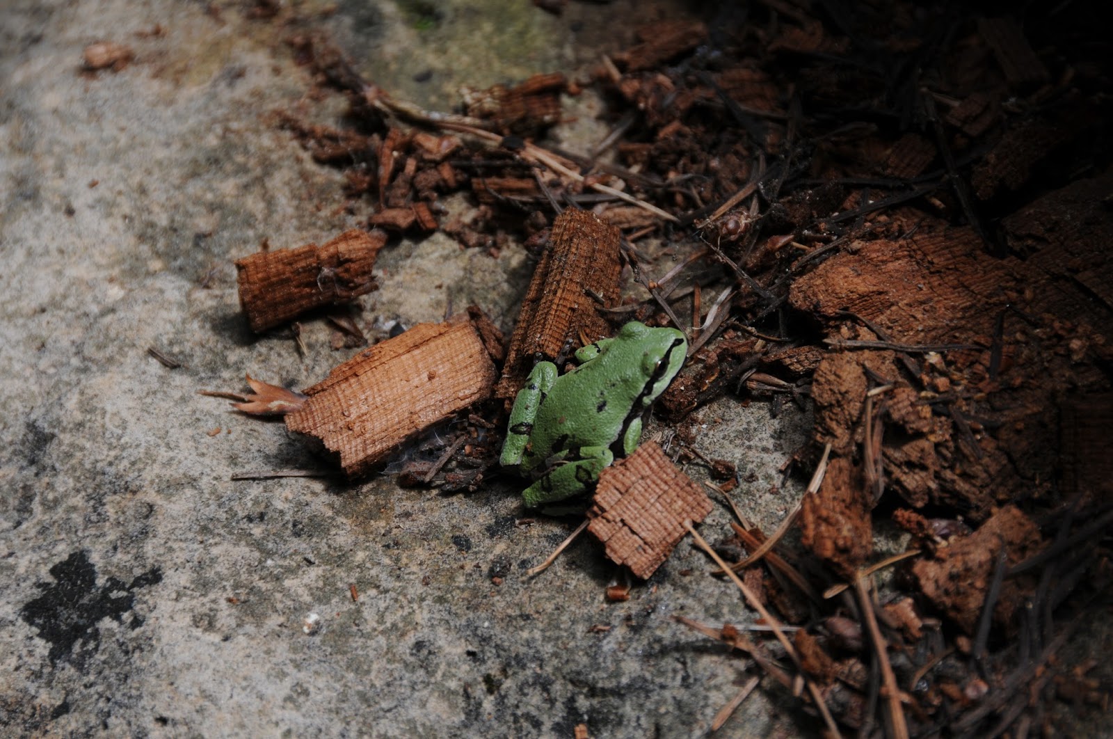 |
| Our state amphibian: Arizona tree frog |
LENGTHS:
FR147E to East Clear Creek: 1 mile.
Kehl Canyon turn off to Rim Road: 4 miles (difficult after
1.2 miles)
RATING:
moderate-difficult (route-finding, rough terrain)
ELEVATION: 6986' - 7420'
GETTING THERE:
From the State Route 87/260
intersection in Payson, continue north on SR87 to Forest Road 147 just north of milepost
287. Turn right and go 2.5 miles on FR147 to FR147E (past Poverty Spring)
on the left. Park here.

3 comments:
Such a beautiful route! It looks so moist there is this normal to have moss on the rocks up there?
Hi Drew, yup--it's very damp in the canyon with moss everywhere, even hanging from the trees. Wildflower grow like crazy there too.
Stumbled across this post while looking for things to do in this area...took the trip and it was well worth it! Even saw an AZ Treefrog. Thanks for posting this hike!
Post a Comment