Find A Trail. Start Your Search Here:

Monday, April 9, 2018

RESTORATION OF MARICOPA TRAIL SEGMENT 20 COMPLETE

RESTORATION OF MARICOPA TRAIL SEGMENT 20 COMPLETE
Tree burned in the 2005 Cave Creek Complex Fire
Wildfires can be as confusing and they are devastating.  Sometimes they roar through a forest in take-no-hostages fury while in other situations, they hopscotch over the land creating a random patchwork of destruction and untouched swaths. 
Strawberry Hedgehog cacti bloom March-April
The 2005 Cave Creek Complex Fire that swept through Tonto National Forest north of the Valley resulted in a combination of heartbreaking ruin and pockets of unscathed life.  One fluke is the survival of a stand of junipers along Cottonwood Creek, an intermittent stream below Quien Sabe Peak. A point of pride of the restoration efforts of the nearly 14 miles of fire damaged trails that connect the Bronco Trailhead at Seven Springs Road with Spur Cross Ranch Conservation Area is the mending of the route that passes by the  mile-long juniper haven that escaped the blaze.
Corrals at the Bronco Trailhead
 Heavy brush and debris was cleared away from the evergreen passage, enabling hikers to admire the trees instead of battling through scrappy thickets.
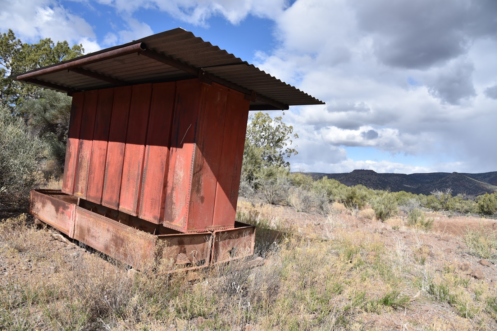
Stock Tank on Trail 245
Precious junipers
Sign showing partners in the trail restoration efforts
The reclamation work has been a years-long endeavor with numerous organizations and volunteers contributing time and materials. A major push that wound up this year put the finishing touches on the project.  From January through February crews from Maricopa County, Tonto National Forest and the American Conservation Experience completed four week-long hitches to repair Segment 20 of the Maricopa Trail which incorporates forest routes Bronco Trail #245 and Cottonwood Creek Trail # 247.
Sugar sumac
Crews camped and worked to clear brush, locate and restore historic cairns, repair tread and place trail markers at half-mile intervals along the route. Flagstaff-based American Conservation Experience is a non-profit organization for young adults ages 18-25 who are considering careers in land management, conservation or other outdoor fields.
False Toadflax blooms April -August
Participants serve 3-to-12 month terms under the tutelage of industry professionals. In addition to performing needed work, associates gain valuable knowledge and hands-on experience.  During the two-month Maricopa Trail restoration undertaking, crews repaired or built 170 drainages, fixed 10 water bars and built or fixed 23 cairns while clearing the trail of rocks and hazards.  Crews were assisted by The Backcountry Horseman Association of the East Valley which hauled in tools and food taking some of the load off the sweaty work.
A fire survivor grows strong
Thirteen years after the fire, the classic trails that run beneath desert mesas and peaks
are revitalized and gaining traction as must-do hiking destinations. The land surrounding the route is healing slowly but steadily.
Blooming barberry along the Maricopa Trail 
Dead trees bearing black scars of the blaze stand among emergent sprouts and spotty islands of survivor mesquite, sugar sumac, scrub oak, yuccas and blooming cacti.  Part of the joy of hiking this section of the Maricopa Trail is seeing how, with a little help from McLeod tools, rakes and human effort, the forest is bouncing back. 
Patches of junipers survived the Cave Creek Complex Fire
Although there may be fewer junipers, those that remain are cherished finds and reminders of the whims of Nature and our role in preserving irreplaceable resources.
The stock tank makes for a good day hike destination
A Crucifixion thorn tree frames mountain vistas
With major work in the in the rear-view mirror, the Maricopa Trail continues to grow and evolve into a world-class recreational hub. 
Scene on the Maricopa Trail
There’s still plenty to do and anticipate.
Major goals for the 300+-mile Valley-circumnavigating route include linking county parks, metropolitan areas, municipal trails and communities with a non-motorized, open space corridor that will protect natural and cultural resources from development.
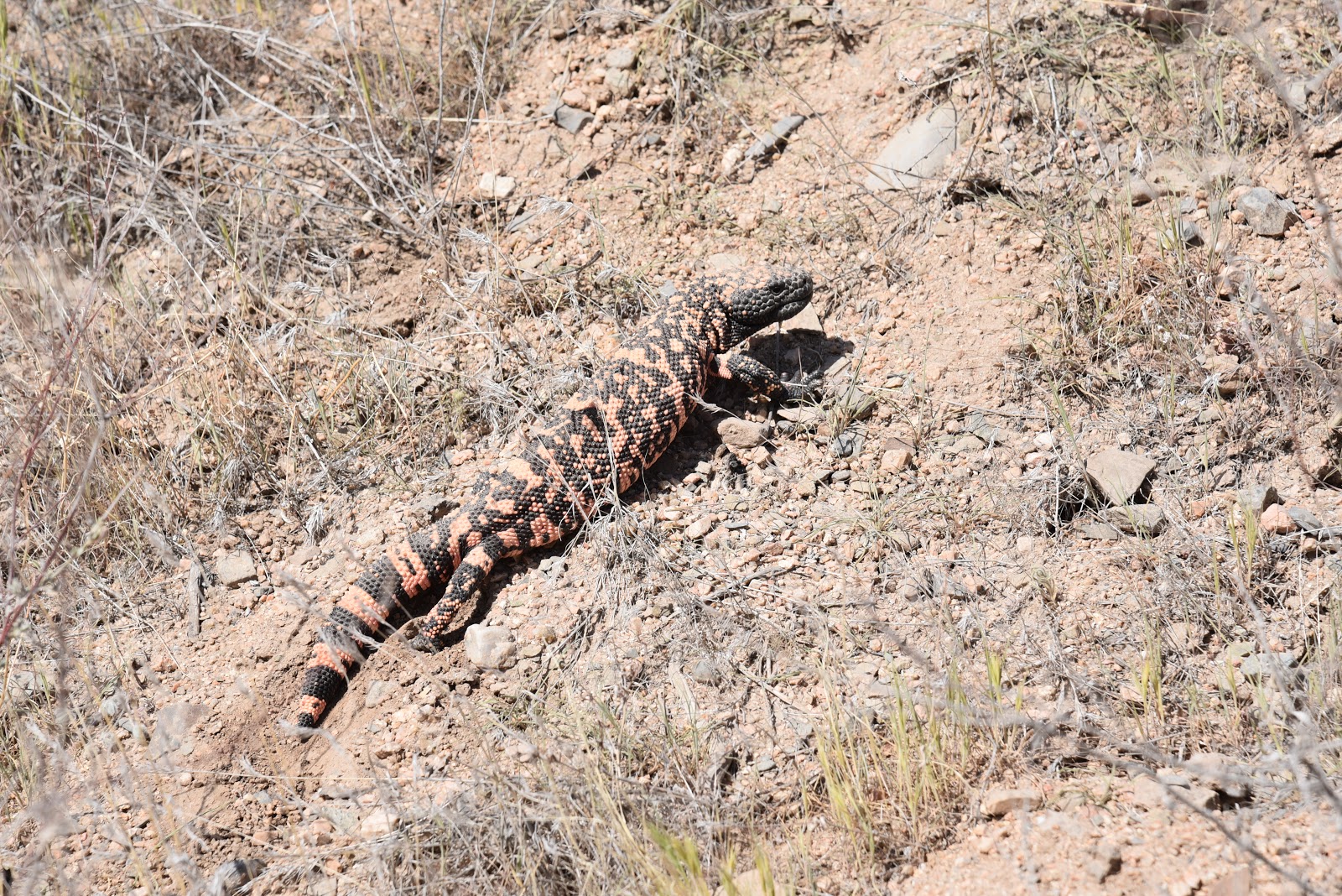
This Gila Monster was not interested in posing for a photo
Per Dwana Taylor, Maricopa County Parks and Recreation Public Information Officer, trail users can look forward to greater connectivity, new trailheads and spurs to the Hassayampa River Preserve and future Vulture Mountain Recreation Area in Wickenburg. 
Hikers on the Bronco-Spur Cross segment of the MT
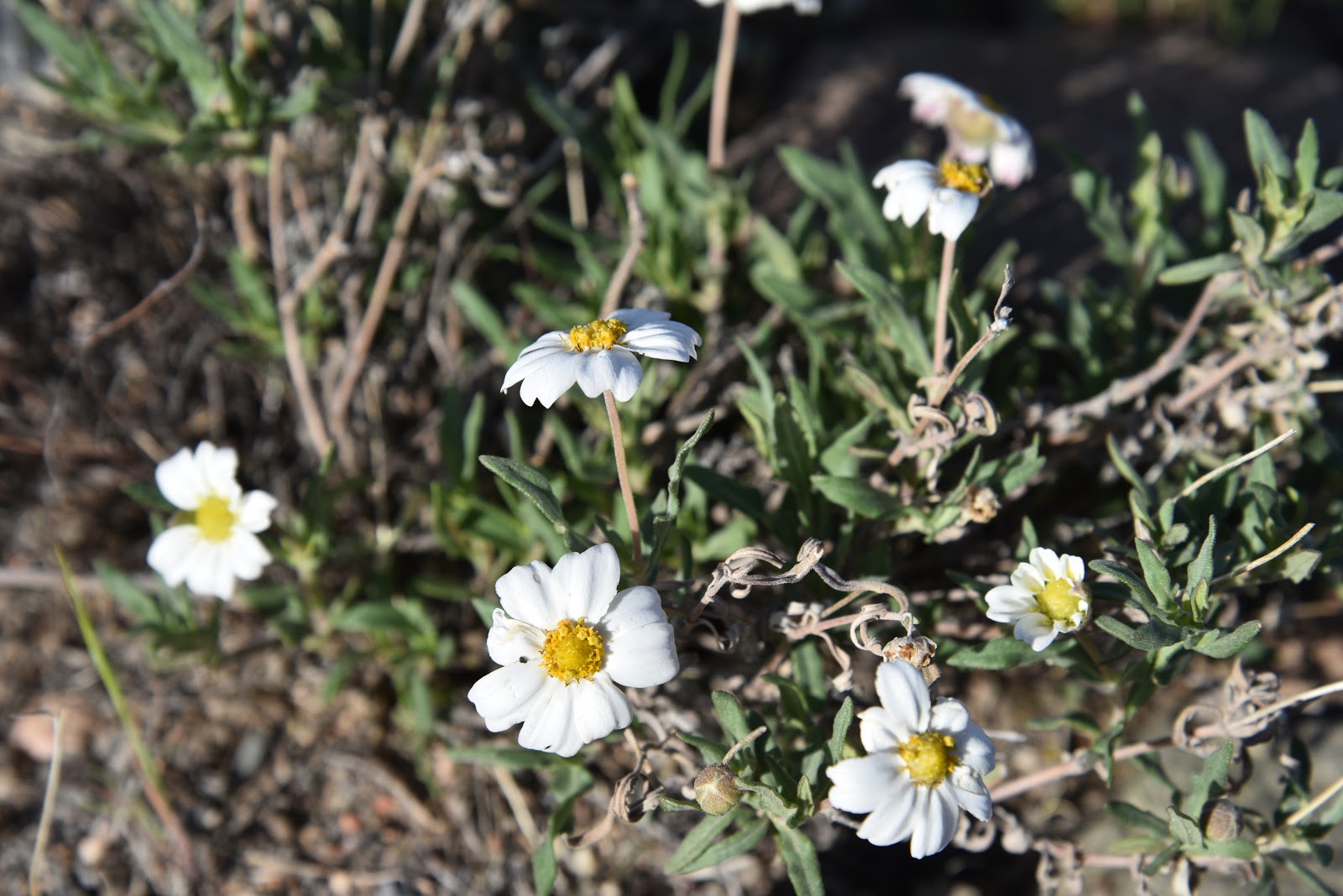
Even in dry years, Blackfoot daisies find a way to bloom
LENGTH: 13.6 miles one way (Bronco Trailhead to Spur Cross)
DAY HIKE OPTION:
Hike 2.6 miles on Trail 245 to the stock tank at the east fork of Bronco Creek. for a 5.2-mile round trip with an elevation range of 3,700 - 4,234 feet.
RATING: moderate
ELEVATION: 2,400- 4,224 feet
GETTING THERE:
Bronco Trailhead:
From the intersection of Cave Creek Road and Pima Road in Carefree, continue 11.6 miles north on Cave Creek Road which turns into Seven Springs Road/Forest Road 24 to the Bronco Trailhead on the left.  The last 3 miles of FR 24 is an all-weather gravel road suitable for passenger cars.  
INFO & MAP
American Conservation Experience

Monday, April 2, 2018

CLARK SPRING TRAIL #40

CLARK SPRING TRAIL #40
Clark Spring Trail
Clark Spring is bone dry.  Like many water features in drought-stricken Arizona, the ordinarily moist natural fountain that trickles into a sandy drainage in Prescott’s Granite Mountain Recreation Area isn’t flowing this year.  Although lack of winter snow and rain has caused the spring to regress into a barely discernable trench, the riparian corridor it feeds along Clark Spring Trail #40 is alive and well.  Even without springtime waterworks permeating the area with lacy rivulets and clear cascades, a hike along this stunningly diverse trail makes for an afternoon of fun and discovery.
Riparian corridor on Clark Spring Trail
The scoured, mile-long gully near the spring that
hosts a community of willows and cottonwoods is just one part of a multi-faceted trip through jumbled terrain just a few miles north of downtown Prescott.  Finding the trail is a little tricky.  
Wild candytuft blooms February through August
Begin on Granite Mountain Trail #216 at the Metate Trailhead. Hike 0.25-mile (veer right at an unsigned junction to stay on #216) to the Balancing Rock Trail #349, turn left and continue to the turnoff for Clark Spring Trail #40 and follow the road roughly 20 yards to the trail proper.  Here, the route begins a 700-foot ascent, moving out of shady Ponderosa pine forests and onto a sunny ridge cluttered with manzanita, cacti and agave. A smattering of pinion pines and live oaks frame views of Granite Mountain, Flagstaff’s San Francisco Peaks and the golden flatlands of Williamson Valley. 
A Half Dome-like cliff (right) on Clark Spring Trail
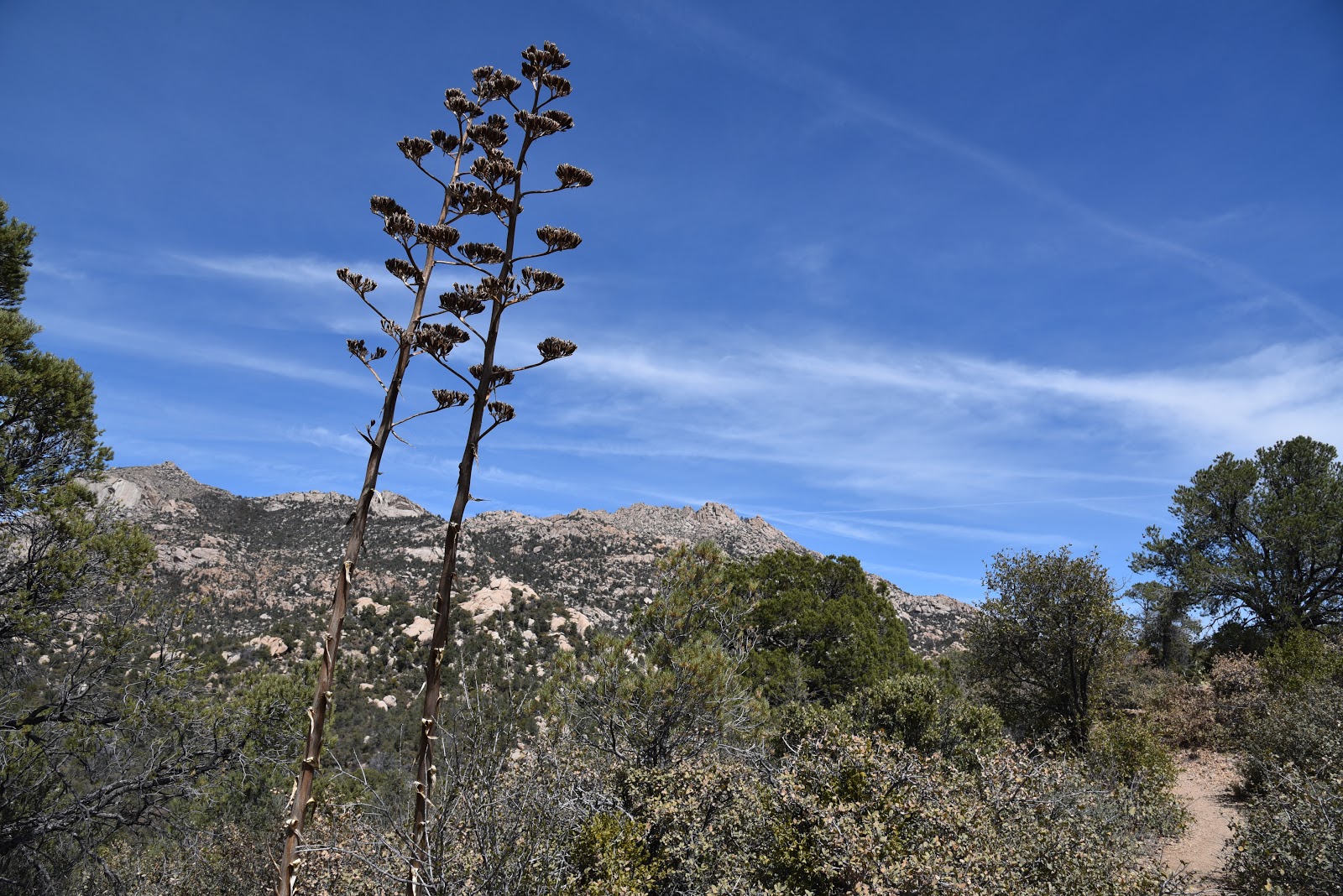
Except for a sheer cliff face that mimics Yosemite National Park’s Half Dome formation, Granite Mountain looks like it fell off the back of a galaxy-class dump truck. Haphazard mounds of rubble, craggy shelfs and balancing spires belie the handiwork of eons of wind and water erosion. Look carefully and you’ll see the sooty scar of the 2013 Doce Fire struggling to heal on the far slopes.  Above the distressed granite piles, ospreys and turkey vultures ride the current above nearby Granite Basin Lake. The steep, rocky segment tops out on a flat where a gateway of spent agave stalks mark the beginning of the descent to the spring area.  This beautiful section wanders under oak-pine canopies that throw refreshing shadows on the dry but still lush riparian corridor below.
Squirrels in trees
The cooler, usually moister environment is a wildlife magnet and you’re almost guaranteed to spot foraging squirrels, scrub jays and woodpeckers drilling into dead trees for insects. The greenway stroll ends where the trail heads back uphill on long, canyon-hugging switchbacks.
View of Williamson Valley in distance
Massive boulders, enormous Alligator junipers and the best views of the hike are the key features of the final half-mile that ends at a high pass between Little Granite Mountain and Two Rock Mountain. 
Agaves and Granite Mountain
For an out-and-back hike, the junction with Little Granite Mountain Trail #37 is the turnaround point. But if you want more miles, take the loop option. 
Drainage area on Granite Mountain Trail
A word of caution though, the last two legs of the loop are more exposed and pass through fire-damaged terrain. Be sure to bring plenty of water and sun protection if you choose this option. To do the loop, hike 2.8 miles north (go right) on Trail #37 to Blair Pass.
Acorn woodpecker in flight
Veer right on to Trail #261and enjoy the final 1.6-mile trek thorough high desert wilderness back to the trailhead.
LENGTH: 4.4 miles out and back OR 6.6-mile loop
RATING: moderate
ELEVATION: 5620 – 6400 feet
GETTING THERE:
From downtown Prescott, go north on Montezuma Street (which turns into Whipple Street and then Iron Springs Road) and continue 4.5 miles to N. Granite Basin Road.
Turn right and go 3.7 miles to the Metate Trailhead. Roads are paved and there are restrooms at the trailhead.
FEE: $5 daily fee per vehicle. Bring exact change for the self-pay kiosk.
INFO & MAP: Prescott National Forest

Tuesday, March 27, 2018

CHILDRESS TANK ROAD

CHILDRESS TANK ROAD
The Ortiz and Hull families of Mesa on Childress Tank Road
What do you do when you want to take friends or family with young kids or mobility issues on a hike but still want to get in a good workout? 
Childress Tank sits on a mesa below the Mogollon Rim
The answer might be found on dirt roads
that spiral off the short, barrier-free trails that cater to the “hiking lite” crowd.  One such place is the Shoofly Village Ruins north of Payson.  For years, this has been my go-to destination for introducing non-trekkers to the history and beauty that lies beneath the Mogollon Rim.  
A visitor reads a sign about an ancient room at Shoofly Village
The site offers an approachable, intriguing way to get outdoors without the preparations needed for more remote or wilderness hikes. 
Gateway to Childress Tank Road
All you need for gear is stable footwear, sun protection and a bottle of water.  The self-guided tour is outfitted with interpretive signs describing dozens of excavated ruins of a Native American community that was occupied between 1000-1250 A.D.
Southwestern lewisia blooms March -June
Stephanie Markoff of Chandler intros her dogs Kona & Louie
Although walking the roughly quarter-mile of easy trails with good company has always been a pleasure, the call of the wild sometimes left me wanting more trail time. Per the Tonto National Forest map of the Payson area, the “more” I craved was always right around the bend.  Adjacent Forest Road 1164 adds a refreshing 3.2 miles to the ruins hike. 
Eli, Annie and Jo Hull on Childress Tank Road
Although it’s too rocky for those without good balance or proper gear, the road can be a fun diversion for adults and energetic kids.  Also known as Childress Tank Road, the rugged two-track swoops through the juniper scrublands of Houston Mesa and Walnut Flat with unobstructed views of the Rim, foothills and rolling grasslands.
Twenty-two-month-old Jo Hull cries for more blueberries
Annie Hull and Anthony Ortiz of Mesa supervise snack time
To find this road, hike north from the parking lot and follow the wide dirt path to a barbed wire fence. Pass the gate and continue down the main course (go straight) to the Forest Road 1163/1164 junction. Turn right, hike one mile, take either fork at the FR 1167 junction and head toward the earthen berm of Childress Tank.  The hike has lots of interesting sights to keep antsy young ones engaged. 
Juliana Ortiz and Jo Hull take a snack break
Wildflowers, scurrying wildlife and continually-changing terrain put the kibosh on boredom.  The road ends at the stock tank where a muddy fringe of animal tracks inspires some detective work. The outdoor classroom is a fun place to try to identify prints that include elk, bobcat, skunk, deer, raccoon, coyote and of course, domestic cattle and dogs. 
I recently hiked this road with Juliana Ortiz (age 5), Eli Hull (age 3) and Jo Hull (22 months) and their parents. Juliana trekked like a pro while Eli and Jo alternated between walking and riding in kid carrier backpacks.  The boys’ mom, Annie Hull and Juliana’s dad Anthony Ortiz of Mesa, brought along plenty of water and snacks and took frequent breaks to keep the kiddos happy.  Except for one tiny meltdown---over blueberry snacks---the kids enjoyed the hike for its achievable length and entertaining qualities. The quick out-and-back trek satisfies the urge for an extra leg stretch while non-hikers can hang out at the trailhead to sketch, picnic or catch up on reading. It’s an outing that everybody can enjoy on their own terms.
Snack time.
Hiking with kids!
Juliana, Kona, Louie and Stephanie at the trailhead
Views of the Mogollon Rim dominate the hike

LENGTH:  3.2 miles roundtrip (4 miles with the ruins tour)
RATING: easy
ELEVATION: 5075 - 5263 feet
GETTING THERE:
From the State Route 87/26 junction in Payson, go 2 miles north on SR87 to Houston Mesa Road (Forest Road 199). Turn right and continue 2.8 miles to the Shoofly Village Ruins turnoff and follow the access road to the trailhead.  Roads are 100% paved.
An excavated room at Shoofly Village
INFO:

Monday, March 19, 2018

CHAVEZ TRAIL & BEAVERHEAD TANK
Old feed trough at Beaverhead Tank.
When confronted with a befuddling trail junction, many hikers opt to bypass the unknown and follow their researched route. In most cases, that’s a smart move. Sticking to plans and designated trails reduces the risk of getting lost and injured.  But while even long-established paths can be fraught with challenges, some forks in the road can be low risk diversions that are too sweet to ignore.   You’ll experience both elements on this two-part trek near Sedona.
View of Mingus and Woodchute Mountains 
The recently re-located and documented Chavez Road has a captivating history as a prehistoric trade route, mule and oxen trail and freight transit system for Verde Valley pioneers. The steep, rough-cut road was an important travel route until 20th century railroads and the General Crook Trail provided safer, more efficient means of transportation. 
Beaverhead Tank
By the 1920s, the abandoned route began to melt into oblivion, succumbing to neglect and encroaching vegetation.  Recognizing an opportunity for “adaptive re-use”, the forest service took on the exhaustive process of surveying and preserving the historic road for recreational use.  The 9-mile section that runs between State Route 179 south of Sedona and the Stoneman Lake interchange off Interstate 17 has been identified, marked with carins (rock stacks) and opened to non-motorized travel.
View from Chavez Trail
 The entire segment can be hiked via car shuttle, a grueling out-and-back hike or sampled as an exploratory day trek.  Although starting on the upper , I-17 trailhead for a downhill hike sounds like a no-brainer, this choice trades avoidance of strenuous climbs for  serious route-finding obstacles. Hikers must have a keen sense of direction to leap-frog from carin-to-carin to stay on track.  For a less complicated outing, the lower trail offers a tougher climb but a better-defined route.  Beginning at the SR-179 trailhead, hike through the gate and follow the rocky road to the 0.1-mile point where the Chavez Trail veers right at the 9204T sign. The wide road to the left is an add-on surprise for the way back.  From the junction, the route ascends 1000 feet in just under 2 miles among pinion-juniper woodlands on a ragged, edge-hugging road to the top of a mesa with spectacular Red Rock Country and Bradshaw Mountain Views.  This is an ideal turnaround point for a moderate day hike.
Juniper-pinion vegetations dominates the hike
 Unless you decide to take on the remaining 7 miles of head-scratching hiking, descend back to the 9204T junction and pick up the unsigned road heading north.  This easy-to-follow, 0.8-mile diversion tacks on 400 feet of elevation gain to the hike as it winds its way to Beaverhead Tank. Tucked into a breezy hollow, the secluded, weedy stock pond and a defunct feeding trough at the end of a road less travelled sees few visitors other than roaming cattle and chipping parades of quail.  
You'll probably encounter cattle on this trek

LENGTH & ELEVATION:
Chavez Trail to I-17: 9.1 miles one way, 3720 – 5320 feet
Chavez Trail to the rim: 4 miles roundtrip, 3720 – 4400 feet
Beaverhead Tank Road: 2 miles round trip, 3720 – 4120 feet
RATING: moderate - difficult
GETTING THERE:
Lower Trailhead:
From Interstate 17 take exit 298 for Sedona/Oak Creek head 3.4 miles west on State Route 179 to just past milepost 302. Turn right onto an unsigned dirt parking circle on the right.  If you reach the Welcome to Red Rock Scenic Byway monument at Dry Beaver Creek, you’ve gone 0.2-mile too far.  The hike begins at the gate marked 9204S.
Upper Trailhead:
From Interstate 17, take Stoneman Lake exit 306 and follow Stoneman Lake Road (Forest Road 213) to the trailhead on the left.
Map & History


Monday, March 12, 2018

SPANISH RUINS

SPANISH RUINS, Mazatzal Wilderness
The mysterious monolith
The town of Payson at the base of the Mogollon Rim is a hiking hot spot with a diverse collection of trails. From creekside rambles (Horton Creek), grueling ascents (See Canyon), pine forest rambles (Highline Trail) and high desert cypress-and-boulder-centric paths of the Payson Area Trails System, there’s something for trekkers of every level. But if you want to hike outside the box; seek out the Payson Packers. The hiking group is a loose-knit, motley band of year-round and seasonal residents with a repertoire of classic and under-the-radar treks.
Hikers make the final scramble to the top.
They’ve been exploring around Rim Country and beyond for nearly 40 years.
Payson Packers working their way up to the ruins
“There are probably about fifty or sixty folks who hike regularly with the Packers,” says Randy Cockrell who leads weekly hikes for the group.  The club’s 250 or so members communicate and plan hikes through an email chain. Even though there’s no club website, it’s not too difficult to find somebody who knows somebody on social media or hiker forums who can get you on the Packer hike invite list.
One of the Packer’s favorite excursions is a hike to the Spanish Ruins, an erroneously-credited Native American historical site. “It's atop a mesa west of Payson and is a lot of dry-stacked stone walls.  None of the experts can agree as to why the place was built, nor who built it,” Cockrell said.  The combination of sweaty exertion, vivid scenery and historical significance make the trek a perennial club destination. “I’ve been to the ruins about seven times and still enjoy taking friends and family there,” Cockrell shared.  “It’s close to town and a great spot for taking cool photos.”
The adventure begins with an 11-mile drive from town that dead-ends at the Doll Baby trailhead in the Mazatzal Wilderness. From the trailhead gate, the destination appears as a sheer, red-tinged plateau.
Randy Cockrell (L) of the Payson Packers at the metates
Although it’s just under two miles to the top, the hike is a steep, slippery slog. To get to the prize, pass the gate at the wilderness sign and begin hiking uphill on the dirt road.  Between gasping for breath and watching your step on the rocky treadway, be sure to look up occasionally to take in views of the cottonwood-lined course of the East Verde River and surrounding juniper-fleeced peaks.
Riparian corridor of the East Verde River
At the 1.4-mile point, go through a barbed wire gate (leave it as you found it) and pick up the narrow footpath on the left.  The next quarter mile plows abruptly uphill through manzanita and wiry scrub to a vertical cliff face where you’ll encounter two boulder obstacles that require hand-over-foot climbs to reach the summit.  From the mesa’s precipitous ledges, 360-degree views coupled with the kind of rush only dizzying, exposed heights can deliver are the hard-earned ROI.  To find the ruins, hike 0.1-mile south among ocotillo and insidious tangles of pants-grabbing cat claw and the haunting images of head-high stacked walls soon appear.
Ruins in the shadow of the Mazatzal Mountains
Although the history of the U-shaped complex is not known for sure, archeologists are certain that it’s not Spanish in origin.  The intricate fortress-like structure was likely built by Native Americans sometime before the 1400s.  With its eastern walls creeping up to a 500-foot drop off and the west side planted into the foothills of the Mazatzal Mountains above water-scoured basins, the purpose of the multi-room structure is a mystery. Jutting from the western wall is a roughly 7-foot-high upright monolith that strikes an arresting profile on the lichen-encrusted fortification. Whether the massive block was part of astronomical, protective, ceremonial or artistic endeavors, the deliberately-placed stone keeps its secrets close.  
"Pancake rocks" on the mesa
While visiting here, it’s important to remember that even though the site is well known and frequently visited, you’re walking within an irreplaceable heritage treasure.  Avoid touching, climb on or altering the precious artifacts. Nothing needs “fixing” here---leave everything as is.  To gain a deeper appreciation of the architectural ingenuity, look closely at how the walls were designed. Ancient, mortar-free technology used the art of cleaver rock stacking and the holding power of gravity to construct the walls that have remained intact for centuries.  
Payson Packers negotiate the final approach to the summit
South of the complex, a series of metates (grinding holes) worn into an oblong boulder whisper of human presence. The metates are situated at the mouth of a shallow cave and natural shelter of limestone overhangs that resemble layered pancakes.  Across the valley, you can see the zig zagging line of the Red Hills Passage of the Arizona Trail.
East Verde River
The remote and challenging route trickles off the slopes down to the East Verde River and LF Ranch which offers bunkhouse style accommodations for hikers.  From a niche in the wall near the monolith, the respite ranch with its known history and obvious purpose appears as a couple of dots near the river at the end of a twisting road.

LENGTH: 4 miles roundtrip
RATING: difficult
ELEVATION: 3360 – 4080 feet
GETTING THERE:
From State Route 87 and Main Street in Payson, drive 10.9 miles west on Main and park at the Doll Baby trailhead. Main Street becomes Forest Road 406/ Doll Baby Ranch Road that’s mostly paved up to the 9-mile point.  There are a few rough, deeply rutted spots that require a high-clearance vehicle. The road gets very muddy and should be avoided when wet.