Find A Trail. Start Your Search Here:

Thursday, May 16, 2013

Hike with me on Saturday May 25, 2013


POST GRAPE-NUTS FIT SUMMIT SAMPLING EVENT
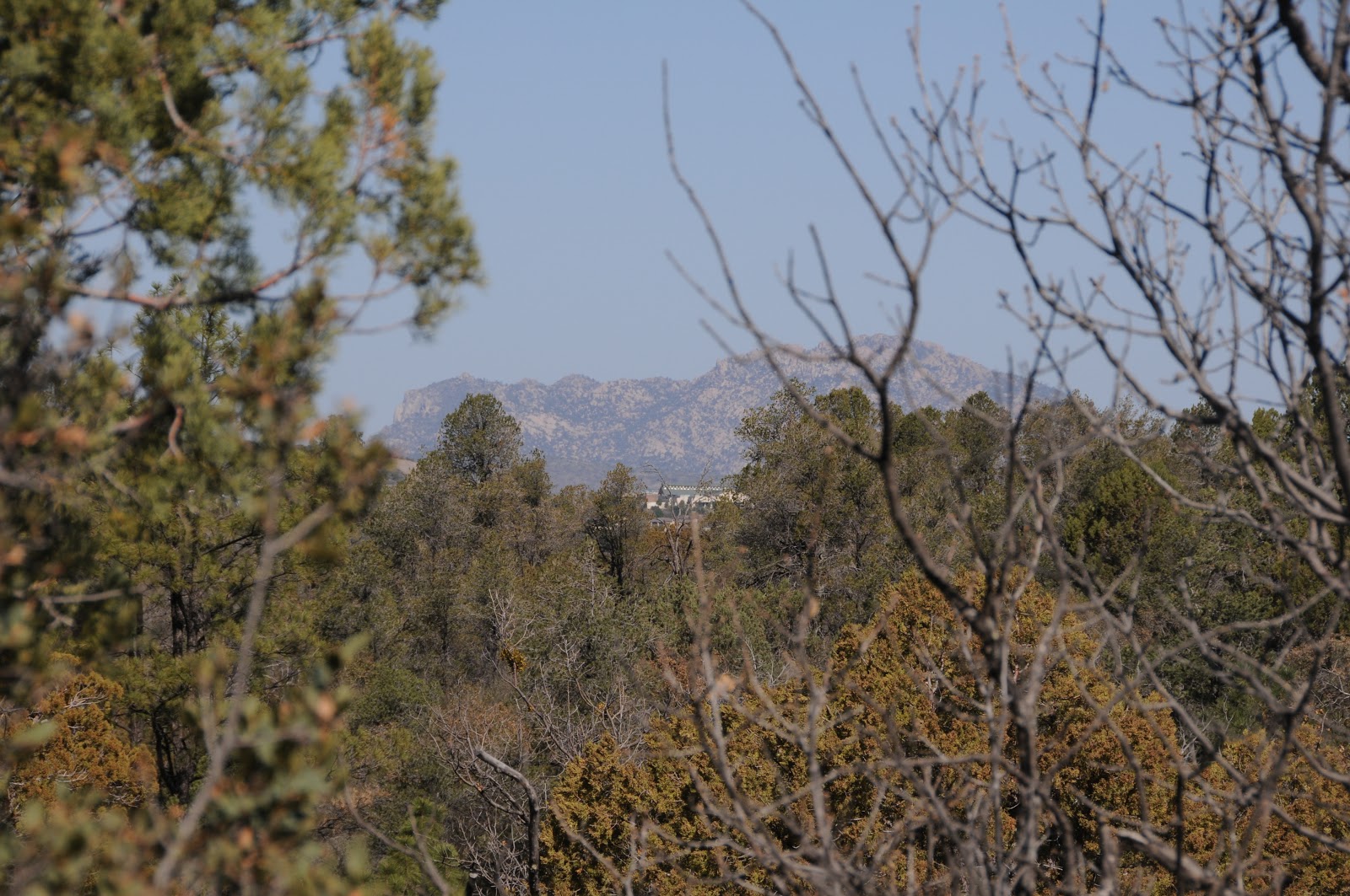
O'Leary Peak on the horizon

Hi Hikers,  As one of 60 hikers selected from across the USA to participate in the 60th anniversary celebration of the first ascent of Mt. Everest, the folks at Post cereals have provided me with FREE SAMPLES of  Grape-Nuts Fit to give out during a commemorative climb up Flagstaff's O'Leary Peak.  Sir Edmund Hilary and Tenzing Norgay ate Grape-Nuts on their historic 1953 trek.  Look for me (or my volunteer sherpas) and claim your goodie.  Hikers who make it to the summit have the option of appearing in photos (or not) with the official summit flag which I'll post here after the event. Hope to see you on the mountain!  Mare

DATE:  Saturday, May 25, 2013. NO RSVP---just show up and start hiking. 
TIME:  we'll be on the mountain from approx. 10 a.m. - 2 p.m.
LENGTH:  10 miles roundtrip
ELEVATION: 6956' - 8916' 
RATING: moderate-difficult (you are responsible for your own gear and safety, this is not a sponsored hike)

GETTING THERE:
From Phoenix, go north on I17 to the I40 interchange in Flagstaff.  Head east (go right) on I40 to exit 201 for US89 north.  Go roughly 10 miles north on US89 and turn right at the sign for Sunset Crater National Park (FR545).  Follow this road 1.5 miles and turn left at FR545A for O'Leary Campground.  Continue 0.3 mile to a free parking apron at the summit road gate.  Do not park in the campground---unless, of course, you plan to camp there and pay the fee.
ABOUT THE EVENT:
http://www.grapenutssummitsampler.com/
ABOUT O'LEARY PEAK:
http://www.fs.usda.gov/wps/portal/fsinternet/!ut/p/c4/04_SB8K8xLLM9MSSzPy8xBz9CP0os3gDfxMDT8MwRydLA1cj72BTJw8jAwjQL8h2VAQAzHJMsQ!!/?ss=110304&ttype=recarea&recid=55146&actid=24&navtype=BROWSEBYSUBJECT&position=BROWSEBYSUBJECT&navid=110000000000000&pnavid=null&cid=FSE_003741&pname=Flagstaff+RD+-+O'leary+Peak+Trail


Tuesday, May 14, 2013

Meet hike book author Bruce Grubbs tonight

Author and outdoor enthusiast Bruce Grubbs will be speaking and also signing his new book tonight at the Arizona Hiking Shack.  The Creaky Knees Guide features 80 easy Arizona hikes selected for seniors, boomers and families with young kids.

WEDNESDAY, MAY 15, 2013 7 p.m.
ARIZONA HIKING SHACK
3244 E. Thomas Rd
Phoenix, AZ 85018
602-944-7723
http://www.hikingshack.com


Sunday, May 12, 2013

RIO DE FLAG


RIO DE FLAG NATURE TRAIL
Flagstaff
Inside the canyon

Another in my series of  “who knew” hikes, this one hides behind Flagstaff’s Museum of Northern Arizona.  After shrugging it off for years, I finally made the detour this weekend and was pleasantly surprised.  Instead of the dull “edutainment” trail I was expecting, this one is free of signs and packed with interest.  The trail begins on the rim of a 50-foot-deep, sheer walled canyon, then descends via a set of stone stairs into a beautiful riparian corridor cluttered with arroyo willows, brambles and Rocky Mountain irises.  Winding among enormous volcanic boulders and Ponderosa pines, the route cuts a figure-eight path with a couple of fun detours.  First, look for another stone staircase that leads up to the canyon’s west rim, here, you’ll follow a rambling, leaf-littered path to an aspen-ringed cove and the stony harbor of an intermittent spring.  Also, on the east rim near the museum, a simple path paralleling US180 leads to a wooden observation deck with a pond and green swale fed by the trickling waters of Flagstaff’s only “river”.
Rio de Flag

LENGTH:  0.6-mile loop
RATING:  easy (rocky, uneven surface)
ELEVATION: 7048’ – 7120’

GETTING THERE:
From Phoenix, go north on I17 to Flagstaff.  Continue through town and connect with US180 (Fort Valley Road).  Go roughly 3 miles north on US180 to past milepost 218 and turn left into the parking lot for the Museum of Northern Arizona.  Trail begins near the museum entrance.

MORE PHOTOS

Thursday, May 9, 2013

An easier way to conquer the Arizona Trail

ARIZONA TRAIL SHUTTLE SERVICES

Every so often I receive event and information rich e-newsletters from the Arizona Trail Association. You can get them too by becoming a member.  But until you do---I wanted to share this very cool beta regarding shuttle services for hikers/bikers.  From the May 8, 2013 newsletter:

If you are planning on hiking or mountain biking the Arizona Trail one segment at a time, consider leaving the driving to someone else. There are a variety of shuttle services available throughout the state, including some that will even take you from the Tucson airport to the start of the Arizona Trail near the U.S./Mexico border. Check out the Shuttles page for contact information.

An increasingly popular option is to gather a group of friends together to tackle an entire passage of the AZT in one day. Most shuttle services can arrange a pick-up and drop-off at Arizona Trail trailheads, and with a larger group you’ll save money.

Some of the preferred shuttle services include:
Southern Arizona:  Southwest Trekking
Central Arizona:  Gnar Gnar Tours
Northern Arizona:  All Star Grand Canyon Tours


ARIZONA TRAIL ASSOCIATION:
http://www.aztrail.org/

Monday, May 6, 2013

Watershed sentinel


APACHE MAID MOUNTAIN
Coconino National Forest
Summit of Apache Maid Mountain: 7307'

Just east of  I-17, 30 miles south of Flagstaff, the isolated silhouette of Apache Maid Mountain  juts above a muted emerald expanse of juniper-dotted grasslands.  Because of its unchallenged dominance on the landscape, a climb up this peak rewards with breath taking vistas of Sedona's red rocks, the mountains of Prescott and the canyon-riddled watershed highlands of Wet Beaver Creek and the Verde River. Although this peak also can be conquered via a 17-mile one-way (3864' - 7307') hike on the Apache Maid Trail that begins on the Bell Trail at Wet Beaver Creek, the way is difficult, dry and best suited for highly experienced hikers.  However, if getting to the high point is your main objective, then scratch the tortuous miles  and instead tackle the massif from its base.   The trail is FR 620, a wide red-soil track hacked out of the mountainside.  Twisting  up the south and west faces of the hill in long, gradual hairpin coils the road makes for a pleasant, not-too-tough climb through a mishmash of Ponderosa pines, oak and scrub while a frenzy of wildflowers  splatters color on disturbed road shoulders and sun washed meadows.  About a half-mile from the top, a jumbled boulder ledge frames exceptional views of Red Rock Country as an abrupt break at the edge of a spralling windswept prairie. On the summit, a fire lookout built in 1961 teeters over its watershed ward.  The tower is open  by invitation only when a worker is present, otherwise, visitors may relax at the picnic table tucked into a shady glen of oak trees.
Apache Maid Lookout
LENGTH: 9.2 miles roundtrip (shorter options described below)
RATING: moderate
ELEVATION: 6063' - 7307'
FACILITIES: restroom, picnic table and hitching post on the summit.  Nearby camping.
GETTING THERE:
From Phoenix travel north on I17 to exit 306 for Stoneman Lake.  Turn right and go 6.4 miles on Stoneman Lake Road (FR 213)  to the signed intersection for FR229.  Follow FR229 (heading toward Apache Maid LO) 4.5 miles and bear right at a "T" intersection with FR230 to stay on FR229. Continue 0.4 mile to a curve in the road where FR 229 swerves left and FR 620 bends to the right. Here, there's a green gate marking the entrance to Apache Maid Cabin. Park in the turnoffs along the road.  From here it's a 4.6-mile one-way hike to the summit. Alternatively, you can continue driving up FR620 to a parking apron at a gate that's  1.8 mile from the summit. We also noted good parking opportunities near FR 2938J which is 3.4 miles from the summit and also cuts about 200 feet of climbing. 
ROAD CONDITIONS: FR 213 is paved for a while then turns to good dirt suitable for all vehicles. FR 229 and beyond is a mix of smooth dirt and deeply rutted, washboard.  Although we saw sedans parked along the way, a high-clearance vehicle is a much better idea. 
oak trees along the trail

INFO: Coconino National Forest
Rent Apache Maid Cabin:
MORE PHOTOS:

Thursday, May 2, 2013

Liquid gold of the backwoods


LYNX CREEK GOLD PAN DAY USE AREA
Prescott

In the grand scheme of things, gold may be precious, but here in Arizona, water is like gold.  Although we have our fair share of creeks, lakes and rivers, it's not like say, Seattle where it’s so damp, moisture is taken for granted. Our water is as rare and beloved as any gem that ever  adorned Elizabeth Taylor. This relative scarcity of surface wetness means that water hikes are an especially big deal here in the Grand Canyon State.  And, with the annual onslaught of dreaded triple-digit heat now smothering the Valley, more of us will be craving luscious creek side escapes in the coming months.  Of course, some of the best water-themed hikes require navigating miserable roads and planning meticulously timed arduous treks into the backwoods of the Mogollon Rim and beyond.  However, there are a few places where water flows just yards from maintained beaten paths.  One good place to try is the gold-panning area north of Prescott's Lynx Lake.  Here, footpaths and two short trails thread among creek side willows, fragrant pines, dredge tailings from former gold mining operations and trickling rivulets heading toward the Lynx Lake dam. The water here is shallow and flow varies with snowmelt and rain but the area's nice shade, easy access and proximity to myriad recreations opportunities make this a sweet kick off spot for a day of exploring. 

LENGTH:
Trail 444:  0.5 mile one-way
Highlands Trail 442: 1.2 miles one-way
ELEVATION: 5425' - 5656'
RATING: easy, exploratory
FACILITIES: vault toilet at site
HOURS: day use only
GETTING THERE:
From Phoenix, go north on I17 to the Cordes Junction interchange for AZ69.  Head west toward Prescott on AZ69 to the stoplight at Walker Road which is just past the Costco and milepost 293. Turn left and follow Walker Rd 1.2 miles to Lynx Creek Road (FR9401, signed Lynx Creek Ruins/Salida Gulch), turn left and continue 0.4 mile to the "gold panning" trailhead on the right.  
INFO:
Bradshaw Ranger District, Prescott National Forest

MORE PHOTOS:

Wednesday, May 1, 2013

Bill Williams Mountain Road re-opens

Hikers (and outdoor enthusiasts)  woo hoo!---just in time for the summer hiking and driving season:


Jacqueline C. Banks
Public Affairs Officer
Kaibab National Forest
(928) 635-8314
jcbanks@fs.fed.us
www.fs.usda.gov/kaibab <http://www.fs.usda.gov/kaibab>
www.fs.usda.gov/4fri <http://www.fs.usda.gov/4fri>
www.flickr.com/kaibabnationalforest <http://www.flickr.com/kaibabnationalforest>
www.twitter.com/KaibabNF <http://www.twitter.com/KaibabNF>

Kaibab National Forest Reopens Bill Williams Mountain Road

WILLIAMS, Ariz. – The Kaibab National Forest has reopened Bill Williams Mountain Road, Forest Road 111, for public use.  The road was closed over the winter due to safety concerns.

While the road has reopened, members of the public should exercise caution while driving in the area due to maintenance work that will be occurring over the next few days.

For additional information, please contact Deirdre McLaughlin at the Williams Ranger District, (928) 635-5662, damclaughlin@fs.fed.us.


Monday, April 29, 2013

Hike a "gold country" gulch


SALIDA GULCH LOOP TRAIL
Prescott
Lynx Creek

When it comes to historic gold ore hot spots in Arizona's hills, the mountains around Prescott held the mother lode.  Defunct mining operations have pretty much depleted the area’s precious metal deposits, leaving behind dredge tailing and pipe dreams for prospectors. Lynx Creek flows through the heart of this gold country and is a popular spot for recreational treasure hunters panning for dust and nuggets.  The Salida Gulch trail #95 begins at a section of the creek that is undergoing restoration from the effects of decades of mining.  It's a beautiful   riparian strip with crisp water tumbling over a pebbly waterway that hikers must cross to pick up the trail. Roughly 0.1 mile beyond the creek, pass a gate and then look for the turn off for trail #95 on the right.  The loop begins within a few yards---go left for the shady "gulch" leg or right for the sunny "ridge" side-- it all circles back.  I began with the gulch leg---a 1.6-mile trek through a narrow, stone-entrenched canyon.  Views are sparse on this east side of the loop but intermittent streams and runoff channels foster a cooling canopy of pine-oak woodlands and blooming shrubs.  At about the half-mile point, a prominent prehistoric rock art gallery of decorative coils, intricately sketched game animals and mystifying human forms are incised into massive grey boulders to the left of the trail.  There's another panel farther up the path, but it's not so easy to spot.
Woodlands on the gulch side of the loop

A mile beyond the petroglyphs, the trail makes a sharp turn and begins climbing to the ridge above the gulch.  This 2.4-mile leg leaves the forests and enters a scrubland of junipers, yucca and manzanita with views of Prescott's famous Granite Mountain and the towers on Spruce Mountain.  At one point, you can look down on the gulch leg of the loop winding below off to the right.  For a trail located just about a mile south of a busy Costco shopping center and adjacent to popular Lynx Lake Recreation Area, this easy-on-the-feet hike is surprisingly quiet and enjoyable.

View of Granite Mtn from the ridge 

LENGTH:  4.5-mile loop (includes access trail 9263)
RATING: easy
ELEVATION:  5050' - 5742'
FEES: none at this site
FACILITIES: none, but there's a vault toilet at the gold panning site
GETTING THERE:
From Phoenix, go north on I17 to the Cordes Junction interchange for AZ69.  Head west toward Prescott on AZ69 to the stoplight at Walker Road which is just past the Costco and milepost 293. Turn left and follow Walker Rd 1.2 miles to Lynx Creek Road (FR9401, signed Lynx Creek Ruins/Salida Gulch), turn left and continue 1 mile to the trailhead at the forest boundary sign.  Begin hiking on trail 9263, hop the creek and look for the trail 95 junction in about 0.1 mile.

INFO: Bradshaw Ranger District, Prescott National Forest
MORE PHOTOS:

Thursday, April 25, 2013

CSI: Flagstaff hiking trail


UPDATE: May 2013, a suspect has been apprehended. The hunt is on for the person who started this month's Fisher Fire and the forest service is asking for your help.  ....watch out for that backpack and hiking stick, though.
...nope, it's not this guy.


From: "Smith, Brady -FS" <bradysmith@FS.FED.US>
Date: April 25, 2013 11:25:07 AM PDT
To: <USDA-FS-NEWS@NEWSBOX.USDA.GOV>
Subject: SOUTHWESTERN-NEWS-RELEASE: Coconino National Forest
NEWS RELEASE                   
U.S. Dept. of Agriculture
U.S. Forest Service
Coconino National Forest
www.fs.usda.gov/coconino                                        
For Immediate Release
Apr. 25, 2013
Public Affairs Contacts:
Brady Smith, Coconino National Forest, 928-527-3490
Brienne Magee, Flagstaff Ranger District, 928-527-8290
Forest Service law enforcement seeking Fisher Fire person of interest
Flagstaff, Ariz. – Law enforcement with the Coconino National Forest are seeking a person of interest regarding the human-caused Fisher Fire which began on April 13 about four miles southeast of Flagstaff near Fisher Point and grew to approximately 35 acres.
The person is described as a white male who frequents the area wearing a brown coat and black T-shirt with a black hat. This person may have a backpack and use a walking stick.
Anyone with information regarding this individual or has seen someone matching this description in that area please contact law enforcement at 928-527-3552.
###

Tuesday, April 23, 2013

KACHINA WETLANDS via HIGHLANDS TRAIL


KACHINA WETLANDS via HIGHLANDS TRAIL
Flagstaff
Kachina Wetlands: April 2013

Hidden on a high Flagstaff mesa just about a mile off I17 is a walk able, 70-acre waterfowl wonderland.  The Kachina Wetlands is a collection of 8 shallow ponds constructed to manage treated effluent water. The project, which began in 1988 with the cooperation of various agencies including NAU, AZ Game & Fish and Coconino County, has auxiliary goals to improve wildlife habitat and foster native vegetation. Although some of the ponds are not operational right now, the site is still prime real estate for winged beasts.   Thick growths of cattails and other aquatic plants coupled with  mid-pond islands provide safe havens from marauding elk and hungry forest critters for the hundreds of species of birds and waterfowl that frequent the area.  The marshy pools are aflutter with grebes, mallards, coots, sandpipers, nighthawks, woodpeckers, swallows, chickadees, jays, warblers, blackbirds and soaring birds of prey.  Until recently, the only hiking opportunity here was the mile or so of circumference paths.  That all changed when the Highlands Trail-- which connects to Ft Tuthill Park-- was completed in 2009.  Woodsy but unremarkable, the easy, urban-class Highlands Trail stays close to civilization dodging public roads and private properties on its 3.7-mile track from the park to the wetlands. The trail wanders through a checkerboard of pine-oak woodlands (with occasional views of San Francisco Peaks and Mormon Mountain), skirts a few suburban backyards and crosses AZ89A before reaching the wetlands. 


LENGTH: 9.6 miles round trip
RATING: easy
ELEVATION:  6890' - 7040'
BEST SEASON: open year-round, but bird sightings are best spring-fall
DOGS: dogs MUST be on leash and stay out of the wetlands ponds
FACILITIES: restrooms, picnic tables, camping at the park
GETTING THERE:
Fort Tuthill County Park (as described here):
From Phoenix travel north on I17 to exit 337 for AZ89A and "county fairgrounds". At the end of the off ramp, continue straight into Ft. Tuthill Park and follow the main road to the Yavapai Ramada parking lot.
Kachina Wetlands (direct access):
From Phoenix take I17 north to exit 333 for Kachina Village.  Go left off the access road, drive under the freeway and take the first right on Tovar Trail. Follow this road 1.5 mile to the corner of Tovar Trail and Lohali Trail, park on the right and pass through the gate to the wetlands.
Yellow-headed blackbird

HIKE DIRECTIONS:
From the Ft Tuthill Yavapai parking lot, hike south on the road on the west side of the amphitheater to where Soldiers Trail (marked by green lathe-style signs) crosses.  Head west (go right) and follow Soldiers Trail roughly .30 mile to a signed, but un-named junction.  This is the access path for Highlands Trail.  Turn left here and within 0.2 mile you'll come to the north end of the loop portion of Highlands Trail.  Go either way and continue 1 or 1.3 mile to AZ89A.  Cross the road and continue 2.5 miles on Highlands to Kachina Wetlands.  There are several trails circling the ponds.  When done exploring, return the way you came or take the opposite leg of the Highlands loop back to the parking area. NOTE: Ft Tuthill Park has an "official" trailhead serving all its trails.  If you begin there, add another mile to the overall distance shown here.
Peaks view along Highlands Trail

INFO & MAP:
Fort Tuthill County Park, Coconino County Parks & Recreation: 928-679-8000

Kachina Wetlands:
NAU management plan:
Northern Arizona Audubon bird checklist:

MORE PHOTOS:

Friday, April 19, 2013

Hike around an iconic Sedona rock formation


LOWER CHIMNEY ROCK & SUMMIT ROUTE
Sedona
Chimney Rock

Next to Cathedral Rock, Chimney Rock is one of the most iconic sandstone formations in Sedona.  Visible from just about everywhere in downtown Sedona, this singular, russet pillar (actually three clustered spires) stands sentry beneath the cream-colored behemoth of 6355' Thunder Mountain (aka Capitol Butte). Soaring to 4995', this natural sculpture cuts an impressive silhouette because of how it's isolated along a limestone ridge.  However, even with two of Red Rock Country's most recognizable geological formations looming 
Little Sugarloaf
above the trail, it's the "baby sister"---4872' Little Sugarloaf---that gets all the attention on this hike because the route makes a wide loop around the layered cone of this mini-mount.  A wooden "summit" sign marks the start of an optional spur path to the top.  The worthwhile diversion is short but mostly on slick rock, so proceed with care.  From the summit, views stretch all the way to Prescott, Jerome and Flagstaff. 

LENGTH:  2.9 miles
Lower Chimney Rock Loop: 1.5-mile loop
Summit Route: 0.7 mile one-way
RATING: easy-moderate
ELEVATION: 4550' - 4600' or 4870' with summit
FEE: A Red Rock Pass is required.  $5 daily fee.
HOURS: dawn to dusk daily
Butterfly on cliff fendlerbush, April 2013

GETTING THERE:
From Phoenix, travel north on I17 to exit 298for AZ179, Sedona-Oak Creek.  Head west (go left) and continue to the "Y" intersection of AZ179 and AZ89A in Sedona.  Veer west (left) through the traffic circle and continue 3.2 miles on AZ89A to Dry Creek Road.  Turn right and go 0.4 mile to Thunder Mountain Road, turn right and go 0.5 mile to the Thunder Mountain trailhead on the left.
INFO:  City of Sedona
MORE PHOTOS:

Thursday, April 18, 2013

Urban exercise hike


ALVORD LAKE
Phoenix

It was one of those Saturdays.  You know, those sacrificial weekend days given to yard work. While out  rushing around to the various plant nurseries in the area, I came across Cesar Chavez Park.  Even though I've known about it for years, I never really considered it a hiking destination.  However, when curiosity got the better of me, I made a quick detour between chores and discovered a very pleasant walking path and an unexpected, welcome leg stretch. The park is packed with ammenities like swing sets for the kids and is also part of the Arizona Game & Fish Urban Fishing Program.  The easy, paved walking path circles the 25-acre lake and has nice views of South Mountain, the Estrella Mountains and  plenty of water fowl.


LENGTH: 1.1 mile loop
RATING: easy, paved, barrier-free
ELEVATION: 1012'
HOURS: 5:30 a.m. - 11:00 p.m.
FACILITIES: picnic tables, shade ramadas, boat ramp, fishing, playground, restrooms.

GETTING THERE:
From central Phoenix, go south to Baseline Road, go west to 35th Ave  turn south and follow the signs to Cesar Chavez Park at 7858 S. 35th Ave.
INFO:
City of Phoenix Parks & Recreation, 602-262-6111

Arizona Game & Fish Urban Fishing Program

Tuesday, April 16, 2013

An educational “add-on” hike


ELDEN PUEBLO
Flagstaff
Add caption

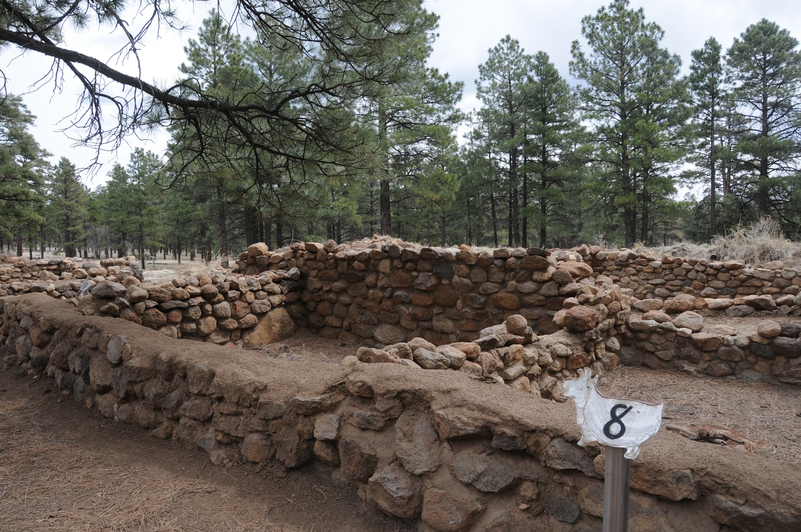
Once the meeting place of the Sinagua people, this archeological site located a few yards from busy AZ89 is now a major stop off for tourists, students and hikers alike. Brochures available at the trailhead correspond with numbered stops along the wide, flat gravel trail.  Each of the 15 sites tells a tale of life and culture in the village which at its high point was home to as many as 200 people.   Although short, plan on spending at least an hour to observe and read about the building techniques, life ways and archeological research.  A visit to this interesting roadside attraction is a good way to wind down after a longer hike in the area.

LENGTH: 0.1 mile loop
NEARBY HIKING TRAILS:
Old Caves Crater,
Elden Environmental Study Area,
Pipeline Trail,
Sunset Crater National Monument,
O'Leary Peak
RATING: easy, barrier-free (gravel)
ELEVATION: 6940'
HOURS: open year-round
FEES: none
GETTING THERE:
From Phoenix, go north on I17 to the I40 interchange in Flagstaff.  Head east (right, toward Albuquerque) and connect with AZ89 north.  Follow AZ89 to milepost 420 and start watching for the "Elden Pueblo" sign, which is just south of Townsend-Winona Road. Turn left and park in the gravel lot. 
INFO: Flagstaff Ranger District, Coconino National Forest
Elden Pueblo Program Manager: 928-527-3452

MORE PHOTOS:

Fisher Fire is 100% contained.


....close shave.  No word yet as to when Sandy's Canyon Trail will re-open.

From: "Magee, Brienne U -FS" <bmagee@FS.FED.US>
Date: April 16, 2013 3:04:11 PM PDT
To: <USDA-FS-NEWS@NEWSBOX.USDA.GOV>
Subject: SOUTHWESTERN-NEWS-RELEASE: Coconino National Forest
April 16 Update:
The Fisher Fire is 100% contained and 35 acres (slightly smaller size due to more accurate mapping last night). Cause is still under investigation. This was human caused, as there was not any lightning in the area, but specific cause has yet to be determined.

Brienne Magee
Public Affairs Specialist
Flagstaff Ranger District, Coconino NF
5075 N Hwy 89
Flagstaff AZ 86004
o: 928-527-8290

Monday, April 15, 2013

Fisher Fire update

UPDATE: 4-17-2013
Although the Fisher Fire has been declared "100% contained" as of yesterday afternoon, there's still no word as to when the Sandy's Canyon and AZT segment near Fisher Point will be re-opened.  Here's a link to the fire map:
http://azdailysun.com/map-of-fisher-fire/pdf_547c7218-a62e-11e2-bdbe-0019bb2963f4.html

Hikers, because Sandy's Canyon trail is one of my favorites,I've been following this fire very closely and will post forest service press releases as they send them to me.  Looks like fire fighters are making progress.....

Sandy's Canyon: fire was approximately here...

From: "Magee, Brienne U -FS" <bmagee@FS.FED.US>
Date: April 15, 2013 9:15:54 AM PDT
To: <USDA-FS-NEWS@NEWSBOX.USDA.GOV>
Subject: SOUTHWESTERN-NEWS-RELEASE: Coconino National Forest
April 15, 2013

           
Fisher Fire update, 8:30 a.m.

Flagstaff, Ariz. – The Fisher Fire crept and smoldered last night, but did not grow in size. Firefighters have a line around the fire and will continue to strengthen them today. Fire managers want to be sure lines hold through the high winds, however, before they declare an increase in containment.


Size: Approximately 40 acres
Containment: 50%
Location: near Fisher Point approximately four miles south of Flagstaff and two miles northeast of Lake Mary Road and the Canyon Vista Campground.
Date Reported: Saturday, April 13 at approximately 4pm
Cause: Human caused, under investigation
Resources: Approximately 100 personnel including four hotshot crews (Flagstaff Hotshots, Prescott Hotshots, Pleasant Valley Hotshots, and Blue Ridge Hotshots), engines, water tenders, a dozer and several overhead
Closures: The Sandy’s Canyon Trail and Arizona Trail at Fisher Point have been temporarily closed.

Smoke may be visible from the Flagstaff area and will drift to the east; expect smoke to be noticeable in Walnut Canyon, I-40, and the Continental Country Club area.

###

Sunday, April 14, 2013

Fire closes Sandy's Canyon & AZT near Fisher Point

FISHER FIRE UPDATE
Hi Hikers, well, we have our first trail-impacting forest fire of the season.  The human-caused Fisher Fire was reported yesterday.  Here's the forest service press release


Fisher Point

April 14, 2013          
Fisher Fire update, 10:30 a.m.
Flagstaff, Ariz. – The Fisher Fire, south of Flagstaff, burned actively throughout the night. This morning it is approximately 40 acres. Winds are expected to continue today, increasing this afternoon.

Fisher Fire Facts
Date Reported:
Saturday, April 13 at approximately 4pm

Size: Approximately 40 acres

Location: near Fisher Point approximately four miles south of Flagstaff and two miles northeast of Lake Mary Road and the Canyon Vista Campground.

Cause: Human caused, under investigation

Resources: Approximately 80 personnel including three hotshot crews, three engines, two water tenders, a dozer and several overhead

Closures: The Sandy’s Canyon Trail and Arizona Trail at Fisher Point have been temporarily closed.

Smoke will be visible from the Flagstaff area and will drift to the east; expect smoke to be noticeable in Walnut Canyon, I-40, and the Continental Country Club area.
 

###

Make friends and influence tourists on AZ trails


BROKEN ARROW & SUBMARINE ROCK TRAILS
Sedona
Chicken Point


Blame the looming federal tax due date or the start of another baseball season, but this past Saturday, I found myself without a hiking partner.  We all know the mantra---"never hike alone", still, I simply HAD to hit the trails.  The solution---head out to a very popular trail and tell someone of my plans.  As the month of April is prime tourist season for Sedona, picking a busy route wasn’t too tough. Close to town and easy-to-find, Broken Arrow Trail is a perfect choice for tourists and locals looking for an easy trek with lots of company.  The trail parallels rugged 4x4 Broken Arrow Road, which is used by Sedona jeep tour companies and off-road enthusiasts alike, so be prepared to see them cross your path.  At the trailhead, I met two very nice guys visiting from the east coast who asked if they could tag along with me as they didn’t “get” the whole basket carin system of route-finding and worried about straying off on one of the unofficial bike routes that cross the main trail.  Actually, save for one confusing junction, the route is easy to follow, but I was happy to have someone to chat with during the hike. (We also “adopted” two ladies from New York for the return trip). In addition to its proximity to town, this hike comes highly recommended due to its ample supply of things to see along the way.  At the 0.6-mile point, there’s Devils Dining Room (not to be confused with Devil’s Kitchen) an impressive sinkhole inhabited by bats.  Next up is an optional side trip to Submarine Rock, a long sandstone formation a couple hundred feet below the main trail.  Soon, the route becomes a series of slick rock passages, each more scenic than the one before, until, just over that last weather worn red rock mound, the incredible vistas of Chicken Point cause a frenzy of “here-take-my-picture” moments.  From here, the trail connects with Chapel and eventually Little Horse trails if you want to add distance or do a car shuttle. However, we returned the way we came as my visiting travel companions had exhausted their camera batteries and were suffering from blissful visual overload.

 
Scene from the trail


LENGTH:  4.8 miles (including 1.4 mile side trip to Submarine Rock)
RATING:  easy
ELEVATION:  4280’ – 4630’
FEE: a Red Rock Pass is required. Daily, $5 daily, $15 weekly, $20 annually.

Slick rock ledge with Submarine Rock on left
GETTING THERE:
From Phoenix, travel north on I17 to exit 298 for Sedona-Oak Creek AZ179.  Head west (go left) on AZ179 and continue to the Morgan Road traffic circle at milepost 312.  Turn right onto Morgan Road and drive 0.5 mile to the trailhead on the left.  Roads are paved up to the last 0.1 mile which is rough dirt, but passable by carefully driven sedans. 
INFO:  Red Rock Ranger District, Coconino National Forest
http://www.fs.usda.gov/recarea/coconino/recreation/hiking/recarea/?recid=55250&actid=50 
MORE PHOTOS:

Thursday, April 11, 2013

Arizona Trail upcoming events


ARIZONA TRAIL RUNNING & HIKING SERIES
promotional postcard

Here's a fun way to get out and experience our state-spanning Arizona Trail (AZT). This series of 10k to half marathon (13.1) running/hiking events on some of the most scenic AZT passages are designed to build awareness of and generate funds to manage and support the  mission of maintaining this 800-mile National Scenic Trail as a world-class recreation destination. Each event comes complete with refreshments, prizes and an opportunity to socialize with like-minded outdoor enthusiasts. There's a modest registration fee and participants must sign up in advance.

UPCOMING EVENTS:
APRIL 27: Vail
MAY 18: Pine
SEPT 29: Mormon Lake

AZT WEBSITE: