


 HOLBERT TRAIL TO DOBBINS LOOKOUT Phoenix South Mountain Park
Phoenicians are lucky to live within sight of the nation’s largest municipal park. South Mountain Park sprawls across our southern horizon and has hundreds of miles of trails that may be hiked individually or in combination loops. The Holbert Trail is easy to access and a cinch to follow due to excellent trail maintenance as well as strategically placed signage. From the trailhead, the path begins by traversing “petroglyph alley”. Keep one eye on the boulders and cliffs while hiking the first flat half-mile. Ancient rock art appears everywhere, as does the evidence of artifact thieves. Once past the petroglyphs, the hike becomes more strenuous as it follows the canyon walls and gently switchbacks uphill to the junction for Dobbins Lookout. The trail is rocky and can be tricky in places, so, pay attention. Hang a right at the signed junction and haul up more switchbacks to popular Dobbins Lookout. An old stone building and numerous vista points with benches make Dobbins Lookout a nice spot to rest and enjoy great view of the Valley of the Sun. Although the City of Phoenix provides ample reciprocals for trash, the lookout area, which is accessible via a paved road, is habitually coated with a layer of crap. Gatorade bottles, beer cans, candy wrappers, Doritos bags and the remnants of romantic interludes. Don’t ask. On our last hike to the lookout, we took along plastic trash bags and policed the area for rubbish but could do nothing about the graffiti. It's interesting to note that garbage and graffiti rarely occur in areas that are not accessible by car. Hey all you beer guzzling, littering, tossers; here’s something to ponder—how safe do you think it is to drink alcohol on the summit of a narrow, winding mountain road and then get back behind the wheel? Wheeeeeee! Just a thought. Anyhooo, I do digress. On our way back down the mountain, several young men who had driven to Dobbins Lookout were perched on the summit, cans in hand and fixated on us with our black trash bags as if we were mutant tree huggers. As we passed beneath them on our descent, I felt a slight “ping” on my backpack, but thought nothing of it. Later that day, when unloading and cleaning my pack, I noticed an aluminum pop-top ring in the mesh side pocket of my pack. It smelled of beer.
LENGTH: 5.8 miles roundtrip
DIFFICULTY: moderate
ELEVATION: 1,350'-2,370'
FACILITIES: restrooms, water, picnic tables, covered ramadas
GETTING THERE: From Phoenix, follow Central Avenue south all the way to the end where it flows into South Mountain Park. Just past the park entrance gate, turn left into the Activity Complex. Drive past the Interpretive Center and go all the way to the end of the road near the restrooms and park. The signed trailhead is directly across the road. South Mountain Park is open from 5:30 a.m to dusk and access and parking is free.
INFO: City of Phoenix Parks & Recreation:
http://phoenix.gov/parks/trails/locations/south/hiking/index.html


 Posts


 ABBEY WAY
Sierra Ancha Wilderness
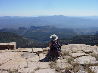
In the forest south of Young, an obscure trail named for 70s eco-guru, Edward Abbey (1927-1989), snakes gently up to the highest point in the Sierra Ancha hills. Passionately protective of the southwest’s wilderness areas, Abbey wrote numerous environmental classics, including, The Monkey Wrench Gang and Desert Solitaire. He did some of his writing while working for two seasons as a forest service lookout in the fire tower on the summit of Aztec Peak.
It is sadly ironic that stretches of Abbey Way were burnt to a crisp by the 2000 Coon Creek fire. Among the charred wooden corpses, survivor pines stand unscathed with seedlings beneath their branches. Abbey once said, “There are no vacant lots in nature.” Scrub oak, Arizona maples, agaves and wildflowers are new tenants amid the fertile remains of old growth.
The summit, relatively untouched by the fire, features sandstone cliffs that had been the shoreline of an ancient Cambrian sea. Views from the top are unlike any in Arizona. Imagine taking the red rocks of Sedona, the Coconino limestone cliffs of the high county, some pine trees from Payson and the stream-side maples of New England, tossing them into a blender and flinging the results over the earth’s surface. Breathtaking.
Whether you are a fan of its namesake or not, Abbey Way is a damn good trail.
LENGTH: 4 miles round trip from the trailhead. 7 miles round trip from the gate.
RATING: moderate
ELEVATION: 6,400 to 7,750 feet
GETTING THERE:
From Phoenix, take US 60 to just before Globe. Go north on SR 188 to 288 (Young Road). Follow 288, a dirt road, for about 14 miles to FR 487. Look for the sign: “Workman Creek Recreation Area”. Drive 16 miles on 487 to the gate with a sign reading: closed Dec. 15 – Mar. 31. You can park at the gate or drive an additional 1.5 miles to the 151 trailhead. But then, you’ll miss hiking past the cliffs and waterfalls. Passenger cars okay.


