BADGER MOUNTAIN TRAIL
 |
| View from Badger Mountain Trail in Prescott |
From its northern terminus at State Route 69 to where it meets the Ranch Trail in Prescott National Forest, the Badger Mountain Trail delivers a continual joyride through changing vistas and ecozones.
The 6.77-mile route winds around the undulating edges and gullies of what is better known as P Mountain—a high-visibility hill inscribed with a big white “P” that stands out over a sea of shopping centers, hotels and casinos.
 |
| Badger Mtn Trail crosses several drainage areas |
Located just over a mile from historic downtown Prescott off State Route 69, the Badger Mountain Trail links the Prescott Mile-High Trail System, Prescott Circle Trail and forest service paths.
 |
| Sierra Prieta Mtns seen from Badger Mtn |
 |
| Granite Mountain (center) seen from Badger Mtn |
The internal route is accessible via connecting trails at either end, however, neither terminus has parking, so the best way to get into the heart of the trail is to use the Turley Trailhead that’s tucked into a suburban neighborhood. This access point lands hikers smack in the middle of the trail.
 |
| Views of Prescott Valley dominate the hike |
 |
| Route traces the western slopes of Badger Mtn |
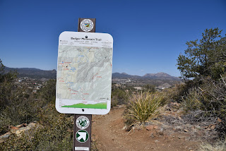
Map signs posted at junctions make following the trail simple. From the trailhead, begin by hiking 0.64-mile on the Turley/Badger Connector to the signed turnoff for Badger Mountain. For the best views and most variety, head right at the signpost and into the core of the uphill trek.
 |
| Badger Mountain is also known as P Mountain |
Initially, the sparsely shaded trail unpacks great views of iconic Prescott geological formations Granite Mountain and Thumb Butte. As the trail makes its gradual ascent up the mountain’s west flanks, views of sprawling Prescott Valley and the distant peaks of Flagstaff dominate the skyline.
 |
| Turley Connector/Badger Mountain junction |
At a little past the 1-mile point from the trailhead, the route makes an abrupt bend into the first of several drainage areas it will traverse where the vegetation changes from high-desert scrub to oak-conifer woodlands.
 |
| A twisted manzanita shrub on Badger Mountain |
The trail makes long, easy curves in and around these leafy corridors providing dappled shade and brakes from the sun-exposed slopes. Vistas also alternate among big valleys, green ravines and the pine-covered peaks of the Sierra Prieta Mountains to the west.
 |
| Oak trees line ledges above a drainage |
Near the 2-mile point, the route enters the national forest for the final climb to the Ranch Trail #62 junction. This makes for a good turn around point, otherwise continue on trail #62 for 3.8 miles to Walker Road near the Lynx Lake Recreation Area.
 |
| Thick vegetation in a drainage area |
LENGTH: 7.38 miles up-and-back as described here or 6.77 miles one way for full trail
RATING: moderate
ELEVATION: 5,669 – 6,308 feet as described here or 5,510 – 6,308 for full trail
GETTING THERE:
From Courthouse Square in downtown Prescott, go 1.1 miles east on Gurley Street to just before the State Route 69/89 interchange. Turn right onto Overland Road and continue to a stop sign at Butterfield Road, turn left and continue to the junction of Wagonwheel Road and Well Fargo Road. Veer right and follow Wells Fargo 0.2-mile to the signed turn off for the Turley Trail on the right. Follow this narrow dirt road a short distance to the parking area.
INFO & MAPS: City of Prescott
https://www.prescott-az.gov/recreation-area/badger-mountain/


No comments:
Post a Comment