


POSTON BUTTE PRESERVE
 |
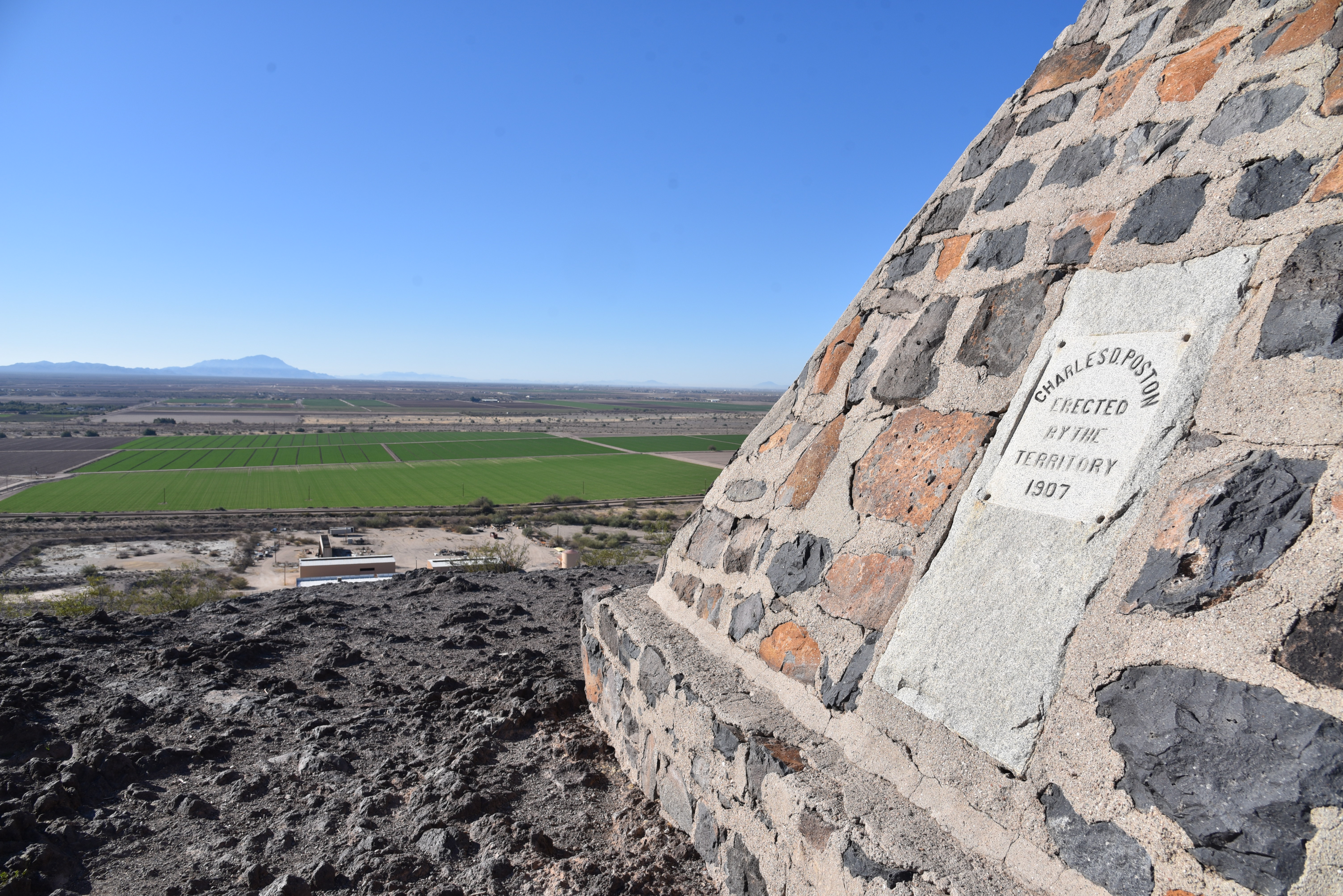
| The monument on the summit of Poston Butte |
Renaissance man or odd ball? It can be argued that Charles Debrille Poston (1825 -1902) was a little of both. The man who became known as the “Father of Arizona” lived a storied and colorful life before being laid to rest (in a roundabout way) on a volcanic mound beside the railroad tracks outside of historic downtown Florence.
 |
| Poston Butte was known as F Mountain |
Over the course of his life, he was a Republican Congressman, world traveler, explorer, writer, mineral entrepreneur, follower of Zoroastrianism-- a monotheistic Persian religion founded in 6th century B.C.--and register of the U.S. land office in Florence from 1877 to 1879. During his tenure in Florence, he constructed a Zoroastrian temple on a prominent local hill that went by the names of Primrose Hill and F Mountain before gaining its current moniker of Poston Butte.
 |
| A short steep section isn't too difficult |
 |
| The trail up Poston Butte is rough but moderate |
 |
| The preserve is undergoing upgrades |
Poston earned his “Father of Arizona” designation by successfully arguing for an Arizona Territory separate from the Territory of New Mexico and in 1864 he was elected as the new territory’s first delegate to the U.S. House of Representatives. He spent his career moving in and out of Arizona before passing away, nearly penniless, in Phoenix.
Today, almost 200 years after Poston’s birth, a roadside monument in his honor is getting some renewed love. Travelers and locals alike have long enjoyed the short hike up Poston Butte. Recognizing the site’s significance and potential as a recreation hub and tourism draw, the Town of Florence recently officially designated it Poston Butte Preserve with plans to expand, protect and enhance it with hiking trails and amenities.
 |
| Superstition Ridgeline seen from Poston Butte |
While it undergoes improvements, the preserve is open to hikers from sunrise to sunset daily.
 |
| Volcanic outcroppings on Poston Butte |
A dirt pull out on Hunt Highway north of the Gila River
serves as a trailhead. To reach the summit trail, walk under a wood railroad
overpass and follow the well-worn, but as yet unsigned route. At first glance, the preserve is kind of a
desolate place. Anchored by a lone hill
in a sprawling desert valley cut with dirt roads, railroad tracks and grazing
cattle, the property becomes more interesting when viewed from the high slopes
of the butte.
 |
| Approaching the top of Poston Butte |
The inky black, ash-infused knobs of Poston Butte are barren save for a few scattered palo verde trees, some scraggly creosote and dry tufts of grass. Rough and unswept, the wide path makes a half-mile uphill plod. There’s a short segment where the trail gets steep but it’s nothing vertical enough to knock the wind out of you. On the way up, vistas include a mix of flat desert valleys, farmlands, distant mountain ranges and a full-frame look at the Superstition Ridgeline bolstered by the iconic Flatiron formation in the Superstition Wilderness near Apache Junction.
 |
| Green fields below Poston Butte |
 |
| Flatiron on the left horizon. |
Despite the 1907 date on the monument, Poston’s body was exhumed from a paupers grave in Phoenix and re-interred here in 1925, exactly 100 years after his birth.
It’s going to be fun watching this quirky Pinal County roadside attraction with a heavy Arizona territorial lilt evolve into a genuine hiking destination.
Fittingly, the Town of Florence plans a 2025 observation of the 100-year anniversary of Poston’s post-mortem return to one of his favorite Arizona destinations.
LENGTH: 1.2 miles to the top and back
RATING: moderate
ELEVATION: 1,450 -1,748 feet
GETTING THERE:
From Interstate 10 south of the town of Sacaton take the State Route 187/387 exit 185.
Go left at bottom of off ramp and connect with State Route 387.
Follow SR 387 to SR 87, go right and continue (SR 87 turns into 287 Florence-Coolidge Hwy) to the major intersection at Main St in Florence. Veer right and then left to pick up Florence Heights Dr. Continue less than a mile to SR 79, turn left (north) and go to Hunt Highway at milepost 136. Turn left and continue to the trailhead on the right to the trailhead on the right.
As of this writing, there are no facilities at the trailhead.
HOURS: sunrise to sunset daily
No comments:
Post a Comment