LIZARD HEAD: Sedona.
 |
| Lizard Head (center) is a familiar sight along Dry Creek Rd. |
 |
| L-R: Lizard Head, Capitol Butte, Chimney Rock |
She’s
impossible to miss.
 |
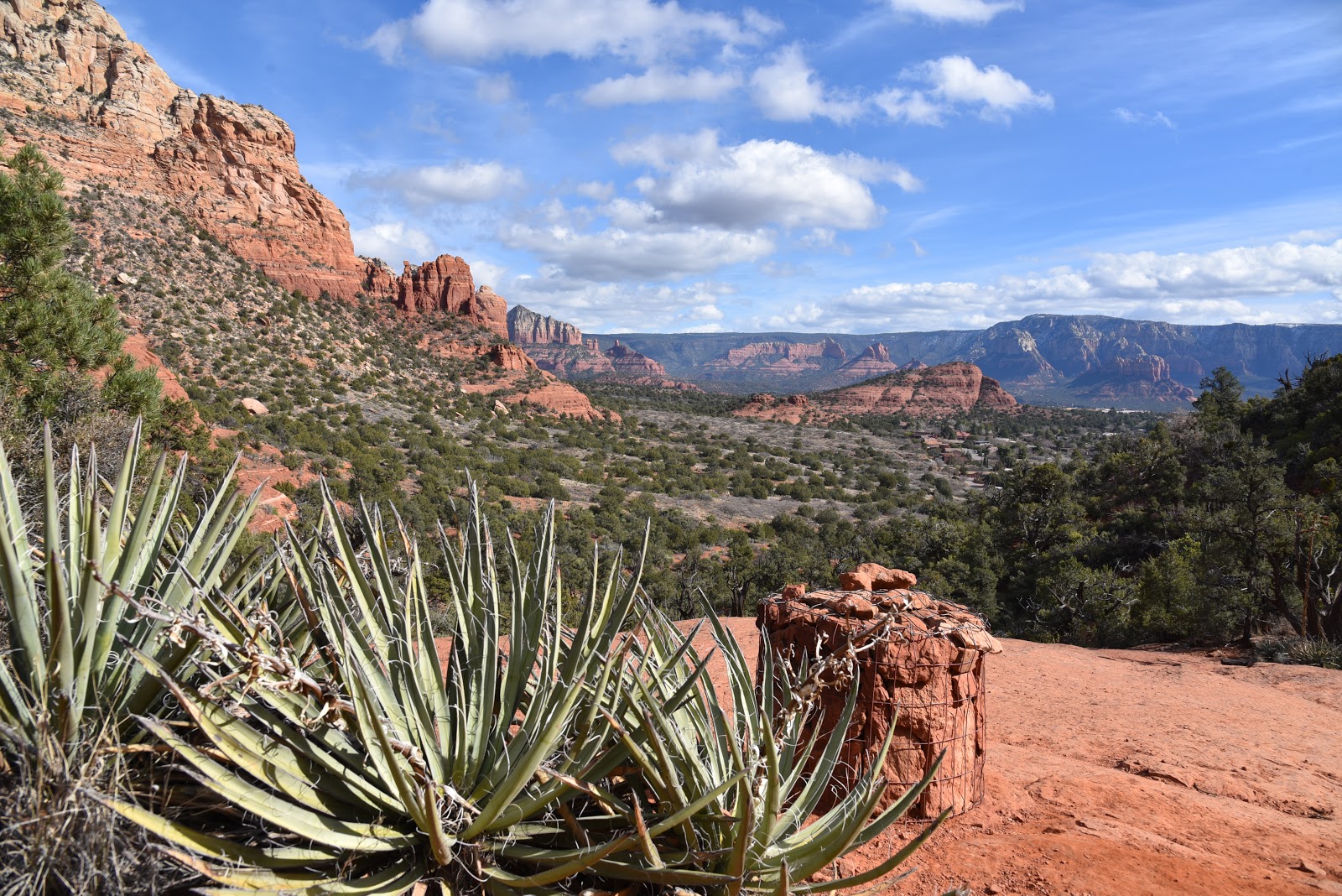
| Agaves frame views from Chimney Pass |
The dragon-esque rock formation that looms
above Dry Creek Road in Sedona’s northwest sector looks like a sentinel guarding the
western edge of Red Rock Secret Mountain Wilderness. Created by eons of plate tectonics, running water and blowing dust, had the prominent nub been sculpted by human hands instead, it might have been titled Reptile in Repose.
 |
| Chimney Rock seen from the Andante trail |
Aptly named Lizard Head, the stony
escarpment is one of several impressive geological features visible from a
cluster of trails that wander along the southern slopes of Capitol Butte, a
6,355-foot massif that’s also known as Thunder Mountain. Several trailheads
provide easy access to the Lizard Head trail which passes just below the
pseudo-reptile’s snout.
 |
| Lizard Head stands out over Lower Chimney Rock Trail |
One route that
gets bonus points for its swing around iconic Chimney Rock and an optional
summit climb side trip begins at the tiny Andante trailhead located a mile
north of State Route 89A.
 |
| Doe Mtn (mesa in center) seen from Upper Chimney Rock |
The
circuit begins with a short walk on the Andante trail. At the first junction,
turn right on the Chimney Rock trail and hike up the series of staircases cut
from native red sandstone that lead to Chimney Pass—a narrow, wilderness
corridor between the smokestack-like form of Chimney Rock and the crumbling
cliffs of Thunder Mountain. In just over
a half-mile, turn right onto the Lizard Head trail.
 |
| Red rock boulders on Thunder Mountain Trail |
The 1.2-mile path is a
slender, ever steeping course that tops out at a scenic overlook at the
half-mile point with views of the Cockscomb rock formation, Doe Mountain, Mingus Mountain and
sprawling suburbs.
 |
| Mingus Mtn and Cockscomb seen from Lizard Head Trail |
Beyond the scenic bench, the trail dips down to connect with
the Chuckwagon trail near Dry Creek Road. If you parked a shuttle vehicle here,
you can call it a day, otherwise, backtrack and hike a half-mile on Lower
Chimney Rock trail to an optional up-and-back climb to a spot just below the
4,872-foot summit of Little Sugarloaf. The short but steep path climbs 150 feet
in under a quarter mile but the extra effort rewards with more epic vistas and
a chance to catch your breath before descending to connect with the Thunder
Mountain trail for the final 0.7-mile return leg.
 |
| Part of the hike is in Red Rock Secret Mtn Wilderness |
If you’re
up for more, consult the forest service maps to explore the many adjacent paths
that roam around more famous Sedona rock pinnacles like Coffeepot Rock and the
Sugarloaf.
 |
| A jumbled wash on Lizard Head Trail |
LENGTH:
4.5 miles as described here
RATING:
moderate
ELEVATION: 4,560 - 4,800 feet
GETTING
THERE:
Andante
Trailhead:
From the
State Route 179/89A traffic circle in Sedona, go 2.5 miles west on 89A to
Andante Drive. Turn right and follow Andante Dr. 1 mile to the trailhead. Hike begins at the
big map kiosk.
INFO &
MAP:
-->


No comments:
Post a Comment