Indian Spring Wash
 |
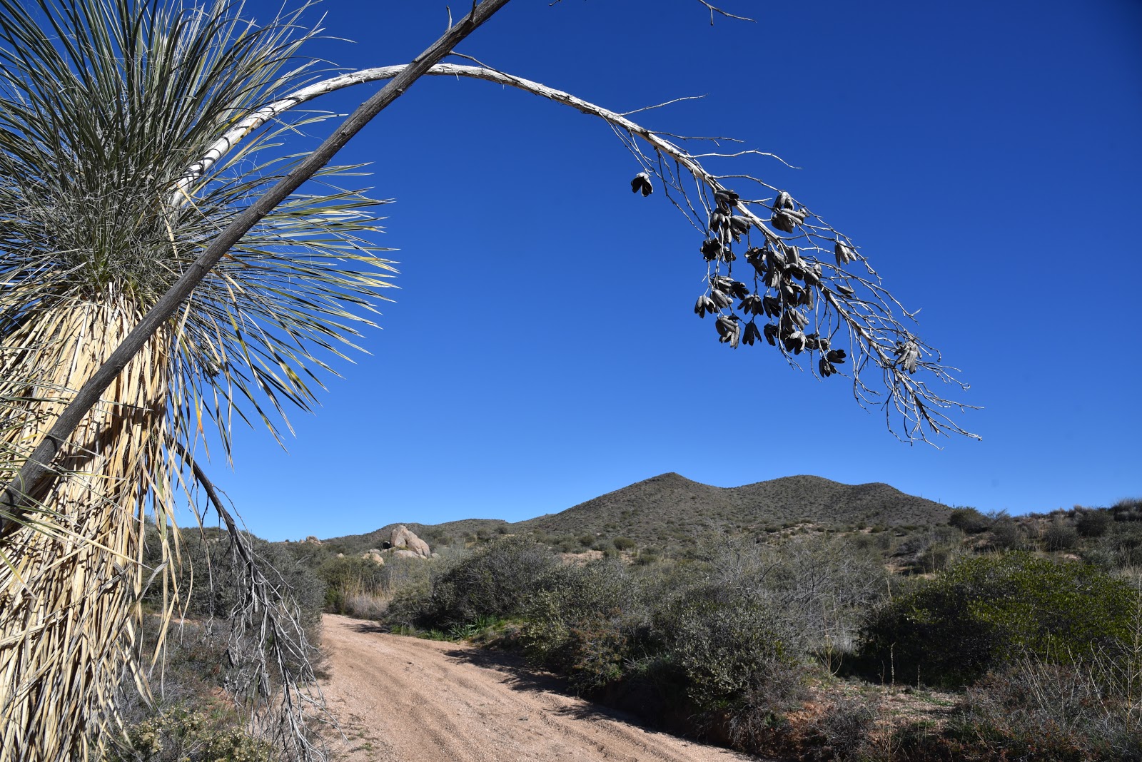
| Indian Butte framed by last season's yucca sprouts. |
By way of Forest Road 532, it’s a six mile hike from Bartlett Dam Road to the Verde River. The road is neither the most efficient nor the easiest way to get there, but it offers a pleasant backcountry trek over varied terrain with outstanding views. The road is part of a cluster of recently restored shared-use routes in the hills between Horseshoe Reservoir and Bartlett Lake northeast of the Valley.
 |
| The first mile is a sandy slog in Indian Spring Wash. |
 |
| Overlooking the Verde River Valley |
Open to ATVs, bikes, horses and hikers, the roads wind through a part of the Tonto National Forest Cave Creek Ranger District.
 |
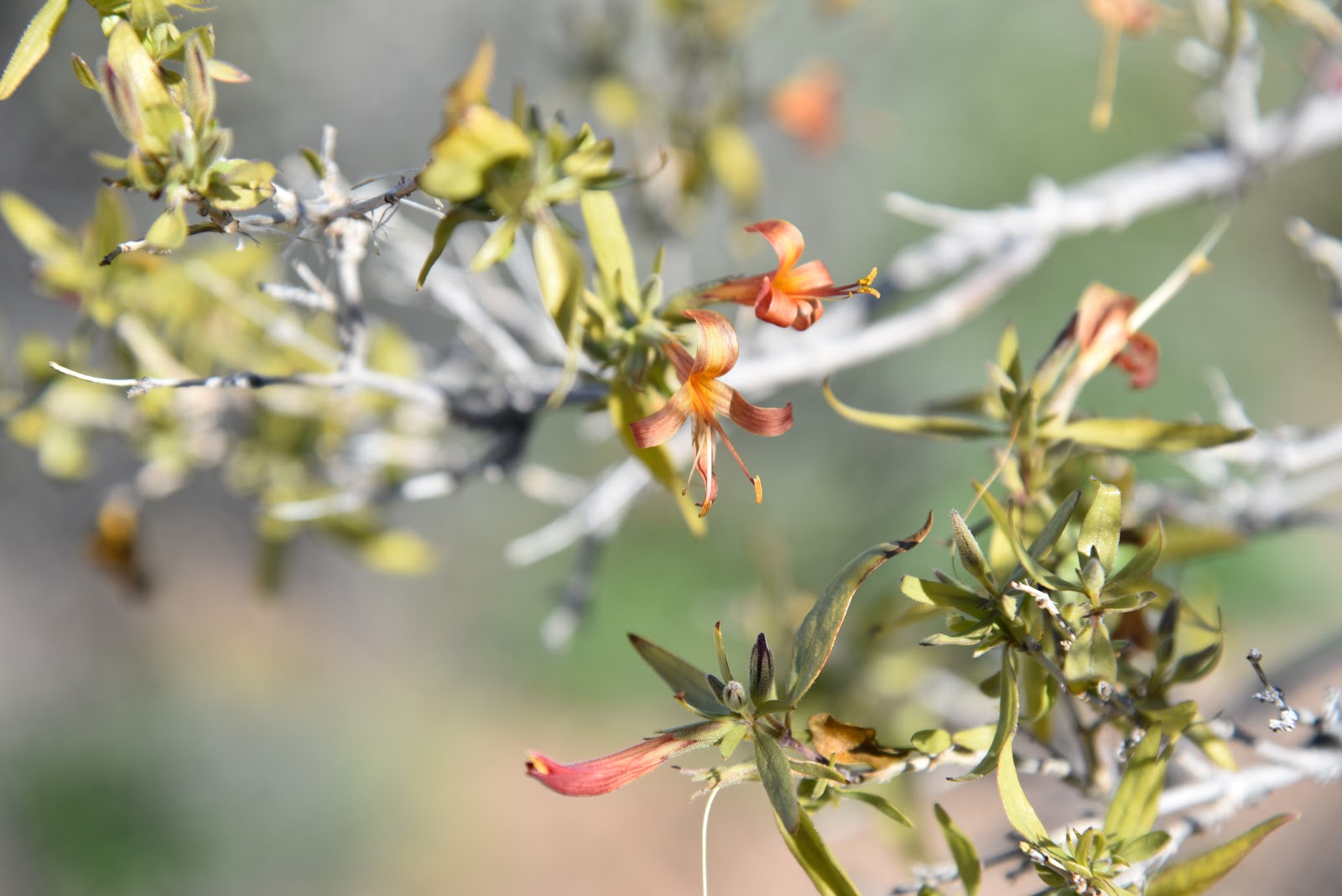
| Desert honeysuckle bloom in the wash. |
A map at the trailhead gives an overview of the system, which at first glance, can be intimidating. However, Forest Road 532 is well-signed and easy to follow. The hike begins in the sandy spillway of Indian Wash. Deeply rutted and softened by motorized traffic and periodic flooding, the first mile is tantamount to walking on a beach. The washy walk dodges among giant granite pillars, sandbars and a
robust showing of desert hackberry, mesquites, turpentine bushes, desert honeysuckle and blooming wildflowers. At the 1.9 mile point, the road moves out of the wash and into the hills as it head up to the saddle between Indian Butte (3745 feet) to the east and Saint Clair Peak (4230 feet) to the west. The first rise provides amazing vistas of landscape of rolling foothills trees, cholla, yucca and shrubs, but the big story here is the mountain vistas. Silhouettes of the Four Peaks, Sierra Ancha and McDowell Mountains form a seamless, peak-centric horizon. The road tops out where Forest Road 1104 head off toward St. Clair Peak and FR 532 begins its 1500-foot dive down to the river. Take a moment here to scope out wall of wilderness peaks backing the Verde River Basin ahead. It’s a long way down (and it feels even longer on the way out) but the wide road mitigates the struggle with passes by rugged cliffs, scenic overlooks and reed-addled riparian areas down in the wash.
Just beyond the 5-mile point, heavily-used Forest Road 42 bisects the route signaling the final approach to the river. The road ends roughly halfway between the two lakes near a primitive camping area called Devil’s Hole. If you didn’t pack for an overnighter or arrange to have somebody with an ATV pick you up, enjoy the sights before trudging back the way you came.
 |
| Point where the route leaves the wash. |
 |
| Saint Clair Peak |
 |
| McDowell Mountains on the horizon. |
 |
| Forest Road 532 ends at the Verde River |
 |
| Trailhead map shows the system of shared-use roads. |
LENGTH:
To the river: 5.8 miles one-way
To the highpoint: 2.4 miles one-way
RATING: moderate-difficult
ELEVATION:
Trailhead: 2725 feet
Highpoint: 3303 feet
River: 1800 feet
GETTING THERE:
From the Pima Road/Cave Creek Road intersection in Carefree, go 4.1 miles north on Cave Creek Road to Bartlett Dam Road. Turn right and continue 9 miles to the trailhead on the left where there’s a gate and map kiosk. There’s plenty of parking along the road.


2 comments:
I haven't been up to that area in years since they closed the road after the fire. Is the 532 road still closed at the Horseshoe Road Dam intersection?
The entrance to FR 532 on Bartlett Dam Road is blocked, however, there are other access points and motorized travel is allowed on the roads behind the blockade. Somehow, the area around FR 532 was mostly untouched by the Cave Creek Complex Fire.
Post a Comment