


SCHUERMAN MOUNTAIN TRAIL
Sedona
 |
| Summit of Schuerman Mountain |
An old dandy standing tall
above a hub of new trails in west Sedona, Schuerman Mountain Trail is the gold
standard of the bunch. With the opening last year of the Scorpion-Skywalker-
Pyramid loops, this moderate trek up an extinct volcanic mound pads it resume
with birds-eye views of its newborn siblings and a chance to glimpse Sedona and
Verde Valley landmarks from an easy-to-conquer mountain summit. The first section
the trail follows an array of solar panels on the edge of Sedona Red Rock High
School then passes a junction for the Scorpion trail before turning upward
along a thin, cypress shaded path pecked from the mountain’s east slope.
On the
way up, look for the dominate sandstone dome of Capitol Butte and
the flat, pine-coated crown of Wilson Mountain. At the 0.3-mile point, veer left at a signed
junction for the vista spur and make the 0.3-mile hike up a boulder cluttered
ridge that culminates at a promontory hovering above the distant profiles of
Bell Rock and Courthouse Butte. On the near horizon, the isolated plateau of Airport
Mesa hosts a continual stream of planes coming and going overhead. To the west,
Mingus and Woodchute Mountains rise to over 7,000 feet at the edge of the Verde
Valley. Once done gawking at the landscape, descend to the junction and jog
left to continue 1.7 miles through high desert grasslands and pockets of
juniper to where the route intersects the Lime Kiln Trail that connects Dead
Horse Ranch and Red Rock State Parks. From this point, there’s no real option
to make a day hike loop unless you’re happy to walk on roads or have parked a
car at one of the parks. That’s why many hikers approach this trail as an
out-an-back trek.
 |
| A dusting of snow in December |
 |
| Capitol Butte on the horizon |
LENGTH: 2.6 miles one-way
(with summit spur)
RATING: moderate
ELEVATION: 4450’ – 4900’
GETTING THERE:
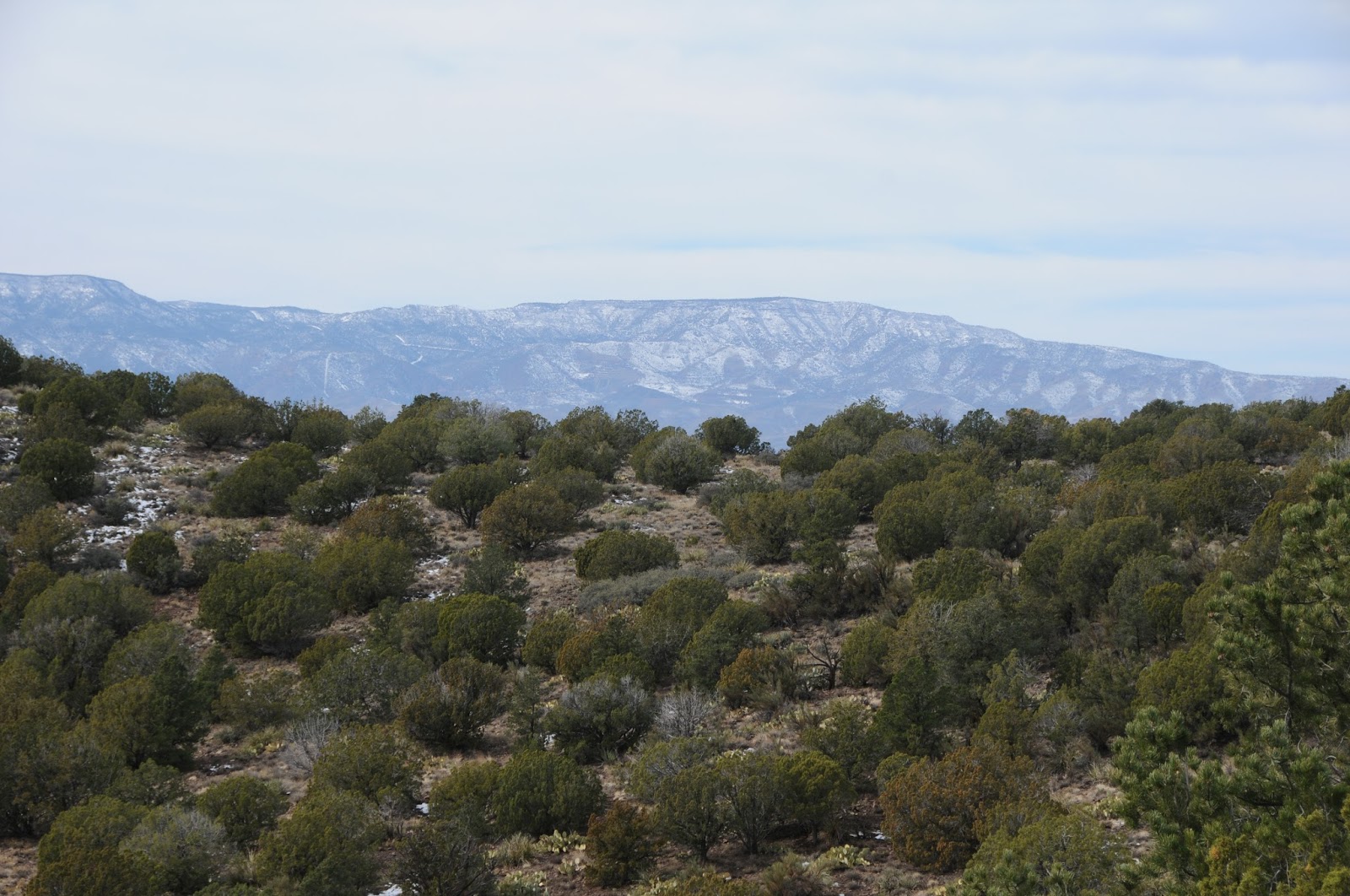 |
| Mingus and Woodchute Mountains |
From the State Routes
179/89A traffic circle in Sedona, head 4.2 miles west (left) on 89A and turn
left onto Upper Red Rock Loop Road. Continue 0.2-mile to the high school
parking lot on the right. Park at the designated trailhead lot only.
INFO & MAP: Coconino
National Forest
No comments:
Post a Comment