


SAN PEDRO RIVER TRAIL
San Pedro Riparian National
Conservation Area
 |
| San Pedro River |
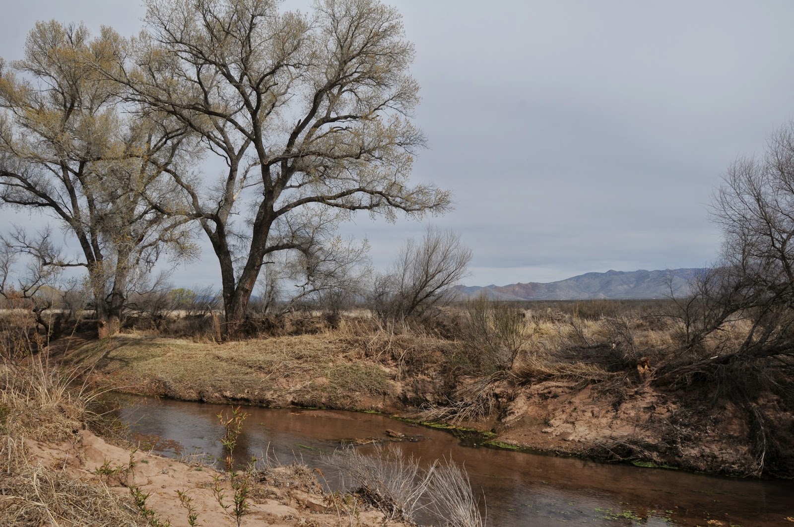
From its headwaters in
Sonora Mexico to the confluence with the Gila River near Winkelman,
the San Pedro River flows 140 miles north through 57,000 acres of
riparian wildlife habitat surrounded by scrub and sprawling
grasslands of the Sonoran and Chihuahuan deserts. Cradled between the
high peaks of the Huachuca Mountains and the ore-rich hills around
Bisbee, the river is one of the last free flowing waterways in the
Southwest. 
Over its lacy course, the unbridled river unfolds in idiosyncratic oxbows, linear pools, marshes and mesquite-cluttered floodplains giving a glimpse of what the area might have looked like to ancient inhabitants.

Over its lacy course, the unbridled river unfolds in idiosyncratic oxbows, linear pools, marshes and mesquite-cluttered floodplains giving a glimpse of what the area might have looked like to ancient inhabitants.

The 27-mile San Pedro River Trail
runs adjacent to the water and a web a spur paths
leading to the muddy banks and pebble-strewn sandbars add myriad opportunities for viewing some of the 350 species of
birds, 80 species of mammals, 68 kinds of reptiles and amphibians and
2 species of native fish that reside in a tangled forest of
cottonwood, willow and ash trees. 
Numerous trailheads and backcountry camping areas are spread long the trail's length making for easy car shuttle, day hike or backpack outings.
The well-signed route is peppered with sites that chronicle the area's human history. There's a Clovis Paleo-Indian culture locale (11,000-8,000 B.C.), petroglyph gallery, mammoth kill pit, remnants of Spanish and Mexican colonial explorations and the foundations of territorial ranching and mining outposts. Taking in the entire scope of SPRNCA is a multi-day venture, but for a quick day trip or to learn more about the conservation area, a good place to start is at the San Pedro House trailhead. Here, knowledgeable volunteers from the Friends of the San Pedro River host guided hikes and are on hand to help optimize your itinerary. This is also the stepping out point for a trek along the San Rafael del Valle section of the route that culminates 8 miles upstream at the Hereford Bridge trailhead.

Numerous trailheads and backcountry camping areas are spread long the trail's length making for easy car shuttle, day hike or backpack outings.

The well-signed route is peppered with sites that chronicle the area's human history. There's a Clovis Paleo-Indian culture locale (11,000-8,000 B.C.), petroglyph gallery, mammoth kill pit, remnants of Spanish and Mexican colonial explorations and the foundations of territorial ranching and mining outposts. Taking in the entire scope of SPRNCA is a multi-day venture, but for a quick day trip or to learn more about the conservation area, a good place to start is at the San Pedro House trailhead. Here, knowledgeable volunteers from the Friends of the San Pedro River host guided hikes and are on hand to help optimize your itinerary. This is also the stepping out point for a trek along the San Rafael del Valle section of the route that culminates 8 miles upstream at the Hereford Bridge trailhead.
or 8 miles one-way for the San Rafael
del Valle section
RATING: easy
ELEVATION: 3762' - 4071'
FACILITIES: Restrooms,
bookstore, picnic tables at San Pedro House. Restroom at Hereford
Bridge.
FEES: No trailhead fees.
Backcountry camping permits are $2 per person per day.
GETTING THERE:
From Phoenix, take Interstate 10 east
toward Tucson. Continue to the AZ90 Fort Huachuca/Sierra Vista exit
#302. Follow the AZ90 signs through Sierra Vista, then:
SAN PEDRO HOUSE TRAILHEAD:
From Sierra Vista, continue east on
AZ90 to milepost 328 and turn right (south) at the sign just before
the bridge.
HEREFORD BRIDGE TRAILHEAD:
From Sierra Vista, continue east on
AZ90 to Moson Road (traffic light just past milepost 325), turn right
and continue 7.6 miles to Hereford Road. Turn left, go 4.6 miles and
turn right at the sign just past milepost 8 before the bridge. Roads are paved up to the 0.1-mile
access roads which are good gravel.
INFO & MAPS:
San Pedro Riparian National
Conservation Area, (520) 439-6400
San Pedro House Trails
System: (520) 458-3559
Friends of the San Pedro
River
MORE PHOTOS:
No comments:
Post a Comment