SIXSHOOTER CANYON
Pinal Mountains, Tonto
SIXSHOOTER CANYON
Pinal Mountains, Tonto
Of all the trails in the Pinals, this one (#197) is the toughest. The long, brutally steep route is strewn with obstacles--fallen trees, degrading slopes and derelict signage all contribute to the trail’s difficult rating. Along the way, remains of cabins, mines and a sawmill dot the woodlands adding a touch of history to this must-do Arizona trail. Access to the trail begins at the east side of the Icehouse CCC campground.
BONUS SIDE TRIP: Pinal Peak
From trail’s end, hike up to FR 651C, go left (southeast) and follow the dirt road past Upper Pinal campground to the 7,848 peak and highpoint of the range.
IMPORTANT NOTE: Pinal trails are notoriously overgrown and rife with obstacles. In addition, directional signage is sparse, so hikers must have excellent map and route-finding skills in order to safely navigate these trails.
A good map resource is the National Geographic Maps, Salt River Canyon, Tonto National Forest #853.
INFORMATION: www.natgeomaps.com/ti_853
LENGTH: 12 miles roundtrip
ELEVATION: 4,520 – 7,560 feet
RATING: difficult
BEST SEASONS: March -October (CAN GET WARM IN SUMMER)
DISTANCE FROM PHOENIX: 95 miles one-way
GETTING THERE:
From Phoenix, take US 60 east to the town of Globe. Once in Globe, watch for the sign that says: “Besh-Ba-Gowah Ruins, Globe Ranger Station”. Leave the freeway here and follow the signs toward the ruins. After driving under the pedestrian overpass, and past the ruins, turn right on Icehouse Canyon Road (Forest Road 112) and go 4.2 miles to the Icehouse CCC campsite where there’s a hiker sign on the left that reads: “197, 192”. If the gate to the campsite is locked, just park in the pullouts along the road.
INFORMATION: Globe Ranger District (928) 402-6200 http://www.fs.fed.us/r3/tonto/recreation/rogs/hikingtrail/grd/SixshooterTrail197.pdf


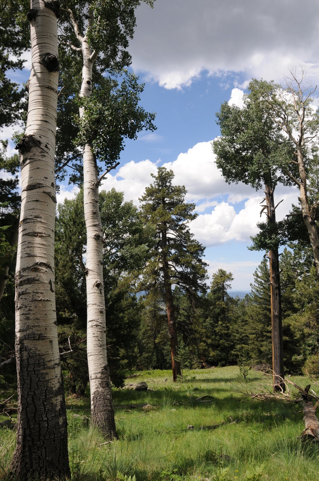
 HART PRAIRIE PRESERVE
The Nature Conservancy, Flagstaff
Before the arrival of European settlers on the western slopes of Flagstaff’s San Francisco Mountain, Hart Prairie was a healthy patchwork of meadows, willow-cluttered wetlands, rings of aspens and a smattering of pines where regular low-intensity natural fires and a community of top-tier predators helped keep the ecological balance in check. Over the past hundred years, the effects of altered hydrolics, fire suppression, and the introduction of invasive plants and non-indigenous animals have transformed the landscape. In 1994, 245 acres of Hart Prairie along with an historic lodge and guest cabins were donated to The Nature Conservancy. Since then, the organization has set out to restore the alpine meadows to their former natural state through creative collaboration with the forest service, local landowners and other conservation groups.
This ambitious restoration project is a work-in-progress and is open to visitors only by guided nature walks offered every Sunday from June 13th to October 10th (except September 12th). The walks are easy, last roughly 90-minutes and cover topics such as topography, willow biology, and wet meadow dynamics.
LENGTH: variable, but about a mile
RATING: easy & educational
ELEVATION: 8,500 feet
BEST SEASONS: June - October
GETTING THERE: Tour groups meet at 10:00 a.m. sharp at the Fort Valley Plaza Shopping Center, 1000 N. Humphreys St. at the southwest corner by the guardrail. Reservations are not required. Participants must wear sturdy shoes and bring sun protection, rain gear and plenty of water. No pets or food are allowed in the preserve.
Fees: Tours are free, however, donations are appreciated.
INFORMATION: http://www.nature.org/wherewework/northamerica/states/arizona/preserves/art15233.html
(928) 774-8892 or e-mail hartprairie@tnc.org.
HART PRAIRIE PRESERVE
The Nature Conservancy, Flagstaff
Before the arrival of European settlers on the western slopes of Flagstaff’s San Francisco Mountain, Hart Prairie was a healthy patchwork of meadows, willow-cluttered wetlands, rings of aspens and a smattering of pines where regular low-intensity natural fires and a community of top-tier predators helped keep the ecological balance in check. Over the past hundred years, the effects of altered hydrolics, fire suppression, and the introduction of invasive plants and non-indigenous animals have transformed the landscape. In 1994, 245 acres of Hart Prairie along with an historic lodge and guest cabins were donated to The Nature Conservancy. Since then, the organization has set out to restore the alpine meadows to their former natural state through creative collaboration with the forest service, local landowners and other conservation groups.
This ambitious restoration project is a work-in-progress and is open to visitors only by guided nature walks offered every Sunday from June 13th to October 10th (except September 12th). The walks are easy, last roughly 90-minutes and cover topics such as topography, willow biology, and wet meadow dynamics.
LENGTH: variable, but about a mile
RATING: easy & educational
ELEVATION: 8,500 feet
BEST SEASONS: June - October
GETTING THERE: Tour groups meet at 10:00 a.m. sharp at the Fort Valley Plaza Shopping Center, 1000 N. Humphreys St. at the southwest corner by the guardrail. Reservations are not required. Participants must wear sturdy shoes and bring sun protection, rain gear and plenty of water. No pets or food are allowed in the preserve.
Fees: Tours are free, however, donations are appreciated.
INFORMATION: http://www.nature.org/wherewework/northamerica/states/arizona/preserves/art15233.html
(928) 774-8892 or e-mail hartprairie@tnc.org.