Find A Trail. Start Your Search Here:

Monday, October 2, 2023

Calloway Butte-New Tank

CALLOWAY BUTTE - NEW TANK

New Tank in Coconino National Forest

Peaceful, secluded places aren’t too difficult to find along the backroads of Coconino National Forest. 

Weighing in at over 1.8 million acres in size, Arizona’s second largest national forest is ostensibly the most diverse. 

Gambel oaks shade Forest Road 142

The northern Arizona swath of public land encompasses the famous red rock high deserts of Sedona, mountain lakes and streams, aspen glens, and alpine tundra around the state’s highest point in Flagstaff.  
Barbed wire fencing around New Tank

While sandstone phantasms, plunge pools and hypoxic vistas are the hallmarks of the easily accessible land, the B-list stuff in between is quite remarkable as well. 
Mountain vistas from Forest Road 142

When viewed through a lens of discovery, who-knew pockets of forest deliver hikes with generous servings of tranquil beauty.  Wildlife water holes, often created and maintained by Arizona Game & Fish Department, are the unsung gems of back road hiking destinations.
Old corral near New Tank

Gateway to New Tank on Forest Road 142

The weedy stock tanks backed by earthen dams are plentiful along 4x4 roads so they’re easy to find.  It's possible and legal to drive to many of them, but road conditions are not for amateurs. New Tank, one of the most scenic water holes, is a sizable pond choaked with water smartweed and bulrushes. 
A peaceful place in Coconino National Forest

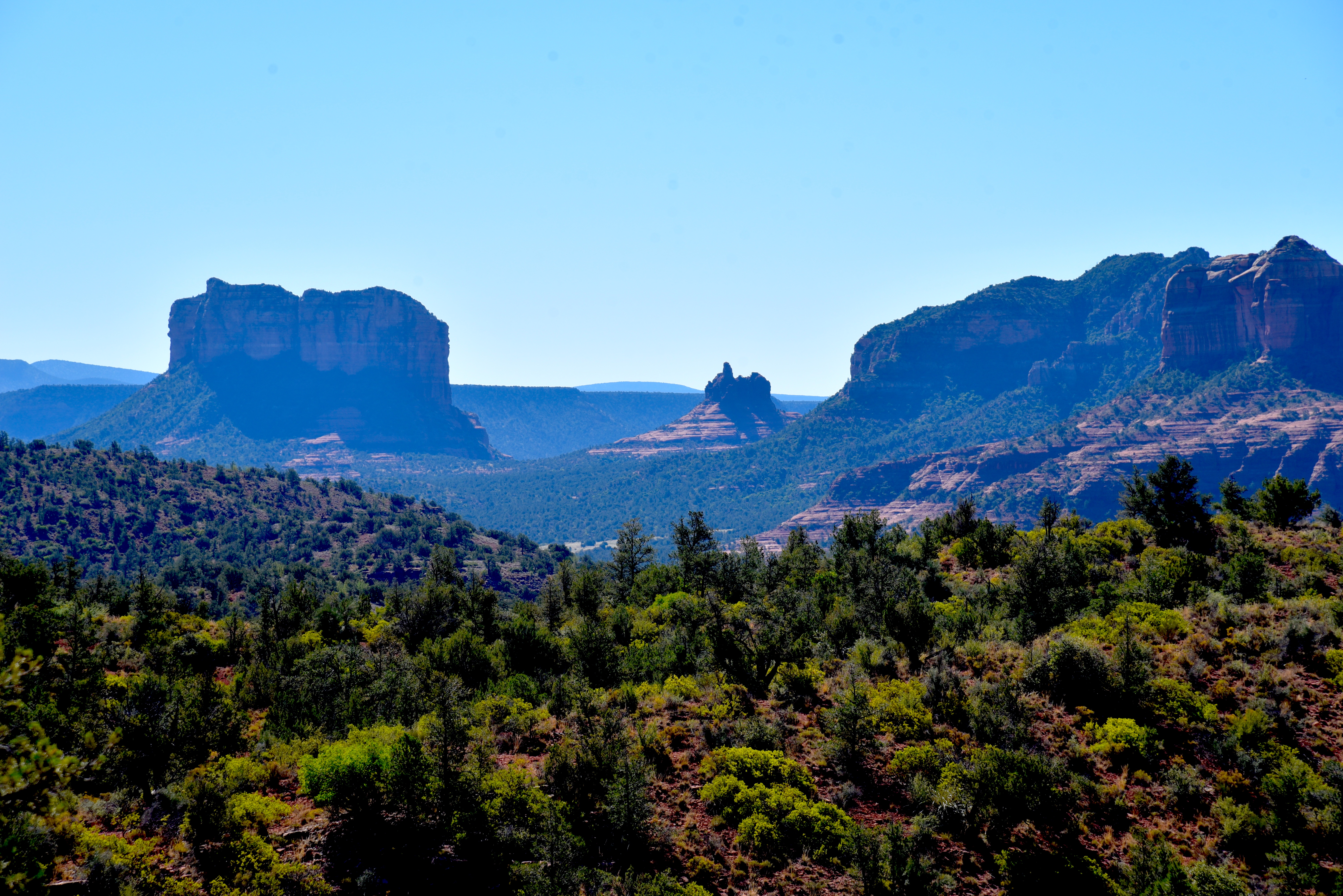
Situated along Forest Road 142 about 27 miles east of Camp Verde, the pond is the focal point of a pastoral scene wrapped in a dilapidated ring of log-and-wire fencing.  The tank sits at the north base of Calloway Butte, a 6,860-foot pine-covered mound south of the West Clear Creek Wilderness. 
Calloway Butte seen from FR 142

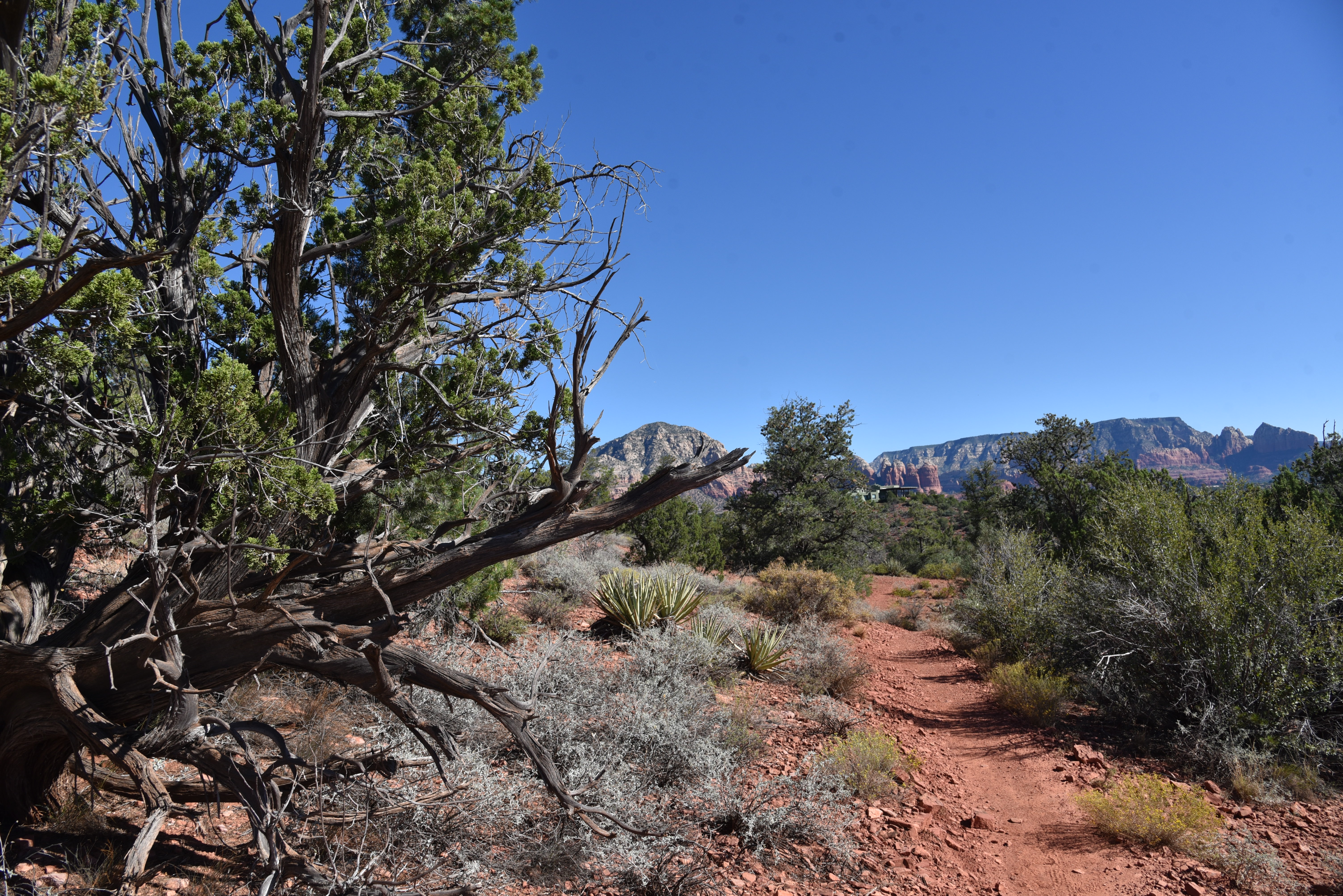
Getting to the tank involves an undulating walk on the rough track of Forest Road 142.  Beginning at a dirt parking area off State Route 260 where the General Crook Trail #130 passes under the highway, the hike makes an immediate descent to a 3-way junction. 
Meadow with a view near New Tank

FR 142 heads left, on the first of a sequence of rocky climbs.  The road is shaded by a mix of Ponderosa pines, Gamble oaks and gnarly alligator junipers, passing by several side roads before dipping down into the cut of Meadow Canyon.  A final uphill crawl reveals mountain vistas peeking through thick tree cover and first looks at the green arc of Calloway Butte.  The road flattens out as it approaches the tank and skirts a rustic corral before meeting the tank at the 2.4-mile point.  
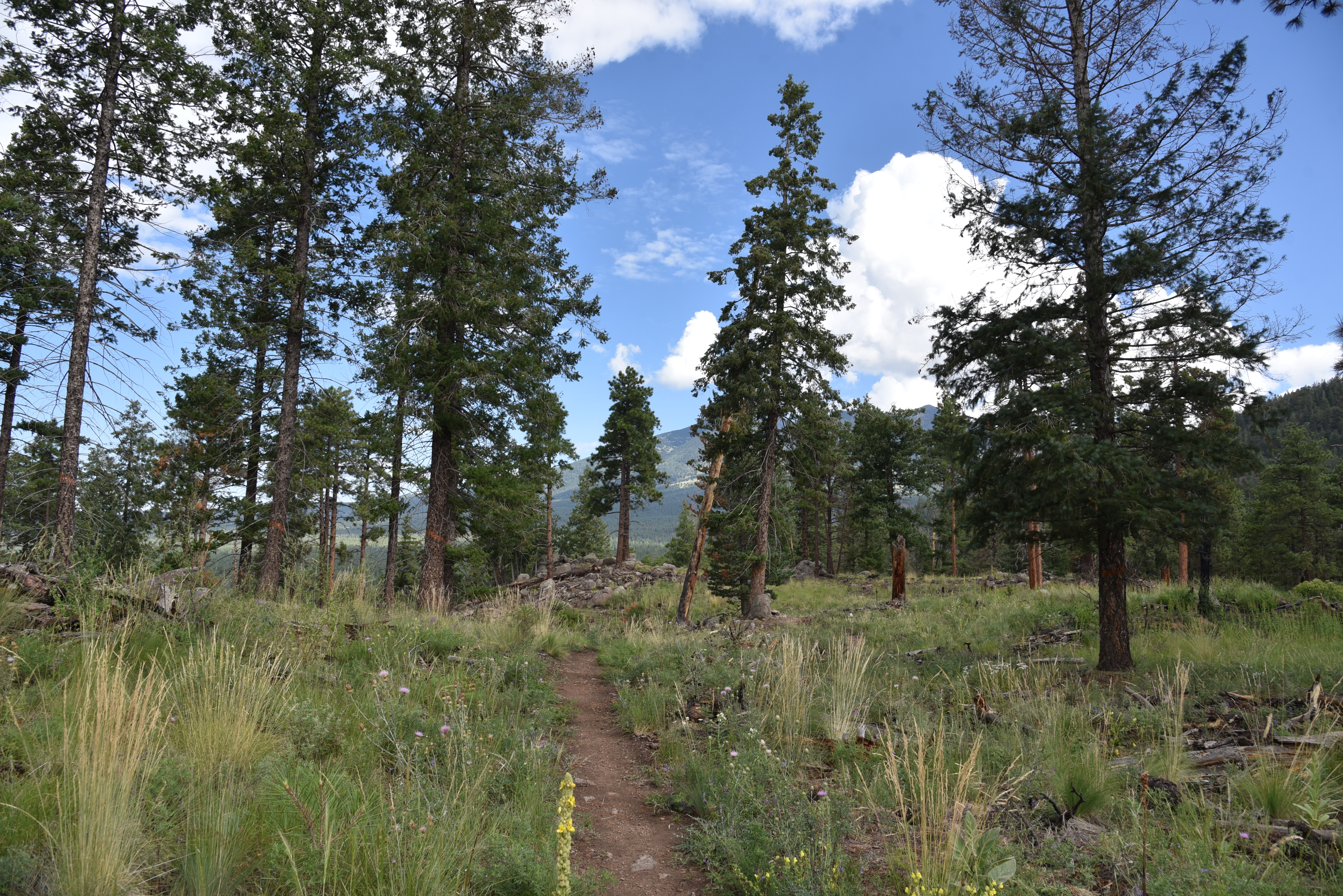
Wildflowers and pines along FR142

Massive oaks that blaze in shades of gold in autumn serve as a leafy gateway to the water hole that attracts all sorts of wildlife.  Elk, javelina, water birds and a robust community of woodpeckers skulk its perimeter.  The photogenic site is drenched in sunlight, the air spritzed with earthy notes of mint and grass. 
Pastoral scene at New Tank

It’s a relaxing spot for a lunch break before heading back or continuing another 0.8-mile on the road to Forest Road 142B, which is also signed as FR 9396. The hiker logo on the post indicates that the Calloway Trail, a half-mile strenuous route that descends into West Clear Creek, lies ahead.
FR 142 traverses Meadow Canyon

Well-equipped, adventurous hikers may follow the narrow, rough road 3-miles the trailhead.  But to stick with the theme of enjoying the pleasure of an unassuming little place between highway and wilderness, New Tank makes for a good turnaround point.
The FR 142B turnoff for the Calloway Trail


LENGTH: 4.8 miles round trip (to the tank and back)

RATING: moderate

ELEVATION: 6,146 – 6,718 feet ( 1,501 feet of accumulated elevation change)

GETTING THERE:

From Interstate 17 in Camp Verde, go 27 miles east (toward Payson) on State Route 260 to Forest Road 142 located past milepost 245 on the left.  Immediately past the cattle guard and turn left into a dirt parking area for the General Crook Trail.  A high clearance vehicle is recommended.

Sunday, September 24, 2023

Verde Vista Loop

VERDE VISTA LOOP

View from the Verde Vista Loop

It’s only a little over a 500-foot climb to the zenith of the Verde Vista Loop.  But getting there is trickier than it looks. 

The green corridor of the Verde River

The trail, which was completed in 2021, is tethered to the still under construction Camp Verde Sports Complex and crosses into Coconino National Forest east of the Verde River and Beaver Creek . 
Verde Vista Loop crosses into Coconino NF

The 5.5-mile non-motorized trail, in the hills southeast of Montezuma Castle National Monument, is a joint effort between the Town of Camp Verde Urban Upland Trail System and Coconino National Forest.  
Verde Vista Loop passes below limestone cliffs

The route departs from the easy-rated , Perimeter Loop that circles the Sports Complex with a level, gravel surface that’s welcoming to hikers, dog walkers and stroller-pushing families.
The route is well signed throughout

 
The Verde Vista Loop begins innocently enough with a walk-through open desert and grassy slopes.  The first mile makes an effortless ascent on a mix of two-track and singletrack dirt. Mountain views stand out all around as the path winds through clumpy forbs, yucca and a green sea of creosote shrubs.
Grasses and a sea of creosote on the lower leg

As the route moves toward the imposing crescent of buff-colored cliffs and a large mesa-like mound to the northeast, views of the emerald band of the Verde River glows in the valley to the west.  After passing into Coconino National Forest, the trail meets a sign warning equestrians that conditions ahead can be hazardous for horse travel. 
There are some steep and slippery sections

Bikers and hikers should take heed too, because beyond the sign, the trail goes full-tilt crazy.  Abrupt twists, loose rock and close-to-the-edge traverses on a base of crumbling limestone characterize the roughly mile-and-a-half ascent to the trail’s high point in the White Hills. 
The Perimeter Loop is level and easy

Narrow and slippery in places, it’s smart to pay attention to footing and not be distracted by the ever-expanding mountain and valley panoramas rolling out below.  
Yucca decorate the Verde Vista Loop

After huffing, puffing and scrambling over chalky ledges, the trail delivers a punch of in-your-face eye candy as a reward.  
Verde Vista Loop climbs to the top of the White Hills

While easier than the ascent, the return leg the loop still has its challenges. It clings to cliffs, sweeps over ridgetop flatlands and hits one last spiral of switchbacks before landing hikers back in the creosote sea.

LENGTH:

Verde Vista Loop: 5.5 miles

Perimeter Loop: 1.6 miles

RATING:

Verde Vista Loop: difficult

Perimeter Loop: easy

ELEVATION:

Verde Vista Loop: 3,136 – 3,688 feet (1,190 feet of accumulated elevation change)

Perimeter Loop: 3,100 – 3,160 feet

GETTING THERE:

From Interstate 17 in Camp Verde, go 4 miles east (toward Payson) on State Route 260 to  Champion Trail about 1/2 mile beyond the Ranger Station. The Champion Trail entrance gives direct access to a parking lot with trail map kiosk.

Monday, September 18, 2023

Herkenham-Skywalker-Old Post Loop

HERKENHAM-SKYWALKER-OLD POST LOOP

Ocotillo frame views on the Herkenham Trail

In the exalted realm of Sedona hiking trails, Herkenham barely registers a blip. Maybe because it’s been around for so long, it has become invisible. Or perhaps its nexus is misunderstood.
 There’s no cave, no natural bridge and no babbling creek. While lacking in traditional hiker catnip, the trail’s list of don’t-haves includes one attribute that some hikers must have.

Courthouse Butte (L) and Bell Rock (C) from Skywalker Trail

There are no crowds.  And to the aforementioned some, swapping a look-at-me Instagram moment for solitude is a fair tradeoff.

The Herkenham Trail sits in the corrugated hills above Oak Creek on the west side of Sedona. It’s part of a network of looped trails that trace airy ledges and scoured gullies. 

Pyramid formation from Old Post Trail

The system that spins around the twisted course of Carroll Canyon has easy access points and lighter traffic than many other Red Rock Country hike destinations. But that doesn’t mean the trails lack appeal.  The singletrack paths trudge through gorgeous high desert ecozones with enough elevation change to guarantee good workouts and continually changing vistas. 
A rare shady spot on Herkenham Trail

The beauty of the Carroll Canyon area in Coconino National Forest is way trail expansion has evolved around a few stalwart heritage routes. Besides Herkenham, the Old Post and Carroll Canyon trails have been around for years, while the newer Skywalker, Scorpion and Pyramid trails add miles with respect for the original core routes. 
Tabletop Mesa (C) from Skywalker Trail

One way to sample old and new is to make a loop hike using the Old Post, Herkenham and Skywalker trails. The moderate-rated hike may be accessed from the Old Post Trailhead along Chavez Ranch Road by hiking 0.7-mile north on the Old Post Trail to the Herkenham junction.
The loop is well signed

The first leg is an easy-going stroll through cactus-dotted grassland. 
Skywalker Trail ducks around a gully

Sparce shade is courtesy of sporadic stands of pinion pines and junipers that pop up in groups large enough to block the sun for a water break but never dense enough the eclipse mountain vistas.  Most of the hike’s elevation gain happens on the 1.1-mile Herkenham Trail leg. While the loop’s overall high-to-low elevation difference is less than 600 feet, the route is deceptively more challenging. A constant string of rises, dips and turns keep things interesting and pleasantly paced.  Herkenham tops out at a small parking area across from the old Red Rock High School.
View of Oak Creek from Skywalker Trail

This site may be used as an alternative trailhead, but it fills up fast, especially on weekends.  At the parking area, the Skywalker Trail begins with a rocky descent outside the bounds of a residential area. 
Capitol Butte (center horizon) from Skywalker Trail

Beyond the homes, the trail begins its 1.5-mile southeast trek.  The first half of the trail rides high on a ridgeline with the best views of the loop.  
A little rain brings out the ocotillo on Skywalker

The green band of the Oak Creek corridor glows in the valley below with outstanding peeks at Courthouse Butte, Bell Rock,  and Capitol Butte.  Views to the northeast are more elusive, but quick looks at the Cockscomb formation and Bear Mountain are available to those who pay attention. 
Carroll Canyon trails are easy to loop up

After several dozen flowing bends, the “sky walking” portion of the trail ends where the long profile of Tabletop Mesa and the colorfully layered peaks of Munds Mountain Wilderness stand out on the horizon.  The trail then makes a steady descent back down to the Old Post trail for the 1.5-mile return segment where the call of scrub jays mingles with the rumble of cars headed toward Red Rock Crossing--the closest ooh-and-ahh catnip.

LENGTH: 5.1-mile loop

RATING: moderate

ELEVATION:  3,979 – 4,569 feet (1,037 feet of elevation change)

GETTING THERE:

Old Post Trailhead:

From the State Route 179/89A traffic circle in Sedona, go 4 miles west (toward Cottonwood) on SR 89A to Upper Red Rock Loop. Turn left and continue 1.8 miles to Chavez Ranch Road (Forest Road 216A), turn left and go 0.1 mile to the Old Post trailhead on the left. There are no fees or facilities at the trailhead.

INFO:

Coconino National Forest

https://www.fs.usda.gov/recarea/coconino/recreation/hiking/recarea/?recid=72089&actid=50

Monday, August 28, 2023

Dipper-Apollo-Pluto-Spacewalk Circuit

DIPPER-APOLLO-PLUTO-SPACEWALK CIRCUIT

Impressive monolith on the Pluto Trail

Flagstaff has a long and colorful association with astronomy and space exploration. Notable mentions include the discovery of Pluto from the Lowell Observatory by Percival Lowell in 1894. And in the 1960s, the Apollo astronauts trained in the Cinder Hills area to test procedures in volcanic craters that resembled the lunar landscape prior to landing on the real thing in 1969.

Apollo Trail winds through volcanic boulders


Additionally, Flagstaff has the distinction of being named the first International Dark Sky City in 2001.

A hairpin curve on the Dipper Trail

That’s a big deal because the city’s policies on limiting nighttime light pollution have many benefits including improving human health, protecting sensitive wildlife and ecosystems and maintaining clear skies for stargazing and studying the universe.
Mountain vistas on the Spacewalk Trail

 (Learn more at darksky.org)

In homage to the Northern Arizona city’s outer space heritage, a new maze of trails in the Mount Elden-Dry Lake Hills (MEDL) area was opened to the public in August.

Wildlife browse sand sage August - November

New MEDL trails connect with Rocky Ridge Trail

 Part of the Schultz stacked loop system, located just a few miles north of downtown, the new Dipper, Apollo, Pluto and Spacewalk trails tie into the previously unveiled Big Bang Trail.
Pluto Trail passes a recovering burn scar

They also add toned muscle to Old Standard backbone routes like Rocky Ridge, Sunset, Brookbank and Upper Oldham Trails.
Mt. Elden seen from the Apollo Trail

Built by Coconino National Forest and Arizona Conservation Corps with the assistance of local volunteers, the trail names slap a celestial sugar coating on a decidedly terrestrial domain.
Wildflower meadow on Spacewalk Trail

While the area’s high elevation and slightly lower O2 levels might give lowlanders (if you’re from Phoenix, you’re a lowlander) a mini case of the woozies, the trail designs minimize the impact. These new routes are not of the old school straight-up-and-down ilk that seem engineered to make you feel like a looser.
Ancient alligator juniper on the Dipper Trail

These scenic paths capitalize on natural landscape contours, using sweeping switchbacks to ease climbs and tight hairpin turns to propel trail users around ravines and gullies.
Paintbrush color sunny spots March - September

The looped trails are easy to customize


To explore this new hub, begin at the Schultz Creek Trailhead, which was relocated away from the course of Schultz Creek this summer,  with a short walk on the Chimney Trail to connect with the Rocky Ridge Trail.

San Francisco Mountain seen from Dipper Trail

The route follows Rocky Ridge for 0.7 miles to where the Apollo Trail heads left.  The 0.3-mile connector path twists among lichen-encrusted volcanic boulders and sporadic tree cover, serving up appetizer views of what’s to come.
Sunflower meadows below the Dipper Trail

At the 1-mile point, Apollo intersects the Dipper Trail. For this trip, the route heads right taking on an edgy segment where enormous alligator junipers frame mountain vistas and glimpses of downtown Flagstaff before exposing first peeks at the sky-scraping silhouette of 12,633-foot San Francisco Mountain.
Mixed conifer woodlands on Pluto Trail

 
Immediately beyond the mountain preview, Dipper meets the Pluto trail at the 1.8-mile point.  Pluto is another capillary-type route of about a third of a mile that runs between the Dipper and Spacewalk trails.  The tightly coiled path jogs around a recovering burn scar and a prominent monolithic stone outcropping, then connects with the Spacewalk Trail. Great views of the peaks can be had by heading left at the junction.
Purple locoweed bloom June - September

Narrowleaf tick clover bloom July - September

The easy singletrack meanders for a half-mile through wildflower meadows and mixed conifer woodlands before bumping into the Big Bang Trail, the turnaround point for this exploratory trip. However, a quick map consult will show a full menu of loop options for longer or shorter hikes.

LENGTH:  4.66 miles out-and-back

RATING: moderate

ELEVATION: 7,160 – 7,765 feet (964 feet of elevation change)

GETTING THERE: Schultz Pass Trailhead: In Flagstaff, go 3 miles north on U.S. 180 (Humphreys Street) and turn right on to Schultz Pass Road (Forest Road 420). Continue 0.5-mile on FR 420 and make a hard left at the Elden Look Road (Forest Road 577) and go another half-mile to the  parking area on the left. There are no fees or facilities at the trailhead. 

INFO:  Coconino National Forest

https://www.fs.usda.gov/recmain/coconino/recreation