Find A Trail. Start Your Search Here:

Tuesday, October 11, 2022

Northwest Passage - Peavine Circuit

NORTHWEST PASSAGE-PEAVINE CIRCUIT

High point view on the Northwest Passage Trail

This out-and-back lollipop loop hike uses part of the Peavine National Recreation Trail, to access the Northwest Passage trail which occupies the outlands of the Storm Trails maze of little loops northeast of Prescott’s Watson Lake. 

Watson Lake & Granite Mountain seen from Peavine Trail

For a short, moderate trek, this one packs in a full house of diverse, scenic beauty.
A Great egret forages the shore of Watson Lake

The hike starts out at the south end of the lake where the leafy belt of Watson Woods Riparian Preserve bursts with cottonwood, boxelder, walnut and other water-loving trees that provide living space for dozens of species of birds.
Cottonwood trees in Watson WoodsRiparian Preserve

Great fall color viewing, too! The first two miles follow the Peavine Trail, a 6-mile repurposed railroad bed built in 1893 by the Santa Fe Railway. Passing beneath arching riparian trees, the wide cinder-base road traces the lake that’s as popular with kayakers as it is with waterfowl.  It  takes little effort to spot ducks, herons and egrets gliding over open water and poking around for food among reed-choaked inlets. As the trail plows north past meadows and through stony corridors, it enters the jumbled rock wonderland of the Granite Dells. 
Boxelder trees blush gold in autumn on the Peavine Trail

White dots mark the Northwest Passage Trail

The billion-year-old jointed pillars and blobs of volcanic rock have been weathering and cracking for millions of years, gradually sculpting into a surreal ochre-colored landscape punctuated with junipers, creek beds and a now defunct railroad route.
A cottonwood tree soaks up water in WatsonLake

Benches are placed at dramatic spots along the route including one overlook with amazing views of the lake and distant Granite Mountain.
Bridge over Boulder Creek on the Peavine Trail

A bridge with an old concrete base surrounded by discarded rail ties that spans Boulder Creek marks the second stage of the hike.
Alligator junipers shade Northwest Passage Trail

Over the bridge at just under the 2-mile point, this trip veers right onto the Northwest Passage Connector. After a few yards, turn left onto the Northwest Passage Trail, where a singletrack moves among the innards of the dells. While the trail is mostly obvious, white paint dots mark the route where it traverses bare rock slabs and sketchy passages. 

Hooker's Evening Primrose bloom July - October

Ducking among massive outcroppings resembling melted taffy and yeasty bread dough, the hike tops out on a stony crest before descending back down to the Peavine for the return leg of the outing.
Billion-year-old granite blobs on Northwest Passage

LENGTH: 4.8 miles

RATING: moderate

ELEVATION:  5,135 – 5,200 feet (380 feet of accumulated elevation change)

GETTING THERE:

1626 Sundog Ranch Road, Prescott.

From State Route 69 in Prescott, go 1.7 miles north on Prescott Lakes Parkway to Sundog Ranch Road, turn right and continue 0.2-mile to the Peavine Trail/Watson Woods Riparian Preserve parking area on the left.

FACILITIES: restrooms, picnic tables

HOURS:

Summer: 7:00 a.m.- 10:00 p.m.

Winter: 7:00 a.m. – 6:00 p.m.

FEE: $3 daily fee per vehicle. Self-serve pay station accepts cash and credit cards.

INFO & MAPS:

City of Prescott

https://www.prescott-az.gov/recreation-events/recreation-areas/trails/

Monday, October 3, 2022

Rim Tank Basin

RIM TANK BASIN

Coconino National Forest.

FR677 ends at the edge of West Clear Creek Wilderness

After a few yards of hiking on Forest Road 677, one might wonder, “For this I missed the church rummage sale?.”  But like a dusty toss off salvaged from a neighborhood tag sale, this hike polishes up nicely.

Gamble oaks frame Rim Tank

From its start point at State Route 260 east of Camp Verde in Coconino National Forest, the rough dirt two-track’s origin isn’t all that impressive. Dusty, rutted and fronted by an overhead powerline and the constant whoosh of highway vehicles, the trailhead doesn’t scream epic hike ahead.

Weedy Salmon Lake Tank appears early in the hike

 The best plan, though, is to trudge on, because this trek’s treasures start to shake out after about a half-mile.
White prairie asters bloom August-October

A brief uphill walk lands on a ridge above Salmon Lake Basin, a green pastoral depression ringed by junipers and barbed wire.  While ephemeral Salmon Lake isn’t located in the basin—it sits to the southeast across SR 260--the weedy swale of Salmon Lake Tank appears adds a watery twist to the sprawling pasture. 

Ledge overlooking West Clear Creek Wilderness

A faint road leads to the tank and a corral strung together with twigs, wire and a metal gate.  The basin itself is a largely shade less, yawning valley peppered with enormous alligator juniper trees with gnarled canopies arching over fields of wildflowers and tall grasses.
Rim Tank near the edge of W. Clear Creek Wilderness

The road twists through the basin and begins an easy climb revealing hazy glimpses of the Bradshaw Mountain to the south San Francisco Peaks in Flagstaff and Sedona’s red rock formations in the north.
Highpoint view: Apache Maid(L) & Buckhorn Mtn (C)

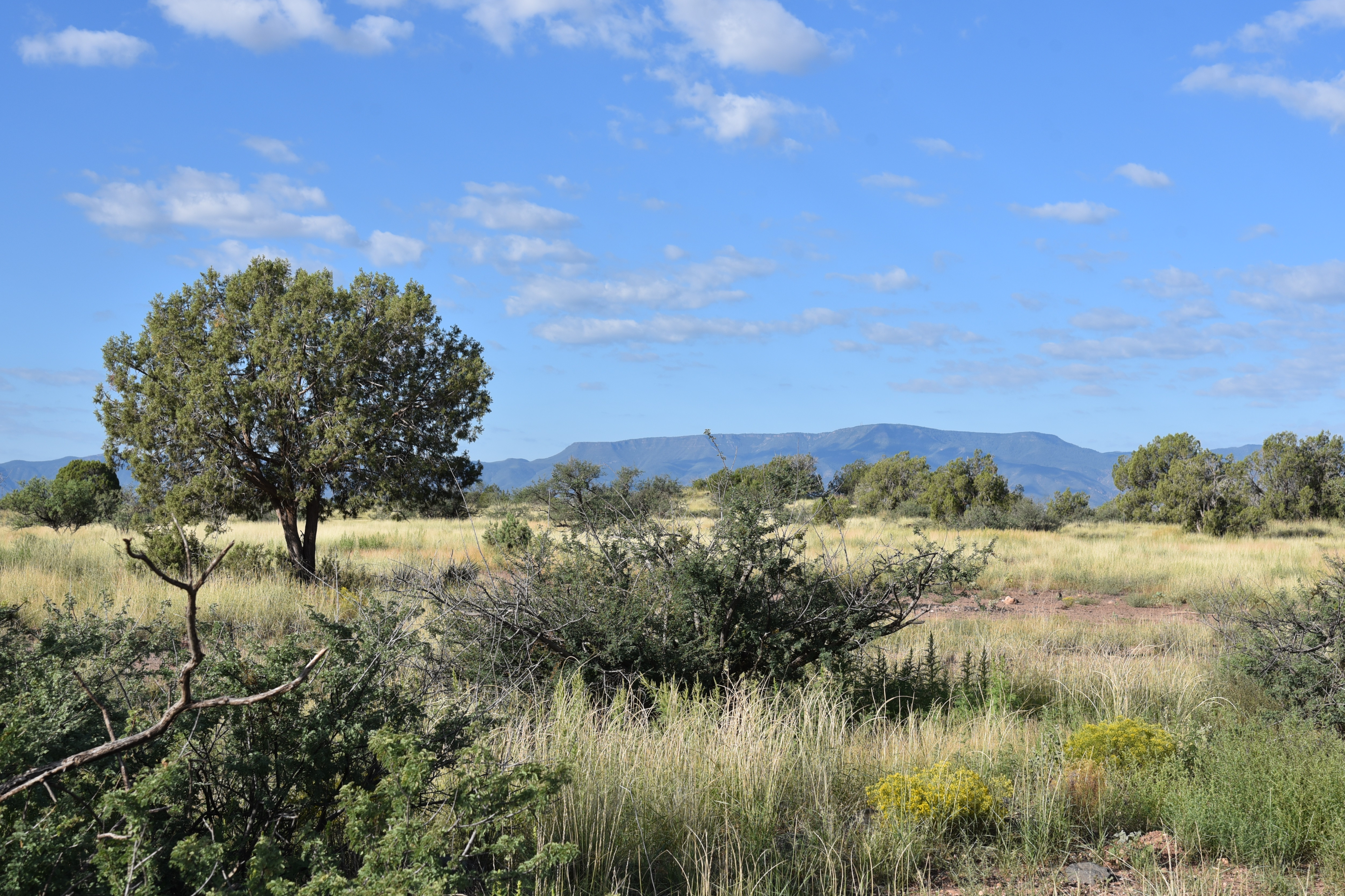
At the 2.2-mile point, where Forest Road 142G spins off to the left, Ponderosa pines and Gamble oaks encroach upon the juniper grasslands, taking over the landscape with a woodsier atmosphere. This trip continues straight ahead on FR667 (not signed) to the hike’s  highest elevation where first peeks of the massive gorge of West Clear Creek can be seen at the edge of Rim Tank Basin. 
Bradshaw Mountains over Salmon Lake Basin

This scenic viewpoint with silhouettes of 7,307-foot Apache Maid Mountain and 6,674-foot Buckhorn Mountain dominating the horizon, marks the descent into the basin’s verdant, drainage-carved woodlands. At the bottom of the first dip, Forest Road 677B heads off to the  right. FR 677 veers left and swings by a linear wildlife water tank contained by an earthen dam before making its final descent to a bucolic scene anchored by the reflective pool of Rim Tank and hike’s premier attraction at the edge of West Clear Creek Wilderness.
Ponderosa pines shade the last mile of FR677

A pastoral scene in Rim Tank Basin

Roughly paralleling State Route 260, but not easily seen from the road, the long, 13,600-acre wilderness waterway runs east-west from Bull Pen Ranch in the high desert Verde Valley to the pine swaddled headwaters of Clover and Willow Creeks on the Mogollon Rim.

Wildlife waterhole on FR 677 near FR677B

A maze of footpaths and roads lead to the chiseled chasm. Popular hiking routes include the West Clear Creek trail—a wet-boots hike that traces the creek’s west end—and the Maxwell, Calloway and Tramway trails that make short, insanely steep descents into remote finger canyons on the Rim. Additionally, a web of dirt roads—like FR 677-- creep up to promontories overlooking the vast water-sculpted wilds for big-picture looks into the enormity of the water-carved wilderness. 

Gamble oaks along FR 677

Corral in Salmon Lake Basin

Annual goldeneye color the landscape through October


Forest Road 677 culminates at a spectacular ledge that hangs more than 1,000 feet above the midsection of the West Clear Creek Wilderness.

The rocky perch teeters over talus slopes spilling from eroding canyon walls. A sugar dusting of junipers protruding from the wreckage--their roots holding tenuous grips—form spotty curtains of green among rock slides and broken clefts. It’s a breathtaking finale to a hike that starts with a sputter and ends with a bang.

Alligator junipers grow large in Salmon Lake Basin

LENGTH: 7 miles round trip (out-and-back)

RATING: moderate

ELEVATION: 5,905 – 6,252 feet (876 feet of accumulated elevation change)

GETTING THERE:

From the Interstate 17 in Camp Verde, take the State Route 260 exit 287 and travel 24.8 miles east (toward Payson) on SR 260 (Zane Grey Highway) to Forest Road 677 on the left at milepost 243.  This is just before where a power line crosses the highway. Park in any of the of the nearby dirt road pull outs or behind the cattle guard gate (close it behind you).

Thursday, September 22, 2022

Ranch Loop

RANCH LOOP

Bear Mountain in Sedona seen from FR 761B

Sedona’s back roads provide pleasantly uncrowded alternatives to traditional hiking trails. 

Wildlife water hole along FR 761B

Open to motorized use, the Ranch Loop circuit west of town is also a great place to camp and walk in the high desert. 

Route briefly parallels the Lime Kiln Trail

Situated between the iconic red rock formations of Sedona and the broad skyline of the Bradshaw Mountains, Ranch Loop uses Forest Roads 525, 761B, 761, 525A, and 525C for a striking hike through rangeland and creek courses. While the route sounds complicated on paper, it’s not difficult to follow.
Ranch Loop is easy to follow

Bright sign posts mark the way throughout. Beginning at the signed juncture of FR 525 and 761B, the route winds through sun baked Coconino National Forest grasslands with mountain views all around.
Cottonwoods & willows line Coffee Creek

 
On the northwest horizon, the hulking silhouette  of Bear Mountain rises over golden fields while the western front is  filled with the hazy forms of Mingus and Woodchute mountains in Prescott National Forest.  In the south, the elongated slope of House Mountain volcano paint a haunting backdrop.
Great mountain vistas seen throughout the hike

Mostly treeless and exposed to mountain crosswinds, the route changes its colors where it passes by a wildlife water hole and crosses the courses of Spring and Cherry Creeks. The pebble-strewn channels and the pond which is contained by an earthen dam, are cluttered with thick stands of willows, cottonwoods and mesquite trees.  Where the route briefly parallels the cairn-marked Lime Kiln Trail, a smattering of roadside ranch relics begin popping up. 
Spring Creek bisects the route

Rustic fencing, barbed wire and a metal tub stand among tangles of cactus and cat claw. 
Cattle guard at the base of a limestone knoll

House Mountain volcano viewed from the trail

The forest service describes the Ranch Loop as a 6.5 mile trip, but that distance doesn’t include the 2.5-mile leg on FR 525c/525 needed to close up the loop.

Mingus Mountain rises over juniper-dotted plains

 
Rock spires of Sedona on the horizon

The tie-up leg comes just beyond the Windmill Ranch site (private property) where the route meets Forest Road 525C, where hikers must head right (east), hike a half-mile to FR 525, then turn right again for the final 2-mile walk back to the trailhead.
An earthen dam contains this water hole

Pronghorn bolt across an open pasture

LENGTH: 9 miles

RATING: moderate

ELEVATION:  3,768 – 4,100 feet

GETTING THERE:

From the State Route 179/89A traffic circle in uptown Sedona, go 9.7 miles west (left toward Cottonwood) on SR89A to Forest Road 525 (Loy Butte Road) on the right. Turn onto FR525 and go 0.5-mile to the Ranch Loop sign at Forest Road 761E.  There are two designated parking areas before the Ranch loop sign. There are many new dispersed camping sites in the area. Please park, stage and camp only in these designated areas.

INFO & MAP:

https://www.fs.usda.gov/recarea/coconino/recarea/?recid=82742

Monday, September 19, 2022

Honeybucket Loop

HONEYBUCKET LOOP

Prescott National Forest.

View of Granite Mountain from Honeybucket trail

At its core, the Honeybucket Loop is a mashup of old forest roads and adopted social paths tied into a hiking trail.

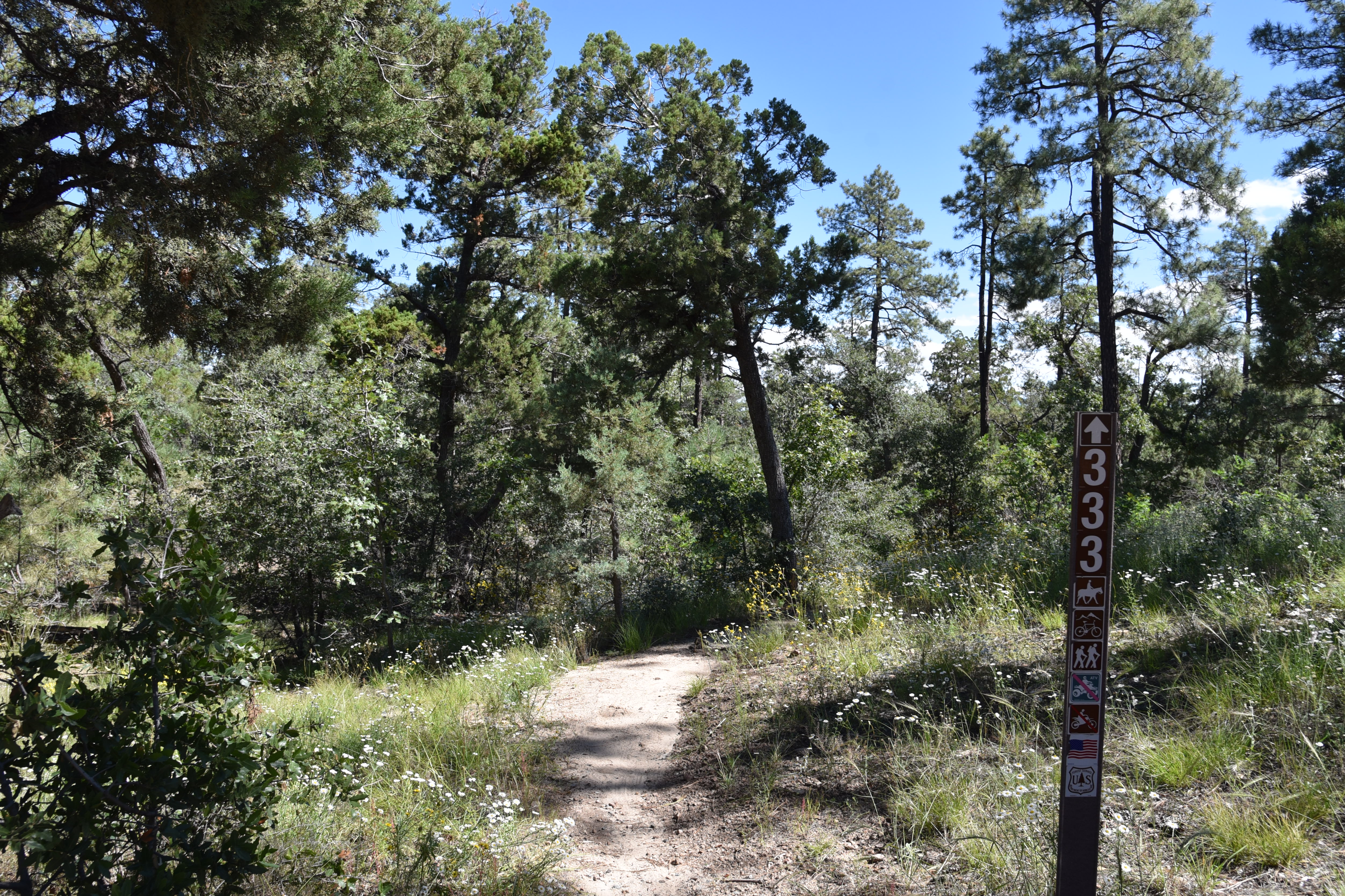
The loop is well signed throughout its 4.6-mile course

 
At its heart, its arguably one of the prettiest little strolls in Prescott National Forest. The route delivers generous servings of mountain vistas, shady forests, interesting geology and late summer wildflowers. It’s a true sweet spot among the dozens of trails that weave through the woodlands around Prescott’s Thumb Butte.
Western dayflowers bloom August - September

The loop is a perennial offering on the Highlands Center for Natural History annual Hiking Spree event. The Hiking Spree challenges hikers to complete 8 out of 10 selected treks over the course of 3 months for a chance to be entered into a prize raffle and purchase a commemorative medallion upon completion.

Thumb Butte peeks through pines on Honeybucket

From a slightly out-there trailhead off Thumb Butte Loop Road just 6 miles west of Downtown Prescott, the circuit begins with a 1-mile walk on the Honeybucket trail #333. 

Western yarrow blooms June - September

Weaving among granite outcroppings and stands of ponderosa pines, this warmup section is ablaze in late summer wildflower color.
A boulder passage on Honeybucket trail

Fleabane, goldenrod, tansyleaf aster, western dayflowers, brickellbush, yarrow, thistle and groundsel add sprinkles of yellow, blue, purple and white in sunny spots. 
Prescott Circle Trail Connector has big views

First peeks at iconic Granite Mountain (7,295 feet) emerge at about the half-mile point where the trail bends northward picking its way through thick scrub and massive alligator juniper trees. The loop portion of the circuit departs from the Thumb Butte Bypass Trail #326 junction. 
View of Granite Mountain from Thumb Butte Bypass

Alligator juniper on the Thumb Butte Bypass

From the junction, continue hiking on Trail #333 as it makes a mild descent toward Butte Creek through a more open terrain with see-forever views of the Sierra Prieta mountain range.
Fleabane decorate the loop May - October

 
Trailhead is a dirt pull off on Thumb Butte Loop Road

The trail traverses green gullies and drainages before meeting up with the Prescott Circle Trail Connector Trail #322.  Go left at the junction and follow this 0.7-mile segment while watching for fleeting glimpses of Thumb Butte ( 6,514 feet) and the Williamson Valley that peer out between breaks in tree cover.  The last arc of the loop starts at a major intersection where the circuit heads left on the Thumb Butte Bypass Trail #326. 
The circuit crosses ravines and drainages

Arizona thistle blooms May - October

This 0.6-mile segment follows an old dirt two-track that makes a gradual climb beneath a pine-oak-juniper canopy with fields of hip-high grasses tangled with blooming shrubs lapping at the ankles.  More peeks at Granite Mountain and Thumb Butte punctuate the skyline before the trail reconnects with the Honeybucket trail for a rewind back to the trailhead. While it’s short and just moderate in its physical demands, the Honeybucket loop never scrimps on visual richness, making it a fine choice for appreciating the flora and mountain terrain of Prescott forests.
Wildflowers blanket a section of Honeybucket trail

LENGTH: 4.6 mile loop

RATING: moderate

ELEVATION: 6,094 – 6,400 feet (703 feet of accumulated elevation change)

GETTING THERE:

From Courthouse Plaza in downtown Prescott, go west on Gurley Street , which turns into Thumb Butte Road.  Continue 5.2 miles, passing the Thumb Butte and White Rock trailheads, to Thumb Butte Loop Road (Forest Road 373) on the left. Follow FR 373 for 1.6 miles to the turn off for Forest Road 51 on the left where there’s a dirt parking apron at a Trail 333 sign.

Thumb Butte Loop Road is washboard rough with some potholes but is passible by most carefully-driven vehicles. The road is not maintained in winter.

INFO:

https://highlandscenter.org/hiking-spree/

https://highlandscenter.org/wp-content/uploads/Honeybucket.pdf