Find A Trail. Start Your Search Here:

Monday, May 20, 2019

BAKER BUTTE

BAKER BUTTE
Lilacs frame Baker Butte fire tower on the Mogollon Rim
A hike up to Baker Butte culminates at an idyllic, pine-shaded pinnacle. Swarms of hummingbirds whip through lilac-scented air and masses of ladybugs cling to trees, shrubs and knee-high wildflowers.
Fire lookout Shirley Payne and her horse Rameses.
Nearby, a horse chomps hay in a makeshift corral while a friendly black Labrador retriever noses a tennis ball. Perched on a knoll at the edge of the Mogollon Rim, the mood surrounding the Baker Butte fire tower is as calm and pastoral as a romantic passage in a Victorian novel.

Pine thermopsis (golden pea) bloom April - July
But this enviable life removed from city heat, traffic and noise belies a very serious purpose.
“Are you coming up?” The voice of fire lookout Shirley Payne broke the silence as she called down to me and my hiking partner from the catwalk of the 30-foot-high tower. “Oh, yeah,” was my no-brainer answer.  Payne, who has worked in the tower for 23 years, welcomed us with a plate of fresh-baked poppy seed muffins.
Payne's dog Jeffrey takes a break near the corral.
The tower is located near the western edge of Rim Road (Forest Road 300)--a 51-mile dirt route that runs between State Route 87 south of Clints Well to State Route 260 near Forest Lakes. Rim Road makes for an iconic scenic drive for anybody with a high-clearance vehicle and the fortitude to endure some queasy, edge-hugging sections. Of the many Coconino National Forest fire lookout towers that dot the Rim, Baker Butte is one of the easiest to reach on foot. For a moderate 3-miler, park at Baker Lake (usually not more than a soggy bog) at the junction of FR 300 and SR 87 and hike 1.2 miles on FR 300 to Forest Road 300B (the road to the lookout) where there’s a parking area for the General Crook Trail, then continue 0.4-mile uphill to the summit. The summit road passes through archways of Gambel oak trees, pines and Douglas firs. Fringed with ferns, raspberry brambles and colorful spreads of Canada violets, Pine thermopsis, sandwort and wild strawberries, the road twists uphill in long loops landing at the base of the fire tower.
Views from tower catwalk stretch from Flagstaff to Tucson
The tower, which earned a spot on the National Historic Lookout Register in 2006, wears its heritage well. Constructed with a not-so-subtle blend of original, repurposed and new building materials, the practical yet homey loft is softened by Payne’s collection of quilts, plants and mementos.  Neatly arranged instruments, radios, binoculars and maps speak to the intense, sometimes harrowing, work of fire spotting and coordination of incident response teams—the daily grind of a fire lookout.
Thick tree cover on the summit road hike.
The long-gone original tower cabin that was built in 1921 was replaced in 1937 with the present 12’ x 12’ model that’s perched on a metal skeleton with wooden stairs. The catwalk was added in 2009 and various upgrades to walls and windows surround a floor covered in speckled, cracked linoleum that smacks of mid-century utilitarianism.
Copies of Payne’s book, Baker Butte Journal 2010, sit near the guest register. Well worth its $20 sale price, the photo-rich volume presents a slice-of-life account of a season in the tower. It's packed with play-by-play descriptions of wildfire response, turbulent mountain weather, recipes and the misadventures of “cidiots” (visitors from cities with irresponsible forest habits) who litter, cause damage, raise hell and sometimes need rescuing.  A stroll around the catwalk reveals see-forever vistas. On most days, the peaks of Flagstaff, Williams and the White Mountains can be seen with the naked eye standing over seas of Ponderosa pines. On the best days, Picacho Peak and Mount Lemmon in Tucson show their silhouettes 200 miles to the south. 
Jeffrey is always ready for a game of fetch
Payne offers fresh-baked muffins to tower visitors.
Below the tower, a tiny cabin serves as Payne’s home for six months (usually May – October) each year. Draped in lilac bushes that were planted in the 1980s, the ad hoc abode has been expanded, adapted and upgraded over decades of use.
Hummingbirds gather at feeders placed around the tower
Tools of a fire lookout's trade.
The sunny kitchen was salvaged from a Depression Era Civilian Conservation Corps camp at Mormon Lake and repurposed into a compact, fully-equipped work space (with hot and cold running water to boot) where Payne cooks up her culinary specialties like the yummy muffins she serves visitors.  Some of her recipes use wildflowers and berries harvested from the forest.
Payne's book describes her experiences working in the tower
Outside, an array of hummingbird feeders attract several species including the Broad-tailed, Rufous and Magnificent. During summer, flocks of the glinting little birds can drain a feeder in just hours, which keeps Payne busy with refill runs up to three times a day. In addition to the elk, chipmunks, turkeys, western tanagers and deer that hang out around the tower, Payne keeps two special four-legged helpers at her mountain top work environment. Rameses, a 21-year-old Missouri Fox Trotter--a gaited breed (horses with a sure-footed, rhythmic stride) who loves mint candy treats, and Jeffrey, a friendly  3-year-old black lab with a fetch fetish and boundless energy provide companionship and assistance. 
Raspberry brambles produce fruit in late summer
During fire season, the Baker Butte tower is open to the public between 8:00 a.m. and 4:30 p.m. when Payne is on duty and closed for lunch between noon and 1 p.m.
The cabin kitchen was salvaged from a CCC camp
Canada violets bloom April - September
As Arizona heads into another fire season, forest visitors should respect fire restrictions and safety protocols. The last thing any fire lookout wants to see is a plume of smoke drifting skyward from a human-caused blaze.  When visiting a fire tower, please observe proper etiquette.

• Respect visiting hours. Do not attempt to enter a tower when no lookout is present.
• Wait to be invited. Lookouts may not allow visitors when monitoring an active fire incident.
FR 300B begins across from a General Crook trailhead
• Lighten up. Leave bulky packs and trekking poles behind. Tower stairs are narrow and space is tight inside.
• Ask permission before taking photos or approaching companion animals.
• Listen up. Follow the lookout’s instructions and don’t touch instruments. 
• Learn something. Ask questions. Most lookouts are veritable founts of knowledge about the forests they watch over.
Begin at Baker Lake (bog) for a 3-mile hike to the tower.

LENGTH:  3 miles roundtrip from Baker Lake or 0.8 mile roundtrip from the General Crook trailhead.
RATING: moderate
ELEVATION:  7430 - 8074 feet from Baker Lake or 7866 – 8074 from General Crook trailhead.
GETTING THERE:
From the State Route 87/260 junction in Payson, go 28 miles north on SR 87 to Forest Road 300 (Rim Road) located just past milepost 281.
Option 1: Park in the dirt turnouts on Rim Road near Baker Lake just a few yards in from SR 87.
Option 2: Follow FR 300 (make a sharp left at a Y junction at  0.1-mile)  1.2 miles to the Baker Butte Summit Road (FR 300B). There’s parking directly across from the summit road in the General Crook trailhead. Forest Road 300 is bumpy dirt but passable by passenger cars.
INFO:
Fire Management Coconino National Forest
-->

Monday, May 6, 2019

WALNUT CANYON RIM

WALNUT CANYON RIM
Vista point on Passage 31 of the Arizona Trail
Arizona Trail Passage 31 runs for 17.9 miles between Marshall Lake and Interstate 40 southeast of Flagstaff.  Because it’s one of the shorter of the 43 passages that make up the 800-mile, state-traversing route, strong hikers can complete it in a day. Blasting through the entire section in a day makes for an epic trek, but numerous access points along the route provide ways to create abbreviated hikes that sample some of the most gorgeous slices of this high-country path.
Arizona valerian grow on moist slopes
The hike traces the rim of Walnut Canyon in Flagstaff
One to try begins at dirt parking apron along Old Walnut Canyon Road.
The moderate trek in Coconino National Forest links wildflower meadows, pine-oak woodlands, a dip into a tapered canyon and amazing vista points overlooking Walnut Canyon National Monument-- a 3600-acre site that protects archeological and natural resources--for a varied, moderate hike. 
The trek begins on a wide, flat path that weaves among pine groves and meadows with glimpses of antenna-cluttered Mount Elden (9298’) to the north.  
The rich soil and sun exposure foster acres of colorful wildflowers like stemless daisies, lupine and paintbrush.
At the 0.4-mile point, turn right at the Campbell Mesa Trails sign and continue on a mild uphill path. Just beyond a wildlife water hole, the trail meets a set of switchbacks carved from limestone escarpments that mitigate a descent along the canyon walls.  Hanging close to the edge, the slim trail passes among rock overhangs and clusters of yucca that cling precariously to cracks in the stony substrate. As the trail dives deeper into the canyon, enormous “yellow bellies” (mature Ponderosa pines that have developed a scaly, yellowish-brown bark) filter sunlight while rangy snags (dead, standing trees) attract insect-seeking birds and nesting critters. While passing through this enchanted forest, be sure to stop and smell the yellow bellies. 
A lupine about to bloom on the Arizona Trail
Their sap has an aroma that’s been described as butterscotch, vanilla and cherry. (My personal take on this fragrance is a top note of sugared cedar, a heart of moss and a base note of patchouli.)   In moist areas under the trees, look for tiny pink Arizona valerian flowers.  The tubular clusters can be seen poking out from blankets of pine needles through early summer.
Brilliant paintbrush are common bloomers along the AZT
Several spur paths lead to scenic points above Walnut Cny.
The short canyon section ends with a climb back up to the rim where the first vista point junction appears at 2.2-miles. To visit the scenic ledge, head left and hike the 0.2-mile spur to a promontory at the western edge of the national monument. Here, a fringe of conifers frame views of a heavily-forested bend in the meandering canyon. It’s a 300-foot drop from the breezy rim to the canyon floor with no guardrails to stymie a stumble.
Stemless daisies bloom in sunny meadows
So, explore carefully before retracing your steps back to the junction and continuing 1.1 mile on to the next vista detour where a 0.6-mile spur leads to more big sky panoramas and impressive canyon views. 
A pine shaded meadow along the route.
If you’re up for more, there are two more vista points before the trail moves off the rim.
Switchbacks mitigate a descent into the canyon
A wildlife water hole on the Arizona Trail
One is located another 1.1 miles down the trail while Fisher Point, the most famous of them all, marks the end of the tour 6.4 miles from the trailhead.
Stop and smell the yellow bellies
Yucca sprout from the craggy canyon walls
Limestone slabs and overhangs line the route
The trail hugs the canyon edge
LENGTH:
To the first vista point and back: 4.8 miles
To the second vista point and back: 7.8 miles
To Fisher Point and back: 12.8 miles
RATING: moderate
ELEVATION: 6613 - 6920 feet  to second vista point, (7033' to Fisher Point)
GETTING THERE:
From the Interstate 17/40 junction in Flagstaff, go 5.4 miles east on I 40 to exit 201 (Country Club Road). Turn right and  go 0.9-mile south to Old Walnut Canyon Road (Forest Road 303, turn left and continue 2.7 miles to the parking area on the right.
Snags (dead, standing trees) attract wildlife
The hike begins at the small Arizona Trail sign on the south side of the road. The last 0.3-mile is on rough dirt best suited for high-clearance vehicles.
INFO: Arizona Trail Association

Monday, April 29, 2019

Kendrick Park Watchable Wildlife Trail

Kendrick Park Watchable Wildlife Trail
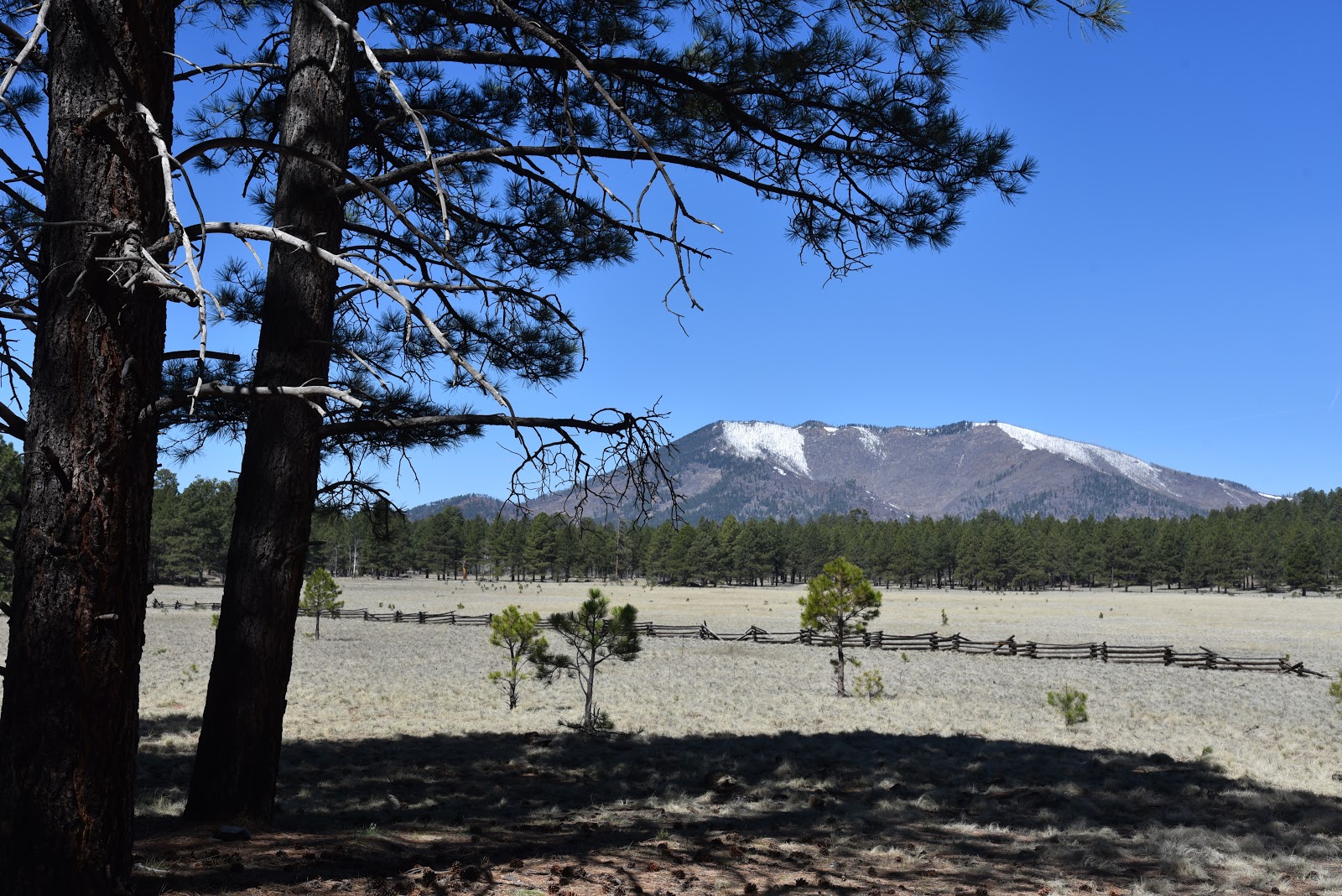
Kendrick Peak seen from Kendrick Park
To young children, traveling the stretch of U.S. 180 that runs between Flagstaff and the south rim of the Grand Canyon can feel like being trapped in a careening container with few sights that appeal to kiddie sensibilities.
A  Ponderosa pine tree provides cover for wildlife viewing
Electronic devise-enabled distractions only last so long before cries of ‘are we there yet’ and ‘I have to go potty’ demand a break from the drive that flows between pine forests and the desert plains of the Colorado Plateau. 
Aspen regeneration project along the outer loop.
The fix is a stop at Kendrick Park Watchable Wildlife Trail.  Complete with walking paths and a restroom, the site that sits on 2000 acres roughly 20 miles north of Flagstaff offers a chance to stretch legs, decompress and maybe learn a thing or two.   The U.S. Forest Service property has two short loop trails that explore biologically diverse spaces in alpine meadows, pine woodlands and aspen glens with excellent views of the San Francisco Peaks (12,633 feet) and Kendrick Peak (10,418 feet).  The quarter-mile short loop is paved and suitable for strollers and wheelchairs while the 1.2-mile outer loop follows a flat dirt trail. 
The San Francisco Peaks soar to 12,633 feet.

Many teaching moments punctuate the hike.
Both paths are outfitted with interpretive signs that describe fascinating facts about the area’s plants, animals and history. 
Two easy loop trails explore the property.
The compact system is packed with points of interest. An abandoned potato field, corral and campsite document some of the surprising ways people have used the land in the past.  Along the outer loop, an aspen recovery area at the edge of sprawling grasslands and signs that explain how wildfires have impacted the landscape illustrate the complex forces that continually shape the delicate ecosystems.  Of course, the big draw here is the opportunity for real-time wildlife viewing.  To optimize your chances of seeing animals wandering in their natural habitats, experienced viewers recommend the following tips.
Fremont barberry grows along the trails.
The outer loop passes through a beautiful aspen grove.
The family-friendly 0.24-mile short loop is barrier-free.
Signs invite visitors to immerse in the experience.
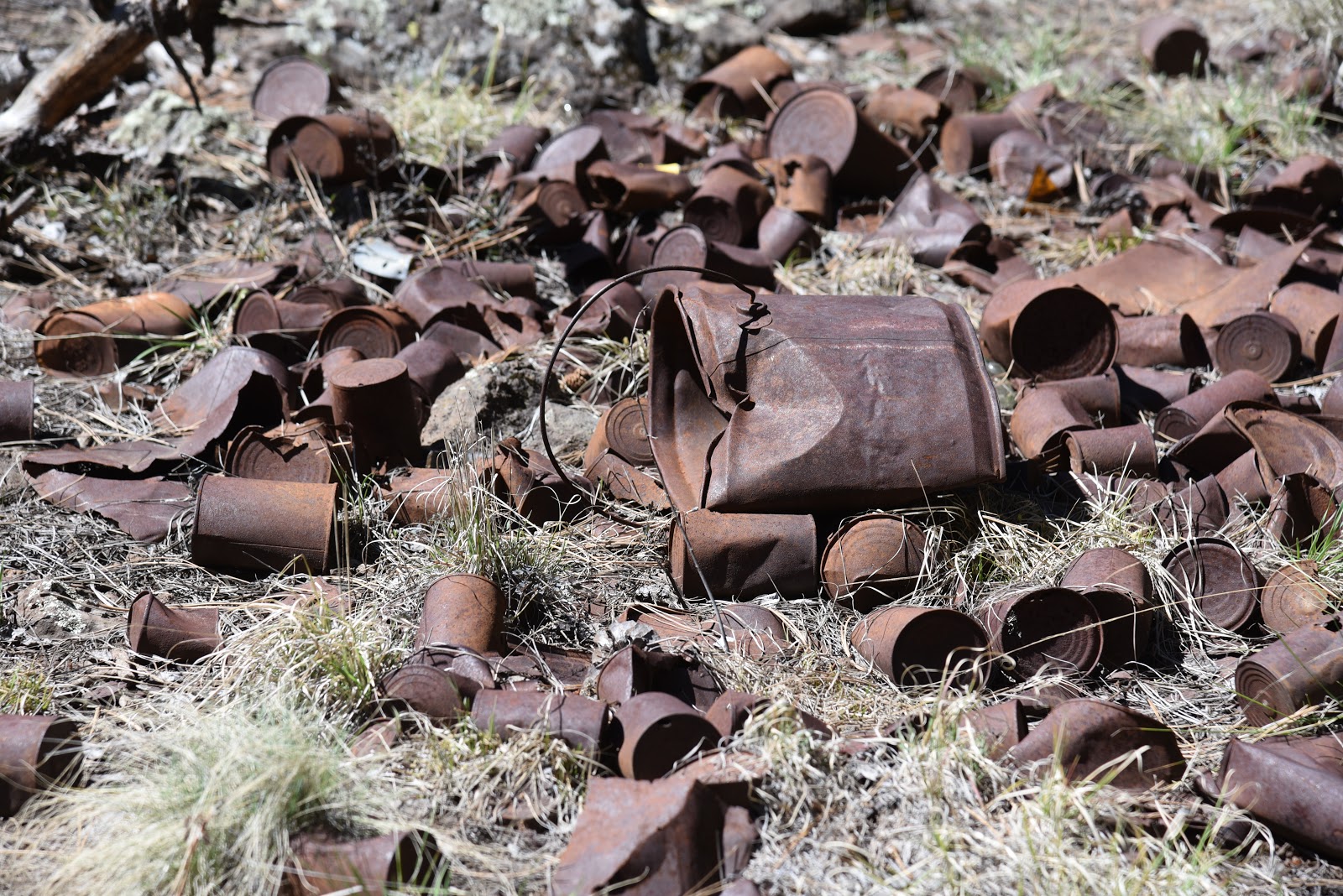
Interesting relics at an abandoned camp site.
• Plan your timing. Wildlife is most active at dawn and dusk.
• Be invisible. Stay quiet, wear neutral colors and avoid using scented products like perfume, lotion and strong laundry additives.
• Be patient.  Sit quietly behind a tree or rock and wait for animals to appear.
• Observe from a distance. Keep wildlife wild by giving them their space. Never harass, feed, or handle wildlife.
When explored quietly and with respect, the trails at Kendrick Park extend a rest stop into an entertaining, educational tour of a northern Arizona wildlife stomping ground with tantalizing backstories and myriad mini lessons built in.
LENGTH: 1.5 miles for two loop trails
RATING: easy, the short loop (.25-mile) is barrier-free
ELEVATION: 7862 - 7915 feet
GETTING THERE:
From Flagstaff, go 20 miles north on U.S 180 to the trailhead located between mileposts 235 and 236 on the west side of the road.
There is a restroom, but no water at the trailhead.
INFO:
Arizona Watchable Wildlife Experience:
Coconino National Forest:
--> -->

Monday, April 22, 2019

CEDAR MESA

Cedar Mesa, Tonto National Forest.
Mogollon Rim seen from Forest Road 322
Cedar Mesa is the kind of place you just don’t stumble upon. The desolate, flattop spread resides at the end of a ridiculously undulating road at the base of the Mogollon Rim south of the community of Pine.  
Gate on Cedar Mesa
It takes effort to get to it but the payoff is a pleasant, uncrowded diversion from the old standard hikes in the area.
Milk Ranch Point, a prominent nose on the Mogollon Rim
The hike follows Forest Road 322 that begins at a dirt pullout along heavily-travelled Control Road (Forest Road 64) near where numerous trailheads and cliff-climbing routes provide connectivity with major travel corridors.
Hikers walk the rough road to Cedar Mesa
The road is an easy snare for curious hikers wondering where the heck it goes. Open to both motorized and foot travel alike, the rough dirt two-track in Tonto National Forest reveals its colors immediately with a steep ascent to a crest where visitors are treated to the first set of magnificent views and a welcome breath-catching moment.
The hike’s ubiquitous landform is the imposing rock jetty of Milk Ranch Point, that towers to over 7400 feet. Patches of vivid green foliage clinging to its escarpments expose the locations of Red Rock and Pine springs that serve as reliable water sources along Highline Trail which is part of the state-traversing Arizona Trail. From here, the climb continues on a milder slope, gradually exposing bigger and better vistas of the Mogollon Rim--a wall of uplifted rock that spans roughly 200 miles from New Mexico to the Sedona area.
Follow the fence line on Cedar Mesa to extend the hike
Although the difference between the hike’s high and low points is only 358 feet, the out-and-back route’s constant ups-and-downs adds up to more than 1000 feet of elevation change. As the road moves southeast through forests of cypress, pinion pine and a fringe of manzanita, the peaks of the Mazatzal Mountains appear as hazy purple mounds on the western horizon.
A baby horned lizard blends in with the local rocks.
At the 1.2-mile point, the route heads left at a 3-way junction where the road narrows as it descends through a rocky corridor fringed with scrub oak, Alligator junipers and a smattering of Ponderosa pines.
Mazatzal Mountains on the horizon
This is where the first good glimpses of the destination come into view---a low slung mesa fleeced in conifers with three quad-burning dips-and-climbs in between. From here, the Payson airport, a brush pit and the chiseled watershed of the East Verde River and its tributaries are visible to the south. Once over the last major hump, the trail emerges on Cedar Mesa proper, encountering a gate at the 2.6-mile point.
Hikers contemplate the undulating route.


The hike features beautiful Rim Country views
 Although the road disappears beyond the fence, it’s possible to extend the hike by exploring on the irregular-shaped mesa that’s just over a mile across.  Vegetation on the sparse, breezy plateau is a homogeneous labyrinth of junipers, so a good sense of direction or GPS skills are essential to avoid getting lost. An easy way to wander and stay found is to follow the barbed wire fence line that encloses the summit for more spectacular Rim views from a seldom-visited, hard-won platform.
The route has many ups and downs.
LENGTH:  5.2 miles roundtrip
RATING: moderate
ELEVATION: 5495 – 5853 feet (1183’of accumulated elevation change)
GETTING THERE:
From the junction of State Routes 87/260 in Payson, go 12 miles north on SR 87 to milepost 265 (2 miles north of Tonto Natural Bridge State Park), turn right on Control Road (Forest Road 64) and continue 0.8-mile to the parking pull out at Forest Road 322.   


Monday, April 8, 2019

Cibola Pass-Jordan Trail Loop

Cibola Pass-Jordan Trail Loop
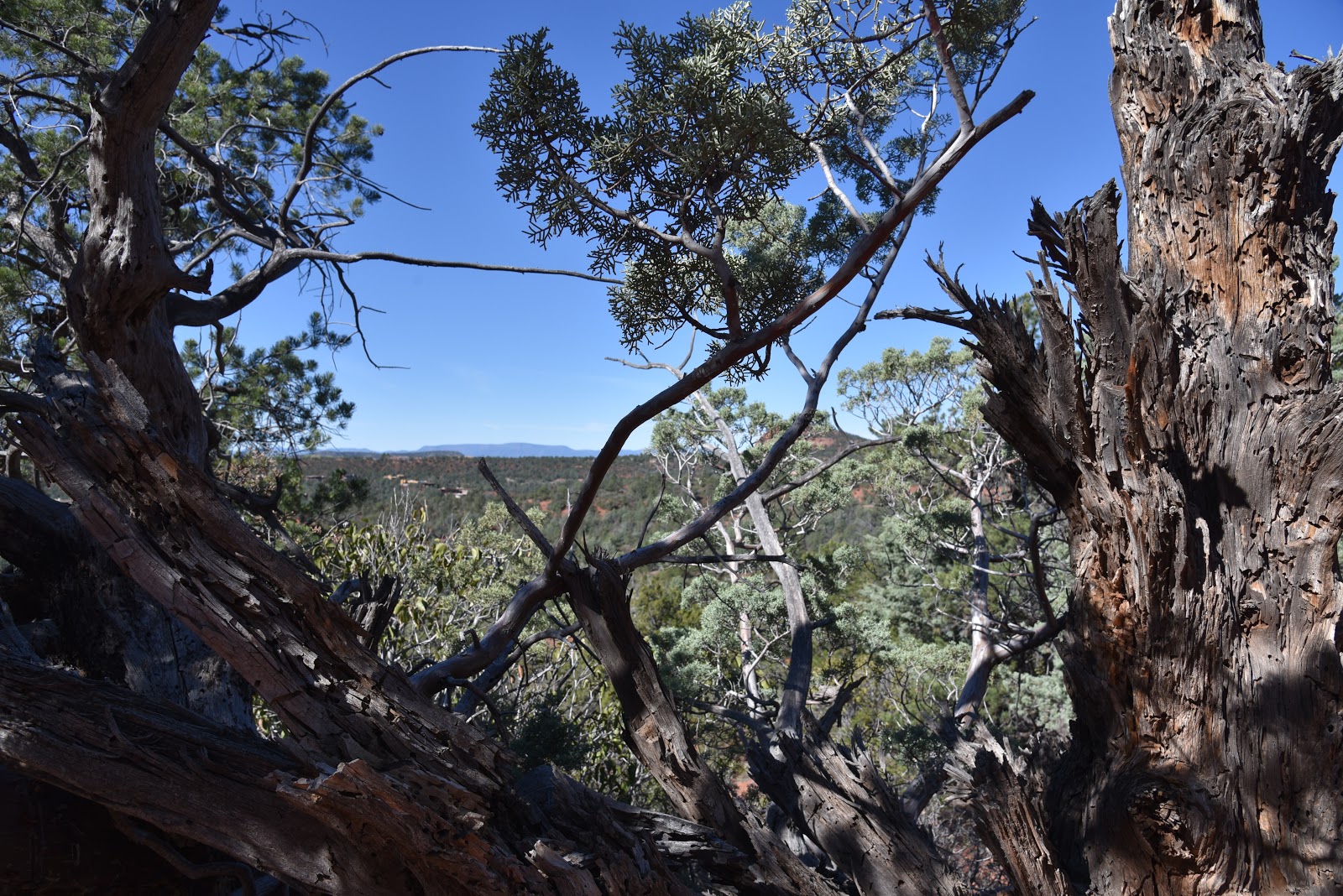
A juniper-framed view on Cibola Pass Trail

Mitten Ridge formations seen from Cibola Pass Trail.
As implausible as it may seem, some people driving through Sedona are in a hurry. It happens, though, but it’s no excuse to forfeit a hike in order to beat the traffic or catch a flight.  Many of Sedona’s trails offer drive-up-and-hike convenience and clever connectivity that accommodates those who have only a couple of hours to indulge in a picture-perfect jaunt.  Take, for instance, the Cibola Pass-Jordan Loop.
Sugarloaf and Chimney Rock seen from Jordan Trail.
When hiked from the Jim Thompson trailhead that’s located just a short drive from Uptown Sedona, this heavenly trek that slices through forests at the southern edge of the Red Rock Secret Canyon Wilderness, gets you in-and-out of the good stuff pronto.  
Huge agaves grow along the route.
As the average hiker moves at about 2-3 miles per hour, it’s possible to whip through this 2.2-mile circuit in just over an hour—provided you can limit ogling and photo stops. The hike scrimps on length but splurges on scenery and workout value.  From the parking area, start hiking at the Cibola Pass post near the fee pay station. Continue a few yards to a three-way junction and continue straight ahead on the Cibola Pass trail. Hiking the loop in this direction gets the steep climbing out of the way within the first half-mile.
A shady spot on the Jordan Trail
The abrupt but not-too-difficult climb is a mashup of switchbacks and flat rest areas overlooking the deep cuts of Mormon Canyon and layers of sheer wilderness mesas.  The signature feature along this section is the hand-shaped, russet stone tower that caps Mitten Ridge.
A scenic point on the Jordan Trail
The route makes a brief passage though the wilderness area on slickrock slopes with stunning juniper-framed views before dipping into a shady drainage.  At the 0.7-mile point, the circuit meets the Jordan Trail junction.
A slick rock passage on the Jordan Trail
Time permitting, take an optional 0.6-mile roundtrip venture, by heading right to see Devil’s Kitchen—an impressive sandstone sinkhole.  To stick with the quick-trip plan, go left at the junction and make a swift ramble on the Jordan Trail through a 1.5-mile pocket of fragrant cypress, giant agaves and oak-fringed bluffs. You’ll be back at the trailhead in a flash with dusty boots and time to spare.
Goodding's Verbena blooms April through September.

LENGTH: 2.2 miles
RATING:  moderate
ELEVATION:  4520 – 4682 feet
GETTING THERE:
Jim Thompson Trailhead:
From the State Route 179/89A traffic circle in Sedona, go right onto 89A and continue 0.3-mile to Jordan Road on the left. Go 0.8 mile on Jordan Road, turn left onto Park Ridge Dr. and continue 0.5-mile to the trailhead on the right. The last half mile is on a gravel road with potholes but is suitable for all carefully driven vehicles. A $5 Red Rock Pass is required.  There is a restroom and a pay station at the trailhead.
INFO:  Coconino National Forest
Red Rock Pass Information:
-->