Find A Trail. Start Your Search Here:

Monday, April 30, 2018

FLAGSTAFF'S FAY CANYON

FLAGSTAFF'S FAY CANYON
Fay Canyon
Not to be confused with the Fay Canyon Trail in Sedona, Flagstaff’s version is a totally different experience. The meandering trail that follows the course of a gully that feeds into majestic Walnut Canyon southeast of town is a mellow, woodsy walk.  Located just east of the heavily-traveled Sandy’s Canyon trail off Lake Mary Road, the Fay Canyon route is a quieter trek with similar qualities.  
Creeping Barberry
The unsigned route is a little tricky to follow. Hike up Forest Road 9477B to the 0.3-mile point, veer left at a gate and pick up a single track heading north.  For reference, there’s a sign warning of heavy horse traffic a few yards down the trail. 
A ravine bisects Fay Canyon
Within a short distance, the trail makes a sharp turn to the right and begins a downhill plunge on long switchbacks.  This piney segment decends on an easy grade to emerge in at the head of the canyon.  Over the next two miles, the gorge gradually transforms from a steep-walled sliver to a gaping valley. Bisected by a water-scoured ravine, the canyon has horse trails on both banks. These can be confusing, but they eventually merge. Just keep heading north and you’ll be fine. 
Arizona valerian
Along its expanding course, the trail passes by pockmarked limestone cliffs, rock shelves and shallow caves.
Fay Canyon
A closer look at the limestone reveals crystal-filled geodes, entrenched fossils and glinting quartz nodules. 
Tiny crystals in limestone
In moister areas beneath the mixed conifer canopy, an understory of thorny-stemmed wild roses, gooseberries and willows grow in profusion among clumpy grasses and patches of creeping barberry, Arizona valerian and daisies galore.
At the 2.6-mile point, the trail ends in an airy meadow where the Arizona Trail passes through. 
Lizards are easy to spot in Fay Canyon
This is the turnaround point for an out-an-back hike, however, trail signs show distances for continuing to the Flagstaff Urban Trails System, Marshall Lake or Fisher Point.  One fun option is to make the short, but steep walk up to Fisher Point. Known for wild winds that churn up speed as they funnel through a network of forested gorges, the area surrounding Fisher Point is a fascinating enclave of contorted rock formations softened by wildflower fields and swaying pines. 
Dunes beneath Fisher Point
To get to the lookout point 400 feet above the major trail junction, follow the signs 1.2-miles and enjoy the breezy vistas. 
Wild rose
View from Fisher Point
LENGTH: 2.6 miles one-way for Fay Canyon, or 8.2 miles round trip with Fisher Point option.
RATING: moderate
ELEVATION: Fay Canyon : 6,620'-6,950' or 7,033' to Fisher Point
GETTING THERE:
From Flagstaff, go 4 miles south on Lake Mary Road to S. Wildlife Road (at the “Hitching Post Stables” sign).  Turn left and drive a few yards to a “T” intersection, veer left and continue less than 0.1 mile to the sign that reads Walnut-Skunk-Fay Closure Area, No Motor Vehicles.  Parking is very limited.  Please respect private property in the area by not blocking roads or driveways.

Saturday, April 28, 2018

Tinder Fire near Kinder Crossing

R.I.P. Kinder Crossing
Kinder Crossing
Tinder Fire near Kinder Crossing
Horse Crossing on East Clear Creek
All I can say is NOOOOOOOOOOOO! The human-caused Tinder Fire reported on April 27th continues to grow and is under investigation.  The wildfire is burning roughly  9 miles northeast of Clints Well on the Mogollon Rim near Kinder Crossing and Horse Crossing trails. These two lush trails that lead to East Clear Creek are (sorry, were) favorite summer hiking destinations. I am beyond sick to know that a careless person has put this rare riparian corridor at risk.
Kinder Crossing
Let's hope the firefighters working the blaze stay safe and that damage to these classic trails can be minimized.

UPDATES:
https://inciweb.nwcg.gov/incident/5763/
MAP:
http://nifc.maps.arcgis.com/apps/View/index.html?appid=750acd60cd9e466fadbc501df5b4bf1d
Horse Crossing

Monday, April 23, 2018

VAN DEREN CABIN

VAN DEREN CABIN
Van Deren cabin 
“A woman’s bullet kills as quick as a man’s!” These menacing words from a lobby card for the 1948 film, Blood on the Moon, spoils one of the movie’s several twisted story arcs.
Western serial movies don’t get any more typical than this one.
Van Deren homestead
Starring Robert Mitchum and Barbara Bel Geddes (in her glamourous pre-Miss Ellie of Dallas phase) the film’s luscious cinematography features several Sedona locations. 
Despite the film’s period-accurate stilted dialogue, unfortunate stereotypes and marginal production qualities, it’s a captivating tale of a sinister businessman versus a good cowboy (and his “spitfire blonde” love interest---the one with the bullets) who foils an evil plot.
Sure, there are plenty of horses, cattle and smoking-gun action scenes that play out in the pristine Sedona countryside that dominated the area before Sedona became Sedona.  
The road to the cabin crosses Dry Creek
But two things make this celluloid psycho-drama special--Mitchum’s noir-ish swagger and vintage silver screen images of what would become Red Rock Country hiking hubs. Yup, you can hike to two of the film’s focal points--Van Deren Cabin and Cathedral Rock.  While many well-known trails including Templeton and Baldwin lead to the world-famous spires of Cathedral Rock along Oak Creek, there’s only one way to get to the less obvious cabin locale.
Constructed in the 1890s, the two-room abode passed through the hands of various colorful characters including homesteader and cattleman Earl Van Deren.  The cabin’s juniper-shaded enclave on a ridge above Dry Creek is a popular 4x4 destination for local Jeep tour companies. You could shell out for a butt-bruising ride, but a hike by way of two beautiful trails northwest of town is a less jarring, satisfying experience.  
Wooly paintbrush flowers are plentiful on the trail.
Slickrock passage on Chuckwagon Trail


Plaque at the cabin gives an overview of the site's history 
Although much of the land surrounding the cabin is private property, the forest service purchased the sliver of territory around the homestead to preserve it as an historic landmark.  A plaque at the site gives an overview of its moonshine-steeped history of ranching, outlaws, murder and romance.  Some say, a ghost lives there now. Apparently, the true history of the cabin would make quite a good film as well.
View from the cabin site
The least congested footpath to the cabin begins at the Long Canyon trailhead. Hike 1.4 miles on the Chuckwagon Trail to the Brins Mesa junction. Follow Brins Mesa 0.1-mile to where it crosses a dirt road.  Turn left and hike the road 0.3-mile to the cabin.  First glimpses of the famous movie set clash with the foreboding words of another promotional lobby card: “When there’s BLOOD ON THE MOON…Death lurks in the shadows.” Usually, the only things lurking in the cabin's shadows are squirrels and lizards.
View from the cabin site
Chuckwagon Trail parallels Dry Creek
Dust, birds and critters slip through ample gaps in the cabin’s cypress log walls.  A corrugated tin-roof that spans the building’s two rooms and breezeway appears to be the only thing preventing the peeling timbers from collapsing.  The homestead’s roost above the creek surrounded by 360-degree mountain vistas is a Hollywood art director’s dream.  
Cabin is constructed of Arizona cypress logs
Although mid-century tinsel town had a love affair with depicting the Old West through a polished, romantic lens where men wore clean shirts and women were perfectly coiffed, life in the remote cabin could not have been that rosy.  Probably the only common thread between the cabin and the forgotten film in dire need of Netflix resurrection is that both Van Deren and Mitchum won their women in the end.
LENGTH: 3.6 out-and-back or backtrack to the junction and follow Chuckwagon for a 5.2-mile loop
RATING: moderate
ELEVATION: 4480 - 4680 feet
GETTING THERE:
Long Canyon Trailhead:
From the State Route179 /US89A traffic circle in Sedona, go 3 miles west on 89A (left, toward Cottonwood) to Dry Creek Road (Forest Road 152C), turn right and continue 2.9 miles to Long Canyon Road (Forest Road 152D), turn right and go 0.5 mile to the trailhead on the right.
MAP:

Monday, April 16, 2018

CRYSTAL POINT TRAIL

CRYSTAL POINT TRAIL
First glimpses of Sedona on the way up to Crystal Point
Cut into a gentle ridgeline where the red rock marvels of Sedona melt into Flagstaff’s tall pines and mountainous terrain, Crystal Point Trail provides a taste of both worlds.
Franciscan Bells decorate the trail
The trail has been adopted by the Munds Park Trail Stewards (MUTS), an organization that maintains recreational routes around the community.  Thanks to volunteer workers who perform regular maintenance, the trail is neatly brushed, signed and switchback-mitigated.  The non-motorized path makes an easy climb through pine-oak woodlands, meadows and edges bolstered by lichen-encrusted boulders.  Even in dry years, high-country wildflowers like brilliant blue Franciscan Bells add pops of color in sunny spots along the way. The trail’s appeal is rooted in its birds-eye glimpses of Sedona that begin to appear through the trees about a half-mile into the hike. 
Summit ammo boxes hold trail log books for hiker notes
Views of rusty escarpments layered with white limestone that stand above the green valleys of the Verde River watershed gain in scope as the route makes its way to Crystal Point.  
Views of Sedona from Crystal Point
The trail tops out on a knoll at the 1.3-mile point where a picnic table with ammo boxes full of hiker logs invites visitors to stay awhile, enjoy the sights and peruse the inspiring—sometimes weird—comments scrawled in dog-eared notebooks.  While some hikers are satisfied to call this the turnaround point, it’s not the end of the trail.  The journey may be extended by continuing down the ridge toward Odell Lake. 
Munds Park Trail Stewards maintain the route
This 2.5-mile segment descends on lazy bends offering even better views than those seen on the summit. 
Wood betony
Once off the hill, the trail follows a wide ravine to the lake. A dry winter has not been kind to Odell Lake. The shallow reservoir has shrunk to a collection of muddy pools. Still, the area near the water teams with birds and waterfowl.  The path ends at a gate in a residential area at the end of Golden Lake Trail.  
Oak buds

View from the switchbacks
Although it might be tempting to explore around the lake, much of the land is private property, so be respectful.
From trail’s end, you could make a loop by hiking 1.3 miles on paved streets back to the trailhead, but it’s not very interesting.  Instead, head back the way you came for a rewind viewing of a pleasant show. 
LENGTH:  3.3 miles one way
RATING: moderate
ELEVATION:  6480 - 7190 feet
GETTING THERE:
From Interstate 17, take the Munds Park exit #322 and continue 2 miles east on Pinewood Blvd (Forest Road 240) to the parking area on the left.  Trail begins across the road. Roads are paved with a short section of maintained dirt that's fine for all vehicles.
INFO & MAPS:

Monday, April 9, 2018

RESTORATION OF MARICOPA TRAIL SEGMENT 20 COMPLETE

RESTORATION OF MARICOPA TRAIL SEGMENT 20 COMPLETE
Tree burned in the 2005 Cave Creek Complex Fire
Wildfires can be as confusing and they are devastating.  Sometimes they roar through a forest in take-no-hostages fury while in other situations, they hopscotch over the land creating a random patchwork of destruction and untouched swaths. 
Strawberry Hedgehog cacti bloom March-April
The 2005 Cave Creek Complex Fire that swept through Tonto National Forest north of the Valley resulted in a combination of heartbreaking ruin and pockets of unscathed life.  One fluke is the survival of a stand of junipers along Cottonwood Creek, an intermittent stream below Quien Sabe Peak. A point of pride of the restoration efforts of the nearly 14 miles of fire damaged trails that connect the Bronco Trailhead at Seven Springs Road with Spur Cross Ranch Conservation Area is the mending of the route that passes by the  mile-long juniper haven that escaped the blaze.
Corrals at the Bronco Trailhead
 Heavy brush and debris was cleared away from the evergreen passage, enabling hikers to admire the trees instead of battling through scrappy thickets.
Stock Tank on Trail 245
Precious junipers
Sign showing partners in the trail restoration efforts
The reclamation work has been a years-long endeavor with numerous organizations and volunteers contributing time and materials. A major push that wound up this year put the finishing touches on the project.  From January through February crews from Maricopa County, Tonto National Forest and the American Conservation Experience completed four week-long hitches to repair Segment 20 of the Maricopa Trail which incorporates forest routes Bronco Trail #245 and Cottonwood Creek Trail # 247.
Sugar sumac
Crews camped and worked to clear brush, locate and restore historic cairns, repair tread and place trail markers at half-mile intervals along the route. Flagstaff-based American Conservation Experience is a non-profit organization for young adults ages 18-25 who are considering careers in land management, conservation or other outdoor fields.
False Toadflax blooms April -August
Participants serve 3-to-12 month terms under the tutelage of industry professionals. In addition to performing needed work, associates gain valuable knowledge and hands-on experience.  During the two-month Maricopa Trail restoration undertaking, crews repaired or built 170 drainages, fixed 10 water bars and built or fixed 23 cairns while clearing the trail of rocks and hazards.  Crews were assisted by The Backcountry Horseman Association of the East Valley which hauled in tools and food taking some of the load off the sweaty work.
A fire survivor grows strong
Thirteen years after the fire, the classic trails that run beneath desert mesas and peaks
are revitalized and gaining traction as must-do hiking destinations. The land surrounding the route is healing slowly but steadily.
Blooming barberry along the Maricopa Trail 
Dead trees bearing black scars of the blaze stand among emergent sprouts and spotty islands of survivor mesquite, sugar sumac, scrub oak, yuccas and blooming cacti.  Part of the joy of hiking this section of the Maricopa Trail is seeing how, with a little help from McLeod tools, rakes and human effort, the forest is bouncing back. 
Patches of junipers survived the Cave Creek Complex Fire
Although there may be fewer junipers, those that remain are cherished finds and reminders of the whims of Nature and our role in preserving irreplaceable resources.
The stock tank makes for a good day hike destination
A Crucifixion thorn tree frames mountain vistas
With major work in the in the rear-view mirror, the Maricopa Trail continues to grow and evolve into a world-class recreational hub. 
Scene on the Maricopa Trail
There’s still plenty to do and anticipate.
Major goals for the 300+-mile Valley-circumnavigating route include linking county parks, metropolitan areas, municipal trails and communities with a non-motorized, open space corridor that will protect natural and cultural resources from development.
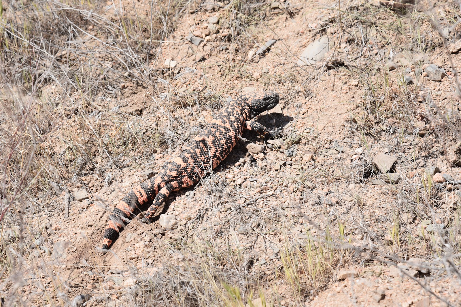
This Gila Monster was not interested in posing for a photo
Per Dwana Taylor, Maricopa County Parks and Recreation Public Information Officer, trail users can look forward to greater connectivity, new trailheads and spurs to the Hassayampa River Preserve and future Vulture Mountain Recreation Area in Wickenburg. 
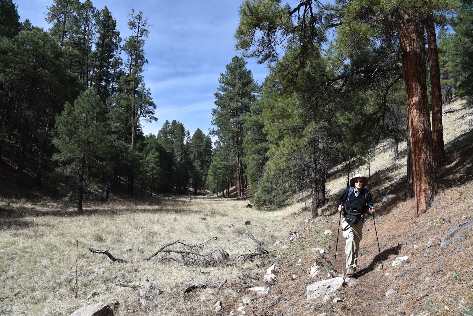
Hikers on the Bronco-Spur Cross segment of the MT
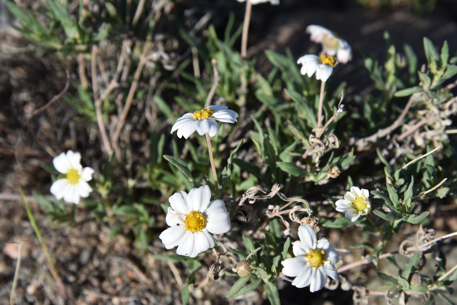
Even in dry years, Blackfoot daisies find a way to bloom
LENGTH: 13.6 miles one way (Bronco Trailhead to Spur Cross)
DAY HIKE OPTION:
Hike 2.6 miles on Trail 245 to the stock tank at the east fork of Bronco Creek. for a 5.2-mile round trip with an elevation range of 3,700 - 4,234 feet.
RATING: moderate
ELEVATION: 2,400- 4,224 feet
GETTING THERE:
Bronco Trailhead:
From the intersection of Cave Creek Road and Pima Road in Carefree, continue 11.6 miles north on Cave Creek Road which turns into Seven Springs Road/Forest Road 24 to the Bronco Trailhead on the left.  The last 3 miles of FR 24 is an all-weather gravel road suitable for passenger cars.  
INFO & MAP
American Conservation Experience