Find A Trail. Start Your Search Here:

Monday, February 12, 2018

SLATE –QUARTZ-GO JOHN LOOP

SLATE –QUARTZ-GO JOHN LOOP

Cave Creek Regional Park
Slate Trail
The site of Cave Creek Regional Park has a storied history. 
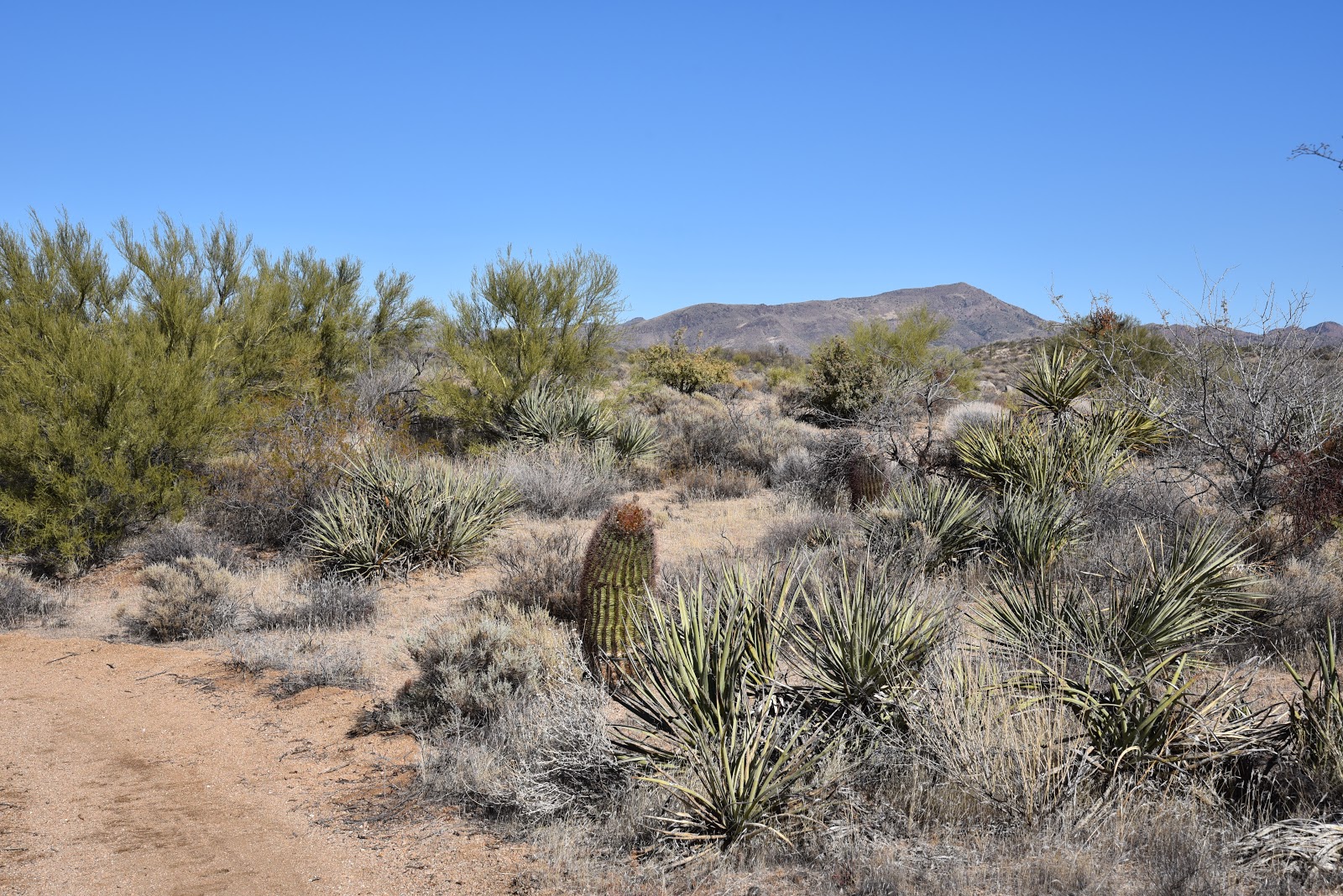
Cactus sprouts
Before there were hiking trails, campgrounds and picnic ramadas, the park and its surroundings were used by the ancient Hohokam people, mine operations, farms and ranches.  The park’s relics of human endeavors are transient compared to its geological features.  Although the 2,922-acre site has been picked over by prospectors in search of gold deposits that never quite materialized, the peaks, gullies and bizarre curiosities borne of earth’s disruptive forces remain basically unchanged since before humans arrived. 
Jasper and Quartz
Taking a moderate-rated loop stroll on the Slate, Quartz and Go John trails reveals a wonderland of rock while staying (mostly) away from the park’s busiest routes.
Slate Trail departs from a paved parking area with restrooms, heading east on an easy-to-follow, wash-addled tread.   During the first stretch, minor outcroppings of vertical-tilted metamorphic rocks –the “slate”—begin to pop up along the trail. Then, just beyond the half-mile point, the scaly gray slabs take center stage. The outcroppings balloon in size running amok on and around the route.   Patches of Palo verde and ironwood trees provide a little shade, but mostly, this hike is open to the sky.
The fin-like rocks form a scrub board surface littered with chunks of milky quartz and blood-red jasper. Some formations jut skyward in shark fin style while others lean in stony waves with tiny cacti sprouting from cracks where splits in the decomposing rock harbor just enough moisture to nurse plants to viability. At the 0.6-mile point, head north on the Quartz Trail for a walk past a gigantic mound of white stone that stands near a bend where a crack in the hilly terrain reveals views of mountains on the western horizon.
This 1.4-mile section follows the contours of several small peaks before it connects with Go John Trail for the return trip. Go John is the longest and most heavily-used trail in the system. Park trails are also used by a nearby horse outfitter that offers guided rides and the swooping, undulating nature of Go John makes it a popular choice for mountain bikers.  So, keep an eye out for speeding bikes and plodding equine parades. Hikers should always yield to horse traffic by stepping off the trail and following the directions of the riders.  From the Quartz-Go John junction, head left, continue 0.9-mile to the Jasper Trail, turn left and hike 0.4 mile back to the trailhead, enjoying the scattered gems and crunchy slate underfoot.
Go John Trail

Quartz Trail

LENGTH:  3.2-mile loop
RATING: moderate
ELEVATION: 2060 - 2300 feet
GETTING THERE:
From Carefree Highway in Cave Creek, go 1.5 miles north on 32nd Street to the park entrance. Follow the main road past the visitor center and park at the Slate Trailhead.
INFO & MAP:

Monday, February 5, 2018

OLD POST-CARROLL CANYON LOOP

OLD POST-CARROLL CANYON LOOP
View of Capitol Butte (Thunder Mountain) from Ridge Trail
Recent trail development in the southwest corner of Sedona has added miles of fresh dirt in the hilly terrain between Airport Mesa and Oak Creek.  Routes like Skywalker, Scorpion and Pyramid are terrific supplements that connect to a maze of old standards, providing additional access points and myriad opportunities to create loop treks. 
Wilson Mountain seen from Carroll Canyon Trail
Before exploring the new and shiny, take a walk on the original, well-worn Carroll Canyon Area Trails for an overview of the what makes this pocket of high desert and deeply scoured gullies so special.  Downloadable forest service maps and signs posted throughout make the system easy to navigate the core trails--Carrol Canyon, Ridge, Herkenham and Old Post.  Whichever way you lace this one up, be sure to include the 1.8-mile Carroll Canyon Trail because you won’t want to miss the best part—a dizzying traverse above a twisting limestone valley.
Here’s one circuit to try. 
Smoke Tree
From the Old Post trailhead, hike 1.1 mile uphill through patches of thorny Smoke Trees and yuccas with big views of Courthouse Butte, Bell Rock and Cathedral Rock on the southern horizon.  Turn right onto Carroll Canyon Trail and get ready for more stunning beauty. The route ascends along jagged sandstone and rough-cut steps to emerge at a scenic vista point. Here, glimpses of Capitol Butte (a.k.a. Thunder Mountain) and the flat-topped form of Wilson Mountain appear to the north.  
View of famous Sedona formations seen from Old Post Trail
The trail then ducks into juniper-cypress woodlands before rounding a bend where the contorted course of Carroll Canyon rolls out below.  A short passage hugs the lip of the steep-walled gorge that plunges 200 feet with views of Oak Creek and its surrounding floodplains peeking through the cracks.  It’s a queasy, edgy walk that ends with a descent into the first of several boulder-cluttered wash crossings.  Once through the wash, the route enters a savannah-like grassland, fringed with mesquite and the occasional cottonwood. 
One of several wash crossings on the route
At the next junction, pick up the Ridge Trail, hike 0.7-mile north and reconnect with the Old Post Trail for the final leg of the loop.  But the scenic wonders aren’t done yet. The back end of the circuit keeps delivering surprises.  
The limestone abyss of Carroll Canyon
Sunny plains sliced and diced into a jigsaw puzzle of flat fields, abrupt climbs and a web of water-whittled muddy ravines define the trail as it brushes past suburban homes before a powerline signals the final descent back to the trailhead.
A Shady passage of Carroll Canyon Trail
LENGTH: 5.5 miles
RATING: moderate
ELEVATION:  4090 to 4440 feet
GETTING THERE:
From the State Route 179/89A traffic circle in Sedona, go 4 miles west (toward Cottonwood) on 89A to Upper Red Rock Loop (Forest Road 216). Turn left and continue 1.8 miles to Chavez Ranch Road (Forest Road 216A), turn left and go 0.1 mile to the Old Post trailhead on the left.
INFO: Coconino National Forest

Monday, January 29, 2018

HOPE CAMP TRAIL

HOPE CAMP TRAIL
Rincon Mountain District, Saguaro National Park
Hope Camp
The Hope Camp historic site sits near the base of the Rincon Mountains wrapped in high desert grasslands, flood plains and thorny vegetation.  What remains of the long-abandoned cattle-herding camp is a barbed wire addled spread of dusty concrete troughs, corroded water tanks and a windmill that’s seen better days.  
View of the Rincon Mountains from Hope Camp Trail
This quiet pocket of relics and the trail that leads to it is now part of the Saguaro National Park Rincon District outside of Tucson.  The dilapited watering hole is the end cap of a remarkable trek and one of many points of interest hikers will encounter on the Hope Camp Trail.  From the Loma Alta trailhead that sits at the edge of Tucson’s eastern suburbs, the route reveals its treasures at a leisurely, constant pace beginning with a stroll on a wide dirt two-track popular with equestrians and mountain bikers.  The initial scene is one of sparse vegetation and little shade, but as the trail begins its descent into Rincon Valley, the landscape explodes with greenery.  At the one-mile point, Deer Camp appears in a depression off to the left.  A collection of rusty metal contraptions and crumbling troughs afflicted with the kind of decay that intrigues rather than offends, sits below a creaky windmill. 
Hope Camp windmill
With half its blades missing and the others dangling like loose teeth, the spider-like tower is a ghostly heirloom of a bygone era.  The trail then enters a mesquite-shaded stretch of washes and intermittent creeks before heading uphill to the hike’s biggest ooo-ahh moment. A short climb reveals a sprawling valley backed by the pine-juniper capped Rincon Mountains that rise to over 8000 feet.  
Hope Camp Trail is within Saguaro National Park
Clambering down from this highpoint vista, you’ll pass among stands of enormous saguaros, cholla and ocotillo before connecting with the Arizona Trail Passage 9 for the final half-mile walk to Hope Camp.  An arch of wooden benches beneath a patch of mesquite trees makes for a good place to take a break and explore the scrappy artifacts that groan and clink in mountain-borne breezes.  The toppled blade wheel of the Hope Camp windmill rests bent and broken at its base.  Look up and you’ll notice a famous name on the tail vane: F. Ronstadt.  Federico Jose Maria Ronstadt arrived in Tucson from Mexico as a teenager in 1882 and became a major contributor to the town’s pre-statehood commerce and culture.
Deer Camp
His business ventures in blacksmithing, wagon making, hardware and pharmacy are legendary. If Tucson were to  elect a “first family”, the Ronstadts would be strong contenders. In addition to his business and civic acumen, Ronstadt’s love of music led to the establishment of one of Tucson’s first orchestras--
Club Filarmonico Tucsonense.  Best known among the musical family members is Federico’s granddaughter, singer Linda Ronstadt.  
Hope Camp relics
Drenched in pioneer spirit, the Ronstadt family legacy is a permanent part of Arizona history. Hope Camp; not so much.  Who knows how long it will be before desert sand, encroaching shrubs and consumption obscure the site from memory.
Beneath the windmill, tucked among rusty-nail planks and unidentifiable tangled bits, a giant saguaro cactus skeleton trapped in the clutch of encroaching tree branches stands frozen, arms to the sky as if locked in a contest with its mechanical neighbor to see which can stay standing the longest.
Rincon Mountains
LENGTH: 5.6 miles roundtrip
RATING: moderate
ELEVATION: 3,120 – 3,360 feet
GETTING THERE:
From Interstate 10 in Tucson, take the Speedway exit 257 and go 14.2 miles east to N. Freeman Road.  Turn right (south) on Freeman and continue 3.5 miles to a stop sign. Veer left onto Old Spanish Trail and follow the signs to the Saguaro National Park Rincon Visitor Center to purchase your $15 pass which is good for 7 days. (There are several pass options; visit the park website for details.)With pass in hand, circle back and continue 7 miles south on Old Spanish Trail to S. Camino Loma Alta. Turn left (north) and go 2.5 miles to the trailhead.  The last half-mile is on rough dirt passable by carefully-driven passenger cars.  Dogs are not allowed.
INFO:

Monday, January 15, 2018

MARICOPA TRAIL: Bartlett Dam Road to McDowell Sonoran Preserve

MARICOPA TRAIL: Bartlett Dam Road to McDowell Sonoran Preserve
Maricopa Trail pass through Tonto National Forest
The 300+-mile course of the Maricopa Trail takes many forms.  Sometimes it’s a single track, canal bank, road or suburban pathway. All the segments are beautiful and useful in their own ways and yet, some of the most memorable are within the Tonto National Forest. 
Desert greenery flanks suburbia.
The 20.5-mile Bronco to Granite Mountain segment northeast of Scottsdale stays within the forest boundary passing by Camp Creek, Blue Wash, Rackensack Canyon and hilly desert back country. The north-south running route is bisected by Bartlett Dam Road making it easy to tackle as a car shuttle hike.
Four Peaks on the eastern horizon.
North of the road, the route is a rugged trek through mountainous terrain, washes and rough drainages while to the south, the hike is a milder adventure with lots of variety.  Both halves share space with a power line that is visible to the west intermittently throughout the hike. Beginning at Bartlett Dam Road, heading south, the trail rolls out in “chapter” format. Each mile of the 3.4-mile trek has its own character beginning with “ATV Heaven”. Much of Tonto National is open for shared-use activities including motorized travel and hunting. Although the Maricopa Trail corridor is designated as non-motorized, surrounding roads are open to all and you will likely encounter dirt bikes, 4x4s and trucks where the trail crosses several dirt tracks. Once past the boulder knoll of Wildcat Hill, the motorized traffic is much less profound.
Sonoran Desert plant life and Cave Creek Mountains.
The rollicking road ruckus is replaced by a quieter chapter of “Wilderness Vistas”.  To the east, a panorama of mountain peaks dominates the horizon.  Look for Weavers Needle and Flatiron in the Superstition Wilderness, Four Peaks and the Sierra Ancha Mountains and the Cave Creek Mountains. Nearer to the trail are outcroppings of quartz, pink granite and some of the biggest barrel cacti anywhere. Clear days yield amazing depth of vision and ahhh-inspiring photo opportunities.  Soon, the trail begins heading downhill toward the northern boundary of the McDowell Sonoran Preserve.  This “Edge of Suburbia” chapter skirts tony neighborhoods where lush forests of Palo Verde, mesquite, ironwood cholla and yucca muffle the sounds of civilization.
Northern boundary of McDowell Sonoran Preserve.
For added entertainment, watch for vociferous phainopeplas—black, crested birds that resemble cardinals—feasting on mistletoe.
The final chapter is “Forest-Preserve Interface” where the trail passes a cattle gate then continues to the north boundary of the McDowell Sonoran Preserve.  Here, the trail ascends to metal gates and barbed wire fences for sweeping views of the familiar profiles of Granite, Browns, Cholla and Cone Mountains within the preserve. 
Superstition Wilderness peaks in distance.
To the south, Pinnacle Peak stands out over still fainter silhouettes of the Phoenix Mountains Preserve and Downtown Phoenix.  This segment of the Maricopa Trail continues 6.4 miles south to the Granite Mountain trailhead, but if you're satisfied with the story thus far, this is your turnaround point.
A Palo Verde tree frames view of Black Mountain.
LENGTH: 6.8 miles roundtrip
RATING: easy
ELEVATION: 2845 – 3220 feet
A female phainopepla 
GETTING THERE:
Bartlett Dam Road Trailhead.
From Loop 101 in Scottsdale, take the Pima/Princess Drive exit 36 and go 13 miles north on Pima and turn right on Cave Creek Road.  Continue 4.1 miles to Bartlett Dam Road, turn right and go 0.4 mile to where a dirt road crosses at a “no target shooting” sign  0.1 mile past the Tonto National Forest ranger station.  Turn right and park along the dirt turn outs. This area is heavily used by ATVs, so don’t block roads.  This segment may also be accessed via a 0.2-mile connector path from a trailhead at the ranger station-- when it’s open. 
Engelmann hedgehog cacti bloom March-April
INFO & MAPS:


Friday, January 12, 2018

ARIZONA TRAIL: GILA RIVER CANYONS PASSAGE 16


ARIZONA TRAIL: GILA RIVER CANYONS PASSAGE 16
The “golden spike” moment for the Arizona Trail is marked only by a simple brass survey post set in a concrete base banked with native rocks.  Dedicated on December 16, 2011,
Trellis bridge over the Gila River below the golden spike site.
the low-key monument that sits above the banks of the Gila River near the town of Kelvin denotes the completion of a decades-long effort to build a non-motorized recreation trail from Mexico to Utah.  The monument bears the initials of Dale Shewalter, the “Father of the Arizona National Scenic Trail.  Sadly, Shewalter did not live to see the completion of the trans-Arizona trail he worked for beginning in the mid-1980s. 
"Golden spike."
The understated tribute on a ridge overlooking a river and trellis bridge at the gateway to one of the trail’s most spectacular segments is an apt tribute to the tenacious teacher, activist and adventurer.
ASARCO Ray Mine in distance
It’s also the keystone of one of the most technically-challenging and profoundly beautiful segments of the 800+-mile route.  David Hicks, former Arizona Trail director who recently backpacked the 26-mile Gila River Canyons Passage 16 enthusiastically recommends it for skilled hikers looking for an epic experience.  “
I feel it is only second to the Grand Canyon in scenic beauty--and, there are many sections of the Arizona Trail that fit that description,” Hicks gushed.  “In the Gila River Canyons there are some sections so remote that you will likely not see another person during the time that you might spend in this passage.”  According to Francisco Mendoza, a Bureau of Land Management Tucson Field office outdoor recreation planner, there are many reasons why this section of the trail was the last to be completed.  “There were the problems of access, rugged terrain, protecting sensitive ecosystems and archeological sites and the need to work with land owners, mine claims, ranching operations and government agencies,” Mendoza said. 
Gila River near Kelvin.
As the man who navigated the topographic challenges and a maze of permits and permissions, he knows first-hand. “Mendoza can be called the Father of the Gila River Canyons Passage,” says Hicks.  “It was he who did the initial scoping of the route and
was the architect for the laying out of this scenic segment.” His work forged many positive relationships among the myriad entities that worked together to create a world-class stretch of trail. The planning and assessment efforts began in 2002 with field reconnaissance, negotiations and tons of paperwork before ground work commenced.
Arizona Trail, Gila River Canyons Passage 16
“First assault happened in 2007,” says Mendoza. A mixed bag of labor including youth crews,
volunteers and contractors was used in the trail construction. Although it’s technically done, the work goes on.  “The term ‘complete’ is relative,” Hicks says. “Sure, it’s done, but ongoing regular maintenance is needed due to fires, erosion and opportunities for improvements. The trail is not a stagnant path but a living Arizona treasure that requires attention and funding to preserve it for generations to come.” 
Dave Hicks, Francisco Mendoza and John Matteson at the spike.
(A recent hike on the passage with Hicks, Mendoza, June Lowrey, public affairs officer for the Bureau of Land Management and John Matteson, Arizona Trail regional trail steward, was punctuated with removing stones, trimming catclaw and making plans to repair a drainage.) The placid riverside start to the passage belies a wild and diverse trip through pristine backcountry with many surprises along the way. For instance, the
15 miles of trail near the communities of Kelvin and Riverside is one of only two sections of the AZT that runs along a perennial flowing stream.
Beyond the water, the trail swings north, climbs steadily for several miles and then opens to what Hicks describes as "jaw dropping awesome scenery”.  Gaping canyons, amazing rock formations and miles of untainted natural beauty are the payoff for making the grueling trek.  Passage 16 ends in the middle of nowhere with no reliable water sources or easy exits, so it’s imperative that those attempting it understand the route and have a plan.  “Eleven miles north of the river, the passage ends.” Hicks says. “But trail users aren't done when they get to that spot.  There's another 12 miles of Arizona Trail in the Alamo Canyon Passage 17 to the Picket Post Trailhead near Highway 60. It’s great backpacking.”
Rugged beauty of Alamo Canyon.
LENGTH: 26 miles one-way
ELEVATION: 1646- 3714’
GETTING THERE:
From US 60 in Superior, go 15.2 miles south on State Route 177 to the Florence-Kelvin Highway. Continue 1.2 miles south, cross the Kelvin Bridge and park where the passage begins south of the bridge along Centurion  Road.
For more access points and detailed route information:


Tuesday, January 9, 2018

Friday, January 5, 2018

P.A. Seitts Preserve at Go John Canyon

P.A. Seitts Preserve at Go John Canyon
Golden cottonwoods along Cave Creek in P.A. Seitts Preserve
Tucked between Cave Creek Regional Park and horsey suburban neighborhoods, the P.A. Seitts Preserve at Go John Canyon is a tiny buffer zone of beauty. The site is owned and managed by the Desert Foothills Land Trust, a nonprofit organization that works to conserve Sonoran Desert open spaces, sensitive plants and native animal species in the north Valley.  While some of the organization’s 23 properties that protect 680 acres are off limits or viewable only by guided tours, P.A. Seitts is open to the public.
The Overlook Trail
The 271-acre site preserves an important wildlife corridor, riparian habitat and historical elements along Cave Creek. Several hiking trails and nature paths explore the property’s various points of interest. To get to the trails, hike 0.2 mile on the access path to a gate and the main trail junction. 
Craggy outcroppings on Overlook Trail
A good way to begin is to take the right fork and knock off the moderate Overlook Trail first. 
Black Mountain in distance
This 0.6-mile one-way path climbs along a slim, craggy path to the preserve’s highpoint, making a loop around the summit for an exceptional overview of the area.  The dark silhouette of Black Mountain looms in the east while the colorful gorge of Cave Creek, hazy urban contours and the hills of Tonto National Forest complete the panorama. Once done exploring, descend back to the gate and continue north on the wide Jeep Trail (a.k.a Military Road). Just over a half-mile from the gate, veer right at a two-way junction. Although it’s not signed, this short road is the Cemetery Trail. Hike 0.3 mile to a “T” junction, and head left to an historic graveyard where several early Cave Creek settlers are buried.  The burial ground has a reverent, yet wild west feel to it.  A random collection of dusty stone circles and wooden planks mark a few resting places, but mostly the dead lie in blissful secrecy.  To continue, retrace your steps back to the Jeep Trail and continue north. You’ll notice signs stating that permits are required to enter the State Trust land that’s part of a patchwork of preserve, park and private properties in the area. No worries, though. If you stay on the designated trails, you do not need a permit.
View from the top of the Overlook Trail
The Jeep Trail continues for 1.1 mile, paralleling the creek and its avenue of cottonwoods, mesquite and willows. In late fall and winter, the trees display canopies of golden leaves. Enormous saguaros, contorted ironwood trees and a smattering of dilapidated barbed wire fences populate the foothills complementing an already visually-rich trek. 
Jeep Trail
Along this stretch, you’ll encounter two rusty metal posts that mark spur paths that go into Cave Creek Regional Park. The second post denotes the preserve boundary and the turnaround point for the hike.
Jeep (aka Military) Trail
LENGTH: 2.3 miles total
RATING: easy-moderate
ELEVATION: 1960’ – 2120’
GETTING THERE;
P.A. Seitts trailhead:
From the intersection of Carefree Highway and Cave Creek Road in Cave Creek, go 0.6 mile north to East New River Road. Turn left, go 0.3 mile to 54th Street, turn right and continue 0.4 mile to the parking area on the right near the intersection of E. Cloud Road and 52nd Street. No fees. Preserve hours are the same as the park’s.

Tuesday, January 2, 2018

BLACK CANYON TRAIL: BUMBLE BEE SEGMENT

BLACK CANYON TRAIL: BUMBLE BEE SEGMENT
Old gate with Sunset Point on canyon edge--far right.
Look down from the viewing deck at Sunset Point rest area on Interstate 17 south of Cordes Junction and the rugged terrain of what the Black Canyon Trail Coalition calls “Arizona’s Outback” rolls out 600 feet below.  The land down under the lookout is appropriately named Sheep Gulch. Whether this is happenstance or a nod to the Australian sheep stations (Aussie speak for ranches) that this gorge resembles, it’s an awe-inspiring sight to behold. Although it’s tough to see from the rest area, the middle section of the 80-mile Black Canyon Trail cuts through this beautiful abyss that’s cradled in a geological upheaval of pre-Cambrian granites, and scaly schists with sprinklings of orange-tinged quartz tossed about like confetti.
Saguaros frame Bradshaw Mountains vistas.
 The non-motorized-use route that stretches from the Carefree Highway in Phoenix to near the town of Mayer off State Route 69, has been designated a National Recreational Trail for its historic significance.
Hikers traverse a section burned by 2017 wildfires.
The trail has been in use since pre-historic times serving as a Native American pathway, a track for herding sheep and other livestock and a travel corridor for traders.  Surrounded by the rough-cut, mineral-rich peaks of the Bradshaw Mountains and the stream-chiseled gullies of Black Canyon, this moderately difficult, easy-to-follow section of trail clings to the canyon walls as it moves northward in smooth swoops and hairpin turns. 
Mountain views are the highlight of the hike.
Beginning at the Gloriana Mine trailhead, the hike heads 4.6 miles north to where it meets the American Gulch Segment near the town of Bumble Bee—a former Phoenix-to-Prescott stage stop established in the mid nineteenth century.
Ocotillo near the Gloriana Mine trailhead. 
 Although this area was impacted by the July 2017 lightning-caused Brooklyn, Bull, and Cedar fires, the scenic value of the hike was only marginally diminished. The trail is clear and the epic mountain vistas for which this segment is famous are still as crisp and inspiring as ever.  The trail mostly follows the 2800-foot elevation contour before it dips into the gulch below Sunset Point. Here, the faint rumble and whir of the freeway above caps a contrasting pastoral scene of ranches, cacti-studded grasslands, creekside willows and the comings and goings of ATVs, hikers and the seasonal parades of sheep that still graze around the sleepy ghost town and its defunct gold mine prospects.
The land down under Sunset Point.
LENGTH: 4.6 miles one-way
RATING: moderate
ELEVATION: 2520' - 2840'
A hairpin turn through a gully.
GETTING THERE:
Gloriana Mine Trailhead: From Interstate 17, take the Bumble Bee/Crown King exit 248 and go 1.2-miles west on Bumble Bee Road (FR 59) to the trailhead on the left. Segment begins across the road from the parking area.  Roads are 100% paved.
 INFO & MAPS: Black Canyon Trail Coalition