Find A Trail. Start Your Search Here:

Wednesday, January 5, 2022

Axle Grease Trail

AXLE GREASE TRAIL

A winter storm brews over Axle Grease trail

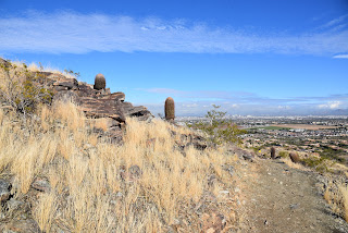
Long and rambling, the Axle Grease trail is a serpentine route that slips through granite outcroppings fleeced with acres of yucca and cacti in the northwest sector of the Scottsdale McDowell Sonoran Preserve.

Black Mountain viewed from Axle Grease trail

The twisty, single track debarks from the new Pima Dynamite trailhead which was dedicated on November 13, 2021.

Cave Creek Mountains seen from Axle Grease trail

Running northeast in the space between Pima Road and the sandy, horsey course of Rawhide Wash, the route features a sequence of tight bends, unobstructed lines-of-sight and fluid runs, that support a made-for-speed atmosphere.

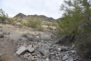
Granite boulders surround the trail

Indeed, hikers and bikers zip through this lush desert path like well-oiled machines.

Tight bends slingshot hikers through the route
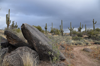
 

And, speaking of oiled machines, the trail name derives from the buckets of grease that hung from horse-drawn wagons that rumbled through the area in the 1800s.  The grease was used to lubricate wheels and axles to keep the rickety vehicles running smoothly. 

A raven croaks from atop a saguaro
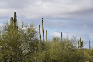
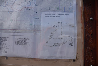
The 4.5-mile trail is not a loop, but many connecting trails may be used to customize hikes for length and preferred points of interest.  Excellent map kiosks at the trailhead show several suggested routes including the locations of scenic viewpoints, geological landmarks and an impressive crested saguaro.

The trail parallels Rawhide Wash

 
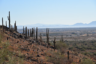
Saguaro skeletons add botanical interest along the way

While the hum of traffic on Pima Road is present over the first couple of miles where the trail traces the property boundary, the din loses its punch as the trail swings farther into the core of the preserve.  Soon, the sounds of 21st century lubricated vehicles are absorbed by vast boulder fields, saguaro forests and the songs of woodpeckers, ravens and raptors moving among thick stands of paloverde trees and fragrant creosote.

Pima Dynamite trailhead was dedicated in Nov. 2021

There are many ways to loop up with the Axle Grease trail

LENGTH: 4.5 miles one way

RATING: moderate

ELEVATION: 2,310 – 2,563 feet

GETTING THERE:

Pima-Dynamite Trailhead

28777 N. Pima Road, Scottsdale.

There are two access roads near the corner of Pima and Dynamite Roads. One is on Pima just north of the traffic signal and one a few yards east on Dynamite.

There are restrooms at the trailhead.

INFO:

Scottsdale McDowell Sonoran Preserve

https://www.scottsdaleaz.gov/preserve

Tuesday, January 4, 2022

Hau’pal Loop

HAU 'PAL LOOP

Sierra Estrella Mountains peek over Ma Ha Tauk range


Situated in the northwest sector of South Mountain Park in Phoenix, the Hau’pal trail fixes a couple of things.

Camelback Mountain has some competition in the Hau'pal Trail

First, the 3.2-mile loop which debuted in 2020 replaces a quagmire of confusing, terrain-damaging park (remember the T-Bone Trail ?) and sloppy user-created paths.  Newly aligned, signed and cleaned up, the route is now a safer, more sustainable trek.

Difficult-rated Hau'pal trail is well signed

Second, it provides swift attitude adjustment for anybody who thinks a short loop hike located a mile south of downtown Phoenix can’t deliver a heart-pumping-- and sort of scary--hike.

Piestewa Peak rises above downtown Phoenix

The route is steep, edgy and rocky

The 3.2-mile loop, which is named for the O’odham word for red-tailed hawk, progresses in three distinct episodes.  Heading counterclockwise from the trailhead (go right), the hike begins with an immediate uphill haul that gets gradually steeper as the dirt single track gains over 1000 feet twisting over clipped shelves and stony folds in the far edge of the park’s Ma Ha Tauk Range. 

Mountain & urban views on Hau'pal trail

Act two involves a breath-taking walk over a sheer ridgeline with vistas that span the entire Valley and reach into the mountain peaks of the Tonto National Forest and farmlands south of Ahwatukee. 
First leg of the hike gains elevation gradually

Narrow, steep and, in places, very close to sheer drop offs, the ridge leg of the hike is not for acrophobics. 
The trail replaced old and unauthorized paths

The final segment is preceded by a short scramble through a rock chute before the trail calms down and swings downhill on gully-riddled foothills with scenic lookout points that frame views of city grids, urban landmarks and the distinctive humps of Camelback Mountain—another short, steep hike destination that might lose its “ultimate city hike” panache once Hau’pal catches on.
Map at the trailhead shows the loop layout

LENGTH: 3.2-mile loop

RATING: difficult

ELEVATION:  1,320 – 2,359 feet

GETTING THERE:

Form Phoenix, travel south on 7th Avenue to Baseline Road.  Turn right (west) and continue on Baseline to 19th Ave. Turn left (south) and follow 19th Ave to the trailhead.  No facilities.

INFO:

https://www.phoenix.gov/parks/trails/locations/south-mountain


Monday, January 3, 2022

Crest Summit

CREST SUMMIT

Mine site on the Quartz Mine trail

Situated in at the southern end of the White Tank Mountains, Skyline Regional Park in Buckeye offers an enticing mix of hiking, biking and equestrian trails.  
Big Valley views from Crest Summit

T
he 8,700-acre park has nearly 20 miles of interconnected trails that wrap around a stronghold of mountain peaks, scoured washes and lofty ridgelines. 
Crest Summit trail is short but very steep

With trail choices that range from barrier-free interpretive strolls to difficult, vertigo-inducing climbs, there’s something for everybody in this West Valley recreation hub. 
Quartz Min trail passes through washes

While all the park trails frame outstanding vistas, there’s one edge-teetering route that skims the roof of the park and even ties in an optional summit side trip.  
Lichens color rock outcrops in Skyline Regional Park

The circuit, which uses the Quartz Mine, Lost Creek and Skyline Crest trails, wanders through the park’s east sector with a sequence of twists, dips and ascents that provide continual panoramic views. 
Challenging Skyline Crest trail traces a ridgeline

Begin on the Quartz Mine trail near the number 3 picnic ramada.  Head east (go left) follow the moderate single track through gullies and washes as it descends along stony escarpments above desert plains. 
Steep switchbacks on Skyline Crest trail

At the 1.4-mile point, the route meets the Skyline Crest junction. For this trip, continue uphill on Quartz Mine. Now steeper and more precipitous, the trail curves north, topping out near a mound of chipped white stone spilling from what appears to be a filled in prospect—the Quartz Mine. 
Trail menu at Skyline Regional Park

The trail traverses a ridge for another 1.1 miles to where it connects with the Lost Creek trail. Turn left, hike less than a half-mile and hang another left onto the Skyline Crest trail.  This leg of the circuit is a real treat. Rated difficult, the rocky, undulating path hugs a knife-edge ridgeline with steep drop offs and jaw-dropping views all around.  After a mile, a set of switch backs winds downhill to land hikers on a saddle where the optional Crest Summit trail presents an optional add-on.  
Park trails are well signed

The short, vertical side trip tacks on only 0.34-mile to the hike, but the additional 200 feet of elevation gain rolls out in aggressive, straight-up style.  The extra effort pays off with unobstructed, 360-degree vistas of the Sierra Estrella Mountains to the northeast, Gila Bend Mountains in the southwest and the Big Horn Mountain Wilderness and the Hassayampa Plain in the northwest.  
Quartz chunks line the trails

From this high-point lookout, the trail descends through a saguaro-cluttered ravine to reconnect with the Quartz Mine Trail where hikers retrace their steps to the trailhead.

LENGTH: 5.94 miles as described here

RATING: difficult

ELEVATION: 1,345 - 2,130 feet

GETTING THERE:

2600 N. Watson Road, Buckeye.

From Interstate 10 in Buckeye, take the Watson Road exit and continue 2 miles north to the park. Roads are paved.  There are restrooms, water, picnic ramadas and camping by reservation at the trailhead.

HOURS: sunrise to sunset daily

INFO & MAPS:

Skyline Regional Park

https://www.buckeyeaz.gov/community/skyline-regional-park/about-the-park

Monday, December 20, 2021

Spine Trail

SPINE TRAIL

Casa Grande Mountain Park.

Desert vegetation in Casa Grande Mtn Park 

The Casa Grande Mountains form an abrupt divide in a landscape commandeered by busy transportation corridors, cotton fields, irrigation canals and desert basins dotted with neon signs denoting truck stops, road side motels, feed stores and RV parks.
Arica trailhead in Casa Grande Mtn Park

The north-south running range is situated where Interstate 8 swerves west off I-10 and railroad tracks funnel  snake-like streams of freight cars through dusty flatlands.

The Picacho Mountains seen from the park

 Awash in the sounds of train horns and the rumble of big rigs, Casa Grande Mountain Park, with its over 17 miles of non-motorized recreational trails, presents a tetchy truce with the roar of commerce grinding below its slopes.
Saguaros clutter the slopes of Casa Grande Mtn

The trails trace the east flanks of the mountain in long, loopy segments that alternately climb to high-point vistas and duck through drainages and rocky bends that momentarily muffle the cacophony of cars and cargo carriers.

A hawk takes flight with a meal in its grasp

 While the soundtrack is a near-constant companion, the trails seem to blend well with the rural-railway theme—apart from but part of the area’s ambiance.  After a few miles of hiking, the ambient din reinvents itself from flaw to supporting character.
Dawn and dusk are the best times to see hawks

The noise is a little jarring at first, but the weirdness is quickly absorbed as trail users step into the hilly 1,025-acre Pinal County park where interesting geology, desert vegetation and a robust wildlife community demonstrate how nature and industry can share space.

Trail post marks theturnaround point for this hike


Arranged in interconnected coils, the trail system is designed for easy customization. 

Neon signs glow below Casa Grande Mtn

The downloadable park map and trail posts are color-coded: blue for easy, green for moderate and black for difficult.  Two long anchor routes, the Spine and Ridge trails, serve as main arteries from which several connecting paths diverge. 
Palo verde trees shade the trail

For an easy- moderate-rated taste of the park, begin at the Arica trailhead.  From the kiosk, follow the access path and veer right onto the Spine trail, which stays low on the mountain’s eastern front.
Extend the hike on any of the park's17 miles of trails

At the first trail post, head right and continue north among giant saguaros and boulder-jumbled washes.  The open country makes for prime hunting grounds for hawks that wait atop saguaros ready to make a meal of any reptile, small mammal or bird that shows itself.
The industrial-wild flavor of Casa Grande Mtn Park


To the southeast, look for the profiles of Picacho Peak and the Picacho Mountains backed by the distant Tortolita and Santa Catalina Mountains near Tucson.  Several unsigned paths and roads cross the trail over the first mile.  Just stay on the well-worn main route. At B-2 GPS marker, the trail splits.  Both legs are about the same length but the “blue” choice offers a moderate hike while the “green” side remains easy.

Picacho Peak (R) stands over an agricultural valley

Both reconnect then split again before converging at the A-5 GPS marker at the 1.48-mile point where hikers can double back or connect with the Ridge Trail for a more challenging return route. 
Trail whistles are the soundtrack of the hike

Spine trail splits into easy and moderate legs

Either way, this easy-access mountain destination at the intersection of workloads and wilds delivers a rewarding day of hiking. Train horns and all.
Giant saguaros are a common site in the park

LENGTH: 3.29 miles roundtrip as described here

RATING: easy-moderate

ELEVATION: 1,505 – 1,626 feet

GETTING THERE:

Arica Trailhead, 2090 E. Arica Road.

From Interstate 10 in Casa Grande, take the Sunland Gin Road exit 200.  Turn right at the bottom of the offramp and continue a short distance south to Arica Road on the right just past the Love’s Truck Stop.  Follow Arica Road 1.6 miles to the trailhead. Roads are 100% paved.

There’s a porta potty at the trailhead but no other facilities.

INFO & MAPS:

City of Casa Grande

https://casagrandeaz.gov/cg-mountain-trails-project/


Monday, December 6, 2021

Juniper Tank

JUNIPER TANK

Juniper Tank is a wildlife haven in Coconino NF

Forest Road 525 serves as an artery of access to multiple recreational destinations. 

Bear Mountain viewed from FR 525 west of Sedona

Located in a

pocket of airy desert scrub between the craggy red rock faces of the Secret Mountain Wilderness and juniper-studded grasslands of Coconino National Forest west of Sedona, the road leads to several OHV routes, the Palatki and Honanki heritage sites and the rugged and remote Loy Canyon hiking trail. 

A wire gate marks the entrance to Juniper Tank

A steady stream of vehicles, usually laden with camping equipment, bikes or trailers, kick up dust along the dirt-and-gravel track. 
A fringe of mesquite provides cover for wildlife viewing

While the obvious recreational draws account for the majority of traffic, a tiny wildlife oasis just steps from the rev-and-roar of 4x4s holds a surprising flip side to the road’s offerings.  The hike to Juniper Tank can be short or long, depending on where you begin.  I parked in a dirt lot 1.3-mile from SR 89A and walked 1.95-miles up FR 525 to the gate for FR 9574 at the Diamondback Gulch OHV trailhead which marks the start of the walk to the tank.  Even though the road walk shares space with motorized traffic, the views more than make up for the dust.  To the west, Mingus and Woodchute mountains stand out over acres of golden rangeland dotted with cacti, junipers and yucca. 
Windmill Mountain soars above Juniper Tank

Directly ahead, the lopsided mound of 4,651-foot Windmill Mountain looms over water-scoured drainages while the iconic forms of Loy Butte, Capitol Butte and Bear Mountain anchor a wall of russet-and-buff-colored wilderness peaks.  From the gate, it’s a one-mile roundtrip walk to and around the tank. Follow the closed road, which is open to foot and equestrian use, as it descends over jostled red earth that traces the cut of a drainage.  
Critters leave their signatures at Juniper Tank

A few yards in, the road splits. Stay right and keep walking as the road gradually degrades into a narrow trail and overgrown footpath. 
Silverleaf nightshade berries grow around Juniper Tank

Windmill Mountain on the Juniper Tank hike

Flocks of birds and scurrying critters are the only clues that a wildlife water source is nearby.  Look for the opening in a post-and-wire fence just ahead, pass through and follow the paths-of-use to a berm that contains Juniper Tank.  
The road to the tank narrows to weedy footpaths

First glimpses of the glassy pond reflecting clouds, mountains and the movements of winged inhabitants are breathtaking. 
Many species of birds flock to Juniper Tank

Trailhead is near Diamondback Gulch OHV area

Situated in a depression surrounded by desert vistas and seep willows, the shallow, reedy waterhole is a haven for desert creatures.  Prints along the muddy margins document visits from bobcats, deer, javelinas, skunks, racoons and dozens of bird species. 
FR 9574 is open to non-motorized use

A fringe of mesquite trees provide places to hide and observe. 
Clouds and trees reflect in Juniper Tank

Patient hikers might spy sparrows, wrens, warblers, shorebirds and maybe even eagles. 
View of Mingus Mountain from FR 525

Dodging catclaw, cacti and a jump over a drainage outlet, the short walk around the tank’s perimeter unpacks rustlings of life, scat, feathers and impressions of a robust community that thrives in a who-knew refuge curiously close to road ruckus.
Forest Road 525 leads to Loy Butte

 
Bear Mountain seen from Juniper Tank

When done taking in the secluded gem, double back and enjoy the sights in reverse.
High-desert scrub dominates the scene along FR 525

LENGTH: 5.2 miles as described here

RATING: easy

ELEVATION: 3,962 – 4,291 feet

GETTING THERE:

From the State Route 179/89A traffic circle in Sedona, go 9.7 miles west (left) on SR 89A to Forest Road 525 (Loy Butte Road) on the right.  Continue 3.25 miles on FR 525 to the trailhead at the Diamondback Gulch OHV kiosk.  Hike begins at the gate signed for FR 9574.  NOTE: to extend the hike, park in any of the dirt pullouts or dispersed campsites along FR 525.  This description begins from a parking area 1.3 miles from SR 89A.

FR 525 is maintained dirt and gravel suitable for all vehicles up to the trailhead.