IRON SPRINGS CONNECTOR-LEAP FROG TRAIL
 |
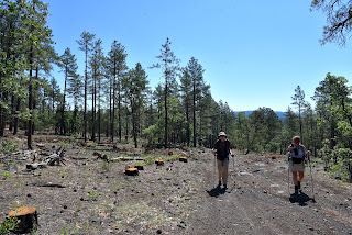
| Hikers on the Iron Springs Connector Trail |
Trails in the forests around Munds Park cater to visitors of many ilks.
 |
| Frog Tank in the Munds Park Trail System |
The slice of Coconino National Forest 20 miles south of Flagstaff is home to the Munds Park Trail System and the Kelly Motorized Trail System. Both systems of looped trails fill the space between Interstate 17 and the Sandy’s Canyon area on Lake Mary Road with over 100 miles of recreational routes.
 |
| Horse Park thinning project on Leap Frog Trail |
Whether used for hiking, mountain biking or off-road motorized travel, the system’s menu of short and long loops makes for an ideal outdoor fun destination. The Munds Park Trail System has several convenient trailheads located just a few miles east of Interstate 17.
 |
| Lizard strikes a pose on Iron Springs Connector |
The Iron Springs Trailhead offers quick access to the area’s most popular trails, the Mud Tank Trail and the Frog Tank Loop. Also departing from the same trailhead, the Iron Springs Connector is a rocky two track that’s open to hikers, bikers and smaller OHVs.
 |
| Ponderosa pines shade Frog Tank Loop |
The mile-long route may be used as the first leg in any number of out-and-back or loop hikes. The trailhead kiosk has maps showing the layout of both systems.
 |
| Oaks and pines on Iron Springs Connector |
The Munds Park trails are mostly rated as easy-moderate and are short in length while the Kelly trails are designed for OHV use and are longer and more difficult. All the trails wander through Ponderosa pine forests with patches of sunny meadows and lots to see.
 |
| Wild bergamot blooms in moist areas |
For a moderate out-and-back day hike, follow the Iron Springs Connector to the Frog Tank Loop junction. Go right at the junction and follow the trail that’s also open to motorized use, downhill to where it crosses a drainage replete with summer wildflowers and tiny pools.
 |
| Domestic cattle share the trails |
At 0.2 mile from the Frog Tank Junction, the trail meets a 3-way intersection. Continue straight onto the Leap Frog Trail #246 which is also known as the Buried Cable Trail. The trail is not signed here, but utility posts along this 0.3-mile segment serve as identifiers. At the 1.5-mile point, the trail reconnects with the Frog Tank Loop. Leap Frog trail continues north, but for a scenic detour, head left and make a 0.4-mile round trip walk to Frog Tank. The watery enclave is a wildlife-magnet at the edge of a sunny green swale. The pretty site attracts waterfowl, birds, elk and meandering domestic cattle.
 |
| Apache Maid Mountain on horizon |
Leap Frog Trail is a 9.5-mile route that twists north, roughly paralleling I-17 before swinging east to Connect with the Rocky Road Trail that leads to Mud Tank and back to the Iron Springs trailhead. But for those not looking to do a half marathon style trek, a good turnaround point for a hike under 5 miles is Forest Road 78A.
 |
| Mormon Mountain seen from Leap Frog Trail |
We ventured about a half mile beyond the junction where the Leap Frog trail continues across FR78A at a nondescript Kelly Trail signpost and begins a moderate climb through the current Horse Park forest thinning project.
 |
| Cattle graze along Leap Frog Trail |
The Coconino National Forest logging project is part of an effort to reduce fire danger by removing forest fuels, restore habitats and improve forest health. Cut trees and log piles are visible long this segment. The thinning project has also opened mountain vistas.
 |
| Wright's bluets bloom May - September |
The silhouettes of 8,456-foot Mormon Mountain and 7,307-foot Apache Maid Mountain peek out from a fringe of tall pines and Gamble oaks, a sampling of what the higher elevations might have in store for strong hikers and brave ATV drivers.
 |
| Iron Springs Trailhead in Munds park |
LENGTH: 4.6 miles out-and-back to 78A as described here with side trip to Frog Tank
RATING: moderate
ELEVATION: 6,565 – 6,625 feet
GETTING THERE:
Iron Springs Trailhead:
From Interstate 17 in Munds Park, take the Pinewood Blvd (Forest Road 240) exit 322 and continue 0.8 miles to Crestline Road. Turn left and go 0.8 miles (road will turn into Oak Dr.) to Iron Springs Road, turn right and go 0.5 mile to the trailhead. Trailhead road is maintained dirt suitable for all vehicles. There are no fees or facilities at the trailhead.
Munds Park Trail System:
https://mundsparktrailstewards.com/maps/
Coconino National Forest Thinning Info:
https://www.fs.usda.gov/detail/coconino/landmanagement/projects/?cid=stelprdb5417804


