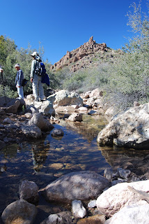
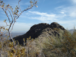
HOLBERT TRAIL TO DOBBINS LOOKOUT Phoenix South Mountain Park Phoenicians are lucky to live within sight of the nation’s largest municipal park. South Mountain Park sprawls across our southern horizon and has hundreds of miles of trails that may be hiked individually or in combination loops. The Holbert Trail is easy to access and a cinch to follow due to excellent trail maintenance as well as strategically placed signage. From the trailhead, the path begins by traversing “petroglyph alley”. Keep one eye on the boulders and cliffs while hiking the first flat half-mile. Ancient rock art appears everywhere, as does the evidence of artifact thieves. Once past the petroglyphs, the hike becomes more strenuous as it follows the canyon walls and gently switchbacks uphill to the junction for Dobbins Lookout. The trail is rocky and can be tricky in places, so, pay attention. Hang a right at the signed junction and haul up more switchbacks to popular Dobbins Lookout. An old stone building and numerous vista points with benches make Dobbins Lookout a nice spot to rest and enjoy great view of the Valley of the Sun. Although the City of Phoenix provides ample reciprocals for trash, the lookout area, which is accessible via a paved road, is habitually coated with a layer of crap. Gatorade bottles, beer cans, candy wrappers, Doritos bags and the remnants of romantic interludes. Don’t ask. On our last hike to the lookout, we took along plastic trash bags and policed the area for rubbish but could do nothing about the graffiti. It's interesting to note that garbage and graffiti rarely occur in areas that are not accessible by car. Hey all you beer guzzling, littering, tossers; here’s something to ponder—how safe do you think it is to drink alcohol on the summit of a narrow, winding mountain road and then get back behind the wheel? Wheeeeeee! Just a thought. Anyhooo, I do digress. On our way back down the mountain, several young men who had driven to Dobbins Lookout were perched on the summit, cans in hand and fixated on us with our black trash bags as if we were mutant tree huggers. As we passed beneath them on our descent, I felt a slight “ping” on my backpack, but thought nothing of it. Later that day, when unloading and cleaning my pack, I noticed an aluminum pop-top ring in the mesh side pocket of my pack. It smelled of beer. LENGTH: 5.8 miles roundtrip DIFFICULTY: moderate ELEVATION: 1,350'-2,370'
FACILITIES: restrooms, water, picnic tables, covered ramadas
GETTING THERE: From Phoenix, follow Central Avenue south all the way to the end where it flows into South Mountain Park. Just past the park entrance gate, turn left into the Activity Complex. Drive past the Interpretive Center and go all the way to the end of the road near the restrooms and park. The signed trailhead is directly across the road. South Mountain Park is open from 5:30 a.m to dusk and access and parking is free.
INFO: City of Phoenix Parks & Recreation:
http://phoenix.gov/parks/trails/locations/south/hiking/index.html
Friday, March 27, 2009
GRAND FALLS
GRAND FALLS
Navajo Nation
Nicknamed the “Niagara of the Desert”, Grand Falls, located on the Navajo nation, puts on a thunderous water show worthy of comparison to its upstate-New York cousin. The 180-foot-high terraced falls were formed roughly 20,000 years ago when lava flows from nearby Merriam Crater (the prominent cinder cone visible on the drive in) dammed the gorge of the Little Colorado River forcing it to swerve and pour over the canyon walls. Bone-dry most of the year, the falls come to life in a rush of sediment-rich, muddy waters during spring snowmelt season (February – April) and following summer monsoon rains (July- September).
Although there are no official trails at the falls, it’s easy to walk along the cliffs where a field of volcanic cinders and solidified tongues of black lava dripping over ochre-colored sandstone walls create an eerie, visceral landscape. Adventurous—and well-equipped—hikers can scramble down into the river channel for up-close views of this geological wonder.
BEST SEASON: March-April and following summer monsoon rains
ELEVATION: 4,700’
Distance from Phoenix: 180 miles northeast
GETTING THERE:
From Flagstaff, travel north on Highway 89A to Townsend-Winona Road (County Road 510). Turn left onto CR 510 and continue for just under 2 miles to Leupp Road (County Road 505). Follow Leupp Rd. for 15.2 miles and turn left onto Navajo Route 70, which is located just past a “Welcome to the Navajo Nation” sign. Drive north on Route 70 veering left at two junctions. At the 8.6-mile point, turn left onto an unmarked, primitive road that leads to the sun shelters and parking area. Route 70 is rough dirt, but passable by sedan.
INFO:
https://www.discovernavajo.com/grand-falls.aspx
INFO:
https://www.discovernavajo.com/grand-falls.aspx
BLACK CANYON TRAIL
BLACK CANYON TRAIL
Near New River
This relatively new path was officially opened in 1992 and runs north-and-south for 9.46 miles to connect trailheads at New River Road and Table Mesa Road west of I-17, with plans in the works to extend the trail for 62 miles! Although just a few miles north of civilization and the outlet malls, Black Canyon Trail retains much of its “old west’ appeal. Used for years to drive livestock and as a stagecoach route, the path parallels the old wagon road that ran between Phoenix and Prescott. The rolling terrain of this trail passes by remnants of the area’s colorful history (including an old bath tub) and offers several high desert ridge vista viewpoints. Plentiful trail signs mark the way along the first couple of miles, but after that, the signs disappear and many primitive roads and unofficial trails crisscross the area. It is a good idea to carry a GPS or trail-marker tape to help in managing your route. Much of the hiking is in highly eroded, sandy washes, lined with grasses and wildflowers. And, oh, just one more thing; all you morons out there who think it is fun to shoot up trail signs: “gee, thanks”, I sleep soundly knowing that all those, silk screened terrorist horses are good and dead.
LENGTH: Optional: total one-way distance is nearly 10 miles
RATING: Moderate
ELEVATION GAIN: 1200 feet (lots of ups and downs)
GETTING THERE:
From Phoenix, take I-17 north to exit 232 (New River Road). Turn left and follow New River Road for about 3 miles and look for the Emery Henderson Trailhead turn off on the right. The roads are paved all the way to the trailhead where there are nice restrooms, hitching posts, covered picnic areas and plenty of parking and a site host most of the time.
BLUFF SPRING LOOP
BLUFF SPRING LOOP
Superstition Wilderness
This scenic loop hike begins on the Dutchman’s Trail, which swings around the spires of Miners Needle and ascends 840 feet to the junction with the Whiskey Spring Trail. From there, continue on the Dutchman’s Trail down into a series of washes and gullies in the shadow of Bluff Spring Mountain where the desert flora changes from subdued to a palette of vibrant greens. Yucca, agaves, and cholla, frame views of the distant twin summits of Weavers Needle. Strategically placed rock cairns help in navigating drainage areas where water from seasonal rains and perennial springs lingers even in the driest months. Pick up the Bluff Spring Trail and follow its undulating course along the ridge overlooking Bark’s Canyon. Hundreds of feet below the trail, the rugged canyon is softened by lush vegetation cascading like spilled paint from the cliffs into a wash. Contorted shadows of hoodoos and eroded remnants of 35-million-year-old volcanic events play on the canyon walls. At the Terrapin Trail junction, stay on the Bluff Spring Trail, which crosses the canyon and descends back to the trailhead.
LENGTH: 9 miles
ELEVATION GAIN: 1500 feet (accumulated)
RATING: Moderate
GETTING THERE:
From Phoenix, take US 60 east to about 8 miles past Apache Junction and look for the brown “Peralta Trailhead” sign on the side of the road. Turn left here onto Peralta Road (Forest Road 77) and drive 8 miles to the trailhead.
ALTA-BAJADA LOOP
ALTA-BAJADA LOOP South Mountain Park Phoenix The Alta trail is a rugged, edgy, uphill climb to an exposed ridgeline. Once on the ridge, the trail rambles like a roller coaster ride with lots of loose rock under foot. Near the end of the trail, look for the spur paths that lead to the summit of Maricopa Peak--for a nice, but optional side trip. Once over the spine of the mountain, the trail heads steeply downhill and ends at the 4.5-mile point near the San Juan Lookout and ramada. From there, connect with the National Trail and follow it for 1.5 miles, cross San Juan Road and then pick up the Bajada Trail which winds for 3.2 miles through desert and rugged washes before it ends back at the trailhead. LENGTH: Alta: 4.8 miles, Bajada: 3.2 mile. ADD 1 mile for the road hike to the trailhead (9 miles roundtrip total loop). RATING: difficult ELEVATION: 1,280' - 2,430' GETTING THERE: From Phoenix, follow Central Avenue south to where it enters the park. From the park entrance, continue on the main road for almost two miles and then turn right onto San Juan Road. Follow San Juan Road for about a half mile and park at the gravel lot near the 2.5-mile marker. The trail starts across the road. NOTE: DUE TO A ROAD CLOSURE, YOU MUST NOW PARK AT THE JUNCTION OF SAN JUAN ROAD AND SUMMIT ROAD. TO REACH THE TRAILHEAD, HIKE UP SAN JUAN ROAD FOR JUST OVER A HALF MILE. UPDATE 2011: San Juan Road is open to vehicles the first weekend of every month for easy access to the Alta, Bajada and National trails. The road is closed to motor vehicles all other times.
INFO: City of Phoenix Parks & Recreation
http://phoenix.gov/parks/trails/locations/south/hiking/index.html
INFO: City of Phoenix Parks & Recreation
http://phoenix.gov/parks/trails/locations/south/hiking/index.html
BARNHARDT REVISITED
When the wonderfully thick pine-fir woodlands of Barnhardt Canyon went up in flames, the devastation was already a few hundred years overdue. Yet, the fact that naturally-occurring forest fires are as inevitable as they are necessary for forest health, did little to keep my heart from aching that summer in 2005 when I kept watch on the plumes of smoke over the Mazatzal Mountains from my Scottsdale office as they made an agonizingly slow beeline toward Barnhardt Canyon. Fires of this nature happen every few hundred years, and it has been estimated that more than 500 years had passed since Barnhardt Canyon last took the heat. The day the fire swept up the canyon, the abundant fuels sent billowy white towers of smoke higher than on any other day of the month-long blaze. Mental images of smoldering trees and eroding slopes haunted me for days.
In March of the following year, we decided to hike the Barnhardt trail to see the damage for ourselves. The drive in to the trailhead showed minimal fire damage and the parking area was completely intact---surrounded by healthy junipers and scrub oaks. A collective sigh and an “it’s not so bad afterall” attitude stayed with us for less than a mile of hiking. Fire is arbitrary in its path and fickle in choosing victims. The pattern of destruction in the canyon seems to make little sense. In places, acres of 100-foot-tall black matchsticks clung to the ravines, still smelling of smoke while random patches of oaks stood untouched. One striking sight was a lone agave—the sole survivor living in an alcove of soot and ash. Gone was the majestic grove of Ponderosa pines that shaded a stony side canyon where snowmelt tumbled downhill. The oak and manzanita hedges that lined a section of trail over a 1,000-foot drop off—gone. It seemed that the damage increased with the elevation. Our normally gregarious hiking group went silent when we rounded the bend past the upper falls. Here, the damage was absolute. Where a sea of manzanitas and scrub oaks had once dominated the landscape there was now nothing but dirt and ash. Save for the blackened remains of an old wooden junction sign placed on a charred tree stump, our beloved trail had been obliterated.
Since the fire, we’ve been going back to Barnhardt every year. The trail has been restored and many of the burnt trees have toppled to the ground and are rapidly turning to dust. Vegetation is coming back strong, and this year, we even had a nice showing of wildflowers. With many of the trees gone, views of the areas complex geology have opened up and the trail has taken on a new flavor. Although it will be hundreds of years before the forests regenerate, the signs of recovery are encouraging. Until then, random, fickle things, like the sprouts that emerged from the lone survivor agave this spring, keep us entertained. Happy trails, Mare SEE MY 2010 ENTRY FOR A VIDEO OF THE UPPER WATERFALL.
See prior entry for trail information.
VERDE RIVER GREENWAY
VERDE RIVER GREENWAY Dead Horse Ranch State Park Weaving among gigantic Arizona sycamore, Freemont cottonwood and Goodding willow trees, this trail stays on the cliffs above the Verde River. Patched together with wooden plank bridges, the route showcases excellent views of cattail-choked coves that support one of the highest concentrations of nesting birds in the United States. This precious riparian gallery forest of trees shrubs and grasses is one of only five remaining in Arizona-- and twenty in the world. Nearly twenty endangered species including the southwestern willow flycatcher, river otter, lowland leopard frog, spikedace minnow, Colorado squawfish and the southwestern bald eagle depend on this rare environment for their survival. ELEVATION RANGE: 3,300 DOG RATING: Dogs must stay on leash and out of the water. Driving distance from Phoenix: 130 miles one-way GETTING THERE: From Phoenix, go north on Interstate 17 to Camp Verde (exit 287) and take Highway 260 west to Cottonwood. Turn left on Main Street (89A toward Clarkdale) and continue to 10th Street. Turn right on 10th St. and proceed over the Verde River Bridge to the park entrance. From the park entrance, take the second right on the road leading to the Mesquite Day Use Area. The trail starts in the left parking area. INFO: Visit pr.state.az.us/Parks/parkhtml/deadhorse.html or call (928) 634-5283 To learn more about the national Wild & Scenic River System, visit: rivers.gov/wst-verde.html To learn about potential threats to the river’s survival, visit: biologicaldiversity.org/campaigns/save_the_verde/index.html Fee: There’s a day use fee per vehicle.
Subscribe to:
Posts (Atom)