Find A Trail. Start Your Search Here:

Showing posts with label Brown's Ranch trailhead. Show all posts

Saturday, January 3, 2026

Maverick-Cholla Mountain-Corral Loop

MAVERICK-CHOLLA MOUNTAIN LOOP

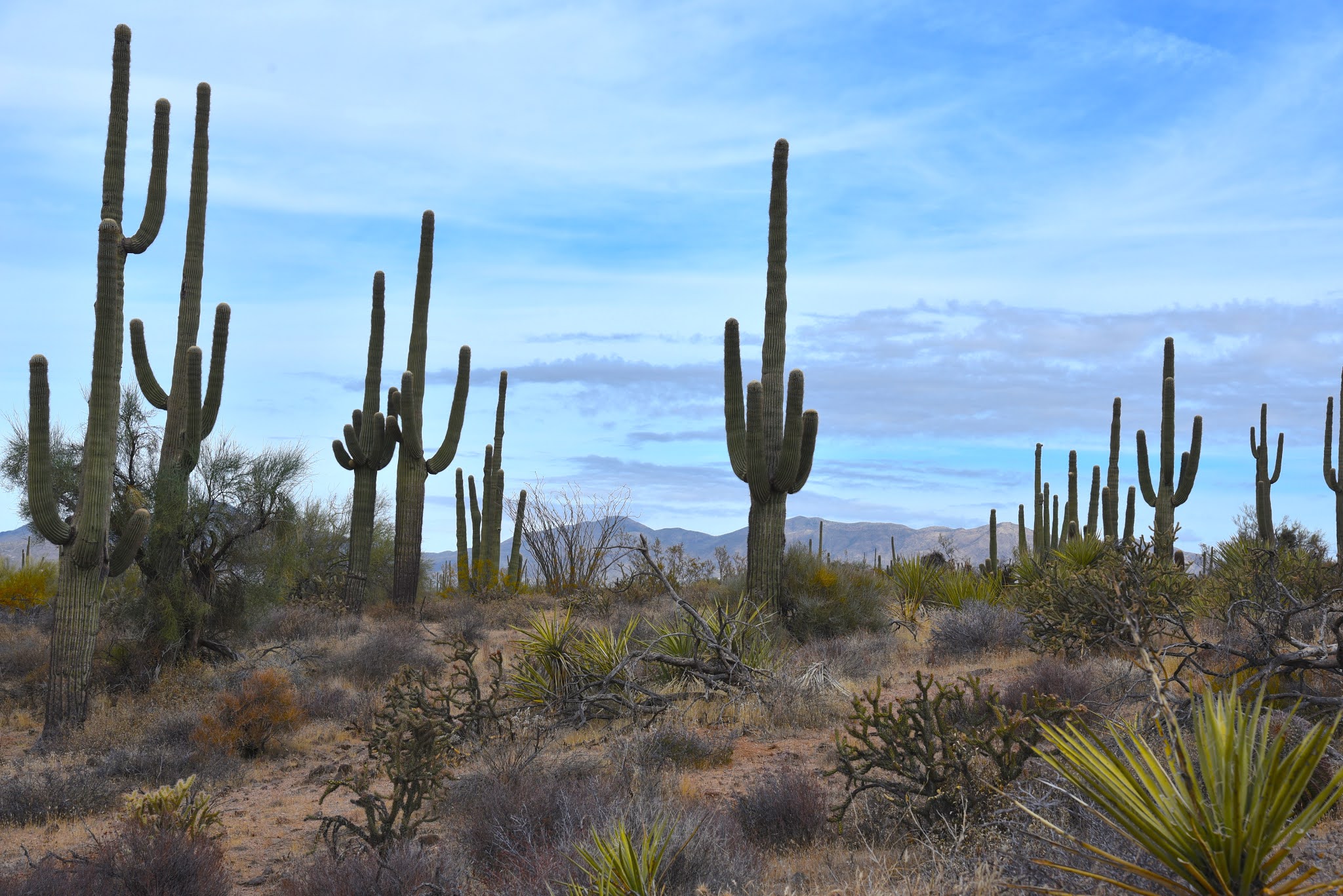
Saguaros on the Maverick Trail

All it takes is a little rain to paint the desert in wildflower color.  

Buckwheat

The late December precipitation in the Phoenix area soaked the Sonoran Desert just enough to revive drought-stressed plants and spur new growth.
Chuparosa

Scottsdale’s McDowell Sonoran Preserve is a rich botanical garden that’s already teasing of spring blooms to come.  
Desert lavender

A short hike using Browns Ranch Road, Maverick Trail, Cholla Mountain Loop and the Corral Trail provide a good tour of desert plant diversity.  From the Brown’s Ranch Trailhead, follow Brown’s Ranch Road north.
Dry Gulch Trail

Along this wide passage, fragrant turpentine bushes and yellow-flowered brittlebush dominate the fringe, shading delicate wishbone bushes sporting tiny white blossoms.  
Cholla Mountain Loop

At the one-mile point, turn right at the Maverick Trail sign.  Fiddleneck, globemallow and shrubby deervetch sprout along washes and at the bases of desert hackberry and wolfberry shrubs.  
Mormon tea

Wolfberry

This early in the season, it takes a sharp eye and slow pace to catch patches of rattlesnake weed, lacepod and scorpionweed emerging from the sandy soils.  
Wishbone bush

Continue following the signs to the Cholla Mountain Loop trail where massive boulders harbor clumps of chuparosa, desert lavender and jojoba bushes.  
Shrubby deer vetch

Hang a left at the Dry Gulch Trail and follow it a short distance noting the expansive basin of giant saguaros that front views of Tonto National Forest mountains to the north.
Christmas cactus

Next, turn left at the Corral Trail. This leg features acres of filaree, also known as stork’s bill.  Introduced by Spanish settlers, the low-growing naturalized plant with purple flowers and a beak-like seed pods served as forage for livestock.
Filaree aka stork's bill

Brown's Mountain seen from Corral Trail

Also, along this leg, look for spiny Mormon tea, fragile paperflower, pungent triangle bursage and Christmas cactus.
Fiddleneck

Back at the Browns Ranch Road junction, head back to the trailhead taking in big views of distinctive flat-topped Brown’s Mountain framed by mesquite, yucca and creosote. 
Fairy duster

Happy New Year!

LENGTH: 4.5 miles

RATING: easy

ELEVATION:  2,678 – 2,800 feet

GETTING THERE:

Browns Ranch Trailhead:
30301 N Alma School Pkwy, Scottsdale


Monday, November 4, 2024

Brown's Ranch Interpretive Trail

BROWN’S RANCH INTERPRETIVE TRAIL

Sign on Brown's Ranch Interpretive Trail

Hikers walking the Corral Trail in Scottsdale’s McDowell Sonoran Preserve have for years  wondered about the scattershot of crumbling concrete and contorted metal strewn about the site of the old Brown’s Ranch. The mysteries have been solved.

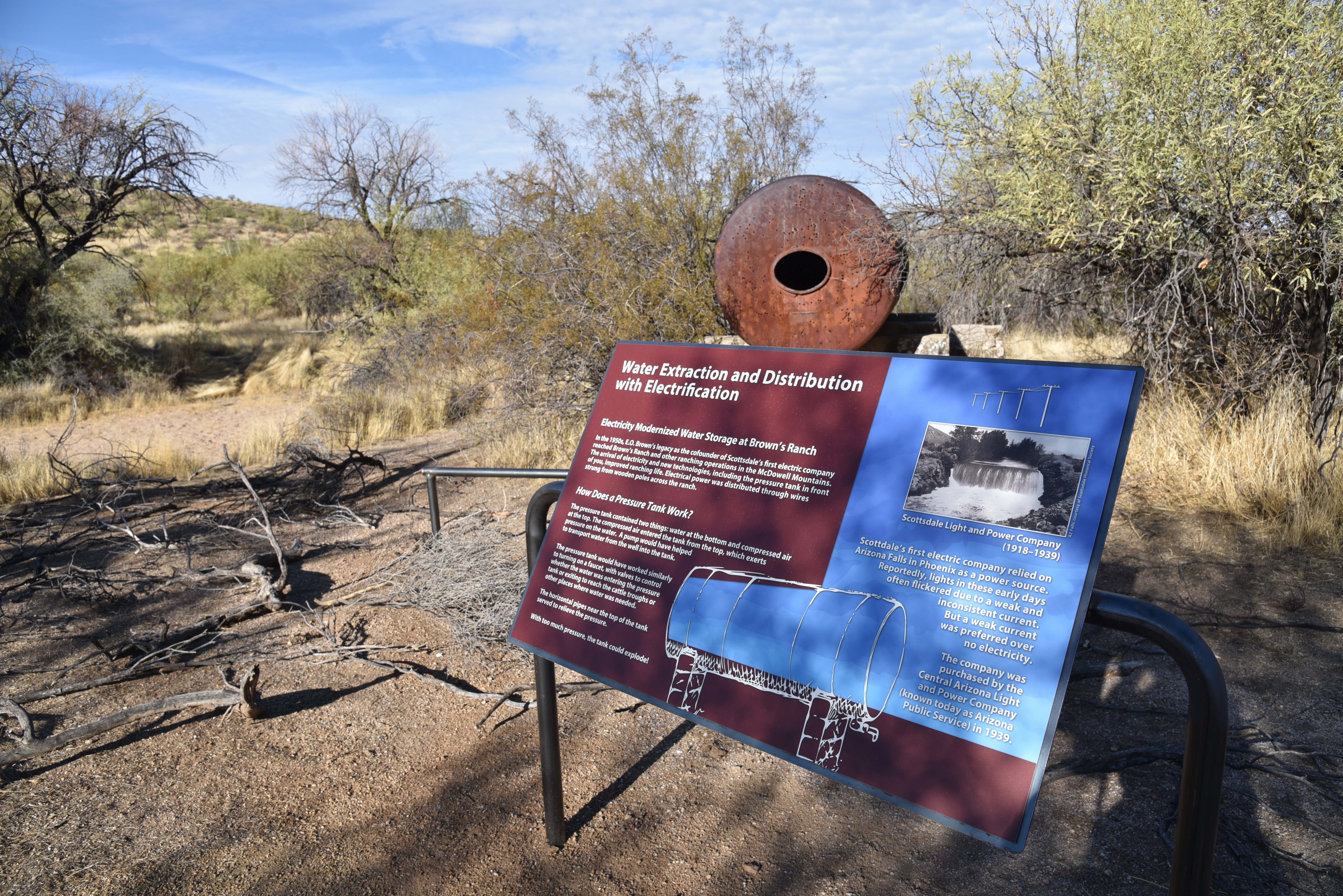
The new Brown’s Ranch Interpretive Trail reveals the details in the detritus.

Cistern at the Brown's Ranch site

Opened in October 2024, the easy 0.3-mile loop trail features 20 educational displays that identify the rusty parts, and faint remains of a working cattle operation that operated from 1916 though the 1970s.  

Also tells the story of the ranch founders—the Brown family--- as well as the native peoples, evolving technologies, military presence, and the personalities that colored and shaped the area from prehistory through the “Old West” an into the present.

Technology in the "Old West" explained

 
An old grain hopper rests among mesquite trees

Prior to the opening of the interpretive trail, the site of the Northern headquarters of the 40,000-acre cattle ranch operation was little more than a few acres of nameless bullet-riddled stuff wrapped in a tangle of barbed wire.  Now the history has been resurrected and artifacts named.

Entrance to the Brown's Ranch Interpretive Trail

For instance, what my hiking pals and I called “an airplane engine fallen from the sky” is a gain hopper. And a deep concrete pit we thought was a water trough is really the base of a cattle weigh station.  Who knew.
Signs on Brown's Ranch Road point the way


The site is reached by hiking 1.4 mile north on Brown’s Ranch Road from the Brown’s Ranch Trailhead. 

Barbed wire surrounds the ranch site

The trail sweeps around the mesquite-and-grass choked artifacts rolling out in chapters over its double loop layout.
The new trail is located off Brown's Ranch Road

Beautifully illustrated signs along the route address topics like how ranchers found water, what life was like as a hired hand and inventive construction and manufacturing methods used in the area.

First timers and regular preserve visitors alike will appreciate how the embellished trail enriches the hiking experience.

LENGTH: 3.1 miles roundtrip

RATING: easy

ELEVATION: 2,647 – 2,759 feet

GETTING THERE:

Brown’s Ranch Trailhead: 30301 N. Alma School Pkwy., Scottsdale.

From Loop 101 in Scottsdale, take the Pima/Princess exit 36 and go 6.5 miles north on Pima to Dynamite Road.  Turn right and continue 2.7 miles to Alma School Pkwy., turn left and drive 1 mile to the trailhead.

HOURS: The preserve is open sunrise to sunset daily.

FACILITIES: restrooms, water, maps. No fees.

INFO:

McDowell Sonoran Preserve

https://www.scottsdaleaz.gov/preserve


Monday, November 27, 2023

Cloudburst-Cone Mountain Loop

CLOUDBURST-CONE MOUNTAIN LOOP

Storm view from the Cloudburst trail

IMPORTANT NOTE: Please stay off wet trails to avoid damaging them. These photos were taken before the storms hit --on dry trails. 

 Funny thing about mountains; they’re rain makers.  The phenomenon isn’t unusual or magic, it’s something called orographic precipitation which is basically rain produced when warm moist air rises and cools over mountain ranges.

Granite boulders on the Cone Mountain trail

The process is fascinating to watch, it rolls out as if trapped in a sort of real-time time-lapse. Clouds rapidly build over peaks to the break point when they drop their payloads.
Granite sculpture on the Hackamore trail

This amazing weather event is easily observed in the mountain ranges that circle the Valley where the massif-borne rain flows down foothills into ephemeral streams and washes in gentle sheets or roiling deluges.  
Storm brewing over the Cloudburst trail

Higher elevations around the Valley like in North Scottsdale and Cave Creek where mountains reach to a cloud-summoning 4,000+feet get the lion’s share of water.
Preserve trails are well marked and maintained

 
Phoenix gets the dregs.  While Phoenix is situated at around 1,100 feet, north Valley locations like Scottsdale’s McDowell Sonoran Preserve rise to over 2,500 feet, and that makes all the difference in terms of taking the edge off city heat islands and soaking up residual mountain rain.  
Brown's Mountain viewed from Upper Ranch trail

The extra height also accounts for the occasional coating of winter snow that frosts saguaros in picture postcard splendor.  The fascinating workings of elevation and mountains on the desert landscape beg to be ogled, and the Cloudburst Trail feels like a purpose-built platform for the mission.

The aptly named hiking trail in the McDowell Sonoran Preserve gives front-row-style access to the spectacle of rain-making mountains in action. 

Early morning sun on Upper Ranch trail

The 0.9-mile trail coils along the base of 3,061-foot Cone Mountain with flat topped Brown’s Mountain standing at 3,253 feet high to the east.  The twisting singletrack in the preserve’s north region overlooks a gorgeous expanse of desert that abuts the hilly terrain of Tonto National Forest.

Stunning skyscape on the Cloudburst trail


There are numerous ways to access the route but using it as leg in a loop around Cone Mountain adds panoramic vistas and interesting geology to the mix.

Maps available online and at the trailhead show multiple ways to weave the Cloudburst trail into a day hike. 

Unobstructed views on the Cloudburst trail

One option is to create a loop hike using Upper Ranch, Cone Mountain, Hawksnest, and West Express trails for a moderate 5.3-mile trek.  Each leg of the route works a different facet of the preserve’s many characters.  The West Express and Hackamore trails bump up against bizarre granite formations and cross paths with powerlines that oddly mimic wiry tendrils of ocotillo cactus.
Loop hike circles Cone Mountain

The Upper Ranch and Cone Mountain trails showcase the preserve’s two distinct peaks and views of iconic Pinnacle Peak and western ranges. 
Looking west from Cone Mountain trail

But, on days when rain is in the forecast, it’s Cloudburst that outdoes itself.  Traversing a shelf-like edge hanging over acres of saguaros, the trail has unobstructed views of churning clouds rising among layers of misted ridges and peaks.
Powerlines flank the West Express trail

The route is easy to pick out or customize using maps available online or at the trailhead. Here’s one option. From the Brown’s Ranch trailhead, begins with a short walk on Brown’s Ranch Road to the Upper Ranch Trail.  Follow Upper Ranch 1.2 miles to emergency marker UR5 and turn left at the Cone Mountain connector.
 

Gathering storm on Upper Ranch trail

Hike 0.2-mile, turn right onto Cloudburst at emergency marker CN3. Follow Cloudburst to emergency marker HW33 and continue 0.1-mile to West Express at emergency marker HW35. Follow West Express 0.4-mile to emergency marker WE17 and turn onto Hackamore. Follow Hackamore to the Cone Mountain junction at CN5, hike back to Upper Ranch and backtrack to the trailhead.

CHEAT SHEET emergency marker breadcrumbs: TRAILHEAD, UR1, UR2, UR3, UR4, UR5, CN3, HW33, HW35, WE17, HT3, CN5, UR4, UR3, UR1, TRAILHEAD.

REMINDER: Please stay off wet trails.

LENGTH: 5.3 miles

RATING: moderate

ELEVATION: 2,508 – 2,713 feet

GETTING THERE:

Brown’s Ranch Trailhead

30301 N. Alma School Pkwy., Scottsdale.

From Loop 101 in Scottsdale, take the Pima/Princess exit 36 and go 6.5 miles north on Pima to Dynamite Road.  Turn right and continue 2.7 miles to Alma School Pkwy., turn left and drive 1 mile to the trailhead. The preserve is open sunrise to sunset daily. There are restrooms at the trailhead.

INFO:
McDowell Sonoran Preserve

https://www.scottsdaleaz.gov/preserve


Wednesday, October 28, 2020

Corral Loop

CORRAL LOOP 

McDowell Sonoran Preserve

Brown's Mountain seen from Brown's Ranch Road

A mile and a half north of the busy Brown’s Ranch trailhead, a gnarled mesquite tree grows through and around the crumbling walls of concrete feed trough.  Nearby, tangled barbed wire, weather-worn and clinging tenuously to wood posts, surrounds a conglomerate of disintegrating foundations and rusty metal scraps.  

Saguaros tower over the Corral Trail

The relics are what remains of Brown’s Ranch.  Established in 1916, the 44,000 acre operation ran cattle in the mountainous desert space before being abandoned in mid-century.  The historic site, which is now part of the McDowell Sonoran Preserve, is the key attraction on the Corral Trail in the popular Scottsdale recreation hub.
Yuccas sway above Brown's Ranch Road

Desert plants grow among the ruins of Brown's Ranch

The ranch site can be reached by following Brown’s Ranch Road north to the Corral Trail.  The 2.3-mile path swings through gorgeous Sonoran Desert between the distinctive flat-top form of Brown’s Mountain (3,253 feet) and the jumbled granite mounds of Cholla Mountain (3,406 feet).  The first set of ranch ruins appear off to the left just a few yards from the road junction.  

A Phainopepla bird perched on a yucca eyes nearby mistletoe

A bird nest (usually cactus wren) built into a cholla cactus

Even with encroaching cacti, catclaw, frothy turpentine bushes and stray twigs poking through cracked stonework, the old west character is so animated here that you might expect to find cattle grazing among the ruins.  Any present-day rustlings, though, are those of browsing javelina, deer, rabbits, lizards and chattering Phainopeplas—black, red-eyed birds with head crests that resemble cardinals-- feeding on invasive mistletoe drooping from ironwood trees.

A disintegrating foundation at the Brown's Ranch site

Cholla Mountain (center) & Granite Mountain (right) seen from Brown's Ranch Road

A string of barbed wire fencing trailing off from the main site soon dissolves into thickets of jojoba bushes and spiny yucca that line the trail as it swings north and west through open desert with towering saguaros and distant views of the Cave Creek Mountains to the north and Sierra Ancha Mountains to the east.  Occasional glimpses of sagging fences are the only relics visible until near where the trail reconnects with Brown’s Ranch Road.

Blue Palo Verde trees grow along the route

Beware of the notoriously sticky "Jumping Cholla"

Navigating the trails of McDowell Sonoran Preserve is easy

The desert reclaims its territory

Cave Creek Mountains seen from Brown's Ranch Road

Here, a round cinder block structure that at one time held ranch resources now serves as a sort of giant planter for mesquite trees surrounded by untamed clusters of "jumping cholla" (Chain Fruit Cholla) that provide fodder for pack rats and nesting habitat for cactus wrens.  Tread lightly while exploring these fragile remains that are slowing being reclaimed by environmental forces and desert creatures. Leave what you find, watch where you step--there are no cow pies, but those pesky magnetic cholla stems (and snakes, maybe) can ruin your day--and enjoy the trip back in time.

LENGTH: 5.5 miles

RATING: easy

ELEVATION: 2,645 – 2,763 feet

GETTING THERE:

Browns Ranch Trailhead.

30301 N. Alma School Pkwy., Scottsdale.

From Loop 101 in Scottsdale, take the Pima/Princess exit 36, travel 6.5 miles north on Pima to Dynamite Road.  Turn right and continue 2.7 miles to Alma School, turn left and drive 1 mile to the trailhead. The preserve is open sunrise to sunset daily. There are restrooms at the trailhead.

INFO:

https://www.scottsdaleaz.gov/preserve

https://azmemory.azlibrary.gov/digital/collection/splimage/id/18/