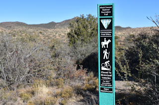
BLACK CANYON NATIONAL RECREATION TRAIL: COPPER MOUNTAIN SEGMENT
Ubiquitous yet largely invisible to the casual hiker, barn swallows play an interesting game of hide-and-seek with those who wander through their habitats.
 |
| Cattle graze near the Black Canyon Trail |
The migratory species feeds in mid-air, capturing insects (they love flies, which explains their name) in acrobatic swoops over open terrain, rangeland and farms.
 |
| Barn swallow nests in the SR 69 tunnel near the Big Bug trailhead |
Similar to cliff swallows, the tiny birds build their nests in natural rock crevasses, caves and crags, but have discovered that human-made structures like highway tunnels, bridges, culverts and abandoned buildings are also suitable locations for their distinctive nests.
 |
| Prescott Hiking Club members take a break on the Copper Mtn Segment |
Plastered to ceilings and walls, the cup-shaped nests are made of dry bits of local grasses molded with mud and lined with feathers. For observant hikers, the earth-toned cups-which mostly look like wads of mud flung onto ceilings-- can be spotted in overhead shadows in the concrete tunnels that usher trails under busy roads and freeways.
The tunnel under State Route 69 in the Yavapai County town of Mayer outside of Prescott is rife with nests as the surrounding landscape is dotted with farms, washes and open range where the swallows never hunger for a meal of insects.
 |
| A handsome longhorn regards hikes on the BCT |
Said tunnel ferries trail users between the Big Bug and Copper Mountain segments of the Black Canyon National Recreation Trail, a 100+-mile historic route that runs between Phoenix and the Verde Valley. While a walk through the tunnel is—at least for nature nerds—an interesting passage, there’s much more to love about the Copper Mountain segment. The trip begins at the Big Bug Trailhead, that's located about an hour's drive north of Phoenix, by taking the left fork a few yards south of the restroom, passing through the tunnel and heading into wide open pastureland. Save for a few lonesome junipers, the scrubby, windswept terrain has little shade and even less to disrupt big mountain vistas including glimpses of the long mesas of the Pine Mountain Wilderness and the pine-covered Bradshaw Mountains.
 |
| Copper Mountain Loop adds 8.7 miles to the hike |
After passing a couple of ranch sites, the trail dives into the an unrelenting series of ups-and-downs. At the 1.6-mile point, the trail meets the Copper Mountain Loop junction.
 |
| Rock cairns mark the hilly route |
The 8.7-mile add-on loop heads left for a twisting trip through the foothills below 5,026-foot Copper Mountain.
 |
| Open rangeland dominates the landscape |
The loop reconnects with the Copper Mountain segment at the Russian Well Segment 3 miles north of the south junction.
 |
| Copper Mountain viewed from the trail |
To stay on the main trail, head right and follow the route northward through drainages, gullies and grasslands where grazing cattle are nearly as pervasive as the swallows that dart among the cows and cacti diving for their dinners.
 |
| Pine Mountain Wilderness on horizon |
LENGTH:
Copper Mountain Segment: 4.6 miles one-way ((.2 miles out-and-back)
Copper Mountain Segment with Loop: 15.1 entire loop plus access from trailhead
RATING: moderate
ELEVATION: 4,020 - 4,414 (1,265 feet accumulated elevation change)
GETTING THERE:
Big Bug Trailhead:
From Interstate 17 in Cordes Junction take exit 262 for State Route 69 heading north toward Prescott. Continue 4.2 miles to the signed turn off for the Black Canyon Trail on the left.
FACILITIES: vault toilet
INFO & MAPS:
Black Canyon Trail Coalition
https://bctaz.org/copper-mountain-loop/
ABOUT THE PRESCOTT HIKING CLUB
https://www.prescotthiking.com/
INFO ABOUT CLIFF & BARN SWALLOWS
https://azdot.gov/adot-blog/nesting-birds-are-protected-during-construction


