Find A Trail. Start Your Search Here:

Showing posts with label Latigo Trail. Show all posts

Wednesday, March 2, 2022

Latigo-Sidewinder Loop

LATIGO-SIDEWINDER LOOP

View from the Sidewinder Overlook


Immersion into the assorted levels of awesomeness of the Sonoran Desert is as easy as stepping off the pavement and into the Scottsdale McDowell Sonoran Preserve.

Creosote shrubs grow among occotillo stems

With over 200 miles of non-motorized trails, the northeast Valley preserve is a major draw for hikers, bikers and equestrians of all levels of expertise. 
Chuparosa plants grow from cracks in granite


With winter visitor season in full swing, it’s smart to have a go-to selection of short and easy treks that showcase the amazing beauty and diversity of our Valley trails.

A crested saguaro is a highlight of the hike

Approachable and enlightening, the Latigo-Sidewinder loop offers a quick trip that’s packed with botanical, geological and scenic wonders. 
Tiny desert rock peas thrive in sunny spots

It’s the perfect hike to do with those who may not be regular trekkers or acclimated to desert conditions. 
Scientists aren't sure how crested saguaros form

Kid’s love it, too.
The route passes through a boulder corridor

The tour begins at the new Pima-Dynamite trailhead where restrooms, shaded seating areas and interpretive signs add welcoming amenities as well as a sense of anticipation.

Stop and smell the lavender on the Latigo trail

An easy half-mile walk on the wide, sandy Latigo trail enters the preserve’s far west edge, passing under powerlines that curiously mimic look the long, slender stalks of native ocotillo cactus.

A phainopepla bird feeds on mistletoe

Along this introductory leg, a veritable botanical garden of blooming native plants vie for attention.  Look for sulfur-yellow desert marigolds and brittlebush, red chuparosa shrubs, fairy dusters,  delicately fragrant desert lavender and the golden desert rock pea. Fruit bearing thornbush, wolfberry and invasive mistletoe attract birds like cactus wrens, phainopeplas, mockingbirds and doves while rabbits, squirrels and lizards surrey among jojoba bushes and many species of cholla cacti. 
Fairy duster shrubs are common on the hike

At the Sidewinder trail junction, head right and follow the signs to the main botanical event—a magnificent crested saguaro.  A sign near the rare specimen presents theories on how the contorted fan-like crests of these desert curiosities might form. 
Desert hyacinth "blue dicks" have edible roots

Desert marigolds add spots of gold to the hike


Just beyond the  crested saguaro, the trail enters a boulder-lined corridor with an optional short detour to the Sidewinder Overlook where Valley mountain ranges my be viewed from a platform of granite shelves.  Newcomers are often stunned by the variety and profusion of desert plant and animal life and the juxtaposition of a low, arid environment with a ring of mountain peaks that might be snow-capped in winter.  

Doves are easy to spot along the trails

A Northern mockingbird sings from atop a saguaro

From the overlook, follow the signs back to the Latigo trail and swing back to the trailhead for a satisfying 2.7-mile loop.

This swift dive into a family-friendly corner of Scottdale McDowell Sonoran Preserve is one to keep in mind for entertaining visitors or just wallowing in local flora and fauna without a lot of fuss.    

LENGTH: 2.7-mile loop

RATING:  easy-moderate

ELEVATION: 2,339 – 2,450 feet

GETTING THERE:

Pima-Dynamite Trailhead:

28777 N. Pima Road, Scottsdale

There are two access roads near the corner of Pima ad Dynamite Roads and the other is on Pima just north of the traffic signal and one a few yards east on Dynamite. There are restrooms at the trailhead.

HOURS: sunrise to sunset daily

INFO:

Scottsdale McDowell Sonoran Preserve

https://www.scottsdaleaz.gov/preserve


Monday, September 30, 2019

LATIGO-ROCK TANK- HAWKNEST LOOP

LATIGO-ROCK TANK-HAWKNEST LOOP

McDowell Sonoran Preserve
Palo verde trees shade the Latigo trail
Black Mountain seen from Rock Tank Trail
Outdoor recreation opportunities continue to expand in the McDowell Sonoran Preserve.  The permanently protected swath of Sonoran Desert in north Scottsdale that has over 220+ miles of trails that wind through more than 30,000 acres of pristine territory recently gained a new trailhead. 
WAPA power lines on Powerline Road
Located in the preserve’s northwest corner, the Pima-Dynamite trailhead that opened earlier this year, is part of the City of Scottsdale’s Phase 3 Trail Corridor Plan. The roomy access point is bordered by Pima Road and State Trust Land, Dynamite Boulevard and Stagecoach Pass and has parking for more than 200 passenger vehicles and special spots for horse trailers. While still under development, several trails in the Phase 3 project which involves 3,000 acres of land just west of the Brown’s Ranch trailhead are open for use by hikers, bikers and equestrians. Like all preserve trails, the new cluster of sustainably-designed, multi-use routes offer safe, non-motorized access while protecting native plant and wildlife habitats.
To get a quick look at the Phase 3 sector, make a loop hike on the Latigo, Rock Tank, Hawknest and Powerline Road trails. 
New trails in Scottsdale's McDowell Sonoran Preserve
A map kiosk at the trailhead shows the system layout as well as its connectivity with old-favorite preserve trails to the east.  The circuit begins with a short walk on Powerline Road to the Latigo Trail junction. The 1.1-mile Latigo leg is dominated by views of the Western Area Power Administration high voltage powerline.  Not exactly anybody’s idea of a perfect hiking visual experience, the looming spider-like metal structures have an odd, other-worldly presence.
A stony passage on the Hawknest Trail
When framed by the gangly arms of ocotillo and the gnarly branches of dead ironwood trees, the towers embody technology imitating nature. The juxtaposition of wires and wilds elicits mixed responses from trail users. Is the high-voltage canopy a necessary co-existence or an omen of doom?  It’s a dialectic best not explored when disparaging the juice conduits while pulling up trail apps on your phone. 
Bizarre granite rock forms are common site along the trails
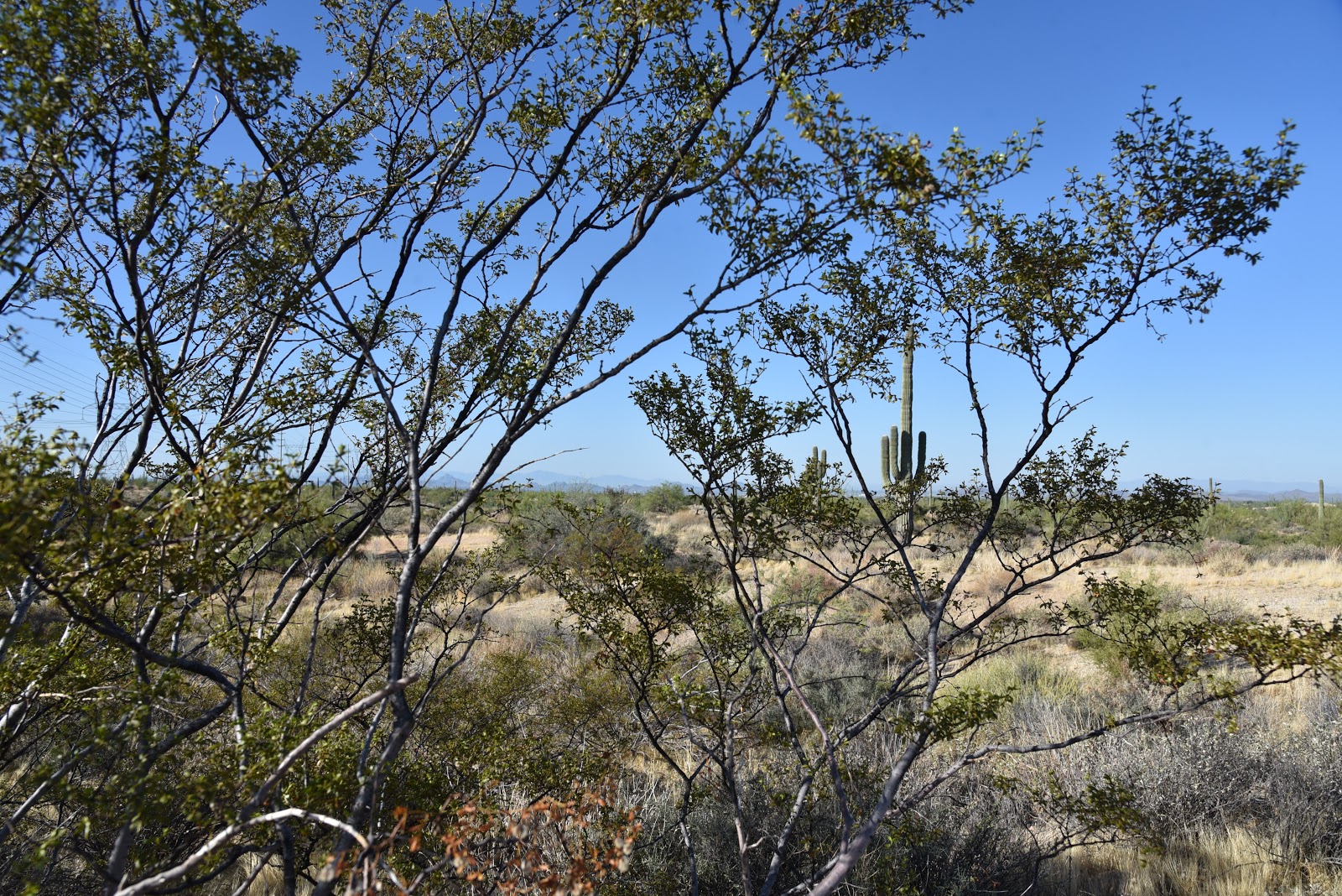
Creosote shrubs line the Rock Tank Trail
Granite boulders on the Hawknest Trail
Wires and wilds on Latigo Trail.
Desert Senna blooms April - October
Hawknest Trail swerves around a granite rock garden
An old mesquite tree on Hawknest Trail
The hike isn’t all power lines, though.  As the route dips and bends, the wires are swallowed by big desert vistas of surrounding mountains and the distinctive forms of Cone Mountain, Pinnacle Peak and Black Mountain.  Hang a left at the Rock Tank trail junction where acres of saguaros, shrubs and hilly terrain mark the transition into a maze of mountain bike routes to the north. 
Sonoran Desert vegetation of Rock Tank Trail
The twisted paths of Dare A Sarah, Scorpion and Snake Eyes trails form a loopy challenge course in an area that, as of this writing, is signed to advise users to use caution because the area is not yet mapped. The trails are indicated on the trailhead kiosk, though. Continue on to the Hawkneck trail junction, turn left and get ready to hike though some narrow stone corridors with bizarre granite outcroppings. Although this leg of the hike also parallels the power lines, Palo verde, ironwood and mesquite trees do a good job of hiding them from view. 
Technology imitates nature on the Latigo Trail
The final miles back to the trailhead meld swerving singletrack paths with the straight-shot, bulldozed power line road that is both a backbone trail for pristine back country hikes and an access route for maintenance crews that tend the wires that send power to mobile devise charging stations.  The paradox abides.
LENGTH: 3-mile loop
RATING: easy
ELEVATION: 2,339- 2,453 feet
GETTING THERE:
Pima-Dynamite Trailhead: 28777 N. Pima Rd., Scottsdale.
From Loop 101 in Scottsdale, take the Pima/Princess exit 36, go 6.5 miles north on Pima Road to Dynamite Blvd., turn right and continue 0.1-mile to the trailhead on the left. No facilities at this time. The preserve is open daily from sunrise to sunset.
INFO: McDowell Sonoran Preserve