


 |
| Willows hug the So. Fork of the Little Colorado River |
At the point on
the South Fork Trail #97 where the route crosses a creek and begins its grueling
climb, I was jolted to a stop by screams that sounded like an injured dog. In a flash, a herd of elk bolted across the
trail just yards ahead of me. Five
females in tandem, then a lone male.
They scrambled up a knoll following the cries of a distressed calf. The adults circled the young one who
continued to wail from its high perch. Two more elk burst from the creek,
stopping briefly to stare me down before they charged up to meet the herd, round
up the calf and bolt into the back county.
They gave me a thrill and I reciprocated with exactly what they needed--their
space.
 |
| Eden meets Hell. |
Encounters like
this one are common on the White Mountains trails of northeastern Arizona.
Before venturing out into the forests, hikers should be aware of common-sense
rules for respecting wildlife. The basic
concept is to keep wildlife wild by not approaching, harassing, “helping” or
feeding them.
The Arizona Game &
Fish website is a good resource for learning about responsible wildlife viewing.
Simple habits like observing from a distance, sticking to trails, keeping food
secured, avoiding nest and den areas and knowing what to do (and not do) should
you encounter a wild animal can protect both you and the animals.
 |
| Wild roses bloom through August. |
 |
| A beaver dam on the river. |
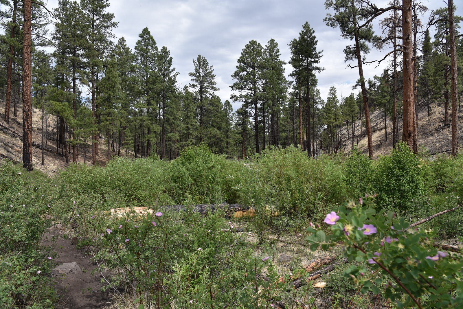
The South Fork
Trail #97 near Eagar, with its proximity to water and varied habitats is a wildlife
magnet. The challenging route can be
done as an out-and-back or car shuttle hike. Most people begin at the South Fork day use
area. Shaded by tall pines, firs and
spruce trees, the first mile of the trail escaped the wrath of the 2011 Wallow
Fire that burned more than a half million acres of the Apache-Sitgreaves National
Forest. This Eden-like stretch follows
the South Fork of the Little Colorado River.
The waterway is cluttered with willows, alders, Red-osier dogwood, skunk bush, poison ivy (leaves of three; let it be) and wild roses. Where the water comes closest to the trail,
be on the lookout for stealthy Great blue herons and ingeniously-constructed
beaver dams. As the trail moves southeast, gradually gaining elevation, it creeps
up on the scar of the fire.
A charred tree trunk here and a pile of burnt logs there precede the kick-in-the-gut
moment. Just over a mile in, Eden meets Hell.
Oddly prefaced by a gateway of
willows, the next 5 miles of flame-plundered terrain are physically taxing
and difficult to process emotionally.
Those who remember what the trail looked like before the fire will find
this segment heartbreaking.
 |
| An elk bolts across the trail. |
 |
| Greens Peak (left) and the Springerville Volcanic Field |
 |
| So. Fork of the Little Colorado on the way to the trailhead |
 |
| Boggy Mexican Hay Lake attracts pronghorn. |
 |
| Red-osier dogwood grows along the river. |
 |
| The first mile of the trail escaped the Wallow Fire. |
 |
| The 2011 Wallow Fire damaged much of the trail. |
Whether the
shaggy band wandered there by chance or because they had learned to associate
picnic tables with food handouts, I gave them what they needed most--- telephoto
lens distance, a clear escape route and not a smidge of food.
 |
| Bighorn Sheep at Point of the Mountain vista area. |
LENGTH: 14 miles
round trip
RATING: moderate
ELEVATION: 7540 –
9060 feet
 |
| Greenery along So.Fork of the Little Colorado River. |
GETTING THERE:
South Fork Trailhead
From the Hon-Dah
Casino in Pinetop-Lakeside, go 32.8 miles east on State Route 260 to County
Road 4124 located near milepost 390 on the right. Go 2.6 miles south on CR 4124, cross a bridge
and turn right into the trailhead parking area. Roads are paved and
sedan-friendly gravel.
Point of the Mountain
From the County
Road 4124 turnoff, continue 2.3 miles east on State Route 260 to State Route
261, past mile post 393. Turn right and go 7.1 miles to the vista point on
the left just past milepost 405. Hike 200 feet back up SR 261 and follow Forest
Road 70B/FR8070B (unmarked at this writing) around the lake to the trail. NOTE: SR 261 is paved but the forest roads are
rough, unmaintained dirt. You could
drive the mile to the trail but four-wheel-drive vehicle is recommended.
INFO & MAPS:
LIVING WITH
WILDLIFE:


