Find A Trail. Start Your Search Here:

Showing posts with label Upper Ranch Trail. Show all posts

Monday, November 27, 2023

Cloudburst-Cone Mountain Loop

CLOUDBURST-CONE MOUNTAIN LOOP

Storm view from the Cloudburst trail

IMPORTANT NOTE: Please stay off wet trails to avoid damaging them. These photos were taken before the storms hit --on dry trails. 

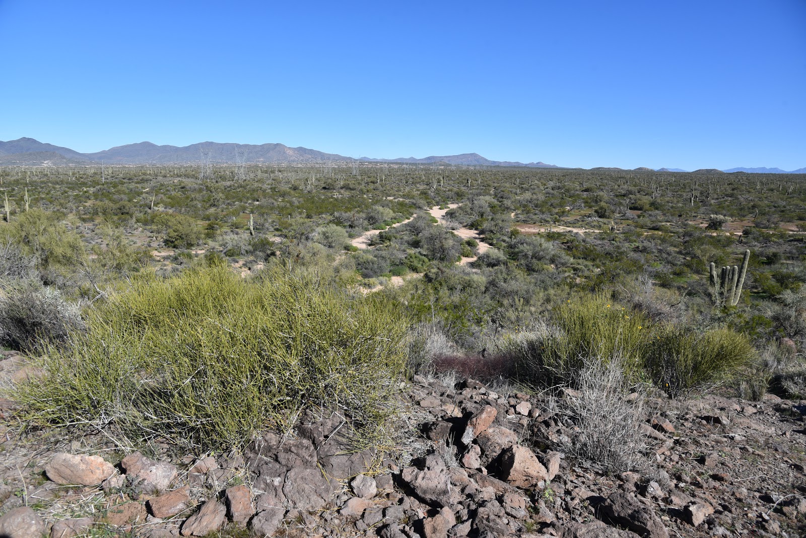
 Funny thing about mountains; they’re rain makers.  The phenomenon isn’t unusual or magic, it’s something called orographic precipitation which is basically rain produced when warm moist air rises and cools over mountain ranges.

Granite boulders on the Cone Mountain trail

The process is fascinating to watch, it rolls out as if trapped in a sort of real-time time-lapse. Clouds rapidly build over peaks to the break point when they drop their payloads.
Granite sculpture on the Hackamore trail

This amazing weather event is easily observed in the mountain ranges that circle the Valley where the massif-borne rain flows down foothills into ephemeral streams and washes in gentle sheets or roiling deluges.  
Storm brewing over the Cloudburst trail

Higher elevations around the Valley like in North Scottsdale and Cave Creek where mountains reach to a cloud-summoning 4,000+feet get the lion’s share of water.
Preserve trails are well marked and maintained

 
Phoenix gets the dregs.  While Phoenix is situated at around 1,100 feet, north Valley locations like Scottsdale’s McDowell Sonoran Preserve rise to over 2,500 feet, and that makes all the difference in terms of taking the edge off city heat islands and soaking up residual mountain rain.  
Brown's Mountain viewed from Upper Ranch trail

The extra height also accounts for the occasional coating of winter snow that frosts saguaros in picture postcard splendor.  The fascinating workings of elevation and mountains on the desert landscape beg to be ogled, and the Cloudburst Trail feels like a purpose-built platform for the mission.

The aptly named hiking trail in the McDowell Sonoran Preserve gives front-row-style access to the spectacle of rain-making mountains in action. 

Early morning sun on Upper Ranch trail

The 0.9-mile trail coils along the base of 3,061-foot Cone Mountain with flat topped Brown’s Mountain standing at 3,253 feet high to the east.  The twisting singletrack in the preserve’s north region overlooks a gorgeous expanse of desert that abuts the hilly terrain of Tonto National Forest.

Stunning skyscape on the Cloudburst trail


There are numerous ways to access the route but using it as leg in a loop around Cone Mountain adds panoramic vistas and interesting geology to the mix.

Maps available online and at the trailhead show multiple ways to weave the Cloudburst trail into a day hike. 

Unobstructed views on the Cloudburst trail

One option is to create a loop hike using Upper Ranch, Cone Mountain, Hawksnest, and West Express trails for a moderate 5.3-mile trek.  Each leg of the route works a different facet of the preserve’s many characters.  The West Express and Hackamore trails bump up against bizarre granite formations and cross paths with powerlines that oddly mimic wiry tendrils of ocotillo cactus.
Loop hike circles Cone Mountain

The Upper Ranch and Cone Mountain trails showcase the preserve’s two distinct peaks and views of iconic Pinnacle Peak and western ranges. 
Looking west from Cone Mountain trail

But, on days when rain is in the forecast, it’s Cloudburst that outdoes itself.  Traversing a shelf-like edge hanging over acres of saguaros, the trail has unobstructed views of churning clouds rising among layers of misted ridges and peaks.
Powerlines flank the West Express trail

The route is easy to pick out or customize using maps available online or at the trailhead. Here’s one option. From the Brown’s Ranch trailhead, begins with a short walk on Brown’s Ranch Road to the Upper Ranch Trail.  Follow Upper Ranch 1.2 miles to emergency marker UR5 and turn left at the Cone Mountain connector.
 

Gathering storm on Upper Ranch trail

Hike 0.2-mile, turn right onto Cloudburst at emergency marker CN3. Follow Cloudburst to emergency marker HW33 and continue 0.1-mile to West Express at emergency marker HW35. Follow West Express 0.4-mile to emergency marker WE17 and turn onto Hackamore. Follow Hackamore to the Cone Mountain junction at CN5, hike back to Upper Ranch and backtrack to the trailhead.

CHEAT SHEET emergency marker breadcrumbs: TRAILHEAD, UR1, UR2, UR3, UR4, UR5, CN3, HW33, HW35, WE17, HT3, CN5, UR4, UR3, UR1, TRAILHEAD.

REMINDER: Please stay off wet trails.

LENGTH: 5.3 miles

RATING: moderate

ELEVATION: 2,508 – 2,713 feet

GETTING THERE:

Brown’s Ranch Trailhead

30301 N. Alma School Pkwy., Scottsdale.

From Loop 101 in Scottsdale, take the Pima/Princess exit 36 and go 6.5 miles north on Pima to Dynamite Road.  Turn right and continue 2.7 miles to Alma School Pkwy., turn left and drive 1 mile to the trailhead. The preserve is open sunrise to sunset daily. There are restrooms at the trailhead.

INFO:
McDowell Sonoran Preserve

https://www.scottsdaleaz.gov/preserve


Monday, November 26, 2018

BASALT RIDGE OVERLOOK

BASALT RIDGE OVERLOOK
Chunks of lichen-encrusted basalt litter the Basalt Ridge Trl.
Whether you’ve only skimmed its core trails or are a seasoned traveler of Scottsdale’s McDowell Sonoran Preserve, it’s easy to see that the 30,500-acre site is a wonderland of geological features.
Distinctive Cone Mtn. flanks the trails.
Brittlebush is plentiful along the route.
Upper Ranch Trail traverses the saddle of Brown's Mtn.
Invasive mistletoe attracts Phainopela birds.
In the preserve’s north sector, several popular routes wind among the impossible-to-miss mounds of Granite and Cholla Mountains that anchor a landscape of crystalized megaliths, nature-sculpted “mushroom rocks” and stony passages, while other trails wander off into areas with quieter dynamics.  As trail build-out progresses within the North Valley preserve, more and more subdued places are being revealed.
Wolfberry shrubs thrive in moist areas.
Take for instance, the Basalt Ridge Trail.  Like most trails in the preserve, the short singletrack can be accessed via numerous connecting trails.  One scenic option is to start at the Brown’s Ranch Trailhead and take the Upper Ranch Trail. The beauty of this circuit is that it departs the heavily-travelled main corridor almost immediately.  The Upper Ranch Trail glides northward over the saddle between the pointed form of Cone Mountain and flat-topped Brown’s Mountain before descending into a sunny stretch of desert cut with sandy washes, arroyos and impressive vistas of the Cave Creek Mountains.  Where water settles in the drainage areas, fragrant patches of Triangle-leaf bursage, fruit-laden wolfberry shrubs, colorful masses of in-your-face brittlebush flowers and creamy Desert wishbone blooms put on lavish botanical displays.  Roughly 1.6 miles from the start, fist-sized globs of rust-and-ash-colored rock begin to appear scattered along the route. 
Brown's Mtn. framed by blooming creosote.
Look closely and you’ll see the characteristic vesicular texture (holes formed by escaping gasses) of volcanic basalt. Unlike the showy, igneous granites that formed underground millions of years ago, this basalt is the result of surface lava flows or explosive events that also contributed to the site’s geological structure.  At the 1.8-mile point, the Basalt Ridge Trail veers off the Upper Ranch Trail tracing the crest of a low-slung rim.
Desert wishbone bush.
A half-mile and two junctions later, the Basalt Ridge Overlook spur leads to the nose of the rim perched above desert lowlands criss-crossed with dry washes and acres of mesquite. 
Mountain views on Upper Ranch Trail
Triangle-leaf bursage grows near washes.
From this tiny vantage point, views of the Four Peaks in Tonto National Forest to the east peek over Granite Mountain while the closer forms of Pinnacle Peak and Tom’s Thumb are visible to the south. Closer still are glimpses of the acres of preserve land set for future trail development that will undoubtedly add more surprises and deeper perspectives into this complex and beautiful terrain.
Cave Creek Mountains seen from the Basalt Ridge Trail
View from Basalt Ridge Overlook
LENGTH: 4.8 miles out-and-back
RATING: easy
ELEVATION:  2632 – 2741 feet
GETTING THERE:
Brown’s Ranch Trailhead,  
30301 N. Alma School Rd., Scottsdale, 85262.
From Loop 101 in Scottsdale, take the Pima/Princess exit 36, travel 6.5 miles north on Pima to Dynamite Road.  Turn right and continue 2.7 miles to Alma School, turn left and drive 1 mile to the trailhead. The preserve is open sunrise to sunset daily.
There are restrooms, water and a map kiosk at the trailhead.
INFO & MAPS:

Monday, March 24, 2014

UPPER RANCH-BROWN'S MOUNTAIN LOOP


Wildflower high season at McDowell Sonoran Preserve
Scottsdale

Brown's Mountain Trail

Standing on the summit of Brown's Mountain, a heart-pumping realization of just how close the desert preserve lapping at its base came to being washed away in a tidal surge of golf properties strikes the senses.   The suburban sprawl tsunami was averted through the persistence and hard work of the McDowell Sonoran Conservancy, hundreds of volunteers and the City of Scottsdale, leaving us with an unspoiled parcel of Sonoran Desert to enjoy in perpetuity.  So, you better darn well get out there and hike! If the spectacular scenery and easy-to-navigate trails are not enough  motivation for you, the months of March and April bring wildflower high season. Even in drier years like 2013-14, strawberry hedgehog cactus, chia, lupines, poppies, buckwheat, chicory, scorpion weed, globemallow and rock gilia add splashes of vivid color to the subtle earth tones of the desert floor.
Mexican gold poppies

The familiar flat-topped silhouette of Brown's Mountain anchors the western end of the parcel. One option to get to the high point is to hike Brown's Ranch Road to Brown's Mountain Trail and take the summit spur trail to the top.
Although this path is narrow, rocky and steep, the climb's ROI is a birds-eye view of the entire trail system and surrounding mountain ranges.  Descend and continue on Brown's Mountain Trail to Upper Ranch Trail and follow its flower-fringed course back to the trailhead.

Brown's Mountain Summit Spur
LENGTH: 4.3 miles
RATING: moderate
ELEVATION:  2710' - 3253'
HOURS: sunrise to sunset daily

GETTING THERE:
Brown's Ranch Trailhead: 30301 N. Alma School Pkwy, Scottsdale.
From Loop 101 in Scottsdale, take the Pima/Princess exit 36. Go 6.5 miles north on Pima to Dynamite, turn right and continue 2.7 miles to Alma School.  Turn left and go 1 mile to the trailhead. There’s restrooms, water and maps at the trailhead.  No fees.
Brown's Mountain
INFO & MAPS: McDowell Sonoran Conservancy
City of Scottsdale: