Find A Trail. Start Your Search Here:

Showing posts with label Springerville. Show all posts

Monday, August 19, 2019

GREENS PEAK: Hike to the High Point of the Springerville Volcanic Field

GREENS PEAK
The beastly profile of Greens Peak near Greer.
From a distance, the lopsided hump of Greens Peak with its sparsely vegetated south face and top fringe of conifers resembles the shaggy profile of an African wildebeest.
Escudilla Mountain (horizon on right) seen from Greens Pk.
The funny-looking hill sits a few miles north of State Route 260 near the town of Greer, between the lofty peaks of eastern Arizona’s White Mountains and the colorful badlands of the Petrified Forest National Park and offers a unique vantage point in the ecoregion between alpine forests and high-desert plains.
Looking toward Springerville from Greens Peak
Mima mounds dot the meadows around Greens Peak
The hike climbs to the top of a cinder cone volcano
Fleabane grow in dense clumps along the route
Aspens thrive on the north face of Greens Peak
The 10,134-foot extinct cinder cone volcano is the highest point of the Springerville Volcanic Field-- a swath of hundreds of diverse geological wonders that runs roughly between the towns of McNary and Alpine. Surrounded by miles of open rangeland, meandering creeks and sweet-smelling fir-spruce woodlands, the area is also home to dozens of easy-to-explore volcanic elements and glacial imprints. For an in-depth but approachable read about this fascinating corner of Arizona, check out A Guide to the Geology of the White Mountains and the Springerville Volcanic Field, Arizona by John V. Bezy and Arthur S. Trevena. It’s available as a free download on the Arizona Geological Survey website. 
Hundreds of geological features are visible from Greens Pk
The book describes several field trips to some of the area’s most interesting peculiarities. The keynote trip is a hike up to Greens Peak.  
Summit of Greens Peak has great views in all directions
With its beastly appearance and half bald, half forested slopes, the mountain is a natural draw for curious visitors in search of an off-the-radar summit hike with primo views. Although it’s short in length and ascends on a gradual, undulating grade, the trek is not for the faint-of-heart. It begins at over 9,000 feet in elevation where thin air will tax the lungs of unacclimated Valley dwellers. If you’re not up to the 600-foot haul to the summit, there are plenty of curiosities to explore around the mountain’s base including the mima (pronounced may-muh) mounds.
Sunrise ski area and Fence Tank seen from Greens Peak
One of the enduring mysteries of White Mountain geology, is the origin of the mounds.
Harebells bloom in alpine meadows through September
Rodents, imbedded root systems and creatures from outer space all have been credited with making these roundish, lumps of gravel that average 2 feet high in the breezy meadows below the peak.
Summit marker on 10,134-foot Greens Peak
The prevailing theory is that these odd lumps are remnants of a glacial ice field that receded some 25,000 years ago leaving behind a landscape that smacks more of Iceland than Arizona.   
A pollinator alights on a Western yarrow plant.
Don’t be intimidated by the hill’s steep, stark appearance. Following an edge-hugging road that makes a 180-degree swing along the mountain’s west and south flanks, the steady uphill slog is easier than it looks.  Along the lung-pumping climb, vista points appear around every kink in the road.
North view from the summit of Greens Peak
Look for surrounding hike hubs like Pole Knoll, Mount Baldy (11,420 feet) and the trails around Big Lake. Near the top, the distinctive profile of Escudilla Mountain (10,912 feet) that sits near the New Mexico border shows a frenzy of aspen resurgence in the scar of the 2011Wallow Fire.  On the summit, a fire lookout and communication towers rise above the coniferous woodlands that cover the mountain’s northeast flanks.
Greens Peak seen from nearby Fence Tank corral.
To the south, the web-like patterns of ski runs at Sunrise Park Resort near Greer stand out above a landscape of misshapen volcanic bluffs, mounds and eroded cones.
Cattle graze in meadows at the base of the mountain.
The mountain’s breezy high-elevation edges are also ideal for birdwatching or spotting herds of pronghorn, elk and ubiquitous cattle roaming among lumpy grasslands and watering holes below.
A fire lookout and communication towers on the summit
LENGTH: 2 or 4 miles roundtrip
RATING: moderate
ELEVATION: 9,520 – 10,134 feet
GETTING THERE:
From Pinetop-Lakeside, travel east on State Route 260 (toward McNary).  Continue to roughly 3 miles past State Route 273 to Forest Road 117 near milepost 380 on the left (about a mile past the Railroad Grade trailhead).  Follow FR117 north for 3 miles to a "Y" junction at Forest Road 61 where a sign reads “Greens Peak 2 miles”. You can park here for a 4-mile roundtrip hike or veer left and drive another mile to the next “Y” intersection at FR61/61C
for a 2-mile hike.  Roads are maintained dirt and cinder and passable by sedan.
INFO: Arizona Geological Survey
Arizona Wildlife Trails:

Monday, June 8, 2015

OCOTE TRAIL

OCOTE TRAIL
White Mountain Grasslands Wildlife Area
Stock pond at White Mountain Grasslands Wildlife Area.

Have you ever wondered where money from the Arizona Lottery ends up? Besides lining the pockets of a few lucky winners, lottery proceeds also support numerous public programs including the Arizona Game and Fish Department Heritage Fund Program for threatened, endangered and sensitive species and their habitats. For the past 20 years the fund has made many positive contributions to the state's wildlife and natural areas conservation efforts while preserving public access and recreational opportunities.
One success story is the White Mountain Grasslands Wildlife Area near the town of Eagar. The 2,850-acre site is comprised of two former ranch properties acquired in 1999 and 2000. The 2.6-mile Ocote trail (named for one of the ranches) wraps around pinion-juniper woodlands, riparian habitat, ponds, a wet meadow, open grasslands, an historic log bunkhouse and rustic ranch house with a windmill.
Interpretive signs placed long the trails give details about the surrounding plants, animals and the how the property's various ecosystems help wildlife thrive. Although the trail is short and can be hiked in about an hour, a better plan is to allow plenty of time to sit quietly at strategically-placed viewing areas to catch sight of the pronghorn antelope, elk, squirrels, fox and dozens of bird species that inhabit this profoundly diverse slice of White Mountain terrain.
While there, kick back at a shady picnic table and contemplate all those bum lottery tickets you've angrily torn up over the years. They weren't losers after all.
LENGTH: 2.6-mile loop
RATING: moderate
ELEVATION: 7,440' - 7,587'
HOURS: sunrise to sunset daily
GETTING THERE:
From Eagar, travel 5 miles west on State Route 260 to County Road 4128 (signed for Springerville Transfer Station). Turn right and follow the paved road 0.6 mile and take the left fork onto a gravel road. Continue 2.4 miles then turn left at a fork and pass over a cattle guard signed for Arizona Game and Fish Department property. Drive 0.3 mile to the trailhead on the left. Gravel road is suitable for carefully-driven sedans.
INFO: Arizona Game and Fish Department
About the Heritage Fund:
MORE PHOTOS:

Tuesday, July 22, 2014

SIPE WHITE MOUNTAIN WILDLIFE AREA


SIPE WHITE MOUNTAIN WILDLIFE AREA
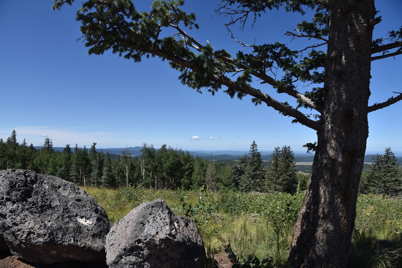
View from the High Point Trail

After barely escaping the ravages of the 2011 Wallow Fire, Sipe White Mountain Wildlife Area lives on as a family-friendly nature discovery destination.  Just over 5 miles of groomed hiking trails take visitors through the property's diverse landscape of wetlands, high-elevation pinion-juniper woodlands and rolling grasslands. A good way to get an overview of area’s conservation efforts is to hike the 1-mile High Point Trail, which loops up to the site's zenith.  Here, a 20x spotting scope provides enhanced vision for critter peeping and gasping at the hulking dome of 10,912-foot Escudilla Mountain.  In addition to its animal-haven benefits and "selfie"-worthy viewpoints, the site is also home to Rudd Creek Pueblo, an abandoned 13th-century village. Archeological digs have uncovered a plethora of artifacts and tantalizing insight to the culture and technologies of the ancestral Pueblo people who 
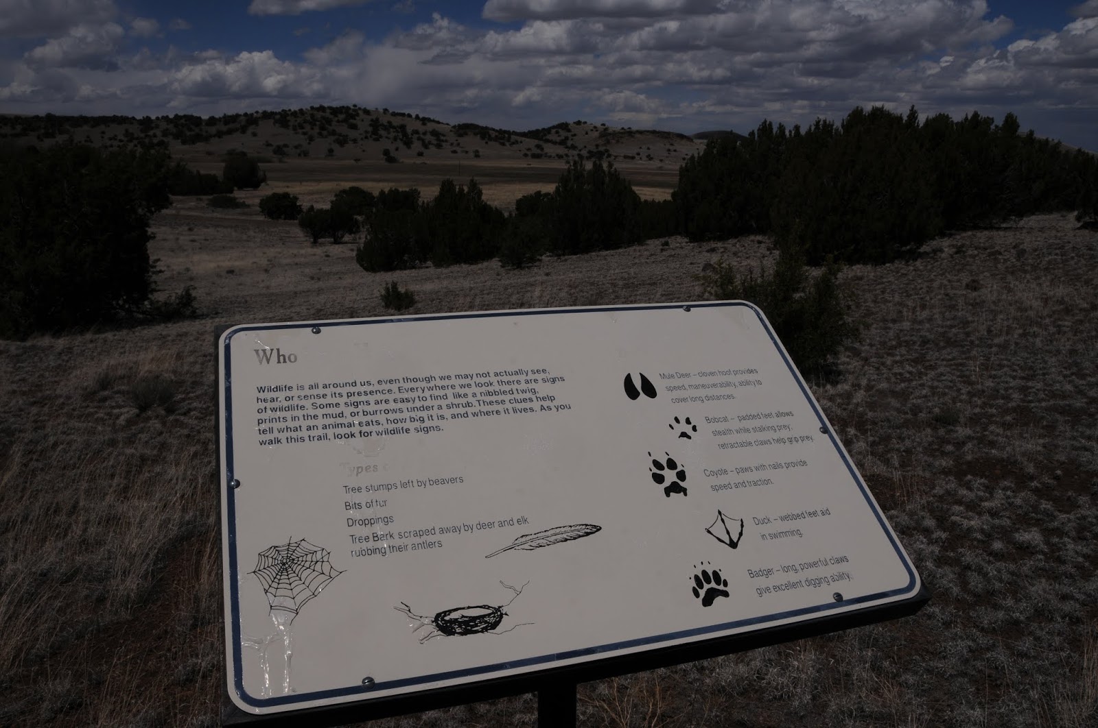
lived here for nearly 75 years. Interpretive signs along the route explain some of the research and samples of intricately painted pottery and hunting tools found at the pueblo are on display in the visitor center.  Sadly, the preserve’s Old Nelson Homestead succumbed to the fire, but the meadow-swaddled trail leading to the charred foundation is open for exploration.

Escudilla Mountain on the horizon

LENGTH:
High Point Trail: 1-mile loop (moderate)
Rudd Creek Loop: 3 miles (easy)
Homestead Trail: 1.5 miles (easy)
Trinity Trail: 300 yards (barrier-free)
ELEVATION: 7625’ – 7836’


GETTING THERE:
From Eagar, travel 2 miles south on US191/180 to the signed turn off on the right at milepost 405.  Follow the maintained dirt access road five miles to the parking area.  The road is sedan-friendly, however there is one section that floods during period of heavy rain. The property has a visitor center with restrooms, water, picnic tables, educational displays and friendly site hosts. The center is open daily 8 a.m. to 5 p.m., from mid-May through mid-October.  In-season hunting is allowed on the property. No fees.

INFO: Arizona Game & Fish Department,

Monday, July 14, 2014

BECKER LAKE WILDLIFE AREA: RIVER WALK TRAIL

BECKER LAKE WILDLIFE AREA: RIVER WALK TRAIL
Springerville
Little Colorado River

A short, meandering stretch of the Little Colorado River is a better place thanks to the introduction of coconut matting and recycled Christmas trees.
These biodegradable materials are just two of the many tools being used by conservation agencies (Arizona Game & Fish Department, Apache Natural Resource Conservation District, USDA, U.S. Army Corps of Engineers, Arizona Dept. of Water Resources and Arizona Water Protection Fund) to restore riverbank stability and inprove wildlife
Footbridge river traverse
habitats. Project managers are quick to conceed that some of these rehabilitative practices are more successful than others, leaving the verdits up to visiting hikers who can draw conclusions based on interpretive singage placed along the experimental test grounds. The biodegradable mats and trees augered into the riverbank are hardly noticable and are slowing down erosion to help reinstate the river's natural flows for a healthier riparian ecosystem. A robust community of water-loving bullrush, grasses and showy milkweed at the water's edge have taken root in the mesh of introduced materials. This is providing shelter for nesting waterfowl and ample building supplies for busy beavers. In fact, so many birds visit the area that the site has been designated as an Important Bird Area by Audubon Arizona . One shady section of the 1.2-mile, streamside hiking trail exhibits the sun-dappled ambience of a Monet garden replete with water-caressing willows and a wooden footbridge. Where the path enters the surrounding floodplain and open rangeland, it becomes easy to see how precious this ribbon of moisture is to sustaining life in the White Mountains.
Although this close-to-town, short hike isn't likely to get you into your target heart rate zone, it's educational value and profound beauty makes it a worthwhile diversion---coconut mats and all.
View of Springerville's Coyote Hills on horizon

LENGTH: 1.2 miles one-way
RATING: easy
ELEVATION: 6920' - 6945'
GETTING THERE:
From Springerville, go 1 mile west on US60 (Main Street) to the parking area on the left.

INFO: Arizona Game & Fish Department, 928-367-4281

Sunday, July 6, 2014

WENIMA WILDLIFE AREA


WENIMA WILDLIFE AREA
Springerville
Beavertail Trail

Within the deeply incised Little Colorado River canyon, Wenima Wildlife Area protects the biodiversity of a scenic 2.5-mile strip of property encompassing three types of ecosystems.
Managed by Arizona Game & Fish to provide essential habitat for native wildlife, the 357-acre site includes riparian stream corridor, upland pinion-juniper grasslands and open pastures.  Two easy trails paralleling the stream are outfitted with interpretive signs and convenient rest areas with benches.  Beavertail Trail heads north through a lush jungle of willow arbors,
Beavertail Trail
house-high grasses, groves of walnut trees and hop-vine-laced brambles before culminating at an old cabin beneath soaring basalt bluffs. Powerhouse Trail winds south exploring a more arid upland habitat of rugged cliffs, creek side grape vines and beaver-built pools where the threatened Little Colorado spinedace fish dart like silver bullets. The ruins of an abandoned native stone shed, pipes and dam equipment mark the end of the route. The property’s surrounding meadows and forests also are open to hunting, fishing and off-trail hiking making for an eclectic mix of public recreational opportunities.
Powerhouse Trail

LENGTH:
Beavertail Trail: 2.5 miles one-way
Powerhouse Trail: 1.2 miles one-way
RATING: easy
ELEVATION: 6700’ – 6800’
GETTING THERE:
From Springerville, travel 2 miles northwest on US60 to the US180/191 junction. From here, continue 0.25-mile north on 180/191, turn right onto Hooper Ranch Road and continue 1.5 miles to the parking area. Access road is sedan-friendly gravel and there are restrooms at the trailhead. The area is open daily from sunrise to sunset.  No fees.  The trails are located 0.2-mile farther up the road from the trailhead.  Beavertail Trail is on the left before the bridge and Powerhouse Trail is on the right past the bridge.
Wildflower meadows

Powerhouse Trail
INFO: Arizona Game & Fish Department

Monday, March 9, 2009

APACHE VISTA

APACHE VISTA Apache-Sitgreaves National Forest UPDATE: This trail has been damaged by the WALLOW FIRE, June 2011. Check with the forest service for updates.  Hovering over the town of Springerville in Arizona’s White Mountains, the Apache Vista Trail #617 showcases outstanding high-country scenery. Situated at 9,000 feet in elevation, the gentle path traipses through wide-open alpine meadows along the edge of a deep, forested canyon. Cool summer temperatures and ample rain foster profuse growths of multi-colored wildflowers and towering old-growth conifers. It’s no accident that the trail has the word “vista” in its name. Expansive views of volcanic fields and river gorges that stretch all the way into New Mexico are this trail’s signature attraction. LENGTH: 5.2 miles round-trip RATING: easy ELEVATION GAIN: 50 feet GETTING THERE: From downtown Eagar, go west on Highway 260 for roughly 3 miles to the Highway 261 junction. From there, turn left (south) on Highway 261 and continue for 7.2 miles to the trailhead on the left. INFORMATION: www.fs.fed.us/r3/asnf (928) 333-4372