TWISTED SISTER-BIG SISTER LOOP
 |
| View of Red Mountain from Big Sister Trail |
With its big bends, sharp declines, tight edges and hairpin turns, the Twisted Sister Trail embraces its bike-borne heritage.
 |
| Salt River Valley seen from Twisted Sister Trail |
The rollercoaster-like trail is part of the Sonoran Desert (Hawes) Trail System in Tonto National Forest. Located between the Salt River and Usery Mountains in Mesa, the system has several access points along Usery Pass Road and Bush Highway.
 |
| The Big Sister Trail is all about rocks. |
 |
| Four Peaks viewed from the Twisted Sister Trail |
The collection of looped singletrack paths began its evolution from from old livestock and mining trails with the development of the (unofficial) Hawes Trail in 1989.
 |
| Vintage aircraft sometimes fly over the area |
In 2005, the trail and several formerly unsanctioned connected routes were adopted into the Tonto National Forest system. With the combined efforts of the forest service and the Hawes Trail Alliance, a non-profit organization dedicated to the system’s maintenance, sustainability and future expansion of the popular recreation hub now has over 60 miles of shared-use routes.
 |
| Red Mountain stands over the Salt River |
When used as part of a loop hike, the Twisted Sister Trail makes for a moderate-rated hike with outstanding mountain vistas and peeks at the leafy corridor of the Salt River.
 |
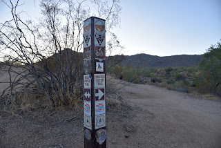
| Hawes Trails are well signed |
The trek begins with a short walk on the Bush Lite West trail to connect with the Wild Horse Trail that’s part of the Valley-circling Maricopa Trail.
 |
| The green corridor of the Salt River from Wild Horse Trail |
At the 0.2-mile point, Twisted Sister spins off to the right and begins its undulating run through saguaro-studded desert in the foothills below the Usery Mountains. Once through a couple of slippery downhills and wash crossings the route trudges uphill, revealing grander views at each turn. The massive form of 2,832-foot Red Mountain (also known as S-wegi Do’ag in O’odham, Wi:kawatha in Yavapai and Mount McDowell, Fire Rock and Gunsight Butte) is a constant presence on the west side of the river on the Salt River Pima-Maricopa Indian Community at the confluence with the Verde River. To the north, iconic Four Peaks hover over the mountains of Tonto National Forest and on the distant west horizon, Camelback Mountain rises above city haze. After just under a mile of steady but not-to-tough climbing, the trail meets a three-way junction.
 |
| Saguaros and boulders on Big Sister Trail |
 |
| Mountains of Tonto National Forest on horizon |
For a short loop hike, veer left onto the Big Sister Trail. Whereas Twisted Sister was all about views, Big Sister is all about rocks. Clinging to boulder-strewn slopes, the slim path weaves through impressive globs of granite, boulder ridges and natural stone sculptures. Midway through the 1-mile return leg, the trail gives up the widest-angle views of the Salt River Valley and on lucky days, grazing wild horses and vintage aircraft from The Commemorative Air Force Aviation Museum can be spotted flying overhead.
LENGTH: 3.6 miles
RATING: moderate for hiking, difficult for bikes
ELEVATION: 1,387 – 1,793 feet
GETTING THERE:
From U.S. 60 in Mesa, take the Power Road exit 188 and continue north (Power Road turns into Bush Highway) to the Wild Horse trailhead on the right between mile posts 23 and 24.
INFO:
https://hawestrailalliance.com/


