


RED MOUNTAIN TRAIL #43
In the space between Lynx Lake Recreation Area and State Route 69 in Prescott Valley, a mountainous back country laced with trails provides a diverse haven for shared-use recreation.
 |
| View from the switchbacks on Red Mountain |
Although it’s lodged between two busy areas, the canyons and hills adjacent to the communities of Dewey-Humboldt have a remote feel, rugged character and more appeal than the view from the highway suggests.
 |
| Red Mtn. trail traces Green Gulch |
One of the most scenic hikes in the area is the Red Mountain Trail #43, an internal trail which can only be accessed by way of connecting routes that begin either near Lynx Lake to the west or at the Green Gulch trailhead which provides access to the Blue Hills Trail System at the east boundary of Prescott National Forest. The less crowded and more direct option is the latter. From the roomy parking area, begin hiking on the Charcoal Gulch Trail #9419 which is open to hikers, equestrian and ATV use. At first, the terrain looks dismal, but conditions quickly improve as the trail moves west.
 |
| Skunk bush that grow in drainages blush red in fall |
 |
| Hike begins on the Charcoal Gulch trail #9419 |
Charcoal Gulch was damaged by the Goodwin Fire that was reported on June 24, 2017 and went on to burn over 28,500 acres of brush, grass and pinion-juniper woodlands 14 miles south of Prescott. Three years after the blaze, the area has been raked and cleared and shrubs and tree saplings are emerging from the stubble. With great views of the Red Mountain destination jutting above the forests to the north, Trail #9419 follows a rocky dirt road that makes its way to where the heads of Charcoal and Green Gulch intersect and tree cover gradually increases.
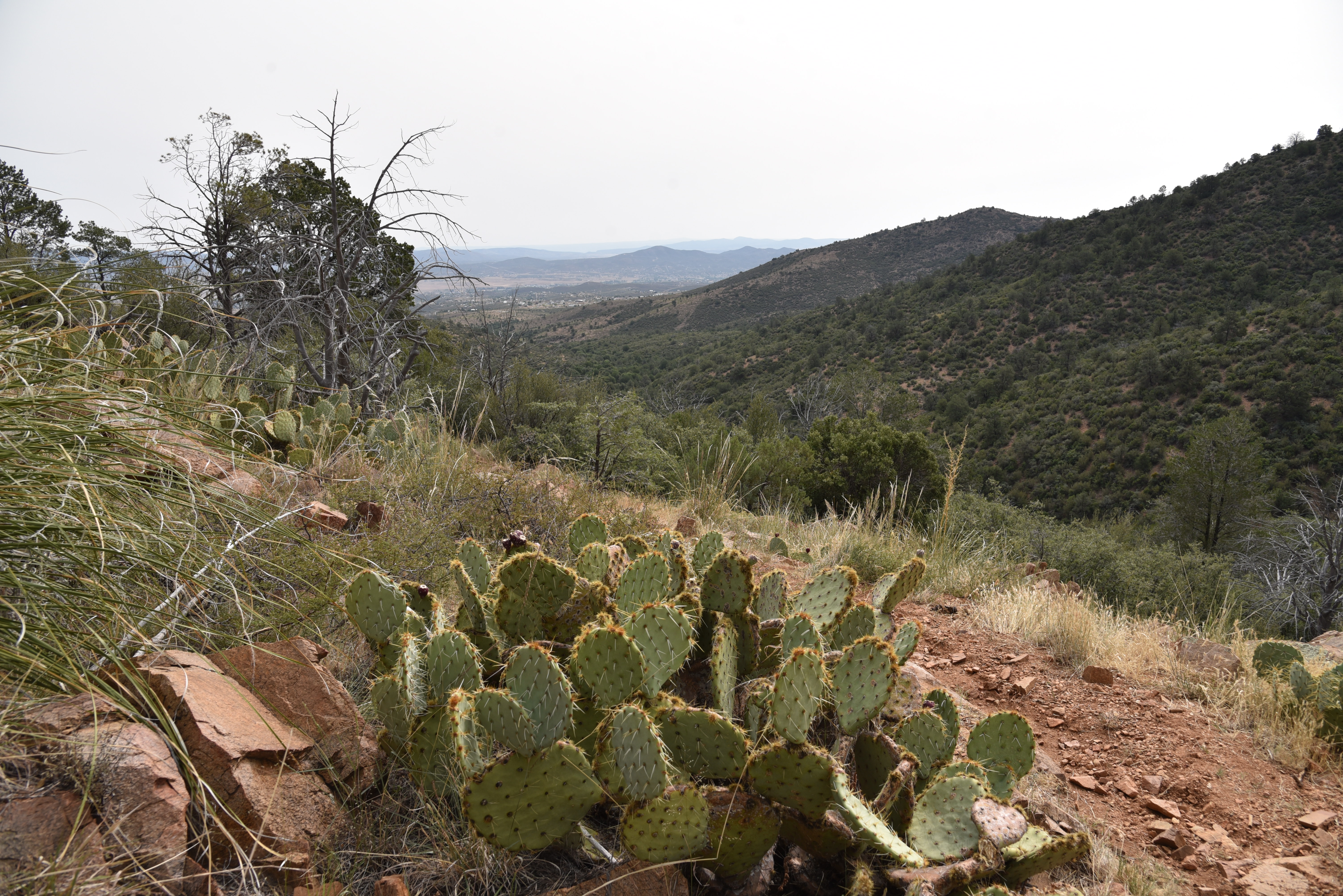
 |
| View of Prescott Valley from Red Mountain |
Watch for peeks at impressive deep ravines and rugged cliffs off to the left along the next quarter mile. At the 0.9-mile point, Red Mountain Trail #43 spins off to the right at an easy-to-miss junction.
 |
| Green Gulch trailhead in Dewey |
 |
| Much of Red Mtn trail passes through forests |
 |
| Boulders line Red Mtn trail #43 |
 |
| Part of Red Mtn trail is canyon bound |
The route crosses drainages several times, gaining elevation gently as it works its way through oak thickets and boulder outcroppings to the base of Red Mountain.
 |
| Some sections of Red Mtn trail are rocky & steep |
Never straying far from the gulch, the trail brushes by stands of water-loving Arizona walnut, willows, alder-leaf mountain mahogany and fruit-bearing shrubs, justifying the “green” part of its name.
 |
| Hike passes through rangeland--close all gates. |
After a mile of forest hiking, the trail leaves the woodlands and enters a dryer clime replete with cacti, yucca and junipers and begins an uphill assault in earnest. The climb segment of the hike is compact and aggressive.
 |
| Scar of the Goodwin Fire on Charcoal Gulch trail |
 |
| An AZ walnut tree shows fall color on 9-12-20 |
A set of tight, steep switchbacks with loose rocks land hikers on high ridges above the gulch where big views of Prescott Valley appear at the bottom of the V-shaped gorge.
 |
| Oak trees shade Red Mtn trail #43 |
 |
| The stony gorge of Charcoal Gulch |
The route flattens out for a bit before making a minor decent into a canyon-bound corridor along an edge-hugging path. Spots of extreme green in the drainages below betray the location of springs that feed tiny riparian niches. A few more ups and downs lead to the junction with the Prospectors Trail #42 at the outskirts of the Lynx Lake trails complex where you can opt to call it the turnaround point or use the forest service map to continue about 5 miles (on trails) to the lake or create a longer loop back to the trailhead.
 |
| Red Mtn trail junction is easy to miss |
Whether done as an out-and-back or complex loop, Red Mountain trail bridges the space between lakeside commotion and open prairies with beauty, challenge and plenty of variety.
 |
| Alderleaf mountain mahagony grows along the route |
 |
| Arching oaks on Red Mtn trail #43 |
LENGTH: 5.2 miles round trip as described here
RATING: moderate
ELEVATION: 5,299 – 6,245 feet
GETTING THERE:
From the State Route 169/69 junction in Dewey-Humboldt, go 1 mile north on SR 69 to the next stop light and turn left on Kachina Place. Follow Kachina Pl to the “T” intersection at Pony Place, turn left and follow the signs to the Green Gulch trailhead, approximately 3 miles from SR 69. The parking lot is designed to accommodate both trailers and cars, so mind the parking protocols.
INFO:
Prescott National Forest
https://www.fs.usda.gov/recarea/prescott/recreation/recarea/?recid=67481