


KINDER CROSSING
| East Clear Creek |
When dogs dream about hiking, images of Kinder Crossing dance in their heads. Tucked into a picturesque canyon with a perennial stream, the trail that leads to an idyllic water-carved passage packs every imaginable doggie delight into a single hike. Scampering rock squirrels, taunting blue jays, jumping fish and leaping frogs give chase, inciting primitive stirrings in even the most sophisticated of city dogs. Sandy beaches along East Clear Creek beckon dig-happy hounds and a plethora of swimming holes stoke the canine “inner wild” into overdrive. Humans too will find much to admire along historic Kinder Crossing Trail No. 19 in Coconino National Forest. Originally used to drive sheep through the rugged canyons of the Mogollon Rim, the steep, rocky trail descends nearly 500 feet along the crumbling, fossil-laden limestone walls of Yeager Canyon.
 |
| Damage from the Tinder Fire seen from the trail |
Like many forested areas in Arizona, the difficult-to-access backcountry surrounding East Clear Creek was recently damaged by wildfire.
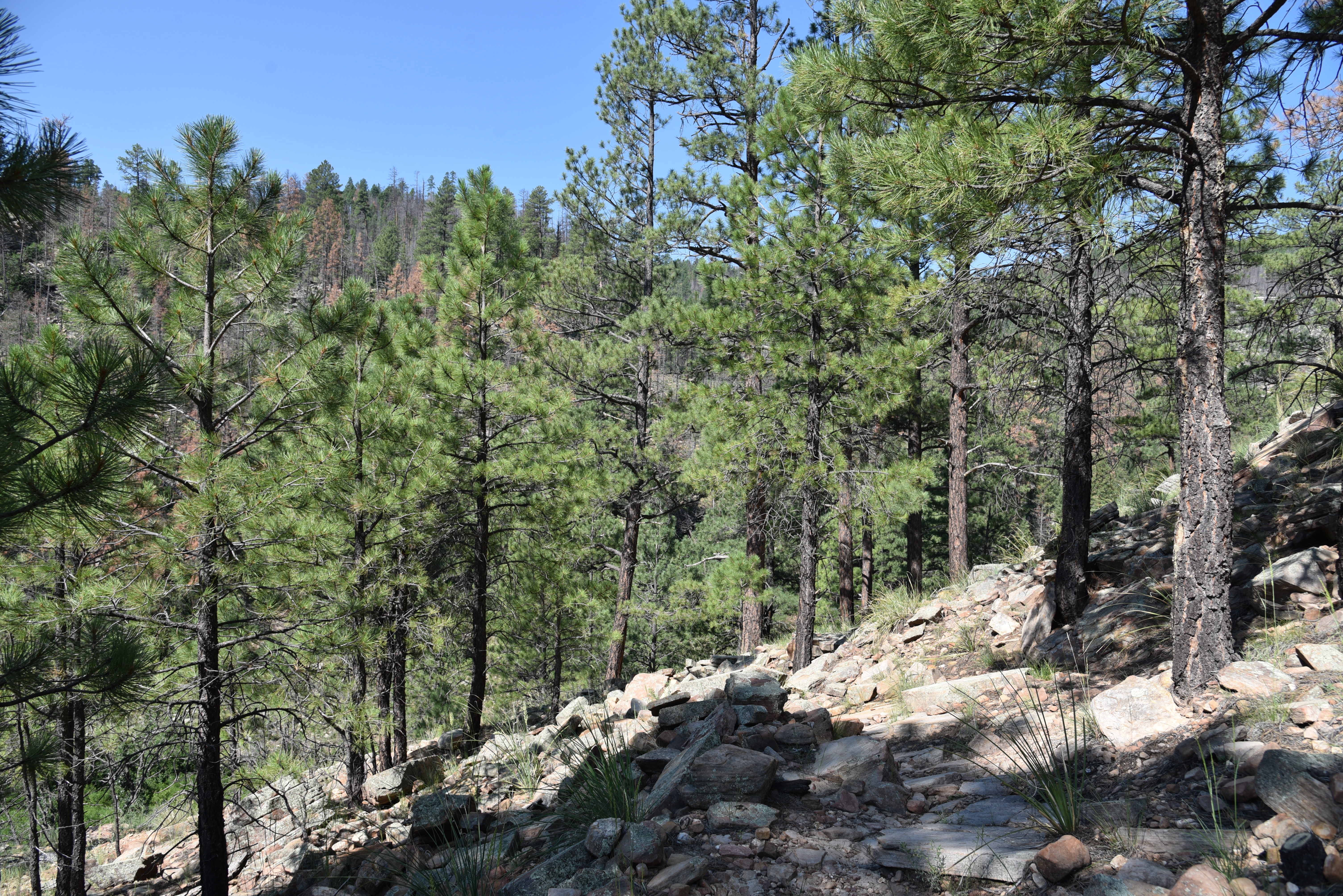 |
| Parts of the trail sustained only light fire damage |
In 2018, the human-caused Tinder Fire that began with an illegal campfire set during stage one fire restrictions which ban campfires anywhere other than in a developed campsite or picnic area, went on to char over 16,000 acres of mixed-conifer woodlands and critical watershed terrain east of C.C. Cragin (Blue Ridge) Reservoir.
| Limestone escarpments line East Clear Creek |
All told, the blaze cost nearly $7 million in suppression costs, endangered the lives of first responders and destroyed 33 homes in communities along State Route 87. That was quite an expensive campfire. The unknown perpetrators live with that.
 |
| Wild geranium grow along the route |
Three years post fire, the viewscape from the top of the trail is one of teetering ashen matchsticks, spots of half-cooked pines and sheets of toppled trunks cascading over scorched-earth ridges and exposed stone knobs previously obscured by tree cover.
 |
| The creekside path is very overgrown |
But, the depressing start belies what lies below. A few yards into the trail, ledges dangling over sheer escarpments serve as a platforms for first glimpses of a meandering green riparian zone hugging the twisted stream.
 |
| Beware of sharp New Mexico locust thorns |
Rife with loose rock and tangled roots, the newly sun-exposed slopes have morphed from a previously dank mushroom-and-moss alcove into emergent plots of common mullien and fragrant cliff-rose shrubs that pull nutrients from deadfall and disturbed soils. The first half-mile is a relatively easy traipse with a barely noticeable descent, but that changes where a primitive rock cairn signals where the trail goes full tilt into a switchback-mitigated spiral to the creek.
 |
| Cliff-rose shrubs scent the upper trail |
As the trail inches closer to the stream, the bleakness of the burn scar spills into a canyon-bound corridor lush with moisture-hungry willows, alders, brambles, wild geraniums and penstemons.
 |
| A toppled pine lies over the trail |
Once at the creek, footpaths trace the flow as it winds through high grasses, sandbars and still pools that lap at colorfully-layered canyon walls.
 |
| Limestone slabs on the switchbacks |
It’s just a three-quarter mile descent to the creek, but the trail continues downstream (go left at the bottom of the trail) for just under a mile to the crossing where the route head up the opposite embankment to Forest Road 137.
 |
| Wild potato is a rare find on the trail |
At this writing, the creekside trail was overgrown, mucky and difficult to navigate.
 |
| Tinder Fire scar visible from a trail overlook |
Thickets of thorny New Mexico locust make bloody work of getting through the quagmire.
 |
| Before fire canyon overlook July 2007 |
 |
| The trailhead is 0.2-mile from the parking area |
 |
| Stay alert while hiking in the Tinder Fire scar |
The hike along the creek reveals tiny waterfalls and slickrock cascades spaced among rockfall and tall survivor pines.
 |
| Common Mullien bloom in the ashes of the Tinder Fire |
Elk, deer and black bears might be spotted wallowing in perennial swimming holes--that is, if visiting dogs didn’t get there first.
 |
| Before fire creekside, July 2007 |
| A quiet pool in East Clear Creek |
LENGTH: 1.5 miles round-trip
RATING: moderate
ELEVATION: 7,000 – 6,417 feet
GETTING THERE: From Payson, go north on State Route 87 to Forest Road 95, which is located roughly 10 miles north of Clints Well between mileposts 299 and 300. Turn right onto FR 95 and continue 4.5 miles to the turn off on the left for Forest Road 95T and follow the signs 0.6-mile to the parking area. The official trailhead is another 0.2-mile down the road. A high clearance vehicle is required on FR 95T. Those with low clearance vehicle should park along FR 95 and hike FR95T.
INFO: Coconino National Forest
https://www.fs.usda.gov/recarea/coconino/recarea/?recid=54998


