Posts
Posts


SHANNON GULCH
 |
| FR 74 leads into Shannon Gulch |
More than 2,000 feet above where the East Verde River crosses State Route 87 north of Payson, snowmelt and rainwater that will eventually drain into Arizona’s rivers and streams begins with a journey through porous escarpments before spilling through springs at the base of the Mogollon Rim.
 |
| The shrubby folds of Shannon Gulch |
Below the Rim’s vertical cliffs that rise to over 7,000 feet and make a 200-mile, east-west stretch through central Arizona, an edgy, almost claustrophobic territory of high mesas, dizzying gorges and backwoods is home to a maze of tributary creeks and drainages that feed into the East Verde River which in turn flows into the Verde and Salt Rivers, two of Arizona’s most important water sources.
 |
| Mogollon Rim vistas from the road's highpoint |
A hike through this tangled, geologically and botanically diverse region is as much an origin story as it is a walk in the woods.
 |
| Milk Ranch Point, promontory on the Mogollon Rim |
While the nearby 50+ mile Highline Trail, which is part of the Arizona National Scenic Trail, clings to the craggy Rim walls, the terrain farther downhill is a more bucolic, less precipitous place.
Several rough dirt roads venture into this scenic slice of hilly watershed.
 |
| Oak, cypress and junipers line FR 74 |
One to try is Forest Road 74 which makes a dive into the green folds of Shannon Gulch to explore a cloistered pocket of backcountry east of the popular Water Wheel recreation sites on Houston Mesa in Tonto National Forest.
 |
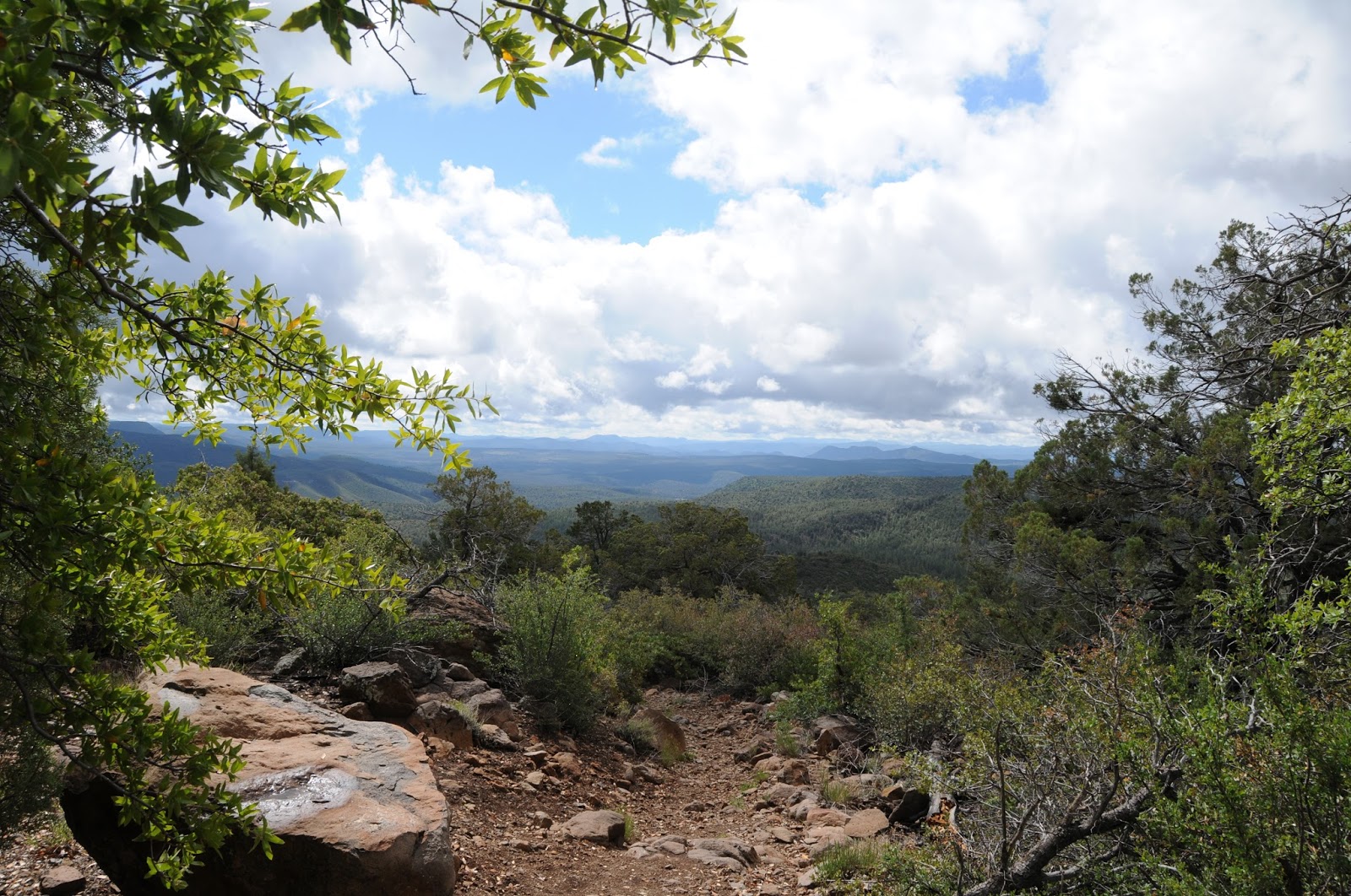
| The downhill section of FR 74 feature great views |
The trek begins at a dirt turnout on Control Road (Forest Road 64), a historical route that traces the base of the rim for 23 miles between State Route 87 and just south of the town of Pine and State Route near Christopher Creek. From the small parking area, the hike heads south following FR 74. The road is open to motorized vehicles capable of handling its rocky, twisted course, but hikers have the advantage of savoring the many natural features that unwind along the way.
 |
| The backroads below the Mogollon Rim are scenic treasures |
 |
| Cedar Mesa dominates the horizon on FR 74 |
Wide and easy to follow, the road hike begins with an easy walk through junipers and scrub oaks with the impressive bluff of Milk Ranch Point jutting skyward to the north and views of the Rim extending to the eastern horizon. Over the first half-mile of hiking, the road inches up it to its highpoint where a short spur leads to a lookout mound with far-reaching views. The panoramic vistas are swallowed up as the road begins a 500-foot descent along the edge of Shannon Gulch.
 |
| A grove of cypress trees grow near the bottom of Shannon Gulch |
Making an abrupt cut in the landscape 12 miles north of Payson, the gulch is lodged between the hulking flattop of Cedar Mesa (5,542 feet) to the west and the Diamond Rim and the ragged valley cut by Webber Creek and to the east. The rough-cut road spirals downhill passing root-tangled eroded cliffs and patches of tight-packed manzanita shrubs.
 |
| See-forever vistas from the road to Shannon Gulch |
After rounding a couple of bends, dramatic views of the Mazatzal Mountains open up to the south while the imposing nose of Cedar Mesa looms overhead. At the 2-mile point, the road meets a junction with Forest Road 1582. This makes for a good turnaround point, but to ad length, veer right to stay on FR 74 which continues another 3.2 miles briefly following the course of Webber Creek over Deer Flat and hopping the jumbled cut of Cherry Creek before ending at a barely there turnout on State Route 87 just north of the East Verde River.
LENGTH: 5.2 miles one way or 4 miles round trip to FR 1582.
RATING: moderate
ELEVATION: 5,400- 4,800 or 5,400 – 4,916 to FR 1582
GETTING THERE:
From the State Route 87/260 junction in Payson, go 12 miles north on SR 87 to milepost 265 (2 miles north of the turnoff for Tonto Natural Bridge State Park to Control Road (Forest Road 64).
Turn right and continue 3.3 miles to Forest Road 74 on the right. Park in the dirt turnout. Control Road is maintained dirt suitable for all vehicles.
INFO: Tonto Recreation Alliance