Find A Trail. Start Your Search Here:

Showing posts with label New River. Show all posts

Tuesday, November 14, 2023

Black Canyon Trail: Biscuit Flat Segment

BLACK CANYON NATIONAL RECREATION TRAIL:

BISCUIT FLAT SEGMENT

Wild burros on Biscuit Flat

Wild burros make lots of tracks--and lots of little burros.  That’s a concern for hikers and land managers because overpopulation can lead to problems like overgrazing, negative impacts on native wildlife, and public safety issues around roadways. 

New River Mesa viewed from Biscuit Flat

With few natural predators and a law that protects them from human hunters, the sturdy African imports that are the descendants of escaped or released pack beasts used by the military, ranchers, Spanish explorers, and miners dating back to the 1500s, the herds can become hordes.

The route follows single and double track paths

The free-roaming, prolific breeders adapted to the Sonoran Desert and other areas in the Western states. Herds quickly grew to the point where they exceed the land’s capacity to support them.  The 1971 Wild-Free Roaming Horses and Burros Act states that the Bureau of Land Management (BLM) and the U.S. Forest Service are responsible for managing and protecting herds and their rangelands as “living symbols of the historic and pioneer spirit of the West.”  

Wild burros cross the Black Canyon NRT

To thin the herds and maintain their health here in Arizona, the BLM uses fertility control and vaccine programs along with periodic “gathers” where burros are helicoptered out of congested public lands and either put up for adoption or transferred to Midwest off-range private pastures where they are taken care of for the rest of their lives.
Biscuit Flat is surrounded by mountains

Cholla line the Black Canyon NRT

The four-legged “spirits of the West” can be observed wandering in several Arizona ranges including the Lake Pleasant Herd Management Area, a 103,000-acre space located 25 miles northwest of Phoenix.  The Biscuit Flat segment of the Black Canyon National Recreation Trail provides non-motorized access into the heart of burro country.

The sandy floodplain of New River


Like the burros that average 400 pounds and 48-inches high, the roughly 100-mile-long historic trail is very much a spirit of Western heritage.

A cactus wren alights on a BCT sign post


It runs from Carefree Highway in Phoenix to the Town of Mayer and has recently been extended into the Verde Valley with new construction.  Following a mashup of ancient travel corridors, wagon roads and livestock tracks that pre-date Interstate 17, the route traverses mountain passes, valleys, sprawling rangelands, defunct mining operations and heritage sites that date back thousands of years.  The 5.9-mile Biscuit Flat segment is, well--flat. 

Signs guide hikers through the New River channel

It’s the first stretch of the route that begins at Carefree Highway and makes a straight shot north to the Emery Henderson trailhead on New River Road just 3 miles west of Interstate 17.
Crossing the New River channel

 
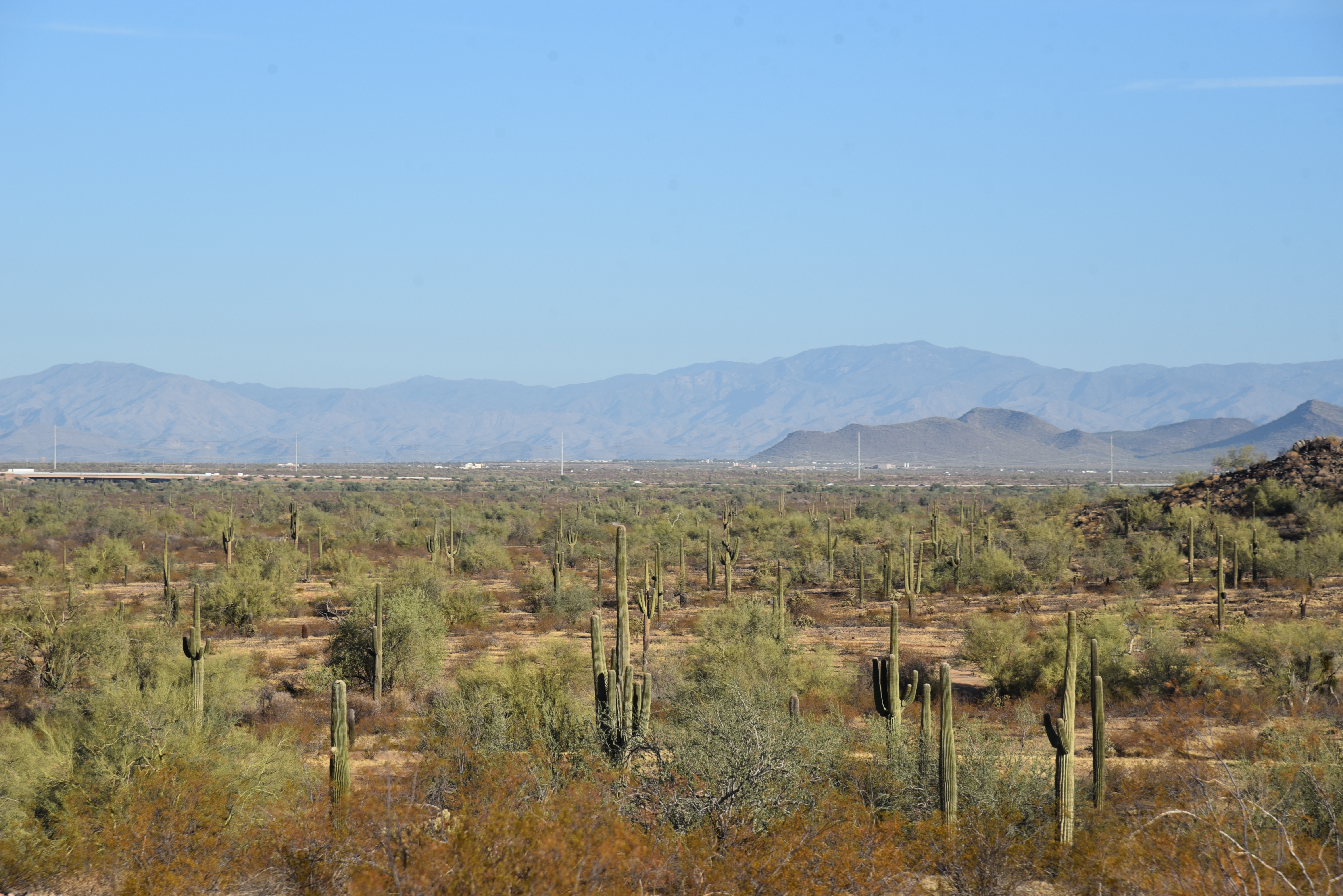
The utterly pancake-level expanse registers like a mood board for a Martian landscape--that is if Mars had cactus, creosote and an ephemeral river running through it.  Resembling images sent back from Mars landers, the place is a massive basin surround by volcanic mountain ranges.
Gavilan Peak (2,980 feet) on near horizon


The thorny plain is dressed in scuffed shades of green muddled with dusty earth and course, dried forbs. Like the Native inhabitants and pioneers that wandered through, this place cut its teeth on surviving in the unforgiving spillway of a desert river.

Green sign posts mark the trail

 
Emery Henderson trailhead on New River Road

Without obvious lures, the vultures come anyway. Riding up drafts, the carrion-eating scavengers make lazy loops and investigative swoops often enough to suggest, something below is dead.  Maybe a javelina, rabbit or coyote. 

An uncommon white burro on Biscuit Flat

What’s alive are the burros, expanding suburbs, a widening interstate, shooting range, prison complex, fairways, a municipal transfer station and the massive semiconductor manufacturing plant rising from desert that surrounds the dusty trail and its relics of the past.
Hikers must watch for toppled signs

Beginning at the north end of the segment at the Emery Henderson trailhead, the path heads south on a mix of singletrack, two-track and dirt roads.  The trail is signed throughout but is crisscrossed with trampled paths made by the burros and fading dirt roads that can be confusing. 

Cave Creek Mountains viewed from Biscuit Flat

Bradshaw Mountains on the north horizon

Hikers must take care at intersections to spot the next sign to stay on track. (Some signs were down at this writing but did not present a navigation problem).  At about the 2-mile point, the trail enters the sandy floodplain of New River and makes a rocky crossing through a tamarisk-choaked channel.
Mountain vistas on Biscuit Flat

 
Old trough on Biscuit Flat

Signs anchored by rock piles guide the way through the weedy waterway.  On the south bank, the trail heads up an embankment, passes a gate and begins a shade less walk through open desert.  The pop-pop of pistol fire from the nearby Arizona Game & Fish Department-managed Ben Avery Shooting Facility grows louder where the trail briefly shares space with the Valley-circling Maricopa Trail and crosses Deadman Wash.  The south trailhead is little more than a dirt pullout and gate along busy Carefree Highway. 
Saguaros on Biscuit Flat

If you parked a shuttle vehicle here, be sure to close the gate behind you to keep the legacy burros from wandering into 21st-Century traffic.

LENGTH: 5.9 miles one-way

RATING: easy

ELEVATION: 1,598 – 1,878 feet

GETTING THERE:

NORTH: Emery Henderson Trailhead: From Interstate 17 in north Phoenix, take the New River Road exit 232 and go 3.1 miles west to the trailhead on the right. The large parking area has space for trailers. There’s a restroom, but it was out of order at this writing.

SOUTH: Bob Bentley Trailhead: From Interstate 17 in north Phoenix, take the State Route 74 (Carefree Highway) exit 223 and go 1.8 miles west to the trailhead on the right. No facilities.

INFO & MAPS: Black Canyon Trail Coalition

https://bctaz.org/

WILD BURRO INFO

https://www.blm.gov/whb

https://www.blm.gov/programs/wild-horse-and-burro/herd-management/herd-management-areas/arizona/lake-pleasant

WILD BURRO ADOPTIONS

https://aci.az.gov/capabilities/wild-horse-burro-training-and-adoption/


Tuesday, October 31, 2023

Granite-Keefer Hill Circuit

GRANITE-KEEFER HILL CIRCUIT

Paloma Regional Preserve

Saguaros frame mountain views on the Granite Trail

The landscape of Paloma Regional Preserve is defined by a massive, flat drainage basin punctuated with a few minor knolls of volcanic rock.

Volcanic outcroppings in Paloma Regional Preserve

New River, when it runs, spills right down the middle of it in untamed rivulets, muddy channels, and occasional torrents. 
Crested saguaro in the Keefer Hill Trail

Bounded by a crescent of desert hills, terra cotta rooftops and the Westwing and Eastwing Mountain Preserves, the large water scoured expanse interfaces seamlessly with its suburban Peoria location. Trail users may walk in from several adjacent parks and neighborhood access points where family-friendly facilities and cul-de-sacs melt easily into acres of protected Sonoran Desert.
Westwing Mountain viewed from Granite Trail

Paloma Regional Preserve’s trail offerings diverge from those of its climb-centric sister preserves. Instead of abrupt stacked loops that culminate on desert mountain summits, the sprawling flatlands are outfitted with a slew of serpentine routes that take their time rolling out the goodies.

New River basin seen from the Granite Trail

  While the preserve’s Compass Rose Trail does ascend to a minor peak, it's an anomaly in an otherwise level field.  
Granite boulders on the eponymous trail

All preserve trails are linked and connect with Eastwing and Westwing parks, so customizing loops and long treks is easy. 
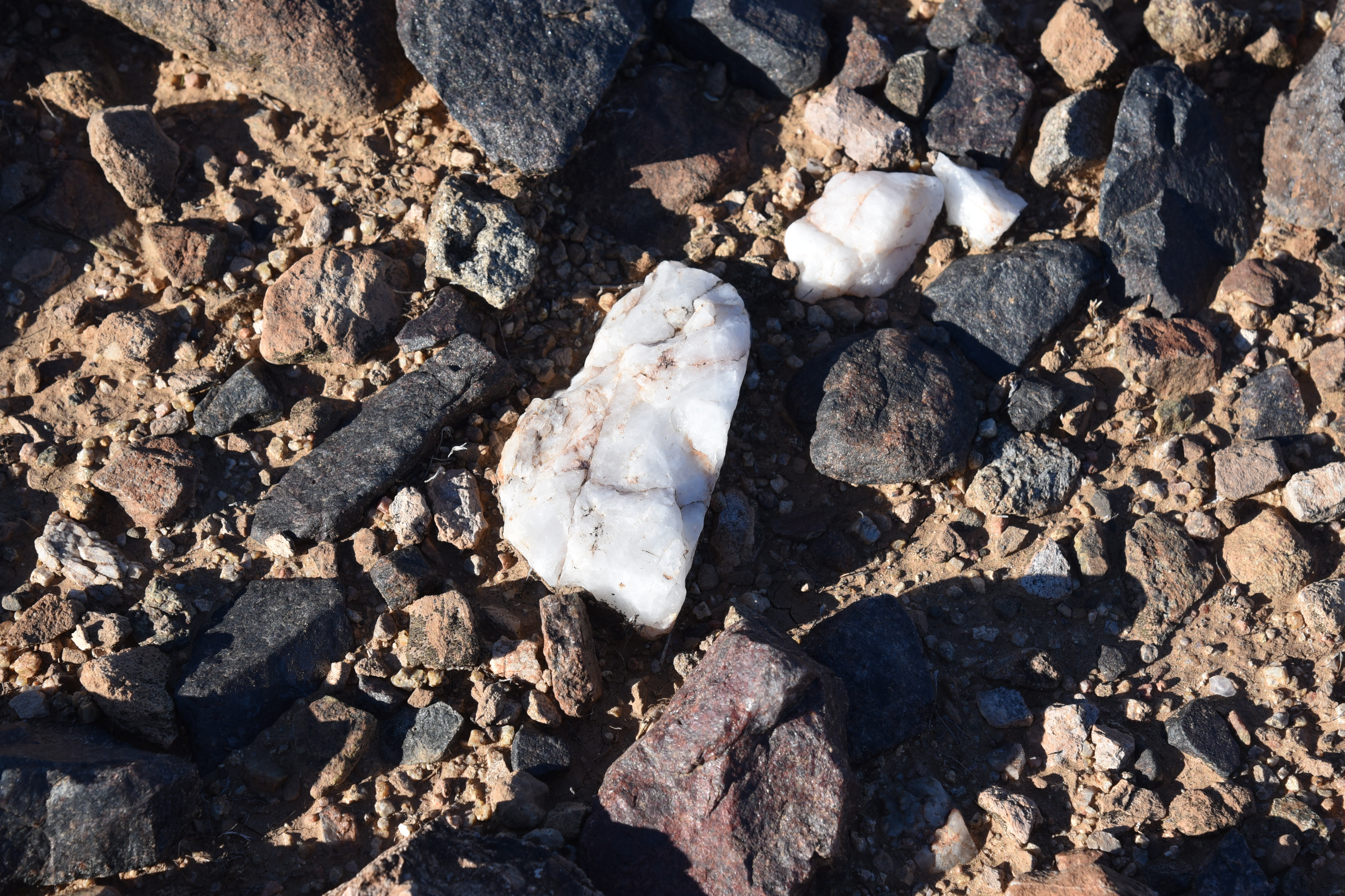
"Salt & Pepper" basalt and quartz line the trails

A good way to start is to make a lollipop loop using the Multi-Use Path A, Granite, New River, and Keefer Hill trails. The hike begins at the 10-acre Sonoran Mountain Ranch Park at the preserve’s east end.
New River Dam seen from Keefer Hill Trail

The trails are accessed from the park’s paved perimeter path where a trailhead with benches and a map kiosk mark the start point.  A 0.3-mile walk on Multi-Use Path A leads to the junction with the 1.7-mile Granite Trail.  The twisty singletrack makes a mild ascent through volcanic boulders, topping out on a rocky mound overlooking the course of New River.  The mesquite-cluttered intermittent waterway appears as a ribbon of green below the ridgeline of Westwing Mountain. 
Tonto National Forest mountains seen from New River Trail

The trail then winds down passing through creosote-dominated terrain strewn with a salt-and-pepper mix of black basalt and white quartz chips.  To the north, the Cave Creek Mountains and peaks and mesas of Tonto National Forest stand out on a hazy horizon.  The circuit follows the New River Trail a few yards to the Keefer Hill Trail junction. The 0.62-mile path traces the base of a 1,650-foot isolated butte. 
View from the high point on Granite Trail

A few feet in, a crested saguaro hovers above a clutter of Palo Verde trees, its elaborate crown splayed into a contorted, spiny bouquet.
Start point for the hike

Beyond the end of the Keefer Hill Trail that rounds crumbling flanks and boulder passages, the Flood Control District of Maricopa County managed New River Dam tames the tendrils of the freeform desert waterway, intercepting its deluge of the manicured subdivisions below.

Preserve trails are well signed

LENGTH: 5.24 miles round trip

RATING: moderate

ELEVATION:  1,412 – 1,515 feet (604 feet of accumulated elevation change)

GETTING THERE:

Sonoran Mountain Ranch Park, 7098 W. Miner Trail, Peoria.

From Phoenix, go north on I-17 to Happy Valley Road exit 218. Go 5 miles west on Happy Valley Road to 67th Avenue, turn right and drive 2.8 miles (road becomes Pyramid Peak Pkwy.) to Sonoran Mountain Ranch Road.  Veer left and go 0.5-mile to Chalfen Blvd., turn left, continue 0.1-mile to Miner Trail and follow the signs to Sonoran Mountain Ranch Park. Turn left into the parking area signed for Eastwing Mountain Trail. Hike begins at the far west end of the park’s paved perimeter trail.

HOURS: sunrise to sunset daily

FACILITIES: restrooms, picnic ramadas, playground, basketball courts. No fees.

INFO: City of Peoria

https://www.peoriaaz.gov/trails

Tuesday, November 1, 2022

Paloma Regional Preserve

PALOMA REGIONAL PRESERVE

An ironwood tree frames views on Compass Rose Trail

Bounded by two desert waterways, a CAP canal, freeways, isolated mountains and the geometric grid of cul-de-sac communities, Paloma Regional Preserve is an island of natural outdoor space. 

Mountain vistas on Multi-Use Path A

The ephemeral character of desert rivers creates seasonal shows of monsoon surges that fade into trickling rivulets and residual pools, all along, feeding swaths of lush greenery in otherwise dry, prickly places. A walkable tour of this critical cycle is on display on the trails of the preserve.
Mesquite trees on the New River Trail

The mostly-flat block of open space straddles the floodplain of New River,  in Peoria, east if the Agua Fria River.

New River Dam bolsters the south end of the preserve

The preserve is anchored by Paloma Community Park which opened in 2020. The amenity-rich site has playgrounds, a dog park, restrooms, sports fields and picnic ramadas. Access to the preserve hiking trails begins at a gate near the dog park where Multi-Use Path A heads east away from the barking commotion.

Speckled Rattler trail leads into Westwing preserve

Wide and sunny, the path serves as a gateway to the preserve’s 12+ miles of trails that also link with the Westwing and Eastwing Mountain Preserves as well as Sonoran Mountain Ranch Park. 
Interesting geology on the New River Trail

With a backdrop of mountain vistas and acres of saguaros, the path soon enters the floodplain of New River.  Mudflats, sandy drainages and water-scoured channels fringed with mesquite and palo verde trees clinging to embankments speak to the power of running water. At the 1.1-mile point, Multi-Use Path A encounters its first major junction where it meets the New River Trail-- a multi-use pathway that runs from Bethany Home Road in Glendale to Pinnacle Peak Road in north Phoenix and serves as a main artery running north-south through the preserve.  
Friendly advise at the trailhead gate.

Park maps available online and well-signed junctions with QR codes and emergency help locator decals, make getting around and staying safe a cinch. While each trail offers excellent hiking, the not-to-miss route on the menu is the Compass Rose Trail. 
View from Multi-Use Path A

The 1.42, moderate-rated path ascends a knoll overlooking the New River Dam for sweet views of the river’s course through the landscape. 
View of New River Mesa & Skull Mesa from Compass Rose

The extra height also opens up views of the Cave Creek Mountains to the northeast and the Sierra Estrella Mountains to the south. From the high point, the brilliant connectivity of the preserve trail system is obvious. The grid of trails below hint at the dozens of options for completing short loop hikes or long distance treks in and around this distinctly desert-water-centric environment.
New River floodplain bisects the preserve

LENGTH:  12+ miles of interconnected trails

RATING: easy - difficult

ELEVATION:  1,369 – 1,550 feet

TRAIL HOURS: sunrise to sunset daily

PARK HOURS: 6 a.m. – 10:30 p,m. daily
FEE: none

GETTING THERE:

Paloma Community Park Trailhead
29799 N Lake Pleasant Pkwy, Peoria.

From Interstate 17, take the Loop 303 exit 221 and continue west to Lake Pleasant Pkwy.

Turn left (south) and go 1 mile to the park entrance on the left.

Trailhead is at the gate at the end of the road near the dog park.

HIGHWAY CONSTRUCTION NOTE:

As of this writing, the Loop 303 exit was closed. Use State Route 74 (Carefree Highway) as an alternative. Take the SR74 exit 223B and head 6 miles west to Lake Pleasant Pkwy. Turn left and go 3.5 miles south to the park entrance on the left.

INFO & MAPS:

City of Peoria

https://www.peoriaaz.gov/home/showpublisheddocument/26718/637774189542300000


Monday, January 24, 2022

Black Canyon Trail: Little Grand Canyon Segment

BLACK CANYON NATIONAL RECREATION TRAIL: LITTLE GRAND CANYON SEGMENT

Agua Fria River pools against cliffs on the Black Canyon Trail

Tucked in the hilly back county between Interstate 17 and the feeder gullies of the Agua Fria River, the Little Grand Canyon segment of the Black Canyon National Recreation Trail, offers easy access to a remote-feeling hike escape.
Big views on the Little Grand Canyon segment of the BCT

The 1.4-mile slice of the 80+-mile route that runs between the Carefree Highway in north Phoenix to the fringes of Prescott National Forest near the town of Mayer, showcases a rugged water-ravaged landscape entrenched by mountains, mesas, washes and mineral-rich foothills just over 30 miles north of downtown Phoenix.

A gate frames mesa views on the Black Canyon Trail


Named more for the presence of the Little Grand Canyon Ranch on the banks of the Agua Fria, rather than for its resemblance of the real geological deal to the state’s north, the segment delivers a pleasing rotation of eye-popping vistas served up by way of edge-hugging switchbacks and slinky single tracks.

Indian Mesa (center-left) near Lake Pleasant

Hikers should be aware that the area is also a popular draw for recreational shooting and OHV use.  Hikers can expect to hear a constant the pop-pop of rifles and the rev of quad engines during the first half-mile of the hike. 

New River Mountains viewed from LGC segment

Ironwoods and saguaros near the Little Pan junction

The trail itself is open only to foot, horse and non-electric bike travel, so the noise is soon absorbed in stony clefts and acres of pristine desert.  To find the route from the trailhead, follow the short access path to a “T” intersection, go right and hike past a chain of RV campsites. The trail is well-signed throughout.
Christmas cactus sprout red fruit in winter

Right from the start, mountain views command attention. To the southwest, the distinctive slanted flattop of Indian Mesa stands among stone sentinels at the remote upper finger coves of Lake Pleasant.  As the trail makes an easy descent along a narrow trail cut from buff-colored,

compacted volcanic ash, scaly metamorphic shelves and quartz outcroppings, views of the Bradshaw Mountains to the north peek out over vivid green foothills covered in paloverde trees, creosote, cholla and massive squads of tall saguaros. 

Trail passes by interesting geological formations

At the 1.1-mile point, the trail crosses a major wash with scoured caves and quartz-laced boulders polished smooth by years of rushing water.  To stay on track at this and all wash and drainage crossings on the hike, be sure to locate the trail signs placed on the opposite side before trudging forward.  
Bradshaw Mountains peek over foothills and saguaros

The route then passes a rustic gate and the unnamed junction for the Little Pan loop segment before making a dive into the wide flood plains and chiseled channels of the Agua Fria River. 
Approach to the Agua Fria River on the Williams Mesa segment

At this point, the trail enters its Williams Mesa segment, heading downhill on a loose-rock cliff face to meet a forest of willow and mesquite trees at the river’s edge.  The sandy waterway is  strewn with haphazard deposits of rocks, pebbles and flood debris. 
Signs guide trail users through the Agua Fria flood plains

Water in the Agua Fria River pools below the trail

Water lingers in pools below sheer cliffs and in glassy rivulets flush with spent cottonwood leaves. 
Watch for signs where the trail crosses washes and the river

The route crosses the broad desert stream and picks up where a few trail signs cling precariously to a sheer rock face where the path heads directly up and on for another 3 miles to where it connects with the Cheap Shop segment near the Little Pan staging area on Azco Mine Road. 
Williams Mesa segment climbs cliffs over the river

The river makes for a nice turnaround point for a 4.2-mile trek.  Consult the Black Canyon Trail maps for ways to build a loop or longer-distance hike in this gorgeous pocket of foothills that’s not too far from civilization.

LENGTH: 4.2 miles round trip as described here

RATING: moderate

ELEVATION: 1,699 – 1,939 feet

GETTING THERE:

Table Mesa Trailhead.

From Interstate 17, 36 miles north of Phoenix, take the Table Mesa Road exit 236.  At the end of the off ramp, turn left, go a few yards and then veer right onto Frontage Road (the unsigned west end of Table Mesa Road).  Continue to the large “Table Mesa West” sign, turn left and continue to the Table Mesa trailhead at kiosk No. 5 on the right, 3.1 miles from I-17.  Roads are maintained dirt/gravel, suitable for all vehicles.

INFO: Black Canyon Trail Coalition

https://bctaz.org